Always to the frontier
Showing posts with label California. Show all posts

Monday, February 2, 2015

Where Is This?

Like yesterday's post noted, sometimes we have conceptions about places that unfortunately prevent us from exploring them and enjoying them.  Take California, for instance.  Most people see it as the beach, maybe some mountains and tall trees, maybe a little desert sprinkled in.  They see a superficial culture of surfers, media and film industry types, and aloof people in general.  In reality, the variable geography of California made for extremely diverse First Born cultures living in close proximity to each other, and the state features a colonial history (some good, some not so good) that stretches as far back as the 16th century.  This is all set against a backdrop of just about every sort of ecosystem one can imagine short of pure tropical, but also featuring the very rare one of Chaparral shrub land.  You can read a little about this natural California in one of my oldest posts, here:

http://americanvoyages.blogspot.com/2012/01/remnants-of-natural-california-canyons_10.html

Moving further east, I have found that some of the biggest misconceptions come from those who live in the larger cities and often groan when thinking of having to travel between them.  In particular, most east coasters seem to view everything beyond the Appalachian Mountains as being pretty much beyond the pale, with such people deriding said territory as the Midwest, a title that locals in the great unknown rush to embrace with equal fervor.  Such lands are unbearably flat (or maybe slightly rolling), covered in nothing but cornfields, and full of people more concerned with family values than with international affairs.  You know, some place like this:


Which is funny, because that was taken not ten miles slightly out of Appalachian valley and ridge country.  Yes, that is pure Pennsylvania right there, taken looking north off of the westbound lanes of PA 283 near Elizabethtown.  Pennsylvania is indeed pretty mountainous, but it also has its far share of rural farmland that could easily pass for something as different and distant as Ontario or Kentucky.  The colony itself, like the other North American European ventures, could not survive without resident farmers and ordinary settlers who came to simply live as much as many would come for various idealistic reasons. 

Here we go about 15 miles more down the road and find those mountains, and thus enter into more forested land and familiar scenes (never minding that Harrisburg is hidden behind the trees).

US 22 North; the ridge ahead slopes down towards the Susquehanna River.  This is in the north of Harrisburg.

Of course, even within those mountains one finds valley floors where rich, alluvial soils have long since been cultivated; the Haudenosaunee (Iroquois) had done so for centuries in Pennsylvania and upstate New York before European settlers found such places equally agreeable. 

Maryland 495 south, not even 10 miles south of Grantsville.

And sometimes, they cultivated up the more agreeable slopes, too.  I have to admit that I did not expect to see such a scene in extreme western Maryland, which is otherwise pretty vertical and sylvan as a default setting.  This could just as well pass for something in rural southern Michigan or Indiana, and judging from left over campaign signs I saw in the area, the locals probably vote for similar end goals.  Labels can be a tricky thing, though, as can misconceptions.  Why not take a trip down some seemingly boring back roads and be surprised now and then?  Just a few miles down the road was enough to turn that landscape into this:


That was taken on the same day, within a few minutes, and the sky was largely blue just like in the other picture.  It was almost surreal how majestic those blue and misty Allegheny Mountains looked...

Tuesday, January 27, 2015

Gyros In The Mojave

If you thought the end of the last post was either a crazy, desperate attempt at making junk food sentimentally patriotic, or just crazy silliness, then you are well prepared for something truly insane that will be shared today: The Mad Greek.  This is a restaurant that has all the charms of what one would expect from a Greek-American eatery that does its best to compete with the house in My Big Fat Greek Wedding.

Click on the image for a higher resolution version, or even save this and let your computer zoom it in for you on your image viewer.

Sadly, I don't have too many more pictures of the place, or at least none that I find readily accessible.   This one gives the glamor shot though, complete with as many Olympian statues as one can handle.  Inside, the place feels like a tourist visitor center, had one just landed at the airport at Athens.  They are pretty much a fantastic road trip stopping point, offering good air conditioning in one of the hottest places in California (Death Valley and only about a thousand and change feet of elevation lies northward, and the road to get there, California 127, actually is the left turn at this pictured intersection) as well as free public restrooms and... until 2014, the best gyros I have had in the United States of America.  The Fleetwood in Ann Arbor, Michigan, recently trumped this, but as I have not been back to Baker, California, where this wonderful pit stop is, since 2010... well...  Let's just say I want to go back.  Baker pretty much being almost as dead center into the Mojave as one can get, I think I have a pretty good excuse.

But again, the food.  The gyros are massive.  This is one of those times where I was so into the food that I failed to take any actual pictures of it, but trust me when I say that you will not need fries or even a drink to feel full.  The meat is excellent, the veggies are better, but what really makes this one stand out is the sauce.  They must put ambrosia in it or something, because it tastes amazing.  So what does it all mean, and why would I turn the blog into something resembling a lousy junk food review?  Well, the Mad Greek, like Baker itself, is something that pretty much only exists because of the American notion of transit.  When the railroad left, modern roads like I-15 moved in, and what you have is a crazy restaurant in a small crazy town in the middle of sand flats which were once lakes and rivers.  On the negative side, it is also a distraction, a man-made oasis that makes people remember their creature comforts and forget how truly awesome the North American deserts are.  Instead of enjoying traveling past ancient volcanic features and through Joshua Tree (Yucca Brevifolia) forests, the modern driver is convinced to speed through the place as fast as possible until one sees signs of "civilization", however crazy and fun they might be.

In fact, you'll have no problem at all trying to get to the Mad Greek, as the billboards are everywhere, starting mostly in Vegas heading south.

This is actually right outside of Baker, and you can see what amazing beauty lies all around Baker.  Those green larger bushes are Creosote (Larrea Tridentata), lovely little things that are probably also incredibly ancient.  They smell amazing, especially after a rain, one of the reasons to go visit the desert for its own sake. 

Instead of the wonders of the desert, one finds comfort in a rest stop or even a road sign and is immediately drawn to something garish like said billboard.  I say this because such was the reaction of many of the other patrons in the gyro palace, happy that they had been rescued from the "monotony" and "lifelessness" of the place they had to drive to get between Las Vegas and Los Angeles.  Don't get me wrong, the sauce and even shakes are worth the drive, but they are pretty much a minor bonus feature to the privilege of being in a land the 'Aha Makhav (Mojave) have long considered a pretty amazing home.  If you find yourself passing through Baker, stop on by for a gyro or a salad (and get some iced tea with some amazing fresh lemons), but also consider taking a few minutes to drive up 127 or back up the nearby Cima dome to enjoy the various easy access vistas this destination dining can lead you to. 

Saturday, March 22, 2014

Treasures Of The North And Winter: Redtwig Dogwood (Cornus Sericea)

In addition to the birches, willows, and mountain ashes which make up the broadleaved gang of the Boreal north, one can also find a nice collection of dogwood, sometimes nearly to the Arctic treeline.  One in particular ranges even further north and bit further south than our Sorbus friend which we visited on ye olde blog yesterday, the magnificent Redtwig Dogwood (Cornus Sericea).

All but the last two of these pictures are taken from a tamarack swamp/fen (pretty sure it is actually a prairie fen) about two miles from your author's dwelling near South Lyon, Michigan.

While most winter interest deciduous plants try to fall back on great features like berries or persistent fall foliage, the Redtwig adds spice to the landscape with wood alone.


They like the same sort of cold winters that Sorbus seems to like, but because they like to get their feet good and soaked (or at least within root range of some plentiful water; I have seen them higher up on stream and pond banks), they don't range as far south into the Appalachians as the Mountain Ash or spruce and firs do.  There are some amazing cool, wet areas in West Virginia and Maryland where this dogwood and its best tree friend, the Tamarack (Larix Laricina) can be found at the far end of their eastern southerly range.  On the other hand, they extend well south into parts of Mexico where a combination of persistent water and artificial north provided by altitude allow them to thrive.  A subspecies is also found along the Pacific coast as far south as the mountains around Los Angeles, a rare find for a climate which does not have much in the way of eastern North American wetlands beyond its vernal pools (which does in fact have some populations of this remarkable plant).

USGS Geosciences, please never stop giving us awesome maps.  We love you.  Very much.

That said, they are indeed a northern plant, and I would definitely classify them even as a Boreal plant, and thus another gift of the winter lands.  Around here, they are a common feature of the swampier parts of the world, and they often form pretty amazing gatherings, as if nature did have some sort of aesthetic plans in mind and desired mass plantings.


Filling a swampy niche and having evolved within a balance, they never tend to completely form monocultures, even while they do dominate the scenery.  When the sun catches these things they turn an incredible bright ruby, but even in the dull overcast winter days they are far more brilliant than most cameras can even hope to demonstrate.


They grow slowly, and the old wood does turn brown even while the newer wood is the same amazing red:

Not the best image, but this old wood versus new wood is demonstrated by the emerging red stem from the central branch here.

In general, though, they tend to form an understory beneath taller wet foot trees like cottonwoods, the lovely Tamarack...

 ...and in a particular lovely combination of color and grace, the Black Willow (Salix Nigra):


Finally, they look amazing against the snow, almost as if to proclaim that not only is this winter and snow not so bad, it is positively enchanting.


Thankfully, Redtwig is pretty popular in the nursery trade, and even if Siberian Dogwood (Cornus Alba) seems to be flavor of the month lately, this is one case where even gardeners in its native land are falling head over heels for our friend.  Heck, there are even golden and green cultivars/selections out there!  Apparently you can plant all three as far south as the lowland Carolinas and parts of Georgia and Alabama, but I would imagine that like any northern plant, they probably do best in wet conditions with colder winters back home; they certainly do not naturally occur much farther south than the Great Lakes, at least at lower elevations. 

I do not know how the early colonists would have seen this plant and have yet to run into early botanical and garden literature regarding it, but the First Born absolutely loved it and used it in everything from smoking mixes to wound treatment.  Redtwig would make an excellent candidate for serious ethnobotanical study, and if this blog did not have a more general focus beyond ethnobotany (I know, I know, sometimes I get carried away with it) I would probably bore you all with a good solid set of posts on findings about good old red bark shrub. 

Oh, and this is just our friend in the winter.  In the spring it bears white flowers, in the summer these turn into white berries,and they all look great on those ribbed leaves.

Again as with our friend Sorbus, this apparently also occurs in northern Illinois, classic eastern Tallgrass Prairie country, a far cry from anything Boreal.  If anyone reading this knows more, by all means, share! 

Note: Cornus Sericea has also been known as Cornus Stolonifera

Wednesday, January 8, 2014

Wednesday Filler: A Western Intruder

Rising above some hidden courtyard, along with some disturbingly modern architecture, is a Mexican Fan Palm (Washingtonia Robusta).  In the foreground grows the native and rugged Cabbage Palm (Sabal Palmetto). 


In Southern California and parts of Arizona and southern Texas, Mexican Fan Palms get planted so much that one would think them native to such parts of the world (they are actually from Sonora and both states on the Baja peninsula).  They feature prominently in street plantings, and often form an urban backdrop in Los Angeles and San Diego, even more so to the extent than how the Cabbage Palm is used in Charleston.  With two native palm choices that nearly grow like weeds already in Charleston, I was amazed to find one at all, but snickered a little bit when I saw how hidden away it was.  Next post, the promised look at the green spaces of Charleston.

Wednesday, January 1, 2014

Wednesday Filler: Redwoods Of The East

While next post we take a look at the broader canvas offered by the boardwalk at Congaree, here today we can catch a glimpse at one of the defining features of the lowland experience.  Seen below is the trunk of a Baldcypress (Taxodium Distichum), in fact an extremely large and old one, at chest height, from about ten feet away.

Why yes, the camera has a rough time in 90% humidity.  The trees seem to enjoy it, though. 

There are other trees of vast scale in the east.  Live Oak (Quercus Virginiana) and Bur Oak (Quercus Macrocarpa) are massive sprawlers of immense volume that can dominate nearly every setting they can find enough crown room to stretch out in.  Eastern White Pine (Pinus Strobus) and Florida Royal Palm (Roystonea Regia) can both grow incredibly tall and dwarf a mature forest of some of the tallest eastern and northern Caribbean trees in their respective northern and Floridian/Cuban habitats.  For a lovely combination of both features, however, the Baldcypress certainly holds its own.  These things are massive in the western redwood family sense of the concept, and just as few of them remain, despite having a much broader range of acceptable native habitat. 

It's a shame we don't have more of recorded testimonies from the early European explorers about what they thought of such sights, and why people were so astonished by the western forests when the East put on quite the show for the centuries leading up to their Californian discovery in the mid-nineteenth century.  If Americans are more so impressed by frontier than the familiar, then what a wonder a frontier in the eastern backyard must have been.  Perhaps words failed so many times, and the redwood family got more attention because people started understanding how so many failing words had started to cause their frontier to disappear before the approach of the civilized world.  John Muir came to his botanical passions when growing up in Wisconsin, and fermented them on a long walk through forests such as these to the shores of the Gulf before he set off for California, and by ship rather than experiencing the heart of the continent the long way.  His loss!

And yes, I just said something bad and silly about John Muir.  Makes you want to pay attention to your backyard more, doesn't it?

Thursday, December 19, 2013

Why Is Congaree National Park Special?

I have mentioned this place quite a bit in talking about the natural South.  Historically speaking it would not have been overly different from many other places in the lush bottomlands of the greater Southern lowcountry.  Yes, its location in the midst of South Carolina meant that it has played host to a number of significant historical events, not the least of which were the exploration of DeSoto and subsequent colonial ventures by the Spanish, as well as being a hiding place from which American nationalists would seek refuge from and use as a striking point against British forces during the Revolutionary War.  By and large, however, this land would just be considered more of what people were taking pains to avoid throughout the South.  People settled on higher ground where the floods could not reach and the land proved workable enough to not necessitate making an existence out of a swamp.  The mosquitoes alone would have sent me packing, as least as soon as summer came around!

Time pressed on, and with it came development.  The end of the antebellum economic system based on slavery meant that the a greater amount of industrialization came to cities like Columbia and Atlanta, along with railroads and a noticeable increase in population.  The swamps were still less than desirable to settle in, but as free and open land became harder to find, they too would fall before the path of civilization.  What's more, there were still incredible trees here the likes of which the first Europeans had seen when they landed on these shores centuries before.  Picture then the typical avarice found in your timber baron and it does not take long to imagine that the giants were seen wrapped in gift paper for the taking.  Baldcypress (Taxodium Distichum) grew this big, and had an even greater advantage to the consumer: extreme resistance to decay and rot.  What else would one expect of a tree that basically thrives when getting its feet wet?  When the forests of northern Michigan and Wisconsin started looking a bit thin of those equally valuable Eastern White Pines (Pinus Strobus) as the end of the nineteenth century arrived, northern millers also started turning an eye to new Southern potential.  With so many eyes on the scenery, it is a wonder that most of the riparian South held out as long as it did.

Congaree was fortunate, however, in having a rather broad floodplain which made extraction more difficult than in many places.  Even Chicago's Francis Beilder, one of the continent's most resourceful and determined timber barons, found that the logistics of extraction were just not economically feasible to make a clear cut of the place.  His company, which by the early twentieth century had purchased the land the park now sits on, left it alone.  Come 1969, prices for timber eventually caught up to the logistical difficulties.  Even as the Tar Sands of Alberta are now tapped for petroleum in an age when the costs of the process of extraction are cheaper than the raw material, so too then did the same reality come to nearly claim Congaree. 

The late sixties were a different sort of time, however.  Even as social upheaval changed the face of the continent and was putting a fight to sexism, racism, and a lot of different conventional ways of thinking, so too had come to pass a new environmental consciousness which had dawned in the wake of Rachel Carson giving everyone a reminder about the danger of our artificial domination of the biosphere.  By the end of the decade, a new appreciation for the science of ecology had awakened local fervor for such otherwise ignored sites like Hoosier Prairie.   What had once been viewed up as a typical Midwestern abandoned field was rediscovered as a true remnant of an otherwise glossed over tallgrass prairie.  In the South, the old bottomland finally got the same recognition, and the Sierra Club and others started to fight for Congaree.   By 1976, just as the locals back in Indiana got a taste and rush of feeling for something they had almost entirely lost, the locals down in deep South Carolina got the same thing for their majestic Congaree.  That's what makes this place so special, really.  Congaree is an amazing link back to the historical, indeed wild and primordial, South.  In an age when political divisions were already working toward the societal breaking point that they find themselves at today, you had all sorts of politicians suddenly drop camp, including even Strom Thurmond, better known for turning back the clock in other less than lovely ways.  All of a sudden people started looking at just how far we had come and just how much we were willing to throw away.

I mention the White Pine logging and Hoosier re-discovery in this post because of just how important Congaree is in relation to the rest of the, well, world conservation movement.  All too often national parks are thought of as areas that protect outstanding natural scenic beauty and little else, and while Congaree does boast incredible spires of trees in a nearly vanished virgin Southern bottomland, we really only see this now after the park has been in existence for a decade and has been officially protected since 1976.  People went nuts over the Sequoias as soon as they were found by us second-born North Americans; a swamp or a floodplain would take much longer to appreciate.  Hell, people still don't appreciate why Cuyahoga Valley got full national park status and probably will not for a long time to come; why be giddy over your typical Ohio low-relief ravine?  There is no towering cliff-face or even old growth forest there, it's just the natural backyard with a few historic trinkets... right?  Guess what, people thought the same thing about your background cypress swamp named Congaree.  People thought the same thing about Joshua Tree National Park until Minerva Hoyt spoke up on behalf of the Mojave.  People thought the same thing about the Everglades (a much better example for this soggy part of the world) until Marjory Douglas told the rest of us to give a damn.

Congaree got a reprieve, and in comparison with some other places like the tallgrass prairie or some bog somewhere on the Canadian Shield, it is easy to see why this place is special.  After all, the trees here are something amazing!  But like all those other places, what is most special about Congaree is how it keeps us connected not only with the wilderness, but with our connection to it.  I may constantly bring up the insane June visit I had among hordes of mosquitoes, but the fact is that this was a wonderful time to visit, to see just how comfortable this Northern Ontarian had otherwise become with the the ease of modern convenience.  It is easy to point out just how easily we can lose historical memory when we demolish a building or change a school curriculum to focus on more "practical" subjects, but it is even easier when do lose that "background" swamp, desert, prairie, etc. that we had to remind us what existence itself was like for those who brought us into our own.  So what does Congaree do for us that other parks do not to the same level of consciousness?

Let's head north for a little bit.

In Canada our national parks got to the same start the way that yours did.  We had our pre-Carson conservationists who had a sense of the overall importance of nature for the soul, you know, like your Roosevelts or Muirs or such.  They saw Banff and made a park out of it (yes, there is more to it than that, but you get the idea) just as down here you had Yellowstone and realized what a unique natural place it was and did the same thing.  After this, though, the Canadian concept of national parks changed.  Perhaps starting as early as 1893 when Algonquin was made into a (then) national park in an otherwise fairly typical section of southern Canadian Shield highlands, park makers got to thinking that in addition to protecting the outstanding areas, perhaps we should start protecting some of the more pristine or exemplary areas of particular biomes across the country.  Today we thus have a place like Point Pelee National Park set aside to show us what is so special about the southern Great Lakes and the Carolinian (eastern-mixed) forest, a place which aside from being a bird-watcher's paradise would not otherwise be seen as significant in the national or continental scheme of things. 

Back South now.

In Congaree we have an amazing park which does this very same thing, celebrating not just the lowland South Carolina landscape but that of the riparian South in general.  In essence, Congaree is amazing not just for its incredible forests but also because it is perhaps the first "regional" park of its kind according to the Canadian concept.  It has been joined recently by a California Chaparral version, Pinnacles National Park, which gives me hope for the future for the central prairies and other "background" scenery.  Yes, there have been many parks created for different purposes in the past which could easily fit into this line of conservation theory (Great Basin National Park really stands out in this regard), but Congaree strikes me as being a huge victory for this idea in general, and it helps that the place is downright beautiful and even a little savage.  Want to see what I saw?  Take a trip down the boardwalk with me next post, but in the meantime check out some of their amazing pictures at their various websites.


Main website

Congaree National Park Facebook Page

Congaree National Park Twitter Page


Sunday, October 27, 2013

"I Don't Understand You": A History Of Linguistic Diversity In Colonial North America: Part One, Mexico.

Aside from the multitudes of languages and language families that existed among the First Born before colonization, popular imagination tends to view North America as being divided between a Spanish south, English center, and French north which has been largely confined to modern Quebec.  In fact, there was a decent concentration of Dutch, Swedish, Russian, German, Gaelic, and even Greek speakers who settled the continent alongside the "big three".  This resulted, along with settlement patterns and military control of territories, in a severe disruption of communication in what was otherwise a complex network of trade corridors and relatively stable alliance set-ups that could ultimately bring people, goods, and ideas from one ocean to another.  Whereas Geronimo and his Apaches found themselves imprisoned in Florida in a different world, looking at a Gulf of Mexico and sweating in the humidity, something they could not even imagine from living in their distant Arizona, the Apaches a few hundred years before would have been decently informed about and may have even seen on some trade or military expeditions.  Colonization resulted in the continent becoming very compartmentalized, ironically an issue which affects politics in relation to language in the present day.

Let's explore who came and what happened piece by piece.  First we can take a look at New Spain.

This portrait of San Bartholome de Las Casas hangs, suprisingly, in the Senate wing of the United States Capitol Building.  More on this man below.
Spanish colonization did not take over everything from San Francisco to Cape Horn overnight.  The Caribbean islands were the first lands in which settlement and language dispersal happened, with the Spanish making their first concentrated and serious colonization efforts in Cuba after having made minor settlements in Columbia and Venezuela.  The Spanish desire for conquest was primarily fueled by lusting after gold and riches, but colonization was based off of taking advantage of trade with interior peoples and establishing a foothold for Roman Catholicism in the New World. 

While on the surface, the spread of the Spanish language would seem to be a practical way of standardizing trade and commerce and making conversion to a new faith much easier, such cultural domination happened only gradually.  Missionaries trained themselves to speak various languages and traders simply relied on existing trade networks and set-ups.  Part of this was due to the work of one man, San Bartholome de Las Casas.  Simply put, Las Casas was disgusted by what he saw as the brutal conquest that Spain was participating in against the people living with him, admittedly as his own slaves, in an exciting New World where he pledged to make a life of freedom and prosperity.  His viewpoints were hard to keep to himself, and he eventually spearheaded efforts to protect the native population of Mexico from cultural annihilation.  Together with the effects that Malinche had previously had on softening the heart of Hernando Cortez, this meant that Spanish colonization started to become a much more complicated affair than just mere conquest.

Missionary efforts were helped quite a lot by this mutual exploration, though sometimes they resulted in Catholicism simply being absorbed into existing religious practices.   Due to this and other reasons, Spanish efforts did start to turn toward cultural dominance.  Spanish did not become imposed on the populace of New Spain until 1696, but legislated cultural transformation became policy throughout the 18th century, and missionary efforts which went along with military expeditions into the northern frontiers of Alta California, Tejas, and the Rio Grande valley followed this policy, especially after the Jesuits were expelled from all Spanish dominions.  While the Franciscans who followed them were not particularly fond of cultural domination, they followed the law in spreading the take-over of Spanish language and customs.  Mexican independence, followed by strong native democratic participation in the new nation, eventually resulted in a reversal of imperialistic cultural and linguistic directives.

Thus the Spanish language has not completely replaced common usage of indigenous languages in Mexico even in the present day.  While most if nearly all non-Spanish speakers in Mexico are functionally bilingual, the majority of pre-conquest languages have survived with enough speakers around to keep them alive.  The Mexican government, in fact, recognizes 68 languages in addition to Spanish as national languages, complete with all the legal rights for those language users shared by Spanish users.  This has been law since 1917.

Native culture has indeed remained dominant in some areas of southern Mexico, and Mexican culture would not be the same without them, to say nothing of how it would be without heavy infusions from the languages of those cultures into Spanish. While efforts to diversify and protect different languages have met with, let's be honest and say completely racist efforts of suppression in the United States and Canada, Mexico simply has such an inter-mixed population that such a thing would be unthinkable there.  The same cannot be said for the rest of Latin America, but that is another story for a different day, and beyond the scope of this blog, at least for now.

Next post we travel 2,300 miles northward to New France and see what happened with French in the New World.

Friday, July 12, 2013

Two Oceans

Busy outdoor day today, so just a little something I found that looked absolutely lovely: our Pacific shore, near Point Mugu, California:


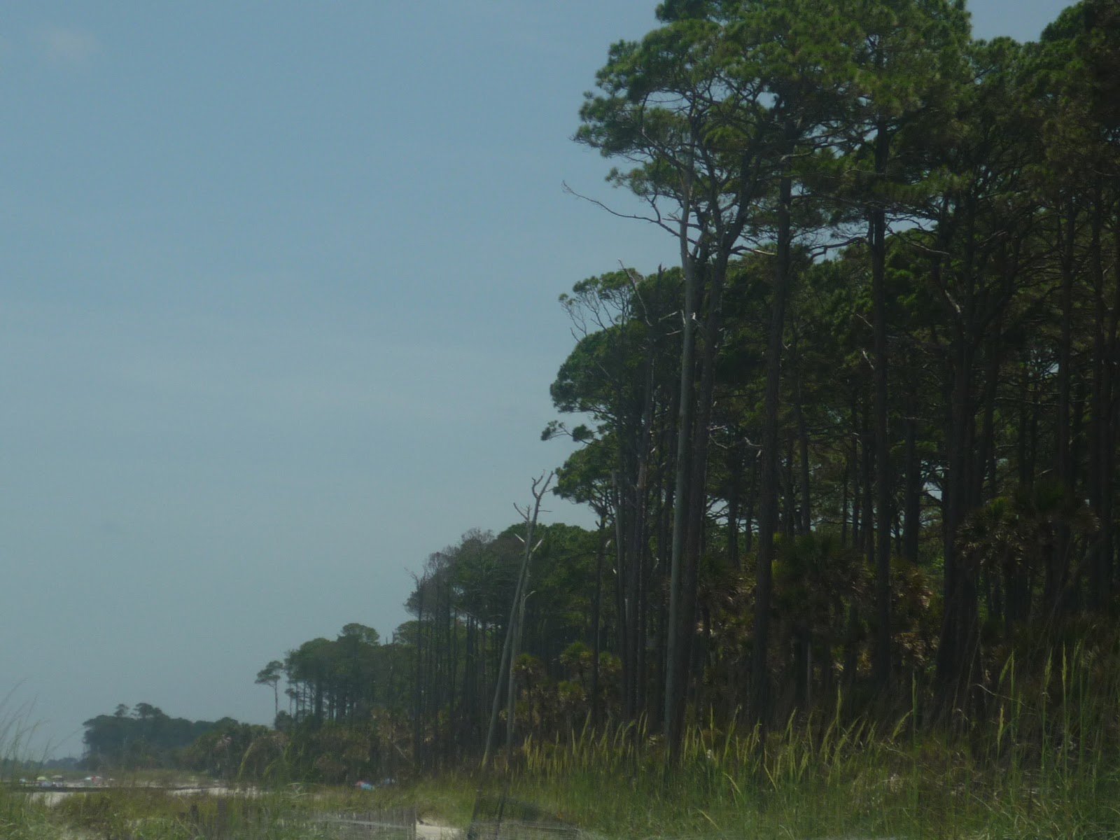
And our Atlantic shore, on Hunting Island, South Carolina:


 In case you are wondering, the Pacific here is cool, a decent level of salty, and pristine blue.  The Atlantic here is warm (almost hot, thanks to the Gulf Stream), not terribly salty, and brownish, both features because of so many rivers pouring into the ocean.  The Pacific has wonderful beaches but is also quite rocky for much of its North American coastline.  Down here in California, more so towards the southern reaches, you don't tend to see a lot of trees, but rather wonderfully dense and lush chaparral (some of the plants were in a winter remission, when the California pictures were taken).  From Virginia Beach southward almost to Cape Canaveral, Florida, you get a lot of what you see above, some dunes backed by wonderful towering pine forests, and southward, including here, palms.

For now just some nice coastal scenery.  I'll revisit both places in detail later. 

Monday, June 3, 2013

Seeking A Pleasant Climate?

Tired of persistent heat, cold, rain, drought, dust, overbearing weeds?  Looking for the perfect place wherein one can keep their windows open all year, day after day, without fear for sudden rain or the sudden dash to stop a thermostat from taking control?  Do you wish to never experience anything remotely connected to "seasonal" again?

Look no further than the San Diego-Tijuana international metropolitan area!  January days in the mid 60's, July days in the mid 70's, and almost no variation otherwise!  Only 10 inches of rain a year!  Temperatures moderate enough to keep one from ever worrying about either frost or drought again!  The swaying palms of the tropics combined with the great frigid swimming pool of the California Pacific right off the backyard!


OK, so its covered in a nice layer of haze and smog much of the time and the water bills tend to be a bit extreme, but for anyone who wants a truly "in between" climate, coastal Southern California is the place to be.  The risks involve potential water hardships if California keeps overdrawing its reserves from farther afield than they ever planned to ship water in, not to mention earthquakes, landslides, tsunamis, insane wildfires (at least with the current wildfire management strategies), and, you know, forgetting that the rest of the world exists, but climate wise the place can be pretty nice. 

There is probably no better place outside of Hawaii and southern Florida for growing a large assortment of palms and even quite a few tropicals.


Having the Pacific Ocean for a backdrop is also pretty nice.  Big blue moderates the temperatures and is amazing water to swim in.


That said, the environmental damage in southern California is catastrophic.  Development has almost completely changed the world there, in many cases actually adding significantly to the natural disasters, especially where wildfires are concerned.   Outside of the North American prairies, there has probably been no place worse affected than here because of the removal of native flora and fauna.  Part of this lies in the fact that precious little room is available for continued expansion (the same problem that southern Florida faces); miles inland lies the beginnings of the deserts of the interior, and even walking a few blocks away from the beach turns up the temperature a few degrees.  Still, people will keep moving to sunny Cali so long as the natural living conditions keep remaining so amazing.  Midwesterners, Lakers, and Northeasterners often look on at such places in envy for the lack of general extremes they have, especially when contending with too much or too little of the good things like moisture, chills, and heats. 

Still, you can never slide down a hill on a sled here in the wintertime.  You can't have many kinds of fruit trees that need a little winter chill to properly fruit.  You can't even make good wine when the heat turns up (not that I am... heh... in any way unappreciative of California wines.  Napa can still manage to get the heat when it needs to.  You know, if you want to make pretentious statements about superiority.)!  Eternal spring is not for everyone or everything.  I often remember this when I feel gloomy over a Michigan late spring, early frost, baking July, or overly frigid January.  We do, after all, have amazing forests, prairies, and water that could make even the majestic Pacific blush.  Perhaps the best thing to do is appreciate what one has and try to make the most of it and learn all one can about it.  The pleasant climate might just end up being the one where the most familiar things flourish. 

Saturday, February 16, 2013

Suburban Southern California...

...from olden times, say, even just 60 years ago.

All selections were taken at a private home in Fontana, California.


No sprawl all the way to the margins of the desert and colder reaches of the mountains.  No fancy boulevards lined with designer boutiques or fast food feeding troughs.

Hell, no lawns.  Just some trees to take advantage of the climate both for beauty and practical use.


Sure, the trees and flowers are mostly exotic introductions meant to make California feel more like a tropical paradise (this is why so many palm trees were planted there, to get people to move to an otherwise arid and water-hungry place, palms symbolizing the easy life) than its own interesting unique ecosystems and habitats, but the native life does manage to creep through here and there.

California Poppy (Eschscholzia Californica)!

Native life was easier to come by anyway back then.  While outlying non-desert areas did feature extensive orchards and vineyards, the foothills were often left to their own devices.  Fires and mudslides were far less devastating  mainly because development did not remove the natural California hillsides to leave either weed fields or barren rock wastes on the margins of housing developments that inched closer into what could have been defensible space.  The first American Californians considered their new home to be the next best thing to paradise, and the first few immigrant generations felt similar enough feelings that they focused more on what could be grown or appreciated rather than on what could make the most money.  These people wanted  their California to still be the paradise that the place had come to be known as for centuries.

The homes even tried to pass for something of an earlier era, stuccoed enough to fake the look of adobe mission architecture rather than look like some grand Italianate mogul's estate.  Architecture, it seems, is a good indicator of what sort of core interests and values a society is attracted to.  Sounds like something to jump around the country looking at, no?

Sunday, February 10, 2013

Sunday Post: Cactus Mountain

Well, it's actually just an unnamed slope along Potrero Rd. in the Santa Monica mountains.  The thicket took me by surprise; I knew that coastal California had its fair share of cacti, but this slope was just packed with them, just like in parts of the inland deserts.  The species is Coastal Prickly Pear (Opuntia Littoralis), probably with some friends mixed in.  While the place may look dry and desert-like, this is mostly owing to being on a south facing slope in rather well drained soil.  Nearby locations are covered in the typical California chaparral and are quite verdant even in the drier parts of the year.  This slope might have had more cover at one point, but successive burnings and invasive species might have overly-stressed the native stuff.  Cacti, though, are a hardy bunch, and seemed to be thriving.  


Wednesday, January 30, 2013

Wednesday Filler: Life Outside (and Inside) a National Park

Would that the many parks and preserves in North America stand as the crowning parts of their representative habitat rather than islands among development or commercially exploited lands.  Many if not most are islands, and sometimes within themselves as well.  Death Valley National Park, for instance, is often captured in popular memory as a hot, dry, unforgiving bare bones desert, when in fact it features pine forests, waterfalls, and snow capped mountains.  Saguaro National Park brings us images of pristine desert scenes, when in fact it is being encroached upon by Tucson, and a quick step on either side of the park road gate brings one into an entirely different world of cactus or concrete forest.

So it is with Sequoia National Park, where the big trees are hardly the only feature even in the park itself.  Much of the lower elevations of the park are wonderful reaches of the California chaparral world, while other parts are dry open oak forests with yuccas abounding.  While not the big trees that inspire awe and amazement, these environments are worthy of exploration and a reminder that while the purpose of a park is to preserve and allow everyone to enjoy our national treasures, a park also exists to remind us that the world outside its boundaries, while not protected, is every bit as amazing and worthy of more than a second thought.


Sunday, December 23, 2012

Christmas is Coming

So why not show a picture from some church somewhere, right?


Part of the courtyard at the mission of San Juan de Capistrano, in the city of the same name in California.  The missions are a great way to see some of old California, and like so many religious foundations around the world are one of the best ways to see into the heart of a people, or at least a people's past.

Friday, December 14, 2012

Ocean Beach, California

Your typical southern California beach scene, with a layer of pollution faintly visible on the horizon, overpriced condominiums, expensive parking, and for some reason an agave in full bloom growing wild on the sand.


It seemed like a pleasant picture, so I thought I would use it.  The title is the location of the beach.  Like many coastal towns, everything is densely packed in and almost no one has a private stretch of ocean front.  Most of the small yards get paved over, and those that do not get planted with palm trees, mostly the tall-growing, salt-tolerant Mexican Fan Palm (Washingtonia Robusta).


The neighboring community of Sunset Cliffs features slightly larger yards, some houses even having pools.  For the most part, however, things are packed as tight as sardines in a can.  Ironically, things here in the seaside high rent district are just as packed here as they are across the border in the slums of Tijuana.  In contrast, densely populated seaside Miami and Fort Lauderdale feature your average size yards and free parking lots, despite space also being a premium in a southern Florida that is otherwise largely too wet and spongy to support much in the way of a city.

The median house price in Fort Lauderdale and Miami closer to the ocean and intercoastal waterway is around $250,000 U.S. currency.  The median house price in San Diego and affiliated towns such as Ocean Beach is $520,000 and more.  Florida, it seems, is the place to get a vacation home, whereas California is the place to live.  Both places have pleasant climates, southern Florida being largely tropical and coastal southern California being what can best be described as "eternal spring", never much deviating from 60-70 year round.  Both places get tons of sunshine.  Florida can present hurricanes, which used to be dealt with by having homes constructed of concrete (it worked).  Coastal southern California can present earthquakes and tsunamis.  Things in general are far more expensive in California than they are in Florida, and yet still the demand for real estate is so much higher in the land of the easy going sunset.  Maybe it is something in the name... people have been attracted to her so strongly for nearly 250 years now.  Southern Florida?  Maybe for the past 70 years or so, once they started cutting down the mangroves.

I happen to like mangroves.  And coconut palms.  And fun Caribbean sea shells.  Still, that crisp Pacific water does feel pretty amazing, and it has a lack of dangerous jellyfish near the beaches in Cali, along with fun things like kelp and sea lions.  To each their own!

Tuesday, December 11, 2012

Taking the Road to the End

You know, even if I did gripe about the cultural and environmental damage interstates can cause, they can be pretty fun to travel from end to end.  There is nothing like seeing a mighty multi-lane highway that has passed through many states come to a rather humble end at some traffic lights.  Take a look at Interstate 8 only a few miles from its western terminus:


And then when this huge conduit of southern California traffic is forced to stop, not only by a traffic light, but by the Pacific Ocean:


I-8 is a bit different to begin with.  In a few places it actually serves as part of the US-Mexico border (though the concrete traffic barriers have since been augmented with a rather tall fence) and part of its course runs beneath sea level out in the Imperial Desert.  I-70 ends in a rest stop in Maryland.  I-94 turns into a fork that can take one into a traffic light in Port Huron or out of the United States across the Blue Water Bridge.  I-95 gets swallowed up its predecessor, US 1, and turns into a Miami city street.  Rather ignoble ends for ribbons of concrete that otherwise are given a path by engineering that blasts mountains to bits and drains swamps to keep the path straight.  Then again, one would hardly build a monument for a road without character...

Monday, December 10, 2012

Sugar Pine

Far be it from me to dismiss the western pines when speaking of stately beauty and gracefulness supported by a sturdy frame.  While it is no Eastern White Pine, the Sugar Pine (Pinus Lambertiana) is definitely worthy of such remarks.  In fact, it actually is a "white pine", bearing needles in clusters of five and sadly being a victim of white pine blister rust.

Rim of the World Drive, San Bernardino County, California.

The Sugar Pine has the added distinction of prominently bearing cones which "drip" from its branches.  Its many picturesque qualities have made it the subject of many paintings and photographs, just as the Eastern White Pine was a favorite subject for artists such as the Group of Seven.  An Ansel Adams photograph of a Sugar Pine is prominently featured in the first floor gallery of the Department of the Interior building in Washington, D.C.

Like most trees of the Pacific range forests, the Sugar Pine is huge.  The tallest specimens are over 250 feet tall.  With the possible exception of pre-colonial Eastern White Pines, such specimens mean that this is the most massive pine in the world.  If you want to see one up close and personal, you need to head to southern Oregon, California, or Baja California, where they can be found in abundance when one climbs higher than a mile above sea level.

Saturday, December 8, 2012

California Refilling

Even as much of the country is still recovering from a brutal 2012 of heat and drought, much of non-desert California is experiencing record rainfall, some parts receiving 800% of their normal amounts in mere hours.  Instead of the devastating floods that come with such intense bursts of precipitation, the rain is going to the right areas and recharging aquifers and lakes.  This has been needed for a very long time.

Lake Kaweah, near Visalia, California, Sierra Nevada foothills.  Though the lake is often drained to a lower level for flood control, the sad truth is that many lakes in California have looked like this for a long time.  

If this continues to some degree through the winter, the deserts, which get winter rainfall anyway, will experience a bloom worthy of taking the most skeptical person's breath away.  2013 will be a year of plenty of water for California, hopefully along with a renewed appetite for better water management practices there.

Saturday, December 1, 2012

A Dry Topic

When I first made my way into the North American west back in the summer of 2008, what impressed me most about the journey was not the impressive vistas or dramatic landscapes.  I was captivated by the desert.  While I had been looking forward to getting through miles of cornfields and surrounding myself in the grandeur of the Rockies, I knew that more flat and dry landscapes were in store for me after all too brief of a taste of the mountains.  However, that trip forever changed many of my perspectives on landscapes and the so-called backwater areas of the continent.

While I did find that the portion of the journey passed far too quickly through the high-altitude spruce-fir forests of the mountains, the High Plains and the deserts of the Colorado Plateau, the two arid frames which bind the mountains, had a charm all their own.  While people such as myself are derided as hopelessly naive of the truth of the matter (you know, us types who love looking at the desert from an air-conditioned home or car), I would have to comment that my fascination of the western dry lands stems not from an appreciation of the exposed geology or blue skies.  Rather, I was taken in by how much life manages to find a way to not only exist, but positively thrive in such a hostile environment.

I-70, Mojave National Preserve.  

To many, a place such as the Mojave is a collection of sand, rocks, strange plants, and insanely high temperatures.  To me it is a wonderful world of those things blended together in something of a divine masterpiece.  To this day, much of the west remains open and free, not yet covered in strip malls or even farms.  While I do not necessarily decry most of what civilization has managed to achieve and build, there is nothing like seeing our world as it has been shaped through years of work without our "improvements".  The desert is still a great frontier where we can encounter a little bit of nature that presents us with enough challenges to not have paved it over.  Tomorrow we will return east and take a look at something where this is still the case among the industrialized and settled eastern part of North America.

Wednesday, November 14, 2012

Wednesday Filler: That Can't Be There?!

Mountain Press has a series of books covering the geology of various states.  As usual, Michigan has been left missing, but what might come as a bit of a surprise to many is that states not otherwise known for being particularly rocky have made the cut.  Indiana, Nebraska, Florida... each have their own little "roadside geology" books.  So far, I have read the New York and Ohio selections with the intention of making a series of posts on what lies beneath the feet in North America.  Anyway, plans aside, I mention such things because we tend to have misconceptions about what an area has to offer.

Take the below picture, for example:


Now where would we think this is?

Perhaps somewhere out west, in the Rockies, or maybe even in the Adirondacks or some such place.  Certainly it is a mountain scene with all the trappings of something passably northern.

No, this is Big Bear Lake, in none other than heavily urbanized, hot and dusty Southern California.  They have mountains there, you see, with substantial enough elevation to produce climactic zones ranging from the hot and dusty to the nearly Arctic.  The lake sits nicely at about 6,800 feet above sea level, meaning the winter gets regular snowfalls and the summers are lovely, resting in the 70's.

Saturday, August 4, 2012

Parks in the News: Hetch Hetchy possibly unleashed!

Hetch Hetchy Valley was one of the first great casualties of the war waged by the conservation movement.  These days we tend to think of National Parks as nature preserves with recreational opportunities in them.  Back in the early days of the park system, protected lands were involved in a battle over utility vs. preservation.  San Francisco needed a reliable source of water delivered to it, and a reservoir capturing runoff from the Sierras seemed like a good idea at the time.  Unfortunately, instead of damming an expanse at slightly lower elevations, plans were drawn up to damn the valley, despite protests to the contrary by John Muir and many, many other people.  The valley, you see, was already a part of Yosemite National Park, and could easily go toe to toe with Yosemite Valley in terms of sheer beauty.  This is what it looked like before the damming:

Public Domain,  Sierra Club Bulletin, Vol. VI. No. 4, January, 1908, pg. 211.

These days it pretty much looks like a third to a half of the bottom of the valley is missing.  This might very well change soon, however...

 http://www.wdam.com/story/19195501/yosemites-lost-valley-will-be-subject-of-vote

In a change of pace from the usual entrenchment of the conservation movement well into liberal front lines, environmentalists are siding with the Republican party against the San Francisco Democrats, with both the green and the elephant hoping to unleash the waters of Hetch Hetchy so that they may flow freely once more.  This comes in the midst of an age when the Sierras and much of the rest of California are experiencing some heavy drought, which is the last time one would figure a vote would be put forth to remove a source of water from a major city.  The battle of the damn is turning into a very peculiar and unpredictable conflict, and the outcome might have ramifications for water use agendas elsewhere on the continent.