Always to the frontier
Showing posts with label Virginia. Show all posts

Sunday, December 15, 2013

Sunday Afternoon Post: Between A Rock And...

This poor Virginia Pine (Pinus Virginiana) seems to be posing for a glamor shot in the latest publication of Rock Gardening monthly. 

Pinnacle Overlook, one of the most accessible and scenic view points in the central-Southern Appalachians!

The forest directly below the pine is Virginia, whereas the small town down there is in Tennessee.  The vantage point this was taken from was straddling Virginia and Kentucky.  Fun!

Monday, December 9, 2013

Residents Of The Piney South: The Loblolly Pine

Sometimes a tree is just considered a weed with a trunk.  In much of the South, pines are considered to be simply background material, stuff that grows in the way of development and agriculture.  A friend I met back in college, a Carolinian in fact, told me that pines were sometimes even considered to be more than just a weed but a real nuisance.  "They don't take too well to storms and hurricanes, and leave a tangled, sap-filled mess to clean up".  Pines are nothing if not sap-filled, but I hardly considered that to be problematic.  After all, they are just as ubiquitous in Ontario as they are in the Carolinas and we go out of our way, occasional tornado or violent microburst aside, to pay vast sums of money to get mature ones in our landscape if they are not already present.  In mostly deciduous SE Michigan and NW Ohio, nearly every public works landscaping project includes at least shelter-belts of pine, usually Scotch (Pinus Sylvestris) or Austrian/Black (Pinus Nigra) but often the native reds and whites.  Mile after mile of I-75 is lined in such a way up in these parts.

I-75 in Georgia or I-95 anywhere south of central Virginia look like such a landscaping project put into years of growth, and a nearly solid wall of Loblolly Pines (Pinus Taeda) screen off the northern tourists and other thru-travelers from the local world.  Janisse Ray even insisted that this was their purpose in her masterpiece Ecology of a Cracker Childhood.  Janisse, you see, loves all the spires of her native forests down in Georgia, but just as I have a particular weakness and reverence for the Eastern White Pine (Pinus Strobus), so does Janisse look upon the noble Longleaf Pine (Pinus Palustris) with grand esteem.  To her, is the Loblolly a seemingly unworthy also-ran that has filled a niche that the Longleaf once dominated?  Without a doubt, she considers it an important and lovely tree, but it is just in so many ways ordinary and second-fiddle to the monarch that was once the Longleaf.  This is not to say that Loblolly Pines are bad trees, just that they are an unfortunate sign of the times wherein entire ecosystems have been disrupted and trees such as this one find a place in an ever-changing world made by humans that lets such highly adaptable species thrive.  The Loblolly is one such tree.

The Lobolly, you see, does not mind getting its feet wet, unlike most other pines.  It can tolerate being at the margin of a swamp better than most of its genus, even while it can handle the harsh, alkaline conditions of an abandoned clay-soil farm field baking in the sun.  Surprisingly, it does not take well to the pure prairie environments found scattered in the South, notably the eastern extensions of the central prairies into the Louisiana coastal plains and the Black Belt, an arching area of prairie (that can now be seen on physical maps as a dense concentration of farmland) stretching across central Mississippi and Alabama.  Like most established prairies, the incredible roots of the grasses and forbs have contributed to the formation of a rich, dark mineral soil.  Likewise, rich soils can be found in the Mississippi valley, an area which forms a significant gap between the eastern and western portions of the Southern forests.  While the Loblolly does tolerate getting its feet wet, it does not like them soaked.  Such land is instead reserved for incredible stands of tupelo, cypress, cottonwoods, and willows (along with the lovely Red Maple <Acer Rubrum>).  In short, we can see that it dislikes certain ecological extremities and even in its very broad choice of tolerable situation is still... average.  Simply put, the Loblolly is a common tree that you will find across much of the South, from Texas clear to southern New Jersey. 

That's the direction I became inspired by when writing this post.  You see, I have so very few specimen pictures of the Loblolly because of how "common" they really are.  Most of my shots incorporate the sentiments of how they get viewed by Southerners, as background scenery behind modern development.
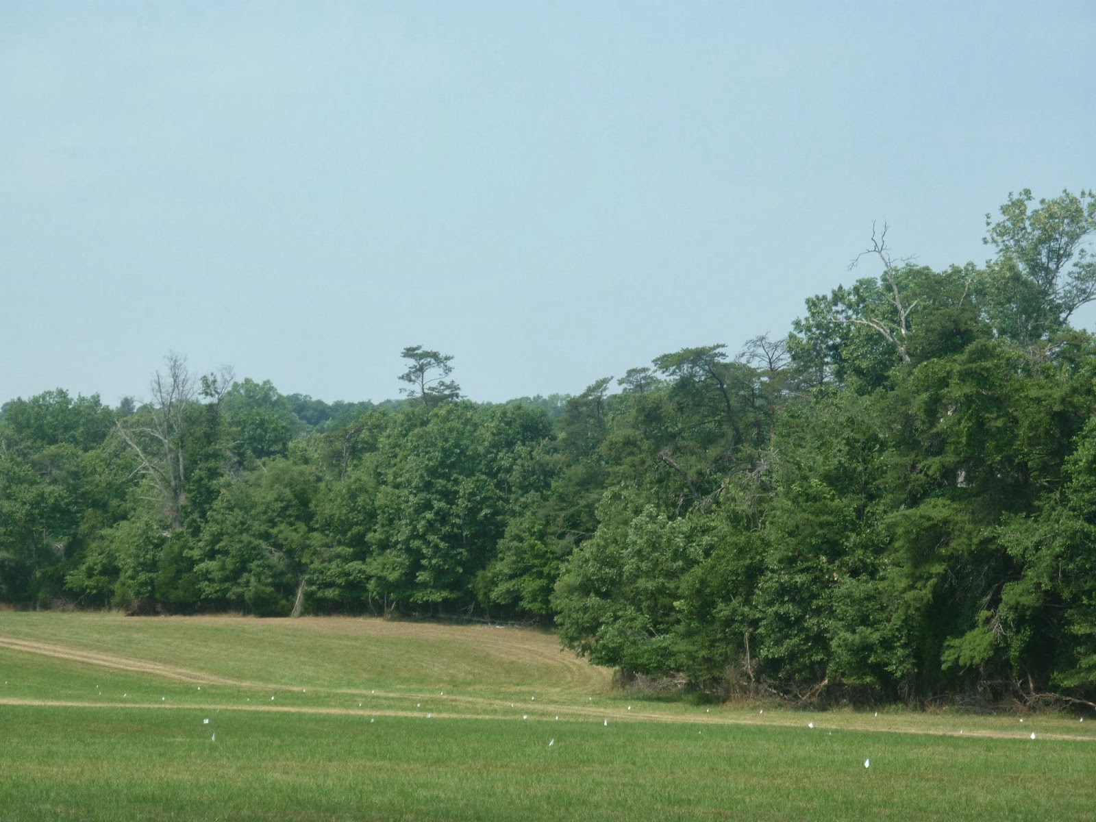
There they are, filling up the backdrop in Santee, SC, just off of Loblolly-framed I-95.  I witnessed very few trees, except maybe old survivors that were big enough to not be considered "weeds", used in a landscape around homes or businesses.  That honor instead went to cold hardy palms (like that lovely Pindo Palm, Butia Capitata) and magnolias fighting with crepe myrtles for places of honor on the front yard.
 In fact, aside from the photo of your typical "it was too big to just yank out" Loblolly back a few posts ago, this is the only canopy or crown shot I have of them!  I regret this, as a stand of Loblollies (and do they ever make fine stands, just like the Red Pines do up north) is a wonderful wall of green, a wall which I remember fondly as a child welcoming me to a South that otherwise felt so very distant from my far north.  I always tried to squint deeper into those dense growths along I-95 and wonder what the forest was like inside them.  Even at that age I figured that this was not a natural situation, that there had to be more in the forest besides a single giant plantation of one tree.  For the life of me though, even as common as they were, they were a tree that seemed to outweigh all the other elements of the landscape.  Only after a half day of Loblolly wonder would I notice the subtle changes that happened in Georgia as Saw Palmettos (Serenoa Repens) started carpeting the understory and Slash Pines (Pinus Elliottii) started to take over, especially into Florida.  The bigger needle globes of the Slash Pines were part of the very different world of the Deep South and Florida, not a Red Pine look alike that the Loblollies were.  The Loblolly fit perfectly into a Canadian child's image of what the South looks like: the same as the north, but with even more pines, palm trees, and a night time that was as hot as a Northern day time, complete with some buzzing outdoor light illuminating this mysterious pine that grew even in such a hot land. 

I was too young to imagine that things had not always been this way.  This is not to say that I had no imagination or that I knew not what a wilderness was (I grew up in one), but that I was simply ignorant of the fact that the Loblolly would have been truly an "also ran" back in the days when the Longleaf was king of the forest and savanna.  The settlers who followed the First Born would have seen that very different world of an incredible arboreal diversity, with towering pines stretching forth above grasses and flowers stretching as far as the eye could see, kept open by the same agent of nature that made lower Michigan, Ohio, and Southern Ontario into a natural park of oak openings, fire.  I imagine, as Janisse Ray does of a South long past, settlers living among these giants, every bit as transfixed upon them as... a child doing the same thing when confronted by the inheritor pine, the Loblolly.  Maybe it is not, after all, such a common tree as it is a survivor and a triumph of nature trying to cope with human development.  I consider the Loblolly to be an arboreal emblem of the modern natural South, in which nature still manages to rebound like, well, a weed!  Even in farm country down there you can't help but run across a tree every few hundred feet, and often enough it will be a Loblolly.  In truth, I have never seen the ancestral forest with my own eyes, and I can only imagine the grandeur of the Longleaf Savanna.  The Loblolly, though, has managed to welcome me home every time I have come back to this land of the South, which holds such an irresistible lure to a botanist who is still a child at heart. 

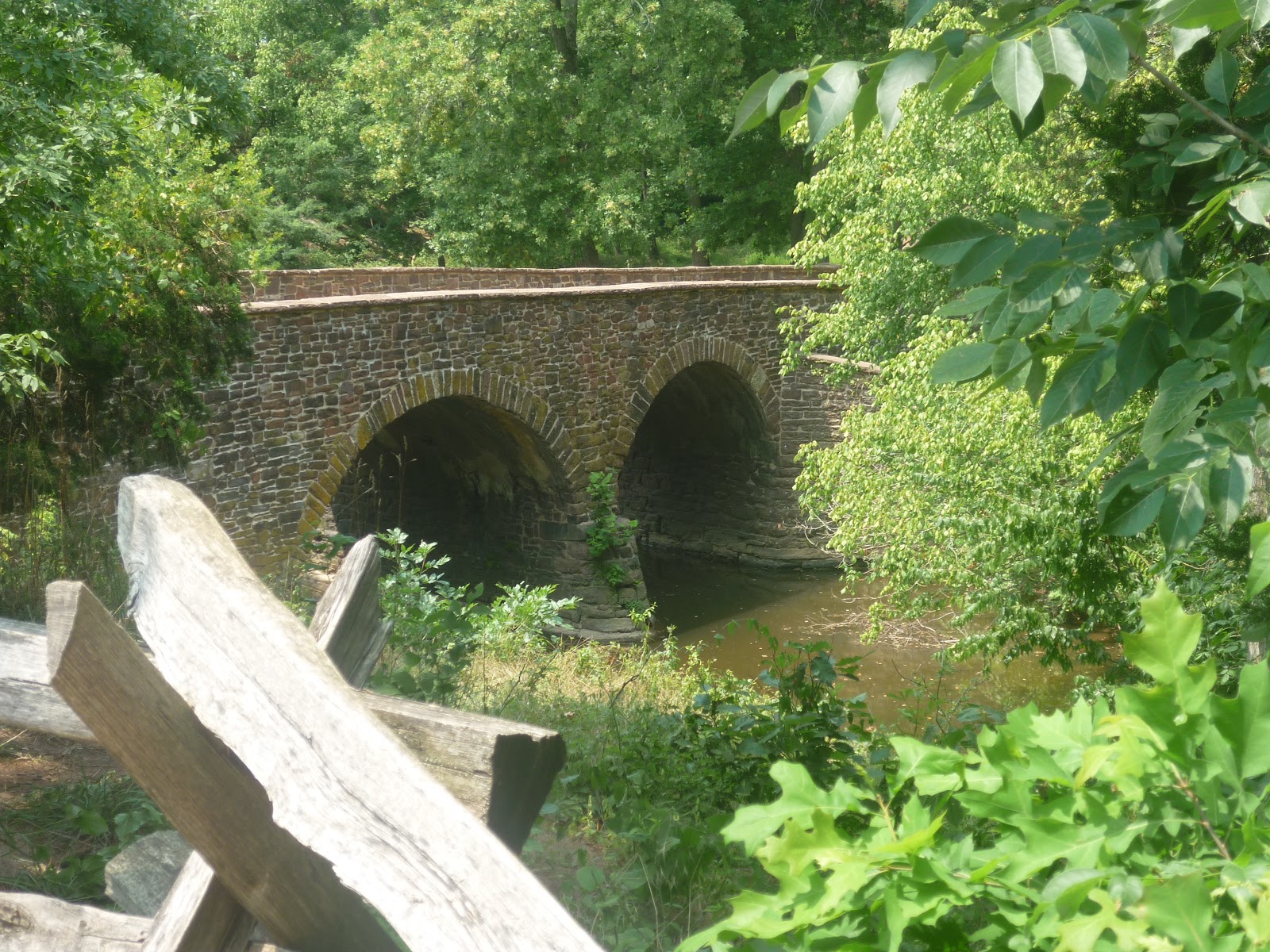
A part of me wonders what life was like where this tree held its own once against the broad rule of the Longleaf.  Perhaps places like Jamestown, places where the continent started to forever change into the modern land it has become, are places where one can still find a forest of curiosities otherwise stepped quickly past by human advancement.  Here maybe can be seen not some oak or pine parkland that provided an irresistible lure to colonial settlement, but a needle carpeted half-forest, half-opening maze of strange trees that grew beyond the landings of mushy cypress forest infested with mosquitoes.  Would the first Virginians have tried to press on toward higher ground capable of more agricultural wonders and either ignored or found inconvenient the odd forest that was too open to give good shade, yet to thick to plop a house on?  What would they have made of this place come winter when even the leafy shrubs beneath the pines would refuse to surrender their greenery, like the Red Bay (Persea Borbonia) or the Loblolly Bay (Gordonia Lasianthus)? 

Both of these delightful messes were captured at Historic Jamestowne, in the drier center of the swampy hook of land that John Smith and company tried to give Virginia a decent go at.

Were such forests taken in by the colonists like the Red Pine forests of wonderful blueberry (Vaccinium Augustifolium) and Wintergreen (Gaultheria Procumbens) understory of an otherwise grand White Pine dominated North, which together with the more open Jack Pine (Pinus Banksiana) openings on sand and granite (depending on what side of Lake Huron you would find them on), and considered second fiddle and scrubish by their northern settling counterparts (compared to the valuable timberlands of the White Pine supercanopy forest)?  We may never know.  After all, we don't even notice the trees around us these days...

But what about that Longleaf?

Saturday, December 7, 2013

Residents Of The Piney South: The Virginia Pine

Head anywhere south of the Ohio River or the Mason-Dixon line and all of a sudden you will find more pines than you can shake a stick at.  The first such wonderful resident is the Virginia Pine (Pinus Virginiana), which looks something like a Jack Pine that moved south and got a bit of a fuller crown and straighter branching as a package deal.

Taken at Cumberland Gap National Historical Park, one of the most cultural significant, scenic, and underrated places to visit in the eastern United States.  Here we see an absolutely stunning specimen of our friend that I would have to rate as the finest Virginia Pine I have ever encountered to date.  Here we see the pine in her full glory, worthy of being counted among the most stately Jack Pines (as featured in the painting of the same name).  The tree also bears a silhouette not far from that of a mature Eastern White Pine (Pinus Strobus).

Needles borne in clusters of two, like the Jack Pine.

Irregular spreading crown, especially while young, also like the Jack Pine.
In the east, they like to wander only slightly far from their mountain homes and thus are found mostly in the backcountry, or Piedmont.  In fact, the Virginia Pine never seems to stray very far from the Appalchians in general, as seen in the following map of their current natural distribution:

Public Domain.  Thank you again USGS, and rest in peace, Dr. Ebert Little.


In Virginia, even right up north near Washington, they seemed to be filling a role comparable to what Eastern White Pines used to, individual trees scattered among deciduous forests, sticking up above the canopy (but in much less of a grand profile). 


Not the best illustration of the concept, but it was the best I could do in 100 degree weather.  This was taken at Manassas National Battlefield Park, just outside of the Virginia side of the DC metro area.

Mind you, they do perform this role further on in their range, even if still only a junior partner to what the Eastern White Pines used to do in forming the supercanopy. 

Also from Cumberland Gap.  All such pictures were taken near the Pinnacle Overlook, which in addition to being a stunning vantage point to take in the Gap itself and the three surrounding states, is an excellent place for the casual explorer to have a taste of central and southern Appalachian flora.

Admittedly, I did not think too much of them for quite some time, a sentiment apparently shared by tree lovers of the past.  I do not recall seeing one at any botanic garden or historic home grounds anywhere one would expect to see them.  This is not overly shocking, as, again, they not present a robust profile as do the other native pines of the east.  Given a chance, however, they can form an elegant profile that makes for a lovely accent to the natural landscape and one that decidedly marks the passage between the Appalachians and the surrounding lands.

Same as above.
US 25 leaving Kentucky and approaching the modern tunnel under the Gap towards the junction of Virginia and Tennessee.
In the true Appalachians and plateau country to their west they are an entirely different animal, albeit again acting like the White Pines in certain situations.  Here they seem to favor rocky, well-drained soil and often grow as if emerging right out from the exposed rocks of the grand eastern mountains.  Much like the Pitch Pine (Pinus Rigida) barrens of further north along the Appalachians, or the Jack Pines growing under similar conditions on Georgian Bay, this is where we can find the Virginias often serving as the dominant tree, laughing at even the hardiest oaks and junipers. 

While not as open as the rocky haunts of the Jack or Pitch Pines, probably due to the greater precipitation available to them in their southward approach, the same effect is appreciable.  Both photos were taken at Pinnacle Overlook.


Such a phenomenon of the hardy pines can be found with relative ease by modern travelers: simply drive along any rock cut or past rock outcrops and even a thick stand of Virginia Pine might not be too far away. 

This blurry windshield shot was taken in a rather unwelcoming stretch of US 23 in Kentucky across the Ohio River from Portsmouth, Ohio.  While the valley had some lovely views, the area is lacking in safe pull out vantages.  Here they at least have a reason, as small bluffs press in close to the road.  

Further south along US 23 in Kentucky, somewhere between Louisa and Hagerhill.  Where there are rock cuts, there are Virginia Pines thriving in the rocky, thin soils that wash down onto them and collect in the crevasses.  And yes, another windshield photo, but broad shoulders are far and few between in this part of Kentucky.
But while they thrive in rocky, dry areas, they are perfectly at home in richer soils more befitting of a forest area. 

Taken near Martin, KY, on Kentucky 80.

Virginia Pines are often the first trees to make their way into abandoned fields.  While the Appalachians do have grassy areas, be they summit balds, small pockets of the easternmost extensions of the prairie, or (formerly) buffalo corridors, grasslands here tend to be but the first stage in landscape transformation rather than a permanent feature.  Most seedlings of the region are somewhat vulnerable to intense sunlight and exposure, leaving the hardier oaks and Virginia Pines the job of handling the scorching summer sun that reminds the human traveler and dweller that this is, even in the mountains, a land of heat and the edge of the South. 

But again, this is not the land of pine barrens, and the Virginia Pine does not get to be the star of the show as do the Jack or Pitch Pines.  Eventually, the pines get surpassed by the forest once trees start shading the ground and making conditions a bit more palatable to other species.  Unless they happened to form a dense enough stand in the harsher conditions or can be found where such conditions never go away (as in an outcrop), much like the mighty White Pines, the Virginia Pines find themselves thinned out and striving for the canopy:

It almost looks like a Pinus Strobus, really.
One of the many overlooks along the road to the Pinnacle Overlook.  The town seen beyond the pines is Middlesboro, Kentucky.

"Accent piece" or not, however, Virginia Pines are certainly a lovely and integral feature of the central and southern highland landscape.  They are very much a traveler's tree, being a pioneer that welcomes back the forest from even centuries of cultivation and welcomes the human wanderer into frontier lands beyond the greater regions of both North and South.  Want to see more?  Time to get really into the South!

Friday, December 6, 2013

Piney South

We North Americans in the lands commonly referred to as either Midwest (grumble) or Great Lakes tend to think of pines as something of a northern tree, at least those of us in the middle latitudes between the lands of cold and warm.  Indeed, west of the Appalachians and east of the Rockies, native pines are largely missing from the landscape south of the Great Lakes, throughout most of the prairies, and until one gets into at least the edge of the South.  The same is not true for the coasts of the continent, where pines can be found from the Arctic treeline down well into the tropics.  Many botanists, in fact, will point out that the greatest living diversity of pines and probable place of origin for many ice-age surviving species is in Mexico, hardly northern by most standards.  Some pines, in fact, only like areas that are warm most of the year if not outright hot and dry.  Only one species of pine, the noble and scraggly Jack Pine (Pinus Banksiana), even makes it to the northern limit of trees.

Still, where once central North America used to have a relative dearth of things pine, one is likely to run across some thanks to a modern landscaping fetish for durable, mass-produced coniferous evergreens.  Sometimes this results in lovely drifting plantings of the majestic and sacred Eastern White Pine (Pinus Strobus) which seems to be popular well into Nebraska and southwards wherever the climate will be merciful.  More often than not, however, the Austrian, or Black Pine (Pinus Nigra) gets slammed into tight groupings to serve as an exotic windbreak far from its happy mountain home in the northern Mediterranean higher elevations.  This is a shame, because we have so many wonderful pines available for use here that can take hot summers rather well.  Anyway, I digress.  How about those hot summers?

Just off of Exit 35 on I-26 near Roebuck, South Carolina.  That there (and those behind) is a Loblolly Pine (Pinus Taeda), and if you spend any time at all in the South you will come across more of them than you can imagine.
You see, the South gets a lot of rain, but in the dry times, even while it is more humid than should be permissible for decent living, that Sun of ours tends to bake the landscape so that something Carolina feels more like something Texas.  There are oaks for that, to be sure, but pines can handle the rough stuff even better.  Drive anywhere south of the Potomac or the Ohio and pines will never be far away.  Drive further along into, say, Tennessee or North Carolina, and they might be all you see for miles upon miles in seemingly pure stands (albeit with fun, acid loving surprises thriving in the partial shade and sheltered soils like azaleas, magnolias, grasses, and blueberries... and <swoon> palmettos).  I-95, from Richmond nearly all the way to Miami, is pretty much miles and miles of pine scenery, and let me tell you, it smells amazing.  Come along the next few posts to take a wonderful look at some of our southern pine friends.  

Saturday, October 19, 2013

Are We Headed To A New Civil War?

North Americans, yes, even us comparatively politically and socially sedate Canadians and Mexicans, are an opinionated lot.  Sure, there are active ideological fronts being fought over in the rest of the world, but here we seem to have built up a culture that thrives on, or perhaps even requires, ideological diversity.  Even in some of Europe's more open societies which rely on total democratic participation to exist as they do, North Americans trump them in terms of respecting the notion of personal determination to the point of it being made into a sort of religion of liberty.  Canada and the United States largely inherited this passion for mother Britain, which in the eighteenth century was every bit as crazy over liberty than the colonies were.  The frontier mentality of rugged individualism, in fact, can largely be traced to the freedom-oriented folkways of the people of the northern borderlands between England and Scotland.  That said, such passions were later transformed by an influx of a wide diversity of immigrants, both free and enslaved, from across Europe and sub-Saharan Africa.  Down in Mexico, a reaction against a distant or otherwise oppressive Spain grew in intensity inspired by what was happening further north.

The history lesson from there on is an important one.  Whereas Britain buckled down in defending a particular concept of freedom, particularly the national identity brand, against intrusions by France and eventually Germany, North America exploded into hundreds of different camps.  In Mexico and Canada, this has always been strongly evidenced by strong provincial/regional traits; the near revolutions in Chiapas and Quebec that have never really faded away are proof enough of this without even looking at the rest of how the countries are at odds with the capitals.  In the United States, however, while the federal government remains strong and appears to be an emblem of power and unity to the rest of the world, well...

Let's just remind ourselves that the thirteen colonies almost did not rebel together, much less stick together once the final shots had been fired at Yorktown.  The backcountry was at odds with the lowcountry, both of which were at odds with the valley inhabitants of the Delaware, Hudson, and so many other watersheds, who were further at odds with the struggling remnants of Puritan power in New England, who were at odds with... you get the picture.  Or maybe not.  You see, especially in the frontier regions, regionalism was the furthest thing from the minds of towns and even just families, clans really, that preferred a lack of contact if not outright war with the neighbors.  The only thing that kept a Virginian mountaineer unarmed in the same room with a Virginian planter, to say nothing of a Bostonian merchant, would be a common threat.  The firstborn, with their ferocity in combat and every bit as strong desire to preserve home security, were the first cause of unity.  Then came their allies the French, either from across the ocean or closer to home among Les Habitants.  Both were largely dealt with in 1763.  In the decades to follow, that new threat would be mother Britain, and finally in 1812, that same mother and her new child and sister to the colonies, Canada, would be the source of final movement into a cohesive national sentiment.  Note though, the term there, for sentiment is not to be confused with identity. 

There were still identities a plenty even within the individual states.  This is how Virginia, a behemoth stretching from the mouth of the Chesapeake to the Ohio valley, eventually became broken into smaller entities, starting most vividly with the memory of the creation of Kentucky in 1797, itself an improbable geographic collage of mountains, savannas, forests, and even cypress swamps.  Yes, such a buffet of both mentality and environment combined into the rugged individualism that continues to define divides with American society.  Most people know that the West is not the Plains is not the South is not the Rustbelt is not the East Coast, but they don't know how fragmented national identity is beyond such simple distinctions.  People with the regions certainly do; no Charlestonian would ever be confused with someone from Memphis.  No "Yooper" would ever be confused with someone from metro Detroit, at least by someone in Michigan.  Buffalo feels like it is at the other end of the world from New York City, if New Yorkers even take the time to recognize that there is also a state called New York (I joke only slightly).

This is now.  How about back, say, during the Civil War?

Artillery at Cumberland Gap National Historical Park.  This gun is in Kentucky, pointed toward both Virginia and Tennessee.  The Gap never saw significant military action, but changed hands many times.  I put this photo here as a reminder that that war was very pervasive, with reminders of armed conflict surrounding nearly all of even the backcountry population.

The sides of the war are usually broken simply into North and South, with the North being pictured as a heavily urbanized industrial bastion of truth fighting against slavery and the South being painted as an agrarian civilization vainly struggling to hold on to slavery.  Military historians often focus on the main events in the Tennessee and Mississippi valleys and the front centered around Virginia.  The truth is, decently-sized battles were fought as far west as New Mexico and as far north as Indiana, and in an age when much of the population, especially in rural fronts, had access to a firearm, little skirmishes across towns were a lot more common than historical memory permits recollection for.  Recent works of fiction like Gangs of New York have managed to revive interest in the back door of the war, but common imagination likes to view the early 1860's as a brief interruption in an otherwise strong national expansion and development.  The truth is, we were all at each others throats half the time, over issues like race, class, the economy, religion, the environment, immigration, language, etc.  Sound familiar?

It should.  We never really stopped fighting, because we are all so damn passionate about these issues.  We had a series of crises, from the two world wars and a rather brutal depression, to bolster the strength of federal versus local identity, but the security, prosperity, and romanticizing of historical memory that came afterwards helped us forget about some things.  Indeed, again, we never really stopped fighting even during the outbreak of peace.

Even people who claim to hate politics and loathe taking sides feel strongly about such issues here, and given the chance to get irritated over at least one of them, will try to weigh in on how they really feel, even if they don't exactly pick up a gun and fire into the air over it.  One such issue is language, which after a delay of nearly two years in running this blog, I think I will finally just bite into and discuss next post.

But in the meantime, how about that title question up there?

Things are getting ugly, and the last lingering stabilization provided for by the Second World War might finally be fading from national consciousness.  Some serious questions are once again being asked, people are either arming themselves with guns or democratic participation in increasing numbers, and, surprisingly and ironically, camps are being formed to make the claim about who is the most American of them all!

Yes, gay and confederate.  Talk about a diversity of camps.  This was taken in a town which I will not call by name, for potential fear of some bizarre form of reprisal, in North Carolina. 

This answer is, we probably are heading to something major that is going to bring about large scale changes to our society, and in a country with a history defined so much by war, armed conflict is certainly not out of the question.  In the coming weeks, let's explore why and what this means together, and as always, through the lens of history and geography.

Sunday, March 24, 2013

Why We Are Not One Country: Historical and Ideological Ancient History.

What is liberty?

Is liberty being allowed to do what you want, to believe what you want free of all coercion?  Is liberty being able to take small pleasures in life, is it about making your own way in life without someone else telling you what to do?

For English speakers in the early and mid eighteenth century, liberty was perhaps all of these things, but above all else it was about being able to own property and not having someone else take it away from you or do anything to it without your consent.  Freedom of religion was also important, to be sure, but it was a sideshow to what truly mattered: power.  That's right, I just linked the two concepts, and the property owners of the time certainly did in mentality if not in direct word.  Perhaps this is a dangerous concept to be illustrating in such words considering as how I am defining the differences between Canadian and American mentalities, as per our last post over two weeks ago:

Defining A Border: Why Are We Not One Country?

The truth of the matter, though, is that world politics are defined by power struggles as much if not more so than by ideological crusades; a world of military forces, cults of personality, etc. means that even the noblest of goals is going to continue to be fought over for some time.  While the human race has taken great strides toward progress by diplomacy and moral force, the fact remains that not all of us are interested in such paths.  The story of how the modern world and our two nations came about illustrate this all too well.  This story is a long one that takes us back to the plagues of the fourteenth century, when the New World was not much more than Nordic legend, at least over in Europe.

By the time the illnesses had run their course, many countries in Europe lost over half their population.  Farms started going untended, market places started breaking down, feudalism looked to be a memory.  Lords were in desperate need of workers to keep their estates running, the labor side of which was finding that they could make demands for a better life if the management wanted to keep things running.  Heirs, even lowly commoners, found themselves in possession of multiple lots and belongings as entire generations would leave only one or two males left in large families.  Some of them turned to trades and business, others to controlling the land as their former noble superiors had done for thousands of years of human history, but all of them found that they now had power unlike anything that had been imagined before.  In Britain, the House of Commons slowly grew in importance.

By the seventeenth century, that house, along with its upper counterpart of Lords, was able to turn the course of history by overthrowing a king.  While that particular revolution soon became overwhelmed by religious zeal, its main issue was never truly forgotten: power did not ultimately rest in the hands of one individual who was claiming sovereignty based on some assumption that human power rested in religious excuse (namely the divine right of kings).  The main issue, of course, was taxation.  You know, money, personal freedom to properly use money and individual economic value.  Some people would take this to the extreme in the next century and try to rid the world of anything other than the currency of economics, relegating religion and morals to the realm of either usefulness or menace.  A very classic line to sum all this up comes from one such "enlightenment" thinker who wrote much in the way of history (particularly focused on Rome), Edward Gibbons:

“The policy of the emperors and the senate, as far as it concerned religion, was happily seconded by the reflections of the enlightened, and by the habits of the superstitious, part of their subjects. The various modes of worship, which prevailed in the Roman world, were all considered by the people, as equally true; by the philosopher, as equally false; and by the magistrate, as equally useful. And thus toleration produced not only mutual indulgence, but even religious concord.”

At the same time there were people still interested in the concept of freedom itself.  Some still clamored for religious freedom, as many do today even in North America.  Some wanted to be able to just keep a small home with ground to grow things in.  Some just wanted to be able to move about freely and not be tied down to any settlement.  Some just wanted to be left alone.  As wars over the power to control these things heated up not only in the British Isles but also in France, these sorts found themselves heading across the ocean to the vast unexplored wilderness of North America.  In 1607, Englishmen came to make this sort of thing happen in Virginia, and a year later Frenchmen did the same in Quebec.  The early years were extremely difficult, especially in the brutal northern climate that the French encountered, and settlement remained largely defensive and frontier-like for some time.  Furthermore, except for the landing in 1620 that would start up the world of New England, these ventures were also meant to be commercial experiments.  Virginia had tobacco potential, and Quebec had fur.  The foundations of two nations were little else than trading posts to begin with:

Part of reconstructed and surviving Jamestown.  Like Quebec and Tadoussac, little of the primal origins of Jamestown remains intact, owing both to development and historic disasters.  The place is definitely worth a visit, as with any historic site, because one gets to experience, with all the senses, the conditions and landscape that the people of history did.  Compared to England and France, wilderness North America was a rough affair for European ideas of comfort.

But before much time had passed, and people were making lives for themselves so far away from problems back home, people started arriving looking for something other than a piece of the game.  People started putting down foundations for homes and experiencing something that was just as appealing as a fight for freedom: a quiet life.  Many people who have come to call this continent home have done so not for reasons of power or belief, or both, but because they wanted something a little bit better than the possibility of having everything destroyed on an annual basis.  Come by tomorrow as we conclude this series and see how this quiet life developed just a little bit differently in the United States and Canada, to see what impact politics did have on everyday life.

Saturday, January 5, 2013

Sunday Post: Looking Down

Yesterday as we explored Mother Seton's home turf we ventured a gaze up the slopes of the Appalachian wall.  Today I figured we might as well look down.


Shenandoah is a remarkable place and one of the easiest to access for people simply looking for some good views.  From atop the crest of the Blue Ridge onlookers can gaze well across the piedmont region, on clear days as far as the coastal plain.  Or, as is the case of this picture, they can look westward into the Shenandoah valley.  While pre-industrial views would often feature a natural haze in the area, the effects of rapid development in the capital region has somewhat added to the veil.  Still, vast horizons or otherwise, looking down the mountain often gives a new appreciation of scale, all the more so in an age when distance is otherwise traveled so easily.

Wednesday, January 2, 2013

Hydro Towers

Yes, they don't carry water, and no, they might not even carry hydro-electricity, but in Canada we call power pylons "hydro towers".  Anyway, they are a conspicuous part of the landscape anywhere near civilization and/or major roads throughout North America.   They can be a definite eyesore, sticking out in front of an otherwise lovely vista.

Estes Park, Colorado.  Resort towns need power, one supposes.

They can sometimes make a mockery not only of natural landscapes, but of historical ones as well.


Both of these were taken during the 2011 re-enactment of the First Battle of Bull Run at Manassas National Battlefield Park in Manassas, Virginia.  It was hard not to get shots without the iron giants in the background, and these are two of the ones I made sure to take to display what an eyesore they are.  This is a sacred site in American history, and yet...

They come in all sorts of shapes, sizes, and materials,  and to be fair, some of them are actually historic pieces of art, such as the Pylons of Cadiz.  Some of them do have elegant patterns to them, and with a little imagination, they look like little Eiffel towers or even people.  The Australian slang word for them, in fact, is "iron men".  Any substantial journey down a major highway will bring one into visual contact with a variety of towers, and childhood memories of heading down I-95 from DC to Fort Lauderdale include associating places with hydro towers as much as the local vegetation.

Just below Hoover Dam, they stick out nearly horizontal from the canyon walls high above the Colorado River.  Western New York and Southern Ontario are absolutely crowded with them, and they are a good way to tell how close one is to the Niagara River.  Many open, seemingly desolate stretches of the deserts and plains are sometimes broken by the sudden appearance of a long line of them that vanish into the distance, often joined by giant wind turbines.  As power sources such as dams can often be deep into wilderness territory, such as northern Quebec near Radisson, hydro towers can often be found even where most other signs of human habitation are usually absent.

They have been with us for a while now, and are still getting built and replaced despite plans to make everything underground.  The Romans left us aqueducts, despite their plans to put their pipes underground whenever possible.  Our steel, concrete, and wooden structures might not last as long, but it would be amusing to see tour buses and their future versions one day stop beside our electric aqueducts for picture taking.   

Tuesday, December 4, 2012

The Potomac Above Natural Navigation Limits

While searching for some topic photos for the blog tonight I came across this picture, which I think I took at Chain Bridge, which connects Washington with Virginia.


In an earlier post, we got to take a look at the Great Falls of the Potomac, another rocky, somewhat dramatic area for a river that is otherwise usually depicted as serene, flat, and just a nice scenic portion of a larger capital scene.  Like many east coast rivers, the Potomac is indeed a nice, flat, boat-worthy river until it hits the toes of the Appalachian rise.  Like the Nile pinching at its "cataracts", these rivers then narrow into rather rocky affairs that feature little rapids.

Yes, I know this is not the Potomac.  What we see here is the Susquehanna river just north of Harrisburg, Pennsylvania. This was taken from US 22 northbound, looking west.  

As seen above, in places where the navigation head is closer to the first great ridges of the Appalachians, the whole affair gets pinched into this sort of scene framed by enclosing mountains.  These features are known as "water gaps".  For the Potomac, this occurs much further upstream than this scene in Washington at Harper's Ferry, where Virginia, Maryland, and West Virginia converge.  Here we have a double gap, where the Shenandoah joins the Potomac.

US 340 looking north upstream the Shenandoah to its confluence, between the mountains, with the Potomac.  The white steeple rising from the left shore is the only sign of Harper's Ferry, WV, that can be seen through the rather dense riparian forests of cottonwoods, ashes, and willows.  

The water gaps and river-worn sections of the Appalachians are excellent places to see the exposed underbelly of eastern North America.  While our vegetated and softened landscape here has nothing on the "naked geology" of the western lands and Mexico, it is far from boring as far as geologists and rockhounds are concerned.  Yeah, we have the classic riverboat scenes, but we also have rougher and swifter patches like this right around the corner.  In some places, they have allowed for dams and mills to be constructed that were responsible for powering and watering the foundations of American industrialization.

Sunday, August 5, 2012

Sunday Afternoon Post: John Smith

Here we have the John Smith statue in front of the excavated ruins of Jamestowne.  He faces the James River, which he probably stared at a lot while his colony was going through the pains of growth and alternating decay.  The people he brought with him were settlers, while he and many who would follow him were not content to merely stay by the river, but explore it further upstream and into the wilds beyond.  Behind him is a lovely tidewater pine and baldcypress forest, probably looking not that different from when he first set ashore here.


Monday, July 16, 2012

Another Savanna Post, or What Did We Have and What Have We Done With It?

And yet again another exciting post from Jim McCormac over at Ohio Birds and Biodiversity.

http://jimmccormac.blogspot.com/2012/07/pearl-king-savanna.html

His post is a look at the Pearl King Savanna, one of last remaining oak savannas in Ohio.  In all honesty though, some of its grass cover is extensive enough to consider it as something of a prairie; a few of his excellent photographs reveal that the horizon is quite distant.  Perhaps this is because of the surrounding farmland.  Though this adjacent agricultural space is very much a landscape of our creation, it is important to remember that it is there because the settlers who poured into the region found such open and "barren" land an attractive place to start plowing and planting.  What could be more pleasant to an immigrant farmer than land that nature has already cleared, and left rich soils to enjoy as well?  The Ohio Valley and Great Lakes were settled relatively fast not only because they had the one thing those living east of the Appalachians craved the most, space, but also because the open landscape only added to the concept.

This had me wondering just how much of the Nearwest and even parts of the interior eastern seaboard used to have savannas and prairies.  Wildfire regimes, both historical and conjectured modern, seem to indicate that they could have been very widespread.  These days, we still have many pine barrens from Long Island southward into southern Florida which have probably survived or renewed themselves because of undesirable soils and/or changing employment patterns.  If the climate and natural processes could support "barrens" in coastal regions, surely they could do they same where they were not entirely different back in the interior valleys of the Appalachians and the lakeplains of Lake Ontario and Erie.  Buffalo, for instance, once thrived in the valleys of Virginia and, you guessed it, the area around Buffalo, NY.  The early colonists and settlers, both French and English, reported the majestic herds in such areas.  They were less thorough in reporting about the landscapes they were found in, except where they found towering forests.

Perhaps this was because nature provided inspiration when the migrants found roadblocks such as mountains and great rivers and lakes.  The scale of the continent's unspoiled lands inspired whole schools of painting that highlighted such expanses, particularly in the work of the Hudson River School.  Such lands also provided inspiration for the birth of the natural romantics like Thoreau and Emerson, and the conservation movement which they spawned.  In contrast, however, little fuss was made about lands that were either convenient, like prairies and savannas, or roadblocks that did not serve to inspire (at least in that era) such as swamps, dry plains, and deserts.  The most striking historical portraits we have of such desires would be in  our conserved lands.  With the exception of swamps set aside for bird refuges, most of the early saved lands were mountains and dramatic valleys.  The Everglades, again in contrast, were viewed as undesirable (despite being one of the most amazing bird habitats in the entire world), and were even being targeted for drainage and destruction by the same people that were promoting conservation elsewhere!

There we have it.  A mountain or large lake could not be moved out of the way, and served as a reminder of the forces that were greater than humanity that could not be tamed.  A grassland?  Well, that would be something more akin to a field that nature had left wild and was just begging to have cultivated for more "useful purposes".  A swamp?  Yuck!  Why would the settlers make a mention out of something they could instead just transform into a monument of expanding civilization, a monument which would leave a much better record and legacy of who they were and why they came there?  Nature was just starting to become appreciated for its own sake back in the late 18th and early 19th centuries, and well over a century would go by wherein civilization was still hailed as the primary triumph of man's dominion over creation.

What did we have?  What have we done with it?  Thankfully, we have people like Jim to show us a glimpse of an answer to these questions.  That in mind, let's keep exploring!

Sunday, July 8, 2012

Sunday Afternoon Post: Exotic North American Prickly Pears in Southern California

While not exactly a place where you can grow everything (no true tropicals or cold weather species), southern California is the next best thing to heaven when it comes to gardening potential.  Inland parts of the coastal basins border on desert conditions while still having enough rainfall and lower temperatures to keep everything from looking like the land over the nearby mountains.  One of the hallmarks of the inland regions would be the numerous cacti grown in most yards, most of them exotic introductions that grow far to the north of their usual haunts, but do just fine here because of the mild winters reasonably devoid of frost that such places experience.

In the spirit of Cactus Weekend (who knows, it could become a real thing one day), here are two such beauties that qualify for inclusion on a blog about things of natural North America.

Indian-Fig Prickly Pear (Opuntia Ficus-Indica) taken in a private garden... er... mess in Fontana, California.  
This pear, as you can see, is quite capable of trunking.  Its pads cup a little bit, and you can see one in flower here.  This cactus is native to central Mexico, and gets planted anywhere warm enough not to hurt it with bouts of cold less than 20 degrees Fahrenheit.  They seem really fond of them in Virginia Beach, and they can handle moist as well as desert conditions.


Wheel Cactus (Opuntia Robusta) taken in a private garden in Claremont, California.


This cactus also trunks and features striking pale blue pads.  I have never seen one in flower, but apparently they send up bright yellow blooms.  They are native and endemic to the southern Chihuahuan Desert in central Mexico.  In my travels I have only seem them cultivated in southern California, and only in the Los Angeles basin and surrounding basins and valleys.  

Stop by tomorrow for a change into something non-prickly.  

Thursday, June 7, 2012

Wilderness Among Cities in North America

Upon exiting Penn Station in Manhattan, one enters a very urban environment of concrete, tall buildings, and hordes of people coming and going.  One can see one of the great capitals of the world of finance, culture, and transport, in many ways the sum total of what we have made for ourselves.  Easily impressed by the hustle and bustle around them, most people will not notice what the horizon terminates on down west 31st or 33rd street. The street vistas end at the Hudson River, but rising above the river is the low rise of the beginning of the Hudson Palisades, a remarkably undeveloped set of cliffs that run parallel to the river and give an often ignored scenic backdrop to New York's skyline, if viewed from down below in the streets.

Likewise, out near another packed metropolis, Los Angeles, are towering mountains somehow still largely covered by forests and chaparral, the Santa Monicas and the San Gabriels, despite every other nearby inch of available land being developed as thickly as possible.  Surrounding and even within Chicago, amazingly, are patches of tallgrass prairie that once dominated much of central and northern Illinois.  And perhaps most amazing of all, near the very spot where the United States traces the start of its modern lineage to, stands a forest of pines, cypress, and tupelos, the very same mysterious forests that greeted the first Virginians coming ashore.


Today these wild lands stand close to one of the larger complex of cities in Virginia that surround the mouth of the James River and Chesapeake Bay, seemingly unfazed by the intense development that has transformed the east coast of the United States in the centuries since the founding of Jamestowne.  Perhaps these sorts of places get unnoticed by most people.  I remember taking a course on Greek history back in college, where on the first day of class the professor asked us all "how many of you have ever even been to a farm?"  Aside from the professor and myself, no one else raised their hand.   I would imagine the same response would be true if he had asked which of them had ever taken a walk into a forest, to say nothing of into a forest off of a path.  Then again, perhaps these places do get noticed by most people, and they exist even if we can't quite figure out why.   The same people would gladly raise their hands if asked if they would support preserving the forest or even help save the farmlands from being turned into mini-malls.

This seems to be an weird sort of dualism in the North American consciousness, that we feel the necessity of wilderness, or at least something rural, even while we enjoy the rush and comforts of the city.  Canadians are proud of their vast northern expanses of nothing but tree after tree, Americans are absolutely enamored of their National Parks, and Mexicans love their native forests and deserts, a love which in recent years has transformed into a broad cultural movement of gardening with natives.  At the same time, we love our convenient highways, our manicured lawns, our benefits of civilization.  We started down in Mexico by draining Lake Texcoco to start farming its muddy remains.  We hacked our way into those swampy tidewater forests we see above to farm tobacco and re-create something of the England we left behind.  We divided up the land into thin strips that marked ownership of the forests that flanked the St. Lawrence River.

We made our way up the rivers and along the bases of mountains further into the wild-lands in order to settle and transform them, and yet the burning desire that propelled this expansion was not so much a steady steamrolling of development, but a thrusting into an exotic frontier that always made us want to see what was behind the next ridge or further upstream the river.  If this were not true, we would not have moved so quickly into lands as distant as California or Alaska.  Eventually, we would recognize this fascination with the world we were transforming and make parks, preserves, and help restore what we had changed back into something more... ancient?  Pure?  Mysterious?  No single reason can explain why we have such a subconscious fascination with our beginnings, but the truth of the matter is that we do have a fondness for our heritage, cultural, natural, and both in relationship with one another.  Heck, I was crazy enough to make a blog about this sort of thing, right?

Sunday, May 20, 2012

The First Battle of Manassas: The Modern Park

Manassas National Battlefield Park encompasses much of where the fighting action took place during the First Battle of Manassas.  As is the case in most eastern parks, it is surrounded by private land, but has managed to keep most of the atmosphere of the field intact.  The park is fairly easy to move about in, and most prominent sites of the battle are recognizable.  As in the last post, the comments for each photo are below the individual pictures.

 Like many Civil War NPS sites, Manassas contains a variety of markers and monuments to denote what took place at various points of interest.  This particular monument marks the passing of General Bee, who gave the famous remark about Stonewall Jackson that inspired the Confederates to get a second wind and turn the tide of the battle.  Pictured in the introductory post, a statue of Jackson doing just what this monument says stands nearby.


 The park visitor center lies on Henry Hill, where the most critical fighting took place, and where Judith Henry was killed inside her house, the first civilian casualty of the war.  The wooden house pictured here was built on the same location as her destroyed home, and is representative of a fairly ordinary house of the time.  The hill does provide a rather nice view, and in the distance one can make out the Bull Run Mountains, as well as faint views of the more distant Blue Ridge Mountains, which from one of the sides of the Shenandoah Valley, where Johnston's reinforcements were coming from.

 In many Civil War parks, cannons are often everywhere, usually denoting artillery emplacements.  Behind the lines of guns can be seen a fairly typical example of Piedmont forest, this particular one thick with Virginia Pine (Pinus Virginiana) and a mixture of different hardwood trees ranging from oaks and hickories to maples and American Sweetgums (Liquidambar Styrciflua).  In pre-settlement times, the area would have been heavily forested.  Like much of the rural areas east of the Appalachians, the nature of the soils and  depletion of soil quality by poor crop management of cotton and tobacco plantings meant that the landscape was not largely open farm.  In some cases, depleted land was abandoned as settlers moved on, leaving fields interspersed by forests such as this one.


 The dense canopies tend to block out much of the sun, as is the case for many mature eastern forests, and many places show signs of deer browsing, wherein the foliage is nicely trimmed on a single level.  In places where local roads did not prove up to the task of transporting the Union marchers, the men would have made their way through these woods.  While they do seem shady and inviting, I can tell you from personal experience that the heat and humidity did not make the experience much more pleasant than it would have been in full sun.  While they do share many species in common, the forests of Piedmont Virginia and Minnesota and New York do not share environmental blessings.  Here, hot means hot and sticky, even in the shade.

 In fact, you can pretty much see the humidity rather well.  I know I have used this picture before, but it does a good job of illustrating the nature of the landscape around the battlefield.  Here we see a wonderful assortment of trees that show just how much variety a transitional landscape like the Piedmont can bring to the local biomass.  In addition to the Virginia Pines, we also see some Shortleaf Pines (Pinus Enchinata) making a nice burst from the canopy.  Friendly forests to the Virginians, dangerous hiding places to the Union forces.

 One of the surviving buildings in the park is the Stone House, which was used as a stop on the Warrenton Turnpike (now U.S. 29) which ran alongside it.  At the time of the battle, the house belonged to Henry P. Matthew, a Virginian farmer.  As it was located near the site of some heavy fighting, easily defensible due to its stone walls, and on the roads back to Union territory, the house saw use as a hospital.  Well over 1,000 men were wounded nearby and treated in the house and on the grounds.  It contains period furnishings and is actually pretty well insulated against the summer weather.

 Not far down the road alongside the house is the actual namesake feature of Bull Run, a small stream which eventually ends up in the Potomac.  Bull Run is crossed by the Stone Bridge, which saw some of the earliest fighting in the battle, where Tyler's flanking met with serious resistance.  The bridge was destroyed during the battle, and the current bridge is a recreation made during the late 19th century.  As you can see, Bull Run is not very broad or deep, and is crossed by other bridges in the area, as well as many fords.  Still, it provided enough of an obstacle to assist the Confederates in maintaining their early lines, until they were forced to retreat by Sherman's surprise attack.  The run is rather healthy, and has many fish in it.


So, what we have mostly seen are shots from the heart of the battlefield, mostly around Henry Hill.

Courtesy of Hal Jespersen, Civil War mapmaker extraordinaire.  

Identified features are Henry Hill, Bull Run, the Stone House, and the surrounding lands, which remain roughly in the same condition that they were in for the actual battle, perhaps slightly less forested then.  The park is definitely worth a visit if one is going to be in nearby Washington for a few days, a destination for those interested in history, nature, or both.

Saturday, May 19, 2012

The First Battle of Manassas: Re-enacted

Internet problems kept these from going out yesterday, but fear not, the pictures taken at the 150th anniversary of the battle are here!  These are not really in any particular order of significance.  Comments of individual pictures are made below each one.


For much of the history of warfare, when armies met on the battlefield under organized conditions, they would often fight in formations and packed into boxes, shapes like diamonds and rectangles, and for the most part, at least since the advent of firearms, lines.  Even as technology improved and a hit from a gun pretty much meant you were going down, line warfare continued to be important.  Some wished for disputes, even those settled in war, to be engaged in with a sort of gentility, not wishing to see men mindlessly hacking away at each other on a battlefield.  More likely, tacticians wanted to control the situation and use formations to the best of their advantage so as to not have to resort to total war to achieve objectives.  Even if some of the enemy would survive, so would much of your side.

By the time of the Civil War, military technology had advanced to the point where this was no longer feasible.  First Manassas featured guns and artillery that could shred an opposing force apart with much more ease and rapidity than before, and those watching certainly got the clue.  Much of the rest of the war was a turning away from open-field line combat, and major battles instead focused on achieving objectives, like capturing ground for better artillery emplacements.


 Here we see some Marines.  For the most part, Manassas was fought by conscripts in the army on both sides.
 The red shirts were not actually uniforms.  Apparently they were common dress during the period for farmers, of whom most of the conscripts would have been drawn from.  Here we see some New Yorkers, along with many from Minnesota.  The actual composition of the armies could have included men from just about anywhere, as the railroad system allowed an ease of transit to the area from as far away as Minnesota and Iowa.  The Confederates used trains to their advantage in getting their men into the fighting, which allowed them to fight relatively fresh from not having to march, and got reinforcements into the fray rather quickly, even from the distant Shenandoah Valley.  The Union forces, on the other hand, did have to march under unpleasant conditions, despite having been mustered from far more vast distances through use of the railroads.  True to form, the men pictured sweated it out in full period dress.

 More of the brave Minnesotans.

 Here we see some Confederates engaging the Union lines at what is supposed to be Turkey Hill.  Obviously, it would be hard to stage a real re-enactment over the total area of the sites.  The only downside to this was the power lines in the background killing the realism.  Also of note, while some Confederates do have grey on, things were not yet color coded by this point in the war.  Men wore what they had available, which included Confederate officers wearing their blue uniforms with Union insignia removed.

 Slightly after Sherman makes a nice attack to turn the tide, the Union forces seem to be gaining the upper hand.  The battlefield is already looking a bit chaotic, with smoke everywhere and lines starting to waver a bit.

 Here we see the sons of South Carolina making a retreat.

 This just looked too impressive not to put up.  12 cannons shot in perfect sync!

 Stonewall Jackson (not pictured) is at this point standing under fire, earning his name.  Some of the officers and men take notice of this and also hold their ground.  A call goes out to rally behind the Virginians, and the retreat that South Carolina was making all of a sudden turns into some pretty decent volleys.  South Carolina really does have a nice flag, what with a Sabal Palmetto on it and all, which is probably why I took this shot in the first place.  Pictured further right is the original Confederate flag, which was in use until May of 1863, when it became replaced by the more familiar stars and bars.


Also at the battle were a number of "tourists" from nearby Washington.  Many were expecting a trouncing of the Confederate forces, and came to watch the battle as if it were a joke.  When things got a bit rough by the afternoon, many of these picnickers and tourists made a run for it, which was probably also the point at which the generals knew that the war was going to take longer than people figured.  The camera might be modern, but the action was pretty spot on.  People brought opera glasses with them to catch a better view of the carnage.  At the re-enactment, there were also women following the lines who tended to the wounded men.  Clara Barton and her teams were on hand to assist the wounded, in some cases even under fire.

All in all, a pretty impressive event.  Nearly all of the battles of the Civil War are going to be covered this way, apparently.