Always to the frontier

Thursday, January 19, 2012

Arizona Strip Country: Vermilion Cliffs National Monument

One of the lesser known national monuments, the Vermilion Cliffs, is easily one of the most surprising ones.  In taking a jaunt through the Arizona Strip back in June, I had planned to at least give a passing visit to as many NPS sites as I could handle (which, trust me, even for a passport stamp fanatic like me, is a very bad idea).  I had done some research on what sites were in the area, such as Pipe Spring National Monument, and noticed a few others, such as the cliffs, were significantly large and filled up that usual nice green map shading that attracts your blogger here as if it were the ultimate candle and I was a moth.

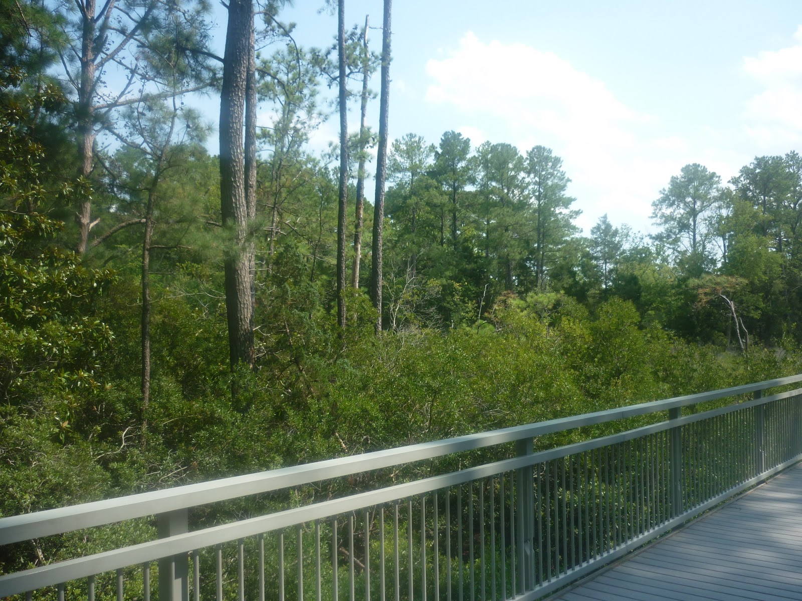
I had made the assumption that such cliffs would easily stand out, that a visitor center would be clearly marked, and that signs a plenty would direct me to the scenic areas otherwise.  Well, it turns out that is one of those more annoying national park sites that are under the jurisdiction of the Bureau of Land Management.  Now, some places, like Grand Staircase-Escalante National Monument, have lovely visitor centers and enthusiastic staff that are all about having silly travelers like me go all "park fan" on them, but for the most part, the BLM is more concerned with making sure land gets used properly than with making sure people can enjoy themselves, get connected with nature, and learn things.  That said, it turns out that they did have a visitor center at Navajo Bridge, the last crossing over the Colorado river that one can drive on before it cuts the vast canyons of the Grand Canyon further downstream.  Silly me, I was less concerned with stopping and enjoying the view than I was with getting on to more monuments.  

I at least afforded myself enough time to stop on the new bridge and take a shot of the river.  This is a downstream view of the Colorado river, not too far away from which the Grand Canyon has its relatively humble beginnings.  Though you see cliffs off in the left horizon, and the Vermilions are off to the right outside of this image, the land immediately around the top of the canyon walls are quite flat; as one drives toward the bridge from the west along US 89, the canyon can be seen nearby as a shadow in the otherwise barren and flat land.  The river is 500 feet below the bridge.  The soil and rock is extremely red.  The land is trodden by few people.  I have to say, I want to come back here some day, and perhaps my greatest travel regret ever is passing through here so quickly.  Maybe I was so much in awe of creation still, after having been to the North Rim of the Grand Canyon only an hour or so prior, but Marble Canyon and the Vermilion Cliffs enthralled me, put me in an extreme state of relaxation, and made me not want to go.  Yet, on I went, almost without a second thought until I was near Flagstaff.  Maybe I was nature drunk.

Anyway, how about the actual cliffs, you know, the point of this post?  Well, let's go see those in just a minute.  For now, as a reference point, this is where we are talking about:

The cliffs themselves are the yellow... banana looking circle I put there.  The orange dot next to them is the Navajo Bridge.  The Arizona Strip is so named, as you can see, because it is cut off from the rest of the state by the gap of the Grand Canyon.  In many ways, it feels like it is isolated from the rest of the continent.  But enough of my pseudo-mystical ramblings, you came for the pictures!

Now, as you can see, at first I did not think much of them.  Yes, those are awesome looking cliffs, and but I had seen taller ones, was still in something of a nature daze, and was mindlessly making my way to "the next stop".  Yeah, you know what, I think I will blame all this on just being out of it at the time.  Anyway, the skies had opened up not ten minutes before getting here, and let me tell you, this is one of those places that rain improves a whole heck of a lot.  The cliffs literally started running water, mud, and even small rocks like mad, and the colors burst out them.  Now, that picture is blurry because I did not think to slow down for a better shot,  but those boulders captured my attention.  A few miles later, I realized where I was, probably because the cliffs got closer and a bit more colorful.

Still, even though I was excited to see yet another place on the map come alive, I was more concerned with destinations than the journey (I promise to stop complaining about this soon), and I had seen cliffs like this before.  The talus piles at the bottom of the cliffs, for example, reminded me of the Book Cliffs near Grand Junction, Colorado, the very first part of the dramatic dry and sculpted west that I had come across back in 2008.  At that point, as if God was mad at me for not being impressed with his work, I came across one of the most beautiful things I have ever seen in my life.  You may disagree, but you were also not there, and trust me, the camera just not do it justice.  

These are the Vermilion Cliffs.  I am told that on the Paria plateau above the rim of the cliffs are some of the most amazing rock formations anywhere on the planet, including The Wave (check out some pictures in the link provided).  Of course, when I come back here (not an if), I plan to explore the area on foot.  Still, I can imagine that at that time, as when I was here before, I will just want to stare at these marvelous red walls as if they were some sort of a natural holy icon.  Now for me, much like a religious icon, these cliffs, even in these pictures, serve to empty out the mind and calm the spirit so that it may listen.  Maybe I was not ready to receive what such a meditative experience might have to offer, and so I rushed.  I don't know.  I plan to return to find out.  

Sadly, I had another camera card with pictures of the washes bursting with RED water in them.  I do not know where I put it, but I will certainly make a second post of this place when I do find it.   


Tuesday, January 17, 2012

Trees in the News: The Death of a Baldcypress

How unfortunate that after posting about Baldcypresses, news comes that the oldest one around did not make it.

To start with, here is the story:

http://www.thestar.com/news/world/article/1116206--3-500-year-old-cypress-tree-in-florida-catches-fire-and-collapses

I suspect that this is an act of arson.  For one, Baldcypress grow in swamps, usually standing water or very moist soil, and even under the dry spell that central Florida is currently having, the tree would be incredibly moist.  A tree like this does not spontaneously ignite.  How could a fire start in a place like this, naturally?  Lightning.  There were no thunderstorms in the area that day.  Furthermore, the thing is pretty resilient to that sort of damage even then, and if it was truly that old, then it would take more than a strike or two to down her.  Sequoias and other large trees, for instance, usually have some splitting and bark burns from lightning strikes, but normally do not die.

No, to light this thing up you would need to go about it artificially and under controlled circumstances, or at least be young, dumb, and pathetic with a false idea that you have nothing better to do.

Yes, the tree was old, and yes, it was pretty hollow inside.  The thing is, it was still alive, and tree or not, it was a well-loved landmark for locals.  I was hoping to see it for myself one day...

Sunday, January 15, 2012

The Edge of the South

Back in July I went on an exhausting excursion into the savage heart of the blistering summer, for some insane reason deciding that such would be the best time to see Virginia and neighboring areas.  Well, it was hot (109) and it was humid (over75% most days), and as I look outside at the snow now, the white blanket that makes so many drivers just plain dumb does not look so awful.  The venture was certainly not boring, however, and it was nice getting back to the mid-Atlantic and "South" after more than 15 years.

Now, before we continue, a few things about your author... One, he is obviously well-versed in geography, the natural sciences, and modern North American cultural anthropology.  He developed a passion for these things when he was growing up, mainly because he was one of the few kids that did not spend long car trips bickering with and teasing his sibling (reverse actually), looking at books and electronic games, or sleeping.  Instead, hours were spent staring out the windows and watching worlds change.  Trips to Northern Ontario or all the way down to Florida were never boring, because they were a chance to be surrounded by that wonderful granite or those palm trees, respectively.  Second, your author, despite being very knowledgeable, is also very imaginative and can sometimes put things on maps that are just not really there.  Sure, when he gets there, things make sense, and if you were to dump him into the middle of a swamp, he would most likely be just fine, know where he was, and be able to find his way around without a map or compass.  

Case in point, even though he had been there before, and knew what was in the area anyway, well... there was a very different conception of what "Virginia" would be like.  This, after all, was the south, no?  Virginia was where the Civil War started and ended, where every soft drink is called a coke, and people speak with that charming southern drawl in their voices.  Yes and no.  As usual, take a look at this map, then we can figure out where to go from there.

Starting at the far southeast, down by Norfolk and inside the yellow line, you have the Tidewater region, one of the first areas in the United States settled by English speakers.  Moving further inland, you leave the salt water estuaries and swamps behind and find drier ground of the coastal plains, and then also an area called the Piedmont, which is west of I-95, the highway you see running between Richmond and Washington.  The areas seemed similar enough to me that I lumped them together.  Past the teal line, things get a bit more vertical and you run into the beginnings of the Appalachians, including the Blue Ridge and Shenandoah mountains.

Now, falling back up to where we noted that your author gets silly regarding expectations, imagine there is no yellow line there, and you have him staring at the map before getting excited about heading to "the South".  Instead, you find what is more appropriately called "Mid-Atlantic", even "East Coast".  You see, especially up towards Washington, while you might have Pepsi referred to as Coke, Magnolias and the odd palm tree lining city streets, and a bit of an accent to the locals, you also have a hectic pace to life, Wegmans, a developed urban landscape, and no guarantee for the area landsliding either a red or a blue candidate.  Likewise, when you do manage to find a more natural setting, things will not look shockingly different from much of the rest of the lower elevations of the north eastern part of the country.

This was taken near the Potomac river near the Great Falls of the Potomac.  Here we maybe have a lusher forest than one might find in Michigan, Upstate New York, or even New Jersey, but with the exception of a few tupelos or the insane amount of Kudzu everywhere, this is hardly what a person from those places would consider exotic or different.  Heading twenty miles south, we run into Manassas National Battlefield Park:

There definitely are a few unique things here.  In the midst of the familiar hardwoods you see Virginia pines sticking out above the canopy.  Down here, they have a slightly longer growing season and better soils to grow in.  Northwards, they are scrubby and small, and tend to stick to sandy, well-drained areas in which they are the predominant species of tree (pine barrens are thus named).  They get taller the further south you go, and things like maples start to disappear, while other pines become more predominant and new kinds of farms start appearing.

In this case, cotton fields start to show up, and by this time, the "South" starts to creep in.  Perhaps cotton fields could serve as one main indicator of where the southern states truly begin, as they are good signs that you are either near some historic feature of the ante-bellum south, or that you have crossed one of the old survey borders wherein slavery was contained/permitted, depending on your point of view.  In fact, even way out on the Texas Panhandle, as soon as you cross from Oklahoma south of the famous 36,30 latitude, there are cotton fields to be seen.  This particular field was the first one I encountered that trip, on the grounds of the Shirley Plantation:

Now let's face it.  Plantations are very much a part of the general image one thinks of when "South" is mentioned.  This particular one might not be as grand as the ridiculously huge mansions common elsewhere, but that is because it has a much older history, with even the building itself dating to 1738.  This was the house where Henry Lee was married, and where Robert E. Lee spent some of his childhood.  The estate sits on the James river, not far away from Richmond, where the yellow line moves in along the river near the city.  In many ways, the plantation is at the edge of another world.

I mention that because the Lees, like so many Virginians, were reluctant to fight against the Union during the Civil War.  Yes, Virginia did secede, but then, as now, much of the state had more ties to an older colonial past, and markets that shared commerce and interests with regions northward, more than southward.  At the same time, slavery was going strong in this area until the last moment, and it was indeed the army of the Shenandoah that secured a victory for the confederacy when the war truly got underway at the First Battle of Manassas.  Some of the most effective and famous leadership in the Confederate army came from Virginia.  Some of those men, such as Stonewall Jackson, even had qualms about slavery, though like the Virginians of the Revolutionary era, owned slaves of their own.  Borderlands everywhere, it seems, tend to have some degree of ambivalence about them.

So what happens when you travel past that yellow line into true tidewater Virginia?  Well, that is where the "South" starts to appear a bit more.  


These were both taken on a very hot muggy afternoon off a walkway in Jamestown.  The park is a special place where one can see roughly the same view that the very first Virginians saw when they landed here in 1607.  Here can be seen Pond pines, and in the second photo on the left you can also make out the shiny leaves of the Lobolly bay, one of the first larger evergreen broad-leafs that can be found heading south.  What really made the swampy little colonial landscape stand out though was the Baldcypress.

At first, I did not recognize it.  Further south, in the coastal Carolinas and onward, they grow in large stands of extensive swampland, often dripping in Spanish Moss.  Here, and when I was last in Arkansas, I did not notice any of that wonderful stuff hanging from it, but the profile of a large cypress is unmistakable nonetheless.  Once I adjusted the scale after seeing this larger tree, things became obvious.

Just as Black Spruce grow where the true North really starts, these trees are good signs that you have crossed into the edge of the true South.  On the Atlantic coast, this is about where they stop growing, while further west, they can be found up the Mississippi river as far north as extreme southern Illinois.

Trees and plantations, of course, do not a region entirely make.  At the risk of sounding stereotypical, when I spent the night in nearby Hampton, Va, I drove past more fried chicken restaurants advertising grits than I ever wanted to see.  Don't get me wrong, us northern types are unhealthy too with our coney islands and poutine

There were other signs as well, some along demographic lines, others involving product advertisement and even the kinds of music being blared out of cars at unreasonable volumes.  I have to say, it was pretty exciting.  At the same time, it was a real tease.  This was, after all, only the edge of a rather large portion of our continent, sort of only a scratch on the surface.  As a young kid, I did not have much interest in taking pictures or writing a blog, so needless to say I have next to nothing of areas further south.  Nevertheless, those trips down the length of I-95 did make enough of an impression on me to pay more attention to places and people in general.  OK, fine, mostly trees, but you get the idea.  

Thursday, January 12, 2012

Organ Pipe Cactus in Bloom

Another short post today, again to show off a lovely plant.  In this case, a cactus flower that bloomed out of season in a private garden in Fontana, California.  Organ pipe cacti, of course, do not naturally occur in California (just across the river in Arizona), but it was such a lovely flower that it deserved a picture, no?

Cacti are a fine addition to any garden that can support them.  They produce amazing flowers, require little in the way of care, and can be good for stopping prowlers dead in their tracks.  There is even a cold weather species that grows in the northern plains and ranges as far northeast as Long Island, the Eastern prickly pear.

Wednesday, January 11, 2012

The Simple Joy of a Tree

I was looking through my thousands of photos that I have accumulated from this past year alone, and I stumbled across this one tree that just begged me to display it on the blog.

Yes, that would be an Eastern White Pine.  Tall, slender, graceful.  I thought, why not make a whole post on this tree?  The sad truth is, although I grew up surrounded by them, have a great liking for them, and consider any landscape in which they are absent to be alien and far from home, I have relatively few pictures of them.

Anyway, this fine fellow is on the south side of M 72, about five miles east of Kalkaska, though I am not really certain.  The tree sticks out quite a bit, even though the area has no shortage of taller trees.  For better illustration, here is a shot from a quarter mile back.

A single impressive pine is hardly a new photographic subject of choice, if Ansel Adams is any indicator of good taste.  The first photograph one sees upon entering the Department of the Interior's gallery, in fact, is a Sugar pine:

You see?  A photograph of a photograph of a single pine!  Now, consequently, both Eastern White and Sugar pines are five needled-pines that have strong, independent branches which are seemingly cast out into the skies as if they were an orans figure in an icon.  Perhaps their common appeal (at least to me) lies in their contradictory existence of being so grand and yet so welcoming and familiar.

Tuesday, January 10, 2012

Remnants of Natural California: Canyons of the Foothills (part 2)

If one starts in the middle of the city of Fontana, California, and drives straight up Sierra avenue (more or less main street) and continue to the exit at I-15, you get probably the most accurate remaining viewpoint of what basin topography and plants would be like.  Downtown, of course, is built up and paved over, and any grasses you might see are manicured lawn specialties.  As you head closer to the mountains, the development eases off a little, and one is surrounded by open fields with the occasional shrub sticking out.  Slowly, about every mile or so, the land gains about fifty to seventy feet in elevation, and by the time you near I-15, you get shrubs starting to make the area look a lot more bountiful.  Ahead, you see the San Gabriel and San Bernardino mountains meeting head on, with a moderately high pass in the middle called Cajon Pass, which leads up and out into the Mojave desert beyond.

Staying on Sierra avenue, which is now called Lytle Creek road, the land becomes a bit rocky, gains about 400 feet to a mile until it hits the town of Lytle Creek.  The road passes over Lytle Creek itself, which this far up is still a stream even in dry months, as it has yet to sink into the dry basin lands.  Here, the ground is denied full sun by the closing canyon walls, and groundwater is closer to the surface as it flows downhill.  In some places, the water pools and cascades in pretty decent displays even in the dead of summer.  On the day I took this, many people were swimming in the creek further downstream.
That soft, pine looking shrub in the front center is the dreaded Tamarisk, a tree which wreaks havoc throughout the western United States.  They reproduce easily, crowd out existing vegetation, suck up the local water table, and even dredge up salt from deep in the ground which they then drop in the decaying leaves on nearby soil to prevent other plants from growing.  Fortunately, this one seemed to be a bit of a loner, and was surrounded by normal, patriotic trees like Fremont Cottonwoods and various willows.

As noted, this lets streams be streams, but it also allows for taller species of trees to grow.  Only a mile and a half into the canyon, the slopes have Bigcone Douglas-fir growing on them.


These are trees of opportunity, to say the least.  They grow mainly on the east and north facing slopes to avoid the desiccation of the full afternoon sun.  Their little niches are rocky, moist, and spots of safety among the otherwise fire prone canyons.  In such conditions, they reach down as far as possible into the basin lands, stopping at around 1,000 feet in their lowest occurrence.  In some areas, they are true survivors, several centuries old and beacons of vitality in a scorched landscape.

In others, the sheer intensity of wildfires overcome them, usually high-intensity blazes that are deliberately set by arsonists or careless smokers (this has been proven and confessed by such people).  Still, they are tough things, and I have yet to see an entire hillside devoid of them. There are always at least a few survivors that were shielded by their neighbors.

The outer trees actually slow the fires, which burn outwards then back to the more flammable vegetation.  Of course, the flammable stuff also has mechanisms that help cope with the extreme fire conditions here.  In the immediate foreground are Chamise, which dominate much of the lower foothill landscape.  These and other shrubs, mainly manzanitas, ceanothus, and yuccas, burn to the ground quickly in the intense fires of the region, aided by the oils in their leaves and branches.  Some of these can even spring right back up again from the roots, which were safely away from the quickly passing fire underground.  Many of the plants have seeds which can remain dormant until activated.  In some cases, several months later, the area can look undistrubed.

Many of the shrubs are deciduous evergreens and could provide for a lovely garden year round in their native climate, but are often passed over for the many plants from around the world that grow can grow in the area.  More often than not, residents living along the foothill ranges see only their distant appearance, which in the summer through early winter look dull and brown.  Closer up though, even in late August when the basins and deserts across the range look brown and choked, these hills can be a very refreshing green.

The large stalk in the middle belongs to a Yucca whipplei, which Franciscan missionaries also named "Our Lord's Candle".  (The plant is hidden in the bushes, but you can make out a non-flowering one on the left of the picture-the spiky pale blue-green plant).  I have seen stems as tall as twenty five feet shoot up from the small plants, which die after they flower in this way, sacrificed for providing nutrients to such a feat of growth that bears hundreds of seeds.  Nature, as some of the more romantic naturalists have noted, is often more of a temple to honor God than most cathedrals.  I would add that it can work just as well as a theology book, given proper understanding.

So why do I find canyons and ravines like Lytel Creek to be so amazing?  Well, maybe because if you cross the Mojave desert for hours and wonder if you will ever see a tree again, you finally descend into this lush world and it stands in amazing contrast to the sandy expanses above and the dry, urban sprawl below.  Here, see for yourself:

Out in the desert, not too far away:

Here in the canyon:

Down towards Fontana, San Bernardino, etc.:

Noticeable contrast, to say the least.  The foothills and their canyons are surrounded by dry lands, and are themselves witness to maybe 20 inches of rain a year, roughly half of what the Eastern United States and Canada receive annually.  They are subject to intense natural (and unnatural) phenomena, and yet are full of life that has not only managed to survive, but thrive.  From a distance, even relatively close up, the slopes do not look like much.


For those who take a moment and venture a closer look, however, there is some lovely life growing here.


Mind you, in some places, the beauty can be arresting even to those always in a hurry.  

OK, so I cheated on that last one, that was taken about seven miles away, off of California 18.  Granted, the landscape and ecosystem are fairly the same.

Lytel Creek canyon is easy to get to, right off of I-15 on the Sierra avenue exit, which is the last exit before heading up into Cajon pass.  There is a wonderful joint ranger station for both the San Bernardino and Angeles National Forests, which aside from having weird hours and a closed bathroom, does have a lovely botanical garden that highlights the native flora.  The canyon is a wonderful remnant of natural California, and the wonderful oasis that once offered rest to the peoples who lived here for ages and welcomed those who arrived in these lands after a long trek across the continent looking for the golden land near the Pacific.

Sunday, January 8, 2012

Remnants of Natural California: Canyons of the Foothills

Let's face it, when most people go places they assume that the fields and patchy woodlands they see outside of the urban areas are pretty much reduced versions of what used to be there before human development radically altered them.  For example, one might see a lovely pastoral scene of a grassy heath, rather rocky hills and low mountains dotted with sheep, and the odd stream running through a shrubby dell and figure that to be Ireland primordial.  Likewise, your average sunbather on Miami Beach might understand that the resort hotels behind them were not always there, but surely the beach extended further and lush coconut palms were backed by an inviting tropical forest.  In truth, nearly all of Ireland was once temperate rain-forest, and Miami Beach was sandy in parts, but in most others covered in stands of Red mangroves backed by limestone outcrops that were topped by forests of Slash pine.

Now, for the most part, rural areas will often give you at least some of what used to be there.  Native trees and flowers will usually be present, although, as our above examples can illustrate, the type of ecosystem that once predominated might not be so clear at first glance.  In some cases, invasive species, urban and agricultural development, and yes, climate change, have altered the local life and landscape to the extent that the natural and native have long since been extirpated.  Case in point: Southern California.

Look at that map.  There are roughly forty some miles from coast to solid teal line in which millions of people are crammed and vast areas are paved over entirely.  That is, of course, where you have suitable land to build on, which would not include much of the mountain areas past the dotted teal line.  The mountains, you see, get cold and snowy in the winter (and who would want that), and they also have the little problems of mudslides, wildfires, and just happen to lie along the San Andreas Fault.  Up past the teal line would be the deserts, which are suitable for building, but tend to get a little hot and cause the average water bill to get a bit insane.  People still live up there, of course, and have for as long as humans have been in the region, but ever since Jedediah Smith and his mountain men came through the desert (at the wrong time of the year), most people of this strange age prefer to live in that coastal zone.  Jed and his men, in fact, thought it was paradise.  This must have been before the traffic, smog, and celebrities.

Most books and articles on the natural life of the region will tell you that in the basins and valleys, we once had lush grasslands dotted in oaks, yuccas, cacti, and glorious displays of wildflowers, such as the California Poppy (which no photograph can ever do justice of).

They will also state, however, that we are really not sure.  Fossil records for the area are sketchy and still being dug up, the historical record is surprisingly vague on the matter, and most native species, especially of the bunch grasses, have long since been replaced.  In contrast, the foothills (approximately where the dotted line is) look the way they did back in the day when Franciscan missionaries and explorers such as Mr. Smith were documenting the region.  Wildfires, for which the area is famous, have kept things that way, preventing development and performing the regenerative role they have for ages.  You see, they are hard to stop because they are extremely hot.  For one, everything is usually bone dry, and that matter is not helped by winds blowing down from that hot, dry desert.  For another, most of the plants there actually have chemicals in them that encourage igniting!  This seems to be counter productive until one understands that a good, clean, fast burn will make the fire move on instead of take time to burn down to the roots.  Now, this is not to say that an inferno rages here every year.  Naturally occurring wildfires are somewhat infrequent here, with stand replacements happening roughly every 30-50 years, depending on location.  When they do burn, though, they really burn.

So, let's take a look at our tinder box paradise, shall we?  The red line on the map above is where we will be going in part two, a place called Lytel Creek canyon.  The canyon forms the boundary line between San Bernardino and Angeles National Forests.  The mouth of the canyon, at I-15, rises out of Cucamonga Valley at about 2,000 feet and continues into the San Gabriel mountains roughly parallel to Cajon Pass.

A preview, then, of a truly remarkable forest that is surrounded by desert, the most developed land in the world, and is forced to adapt to less than 20 inches of rain a year, and intense wildfires that can burn everything to the ground.