When a cross section of North America is pictured, starting at one ocean and travelling the breadth of the land to another, common imagination usually orders ecosystems into nice compartments of "what belongs here". Starting, say, in Virginia along the Atlantic coast, we have southern forests of cypress trees and pines, moving into mixed-forests and maybe spruces and pines up on the higher parts of the Appalachians. These forests continue, almost uninterrupted and dense until they part beyond the Mississippi river and open into vast grasslands, which in turn give way to mountains, deserts, and finally the verdant Pacific shores. The truth of the matter is, this is a very inaccurate portrait. Prairies once existed in parts of interior Virginia and western New York, forests once followed the rivers that drained the plains, and the pre-settlement map probably looked more like a mosaic than a well-ordered set of parallel vegetation zones.
Vast grasslands that once covered many parts of interior North America often existed in isolated patches between "solid forest". They did so for different reasons, most often because the soil was not otherwise suited to certain types of forest, and because fires, both natural and set by native peoples, would clear out saplings often enough to let the grasses maintain a hold on the landscape. The frontier between forest and grassland was constantly shifting, as two different worlds were locked in competition for dominance. Most often, the interface between forest and grassland was convoluted and the two habitats engaged in a dance wherein a little grass and a little bit of tree could be found well within each other. Dependable rains would usually keep things from being too bone dry to spark regular fires the further east one would go, but in the lands surrounding the eastern Great Lakes, a ton of glacial sand deposits meant that some otherwise moist lands would provide for the drier conditions to support grasslands, or partial grasslands. Moderately high rainfall would still provide for certain trees that could take well-drained conditions to remain among the tallgrass, notably oaks, junipers, and pines. "Eastern prairies" would thus be better termed savannas.
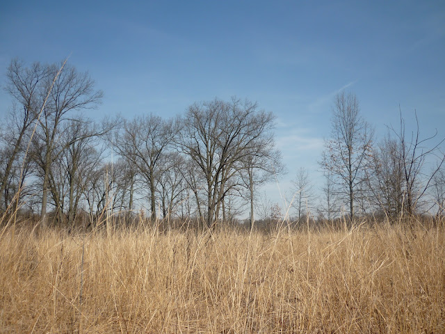
Much of these grasslands have gone, however. The Nearwest has been under steady development and cultivation since the end of the War of 1812, and even where the land has not been completely harnessed, land management and fire suppression has turned most "wild" land into some pretty dense woodland. Fortunately, western Lake Erie has several notable examples of remaining savannas, especially in the areas around Toledo and Windsor. I intend to document these here, preserve by preserve. In the meantime, below are three fine examples of what an oak savanna looks like. As you can see, the trees are still as tall as one would expect them to be in the well-watered east, and while the tallgrass is impressive, this is hardly what one would call the open range. Still, it is a lovely and unique ecosystem, and a place of significant ecological diversity.
These particular images were captured at the Kitty Todd Nature Preserve just outside of Toledo. The preserve is often mistaken for an abandoned field, which is understandable, as most of the surrounding land does have active farms on it, rather than contrasting forests which once would have made this sort of grassland stand out.


No comments:
Post a Comment