While are not exactly sure how old the Ottawa River is, we do know that it sits within a 175 million year old rift, the Ottawa-Bonnechere Graben. The rift lies within much older rock, the Grenville Province of the Canadian Shield. While some parts of the Shield include the oldest surface rock on the planet, dating back to four billion years ago, the Grenville portion, which includes the Laurentian and Adirondack Mountains, is actually much younger, at a "mere" 1-2 billion years of age. The edges of the rift are pretty easy to come across, namely on the southern edge, which forms rises of elevation nearly 1,000 feet in height along the middle Petawawa River, one of the largest tributaries of the Ottawa...
As well as the northern edge, which can be seen all along the Ottawa River, particularly in the Gatineau Hills north of Ottawa, and the peaks of the Laurentians across from Mattawa and Deep River, Ontario...
 |
| The Ottawa River in a more or less natural state at the confluence of the Ottawa and Mattawa Rivers. The opposite shore is the north fault wall of the rift. |
 |
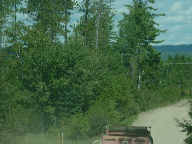
| The Brent road, near Deux-Rivières, Ontario, looking north. The ridge in the background is the north edge of the Ottawa Valley. Seen here are typical pine forests of the lower elevations of the valley. White (Pinus Strobus), Red (Pinus Resinosa), and Jack (Pinus Banksiana) Pines thrive in the incredible masses of sand which are found here. The pines formed the backbone of the early Canadian logging industry. |
We do know one consequence though. The ice sheet left us sand. A LOT of sand.
The best sand on earth, in your author's opinion, and he has taken in some fine sand in the tropics and deserts. I even wrote a post about it. The Ottawa Valley is full of it, especially from Mattawa and downstream, as well as along its major rivers named above. Even down past Ottawa where the river gets a bit more broad and even slightly "southern" looking, in parts even refusing to expose its granite underbelly, there is sand to be found. This sand, in fact, supports some of the easternmost natural prairie in North America. The pines like it, the birches and aspens tolerate it, but nothing can handle large, flat, hot stretches of sand like grasses and friends of grasses. Well, I suppose the pines like it as much as the grasses.
 |
| The Brent road, one of the many wilderness roads that one can take to easily explore the dense pine lands. |
That's pretty much what is underneath the Ottawa, and what it flows through. Sand and lots of Canadian Shield stuff, mostly granites, gneisses, and even gabbros. Down between Ottawa and its mouth near Montreal one runs into some limestone, but for the most part this is a Shield River through and through. The water is as black as tea in many reaches, a gift of the dense forests and bogs that feed it, very much different from many of the silt laden rivers that drain the rest of the continent. Like them, however, the river is very wide for much of its length. The Ottawa passes through a variety of landscapes as a result, including the boreal forest, the transitional forests, pine barrens and remnant prairies, urban and rural areas, and some desolate looking sand spits and beaches that remind the explorer that even with all this water around, we tend to remain a somewhat drier continent. For the most part, a trip up or down the Ottawa is a trip in the north country, with a few tastes of the rest of the northeastern continent.
Over her short 790 miles, the Ottawa only descends about 1,100 feet, (a descent over a comparatively steeper gradient than the Mississippi's, albeit of equal elevation) but she used to have some pretty intense rapids in places until they were dammed over in the last half century or so. As such, the Ottawa was never really an ocean-accessible river like the Mississippi or Colorado were, at least not for larger vessels beyond canoes or logging rafts. For the canoes and rafts, though, it was a very, very attractive road indeed, which we will explore in the next post.


No comments:
Post a Comment