I was doing some reading last night on Canadian history and came across a chapter on the War of 1812. When I finished the chapter, the thought crossed my mind that the 200th anniversary is well on its way, and that in the United States, it will largely get ignored in lieu of the commemorations being held everywhere regarding the American Civil War. Thinking further back, I remembered how in history classes in high school, 1812 was often ignored outright, if not given a very minor mention. This is unfortunate, as it is one of the three conflicts I consider to be instrumental in shaping the political and cultural landscape of North America as it exists today. For Canadians, the War of 1812 was in many ways the birth of our nation. For Americans, it opened up your path towards Manifest Destiny, confirmed to the World what had been achieved in the earlier revolution, and served as both the finale and opening act of the generation of the founding fathers and their children, respectively.
Even more impressively, for the first time in history, a nation won a war by means of conference rather than superiority of arms. True, the British had the business over in Europe to deal with at the time, but they were by no means distracted enough to not be able to give adequate attention to what was going on over in our world. Quite frankly, there was some pretty amazing diplomatic force present at that Treaty of Ghent. Despite enormous losses on the frontier, which included the capture of Detroit and Chicago (then Ft. Dearborn), and the near outright destruction of Buffalo, the United States managed to keep the border at the Great Lakes and the Saint Lawrence River. Despite the mess that British regulars made of Washington and Baltimore, the United States kept its sovereignty intact. While it was true that Baltimore was successfully defended, and American forces did secure a number of other victories, they were by no means significant enough to justify a return to ante bellum status of borders and rights. Instead, the United States won a diplomatic victory the likes of which has never been trumped. This bolstered the national confidence and gave credence to a spirit of expansionism that until then had been kept somewhat in check by the warnings of George Washington to be satisfied with independence and not become involved with international matters. The renewed energy would result in the construction of the Erie Canal, the start of extensive settlement in the Midwest and Lakes, and the creation of a northern limit giving rise to looking towards defining a southern boundary. This would prove to be the start of turbulent times for Native Americans and Mexicans, especially for the peoples of the Ohio Valley.
The outcome encouraged President Madison to make some interesting statements during his seventh annual State of the Union Address. In effect, this war not only secured American independence, but that of the entire continent from foreign domination. In an age where our economic sovereignty has come into question in the face of increasing dominance by nations such as China, we might be seeing this doctrine invoked a bit more in the future. Ever since 1814, North America has been made into what it has become not because of world scale imperialism, but because Canada, the United States, and Mexico, have learned that cooperation and inter-dependence have truly shaped our part of the world into what it has become. Do not get me wrong, I "believe" in humanity and the progression of the world. At the same time, regional development counts for something. That, I suppose, is a post for another time, a time in which I have become much more informed and can witness certain conditions first hand.
So about those neighbors then? Well, for Canada and Canadians, who are quite well educated on the importance of this conflict, this was freedom and the start of the forging of a national identity. While the concept of true sovereignty was a bit farther away, "Canada" looked like it was starting to have a chance beyond "land that the Yankees are going to take away maybe next year". While the history books and popular jest like to insist that Redcoats did all the work, the truth of the matter was that the locals, be they native or transplanted, did a substantial amount of fighting. For that matter, it was not the Redcoats that had their homes and fields burned to the ground. Many battles had men and sometimes even women fighting for their homes that were perhaps no further than a mile or so away. The Battle of Chateauguay, in fact, was fought almost entirely by Canadians born on North American soil.
In the coming year, I plan to visit and re-visit many of the key sites associated with the war, and will leave some posts about impressions (with photographs, of course) as I come to them. In the meantime, check out your local bookstores for titles on the subject, which I have been noticing have been displayed even in the United States lately!

Always to the frontier
Friday, December 16, 2011
Tuesday, December 13, 2011
Pure Michigan.
OK, OK, I admit it. Tuesday has rolled around and I have not thought of anything good to put in these pages. No, I have not given up on the blog, I just need to spend more time with it.


For now, enjoy a photo-journey through the Great Lakes State.


Tuesday, December 6, 2011
Life at the Top, part one.
The journeys in this blog have thus far introduced the reader to a variety of topics from mountains to deserts to upstart beavers. Much encouragement has been made on the part of your author to explore the world around you, and this has taken us from Virginia clear across to California thus far. Much attention has been placed on mountains. Why is that? Well, mountains are nothing if not majestic, and they are a wonderful way to see a great diversity of landscapes all rolled into one. Take the Los Angeles area, for instance. You can move from grasslands and oak forest, through pines and spruces, over rocky fields and alpine meadows and finally end up in desert in the space of 10 miles. Elevation can be much less pronounced, however, and have just as much influence with changes as subtle as only a few inches, as is the case at places like Big Thicket National Preserve and the Everglades. At Big Thicket, a foot of elevation gain can move you from a cypress swamp into a palmetto forest en route to a pine barrens. I hope to tour the area personally next year, and give us some great pictures in the process.


What happens when you really gain the elevation though? What happens when you pass through pines, spruces, and then notice that not only is the air getting a bit frostier, breathing is getting a bit rougher and that sun just seems to beat down more than it ever did during that time you fell asleep on the beach and woke up red as a tomato and embracing a beached whale for some reason? Well, depending on where you are, you might see a distinct lack of vegetation and life in general, at least at first glance.

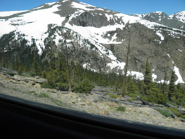
For frame of reference, the pictures used here are going to be largely from the Front Range of the Rockies, and then in Rocky Mountain National Park. That particular shot was taken off of Trail Ridge road which runs through the park and climbs as high as 12, 183 feet up into the wild blue skies. The road is perfectly fine to drive on, at least from late May until early October, but the experience is not for the faint of heart. Most people will have something happen to their bodies once they pass 8,000 feet, and much beyond 11,500 (which also happens to be the tree-line), things can get a bit bumpy. The tree-line is my limit for normal functioning. Above the line, I experienced a slightly light head and reduced reaction time, while my heart rate remained normal. I saw other people on this delightful glacier (yes, you can walk on it) hopping and skipping about without problems, but then I have also been in the car about 2,000 feet lower on I-70 with a friend who nearly passed out from just sitting and breathing as normal.

This is a land of extremes, and seemingly very remote. No one can really live this far up unless they are much closer to the tropics (La Paz, Bolivia is about 12,000 feet up and boasts streets lined with palm trees), and even the trees give way. As you can see, those spruces are either dead or growing on the side of their trunks away from the cold and wind. Most of them are barely 12 feet tall, and are true champions of their species. Twenty feet further up, they shrink into mats of vegetation huddled low to the ground. You can see those here. Those are trees, believe it or not. They are just very small, because the growing season is maybe a month or two months long. And yes, that is an elk. Heaven knows what it is grazing on.

Twenty feet further down are healthier fellows, but they are far less impressive considering as how they are literally protected by themselves. The winds drop inside any forest, and the canopy, even as open as it is here, can keep snow from melting into June or shrubs from defoliating into November. Still, this is a world more than two miles above the sea, and a cold one at that. Even where the forest does pick up a bit more mass, things are hardly ideal for growing.

Now I don't know about you, but those are some pretty amazing trees to be doing that. Sure, the gap in the snow is artificial, as the road is plowed. Truth be told though, I stuck my hand in there, and my arm went all the way in before I felt anything resembling ground. That spruce is mostly trunk! I have no idea how it managed to grow the way it did, as up this far, things grow very slowly (decades for a foot of length). This is what the top of our continent looks like, and not only here. Remember how I advertised mountains as the land of diversity? Well, this land of the tree-line and higher is called the "Hudsonian" life zone. It is named after the southernmost tundra in the world, that which rings Hudson Bay. Species here can be found there as well, and a trip up the mountain gives you the habitat equivalent of driving from Omaha to Churchill, Manitoba. There, and here, even in the most undesirable of conditions, life grows as soon as the sun can hit it.

Mind you, there was still a pretty heavy snow pack.

These pictures were all taken in mid-June, by the way.
There is more on the way. This seemed like an interesting place to stop for now.
Tuesday, November 29, 2011
Eastern Mountains: Passable or Precious?
A friend from Cameroon once commented on how flat North America was. He said that there are no mountains anywhere in sight. I told him that Detroit is hardly a good place to judge a continental landscape by, but he said that he had traveled out to the Rockies and said that they were so low compared to what they had in much of Africa. Equatorial African mountains certainly are tall, but that is because most of them have extremely high prominence, meaning that they are lone peaks sitting on much lower ground. Mount Cameroon, for example, sits near the Atlantic Ocean on tropical lowlands and sticks up more than 10,000 feet above the surrounding landscape. Mount Kilimanjaro rises over 19,000 feet from its base.
In contrast, the Rockies, the Sierras of California and Mexico, the transverse and peninsular ranges of Southern California, the Brooks, and the Cascades, our tallest mountain ranges, all have bases that start from much higher ground for the most part. There are exceptions, of course, and three of the 10 most prominent peaks of the world are on our continent. In no way, however, do our native ranges look less dramatic.

Those peaks are anywhere from 12,000 to 14,000 feet above sea level, and while the bases might sit at 7,000 feet or so, they are still mountains. So what makes a mountain, exactly? Most people think about a pointed mass of gray rock with a snow cap at the top. The scientific community seems to have tons of differing opinions, with some communities stating that a mountain needs to have at least 4,000 feet of rise to it, and other saying a mountain requires at least 8,000 feet of elevation, which would eliminate the Appalachians and even much of the mountains of western Texas as candidates. And come on, take a look at the Shenandoah mountains and tell me they do not fit the bill!


Some people I know call these hills. Those are some pretty impressive 3,500 foot hills. I don't know about you, but when the temperature at the base is 90 degrees, and up near the top it is 76, I would qualify this as more than just a hill. At the base there are Southern Magnolias and Tupelos planted to line city streets. At the top you have red spruces, white pines, and hemlocks. During the winter months the upper half of the range will be covered in snow while the valleys and Piedmont will be sitting in their lovely mud and mid-40s. In some places, things can even get a bit rocky, and the tops will be open meadows or rocky balds. I'm sorry, but these are more than just hills.
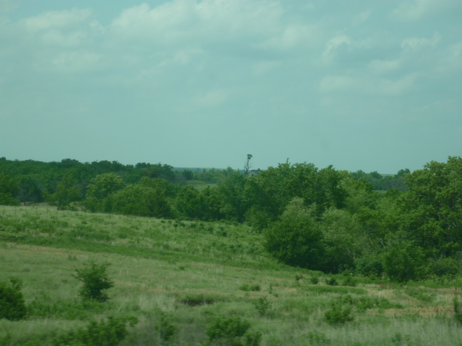
So what is a mountain? I would say that a mountain is a mass of the planet that protrudes from the ground significantly enough to have different vegetation and temperatures at its top than what would be found at the bottom. A hill would be something much lower, and without much relief to it. In my post on the Great Plains, you can find pictures of the Flint Hills in Kansas, which provide good examples of what I would call hills. I could go on with a list, but I suppose I would do better to make a map of a familiar region with what consists of mountains and hills.

The mountain areas are teal, the hills are that yellowish-green. Perhaps I am too generous in calling some things "mountain". In each of those areas, however, they have sufficient vertical relief and road grades as high as 16% in places. Most of the Appalachian region does not require explanation (ignore the bottom part of the map, as well as the top of Quebec, I just forgot to scroll down there while painting), though some of the other regions might. In Quebec along the Ottawa river are the Laurentian mountains, which share characteristics similar to the mountains to their south, the Almaguins and Algonquin highlands. These are substantially rainier and rockier than the surrounding areas, so much so that they actually cast a slight rain shadow to areas east of them. These regions are the only place in Ontario that one can find certain species of trees and mushrooms. To the west, still in Ontario, are areas that have not been given any particular range name, but actually are part of the northern continental divide, separating waters that drain north to the Arctic and south and east to the Atlantic.
Over in Michigan, in the lower peninsula, are areas of relief one would not expect to find in an otherwise pancake flat state. Towards Gaylord the area almost passes for Appalachian. This is along M-72, about seven miles west of Kalkaska, MI.

Closer to Lake Michigan and to the south, the area rounds out a bit more and becomes hilly, an excellent contrast between "mountain" and "hill" according to my definition. This is again along M-72, descending down to Grand Traverse Bay, on the Leelanau peninsula.

Maybe only I can tell the difference. Anyway, near the Wisconsin/Michigan border are the Porcupine Mountains, the one place in Michigan lucky enough to be blessed by the Canadian Shield and its wonderful granite. Again, this area is not extremely tall, and only bears around 1,200 feet of relief, but the effect on the climate and vegetation is noticeable. The mountains can see daytime highs in the forties as late as June and as early as September.
How about those yellowish areas? That big north-eastern pointing spear in Michigan and Indiana is called the Jackson Lobe, some of which is also referred to as the Irish Hills. It is largely a glacial moraine left over from the last ice age, consists of sands and till, and is one of the last strongholds of eastern oak savanna prairies still left in the area. Over in southern Ontario, the hills are part of the rump of the Niagara Escarpment and the Oak Ridges Moraine, one of the largest protected greenbelts in the world. This was formerly the dividing boundary between the lands of the Huron and Iroquois peoples. Of course, they only made it that way because the muskrat/beaver border wars had already marked this border centuries before. The beavers won, but the muskrats ended up building more strip malls and outpaced them economically. The beavers eventually lost their colony of Barrie, which the Muskrats would reorganize into their northernmost bedroom community.
Aquatic rodent territorial conflicts aside, the mountains and hills of this greater area have long served as cultural and economic boundaries between different regions. Furthermore, even the slightest rise in elevation and transition into rockier areas causes big shifts in the local vegetation and animal life. This can be seen powerfully heading north on I-75 past West Branch, MI, or on Ontario 11 once one passes over the Severn river. More subtle changes can be seen heading into the Appalachians on I-80 in Ohio eastbound from about the Cayuga river onward. You can probably find changes anywhere on that map above if you look close enough. Go see for yourself, and bring plenty of rodent spray.
In contrast, the Rockies, the Sierras of California and Mexico, the transverse and peninsular ranges of Southern California, the Brooks, and the Cascades, our tallest mountain ranges, all have bases that start from much higher ground for the most part. There are exceptions, of course, and three of the 10 most prominent peaks of the world are on our continent. In no way, however, do our native ranges look less dramatic.

Those peaks are anywhere from 12,000 to 14,000 feet above sea level, and while the bases might sit at 7,000 feet or so, they are still mountains. So what makes a mountain, exactly? Most people think about a pointed mass of gray rock with a snow cap at the top. The scientific community seems to have tons of differing opinions, with some communities stating that a mountain needs to have at least 4,000 feet of rise to it, and other saying a mountain requires at least 8,000 feet of elevation, which would eliminate the Appalachians and even much of the mountains of western Texas as candidates. And come on, take a look at the Shenandoah mountains and tell me they do not fit the bill!


Some people I know call these hills. Those are some pretty impressive 3,500 foot hills. I don't know about you, but when the temperature at the base is 90 degrees, and up near the top it is 76, I would qualify this as more than just a hill. At the base there are Southern Magnolias and Tupelos planted to line city streets. At the top you have red spruces, white pines, and hemlocks. During the winter months the upper half of the range will be covered in snow while the valleys and Piedmont will be sitting in their lovely mud and mid-40s. In some places, things can even get a bit rocky, and the tops will be open meadows or rocky balds. I'm sorry, but these are more than just hills.
So what is a mountain? I would say that a mountain is a mass of the planet that protrudes from the ground significantly enough to have different vegetation and temperatures at its top than what would be found at the bottom. A hill would be something much lower, and without much relief to it. In my post on the Great Plains, you can find pictures of the Flint Hills in Kansas, which provide good examples of what I would call hills. I could go on with a list, but I suppose I would do better to make a map of a familiar region with what consists of mountains and hills.

The mountain areas are teal, the hills are that yellowish-green. Perhaps I am too generous in calling some things "mountain". In each of those areas, however, they have sufficient vertical relief and road grades as high as 16% in places. Most of the Appalachian region does not require explanation (ignore the bottom part of the map, as well as the top of Quebec, I just forgot to scroll down there while painting), though some of the other regions might. In Quebec along the Ottawa river are the Laurentian mountains, which share characteristics similar to the mountains to their south, the Almaguins and Algonquin highlands. These are substantially rainier and rockier than the surrounding areas, so much so that they actually cast a slight rain shadow to areas east of them. These regions are the only place in Ontario that one can find certain species of trees and mushrooms. To the west, still in Ontario, are areas that have not been given any particular range name, but actually are part of the northern continental divide, separating waters that drain north to the Arctic and south and east to the Atlantic.
Over in Michigan, in the lower peninsula, are areas of relief one would not expect to find in an otherwise pancake flat state. Towards Gaylord the area almost passes for Appalachian. This is along M-72, about seven miles west of Kalkaska, MI.

Closer to Lake Michigan and to the south, the area rounds out a bit more and becomes hilly, an excellent contrast between "mountain" and "hill" according to my definition. This is again along M-72, descending down to Grand Traverse Bay, on the Leelanau peninsula.

Maybe only I can tell the difference. Anyway, near the Wisconsin/Michigan border are the Porcupine Mountains, the one place in Michigan lucky enough to be blessed by the Canadian Shield and its wonderful granite. Again, this area is not extremely tall, and only bears around 1,200 feet of relief, but the effect on the climate and vegetation is noticeable. The mountains can see daytime highs in the forties as late as June and as early as September.
How about those yellowish areas? That big north-eastern pointing spear in Michigan and Indiana is called the Jackson Lobe, some of which is also referred to as the Irish Hills. It is largely a glacial moraine left over from the last ice age, consists of sands and till, and is one of the last strongholds of eastern oak savanna prairies still left in the area. Over in southern Ontario, the hills are part of the rump of the Niagara Escarpment and the Oak Ridges Moraine, one of the largest protected greenbelts in the world. This was formerly the dividing boundary between the lands of the Huron and Iroquois peoples. Of course, they only made it that way because the muskrat/beaver border wars had already marked this border centuries before. The beavers won, but the muskrats ended up building more strip malls and outpaced them economically. The beavers eventually lost their colony of Barrie, which the Muskrats would reorganize into their northernmost bedroom community.
Aquatic rodent territorial conflicts aside, the mountains and hills of this greater area have long served as cultural and economic boundaries between different regions. Furthermore, even the slightest rise in elevation and transition into rockier areas causes big shifts in the local vegetation and animal life. This can be seen powerfully heading north on I-75 past West Branch, MI, or on Ontario 11 once one passes over the Severn river. More subtle changes can be seen heading into the Appalachians on I-80 in Ohio eastbound from about the Cayuga river onward. You can probably find changes anywhere on that map above if you look close enough. Go see for yourself, and bring plenty of rodent spray.
Friday, November 25, 2011
The Charms of Different Waters
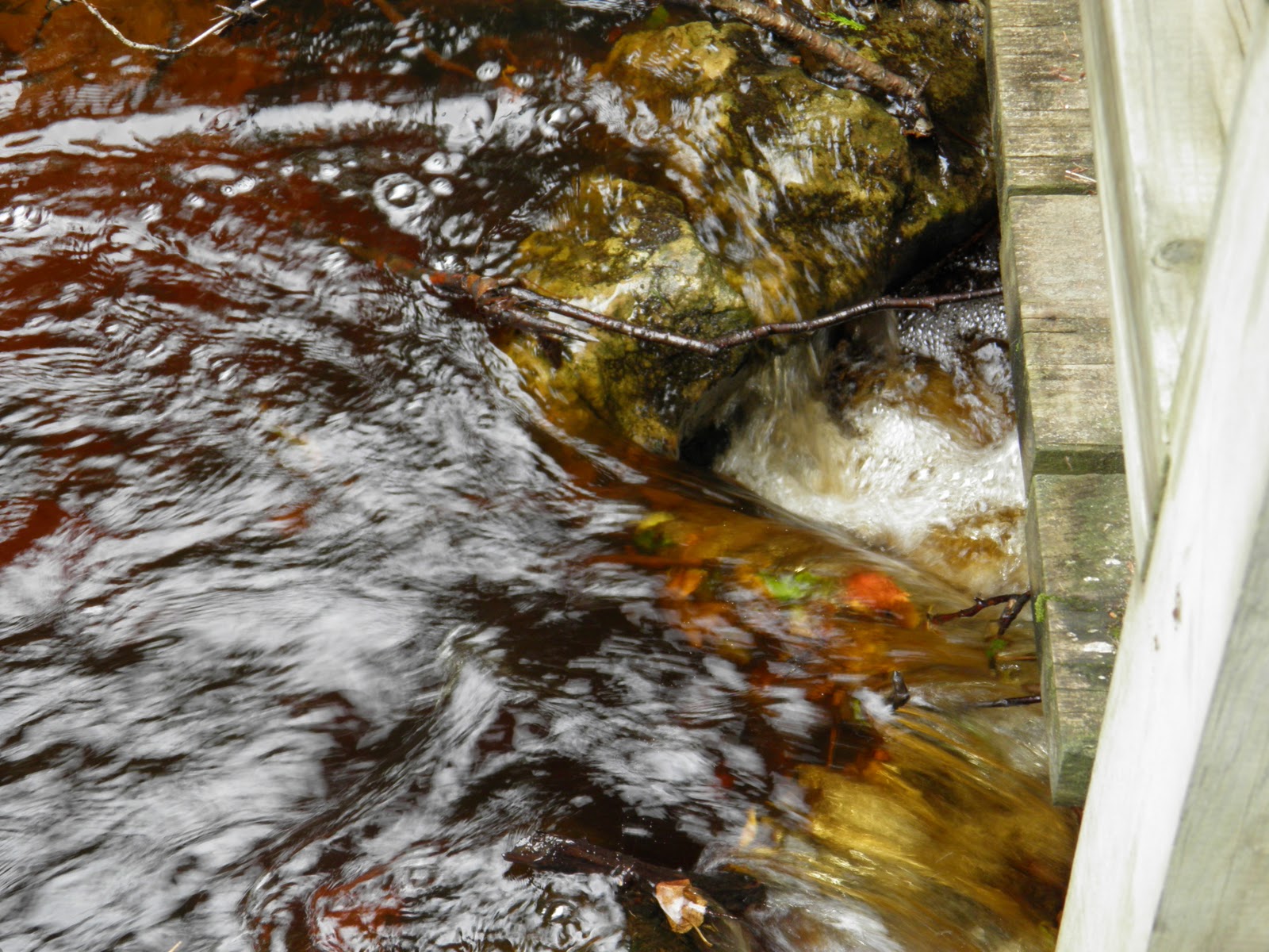
Tannin rich waters from just downstream of Miner's falls in Pictured Rocks National Lakeshore. The water is quite clean, despite appearances. It varies from golden to a dark brown. Great to swim in, probably not so great to drink, unless you have a tolerant body or need a good spring cleaning. I myself have drunk some pretty potent water from the Petawawa river without once contracting beaver fever. Most people need to boil it, though, after which it can be some of the best tasting water around.

Then we can take a look at Lake Michigan, with its lovely greenish blues that are nice to swim in, even if the waters feel a bit more gritty. They have a chalkier taste to them, pretty much what Chicago and Detroit tap water tastes like, minus the trace amounts of chlorine. This lovely spot is where the Manistee river gently flows into Lake Michigan. You can float on your back down the river right into the lake, and depending on the time of year you do it, such a swim will involve a nice thermal surprise.


The waters all taste different, and they all even feel different on the skin. Bottled waters, if sourced naturally from springs or exposed bodies of water, will taste different based on mineral concentrations and specifics. Poland Spring, for instance, tastes very smooth and slightly crisp, because it comes from a slightly acidic source within granite bedrock deep in Maine. Evian has a more alkaline taste to it, because it comes from an area of the Alps with concentrations of calcium in the surrounding rock. While you are forking over sometimes as much as five dollars for bottled water, which is ridiculous in itself, the truth remains that water can taste different and is not universally the same everywhere in the world. Case in point? The ocean!
In the ocean, another factor comes into play that might not have effect on the taste of water except in larger lakes and rivers, namely that of what else is swimming in it. No, I don't mean whales and tuna, but I do mean macro-algae like kelp, coral masses, and even concentrations of bacteria that are more at home in the primordial conditions of the world sea than on shore or in inland bodies of fresh water. Then there is salt. Just look at what it can do to water in the ocean.
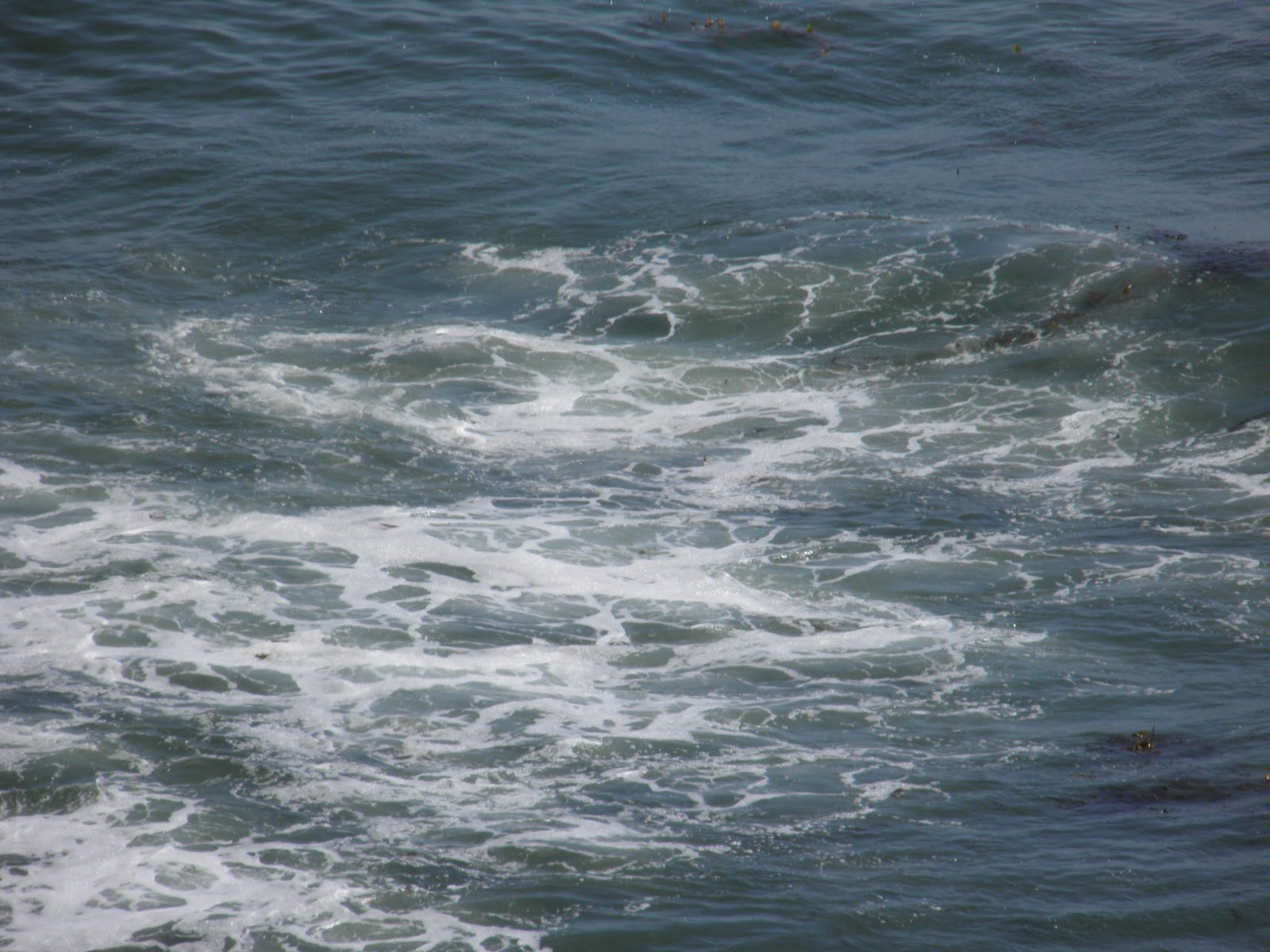
Nice, no? Sure, you can get some pretty intense foam in a lake on a stormy day, but walking into the ocean on a wave blessed beach is like stepping into the ultimate Jacuzzi. The salt perfects whatever else might be in there, which can include hundreds of different minerals. Sea salt is an excellent exfoliant, and once the salt is either washed off or falls off the skin, your outermost layer feels fantastic. Salinity is not uniform throughout the world ocean, and can vary based on a number of factors including temperatures and how many tequila shots the mermaids in the area happen to be drinking. That picture above, and these below, were taken at Cabrillo National Monument, in San Diego. In the first picture, you can see the kelp forests growing beneath the surface. In the last shot, you can make out some of the tide pools that are just teeming with life.

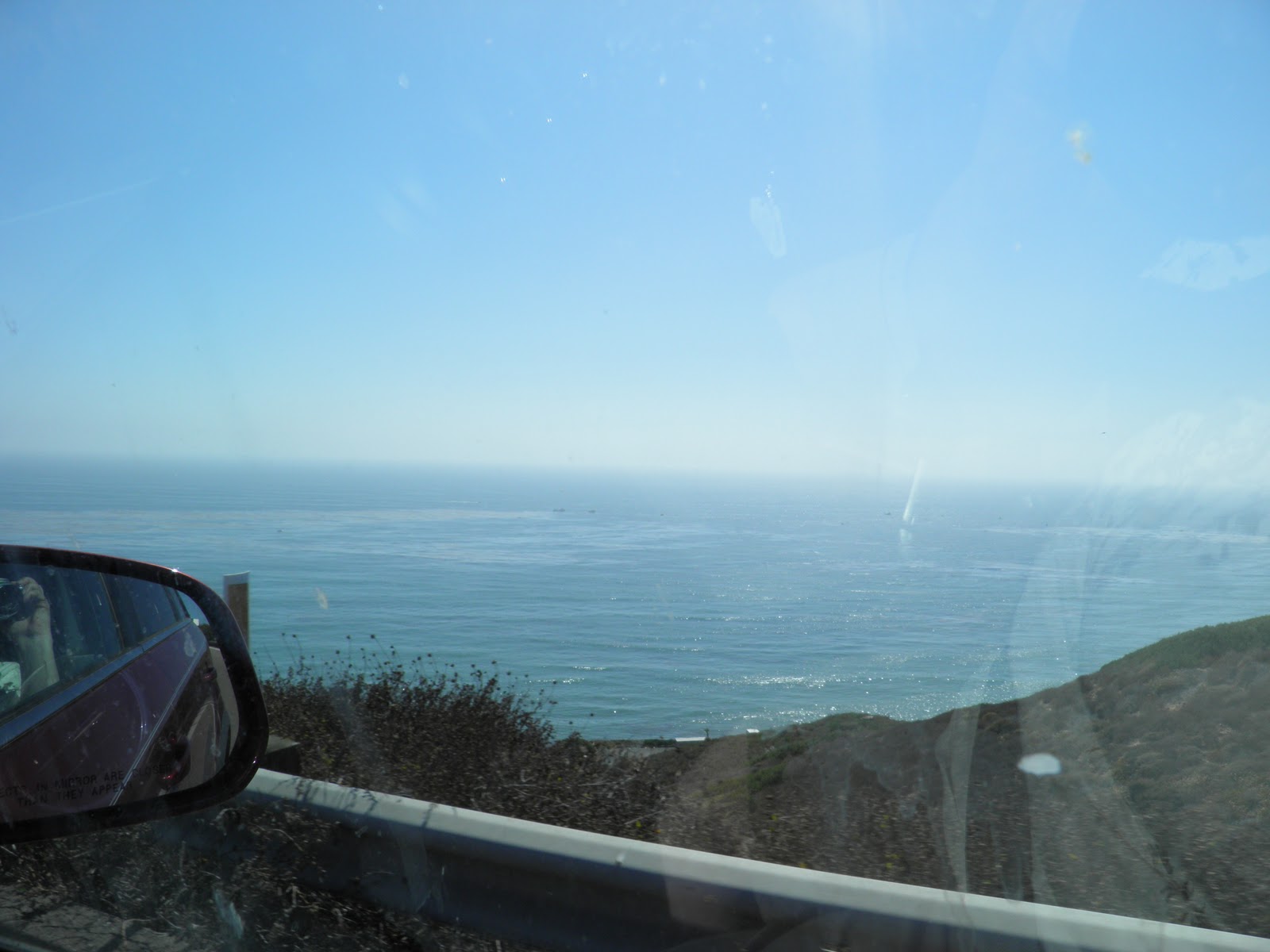

Southern California has incredible water. It is rather cool for its latitude, moderately salty, and is softened by the amount of kelp that grows about 100 feet offshore for much of the length of the coast. The bottoms are generally sandy, even though much of the coast can be rugged, and there are far less dangerous creatures in the water than are found offshore in Florida and much of the Gulf Coast. This is probably because eastern and southern beaches have warmer waters, and are much more saline. The beaches of the Atlantic and Gulf coasts are, however, worth visiting, and their waters are preferred to those of California by many people.
In any case, the oceans surrounding North America are special. While I would prefer to live on a lake, and one special lake in particular, having a second home on the sea somewhere would be a nice thing too. Breathing comes easier by the shore, and moist winds can actually help lower blood pressure. The air even contains ionized oxygen molecules that add to the already calming physical and psychological effects that standing next to a large body of water brings.
Our waters are a wonderful place to begin a better exploration of our continent. Our predecessors certainly thought so.
Monday, November 21, 2011
The Great American Desert
Last post we ventured into the Midwest and your author made shocking claims as to what it should actually consist of. Daring arguments were made as to what could consist of cultural and ecological boundaries of the region, arguments that left out portions of states that are normally considered parts of the Midwestern area. In the same post, the Midwest was largely described as a region of certain values and open lands. The historical record given related that many settled in those lands, but some thirsted for something more, for truly open country, and headed further and further west.
Imagine, if you will, a family or two heading past the tallgrass prairies and scattered woodlands into the sunset. Imagine them cutting through some trees and shrubs somewhere in Kansas or Nebraska, expecting to find yet another open space with a line of trees in the distance. Instead, they find this:

They had heard stories before, of course. Government surveyors, French beaver hunters, even caravan merchants headed for the Mexican markets in Santa Fe had come and gone through the cities of St. Louis and Chicago for decades, telling tales of a vast, empty dry land that opened up beyond the sunset. They heard stories about many things. Now the reality of the stark open lands was set before them. But almost immediately, as a traveler from these days will find, they would discover that the Great plains would end up being far more than just a thousand miles of flat barren sands.


They would find rolling hills.


They would find incredibly rich soils, plentiful rains, and hundreds of species of wildflowers which blanketed the ground.

They would even find places where the eastern forests would refuse to give in to lighter rains and frequent, sweeping fires. They would find large open expanses where there was more sky than planet, where the wind would constantly howl, where the horizon would go on forever.
They would choose to stay in the "Great American Desert" while others would turn back to the eastern lands and still others would follow the wagon ruts and rivers west to the lands of promise in Oregon and California. For a brief time, things were peaceful. Americans, both immigrants and those born in the lands further east, would herd animals, plow and plant what they could, and hunt the Buffalo that teemed throughout the rolling lands of grass. They would live in peace with their neighbors, the Osage and Pawnee. They would build homes dug into the ground and roofed with turf (there were trees, but there were few of them and they were not of construction quality or size). In Canada, they would move out onto these lands and even marry some of the Cree and Assiniboine people there.
Then in the lands of the south, men from further east would insist on ownership of the land. They would run metal rails across it, they would kill all the Buffalo (sometimes for fun), they would let their herds eat through the grass so fast and often that it would not regrow, and they would find shiny metals in the ground that would cause human stampedes. The Osage and Pawnee would die from diseases, and the Lakota, Cheyenne, Arapaho, Comanche, Kiowa, and Crow would point fingers at the newcomers and one another. Much blood would be spilled. In Canada, the descendants of the First Nations who married the French settlers and company men of the Hudson Bay company would perhaps see what had happened to their south and would rise up against the easterners before they could do the same to them. Their leader would die for their struggle; their voice would echo far into the future.
The winds would carry these voices of the north and the south. They would be so loud that no one would forget what had happened on these open expanses of grass. Perhaps they have been heard, for few people would ever live in these lands again. In many ways, the plains remain as they started. They are still very much a land of frontier. The buffalo are largely gone, Indians are a memory and the object of memorial battlefields rather than a presence, and barbed wire fences in different range lands.
Yet the grass still blows beneath a broad sky.

The land seems to go on forever.

The plains seem to retain a quality of the great unknown that they had two hundred years ago. Many people dismiss them as something to quickly pass through, a stretch of land between the friendly trees and farms of the east and the grand vistas of the mountain west. People insist they died of boredom! Others call Oklahoma through Alberta the "fly-over" lands.
Then some people, like me, know they have truly made it to the west once they see those last trees grow shorter and shorter and cling to riverbanks. Not that the trees out there are unimpressive, mind you. Plains Cottonwoods and Green Ash can be quite the welcome site along rivers like the Platte and Canadian.

Yes indeed, such trees can be a welcome sight if the prairie becomes too monotonous. Then again, very few of the crossings are. Sure, I-70 has about 200 miles of pretty bland terrain in western Kansas, but most of the other routes follow river valleys, pass by volcanoes, and roll up and down with sweeping terrain.

And yes, in some places, you can stand literally in the middle of nowhere and see nothing but miles and miles of miles and miles. Even then, though, you notice the small things. The grass gets shorter. The air gets drier. You start seeing sagebrush everywhere, and tumbleweed blows across the road. Shrubs get replaced by cacti.


And then, just when you thought you were going to reach the end of the world, where the ground dries up and you think for sure that nothing can be past that next hill but more endless plains...
You see this.

This then, is the point where you know you have not been going into endless wastelands, but you have been swallowed already by the immensity of the North American West.
This is why I did not include much of the plains in the Midwest, because they are truly part of the west. The air is dry, the horizons are grand, and even the towns have more to do with silence and the war against a hectic pace of life then they do with being towns. They stick up from the plains like small oases, little islands of trees, often with a church steeple in the middle, and broad dusty streets that still have tumbleweed flying across them in high winds.

Are you expecting a saloon fight to break out? I sure was. That is, until I realized that here are people who could care less about a good fight. Or government. Or how prosperous the downtown boutiques are. Here, the most prominent features of town are the local eating/drinking establishment with the most cars outside (which depends on what is on the menu a given night) and the roundabout in the middle of town where sits the modest county hall and a statue to either a famous explorer or famous Indian. You might see a statue of Truman in Independence or some army colonel in any given town in Illinois, but here you are more likely to find one of Black Kettle or Pierre DeSmet. This is a land of farming immigrants, native peoples in love with the sheer immensity of the land rather than what can be grown from it, the descendants of French explorers and fur traders, Mexican and Texan ranchers, and homesteaders, even freed men looking for a new future. This is where the western lands begin.
Imagine, if you will, a family or two heading past the tallgrass prairies and scattered woodlands into the sunset. Imagine them cutting through some trees and shrubs somewhere in Kansas or Nebraska, expecting to find yet another open space with a line of trees in the distance. Instead, they find this:

They had heard stories before, of course. Government surveyors, French beaver hunters, even caravan merchants headed for the Mexican markets in Santa Fe had come and gone through the cities of St. Louis and Chicago for decades, telling tales of a vast, empty dry land that opened up beyond the sunset. They heard stories about many things. Now the reality of the stark open lands was set before them. But almost immediately, as a traveler from these days will find, they would discover that the Great plains would end up being far more than just a thousand miles of flat barren sands.


They would find rolling hills.


They would find incredibly rich soils, plentiful rains, and hundreds of species of wildflowers which blanketed the ground.
They would even find places where the eastern forests would refuse to give in to lighter rains and frequent, sweeping fires. They would find large open expanses where there was more sky than planet, where the wind would constantly howl, where the horizon would go on forever.
They would choose to stay in the "Great American Desert" while others would turn back to the eastern lands and still others would follow the wagon ruts and rivers west to the lands of promise in Oregon and California. For a brief time, things were peaceful. Americans, both immigrants and those born in the lands further east, would herd animals, plow and plant what they could, and hunt the Buffalo that teemed throughout the rolling lands of grass. They would live in peace with their neighbors, the Osage and Pawnee. They would build homes dug into the ground and roofed with turf (there were trees, but there were few of them and they were not of construction quality or size). In Canada, they would move out onto these lands and even marry some of the Cree and Assiniboine people there.
Then in the lands of the south, men from further east would insist on ownership of the land. They would run metal rails across it, they would kill all the Buffalo (sometimes for fun), they would let their herds eat through the grass so fast and often that it would not regrow, and they would find shiny metals in the ground that would cause human stampedes. The Osage and Pawnee would die from diseases, and the Lakota, Cheyenne, Arapaho, Comanche, Kiowa, and Crow would point fingers at the newcomers and one another. Much blood would be spilled. In Canada, the descendants of the First Nations who married the French settlers and company men of the Hudson Bay company would perhaps see what had happened to their south and would rise up against the easterners before they could do the same to them. Their leader would die for their struggle; their voice would echo far into the future.
The winds would carry these voices of the north and the south. They would be so loud that no one would forget what had happened on these open expanses of grass. Perhaps they have been heard, for few people would ever live in these lands again. In many ways, the plains remain as they started. They are still very much a land of frontier. The buffalo are largely gone, Indians are a memory and the object of memorial battlefields rather than a presence, and barbed wire fences in different range lands.
Yet the grass still blows beneath a broad sky.

The land seems to go on forever.

The plains seem to retain a quality of the great unknown that they had two hundred years ago. Many people dismiss them as something to quickly pass through, a stretch of land between the friendly trees and farms of the east and the grand vistas of the mountain west. People insist they died of boredom! Others call Oklahoma through Alberta the "fly-over" lands.
Then some people, like me, know they have truly made it to the west once they see those last trees grow shorter and shorter and cling to riverbanks. Not that the trees out there are unimpressive, mind you. Plains Cottonwoods and Green Ash can be quite the welcome site along rivers like the Platte and Canadian.

Yes indeed, such trees can be a welcome sight if the prairie becomes too monotonous. Then again, very few of the crossings are. Sure, I-70 has about 200 miles of pretty bland terrain in western Kansas, but most of the other routes follow river valleys, pass by volcanoes, and roll up and down with sweeping terrain.

And yes, in some places, you can stand literally in the middle of nowhere and see nothing but miles and miles of miles and miles. Even then, though, you notice the small things. The grass gets shorter. The air gets drier. You start seeing sagebrush everywhere, and tumbleweed blows across the road. Shrubs get replaced by cacti.


And then, just when you thought you were going to reach the end of the world, where the ground dries up and you think for sure that nothing can be past that next hill but more endless plains...
You see this.

This then, is the point where you know you have not been going into endless wastelands, but you have been swallowed already by the immensity of the North American West.
This is why I did not include much of the plains in the Midwest, because they are truly part of the west. The air is dry, the horizons are grand, and even the towns have more to do with silence and the war against a hectic pace of life then they do with being towns. They stick up from the plains like small oases, little islands of trees, often with a church steeple in the middle, and broad dusty streets that still have tumbleweed flying across them in high winds.

Are you expecting a saloon fight to break out? I sure was. That is, until I realized that here are people who could care less about a good fight. Or government. Or how prosperous the downtown boutiques are. Here, the most prominent features of town are the local eating/drinking establishment with the most cars outside (which depends on what is on the menu a given night) and the roundabout in the middle of town where sits the modest county hall and a statue to either a famous explorer or famous Indian. You might see a statue of Truman in Independence or some army colonel in any given town in Illinois, but here you are more likely to find one of Black Kettle or Pierre DeSmet. This is a land of farming immigrants, native peoples in love with the sheer immensity of the land rather than what can be grown from it, the descendants of French explorers and fur traders, Mexican and Texan ranchers, and homesteaders, even freed men looking for a new future. This is where the western lands begin.
Sunday, November 20, 2011
What is the Midwest?
Growing up in Canada, certain designations given to regions, cities, and peoples seemed inappropriate to me when I moved down to the States and was suddenly inundated with a new world view regarding the way things are to be properly labelled. Southern Ontario and the corridor from Windsor to Quebec had always felt like an equivalent to the eastern United States, even the corridor paralleled it geographically more than 300 miles inland. Needless to say, I was a bit puzzled when people referred to Detroit and even Cleveland as "Midwest". For one, despite what people may wish, Michigan on the whole shares more of a political affinity to interior New York and Pennsylvania than it does with Iowa or Illinois. We largely have the same regional dialect of American English here as they do in Buffalo or Altoona, and even our quintessentially "Midwestern" German immigrant population out in the countryside came to us around the same time as it did for western New York and much of southern Ontario. Our cities, in contrast, are islands of Italian, Irish, and Polish immigrants, and a deeper heritage remains of our French beginnings.


Geographically, we are due north of Florida and Georgia, and the vast majority of our state lies within the Eastern timezone. (And yes, so do Indiana and Ohio). Finally, our landscape and climate is far more a child of the Great Lakes and the legacy of the Laurentide Ice Sheet than it is that of the Midwestern prairies. Back during the 1790's, Michigan was called the Northwest. The frontier has long since moved on, however, and with it all the good land values that have been packed off to places like Washington and California. The beaver migrations undoubtedly had much to do with this, the small aquatic rodent ever on its quest for virgin stands of birch trees in which to build moderately priced condos.
Now, I am likely to generate some controversy with this map, but have patience, I can explain it.

The red line indicates my proposed definition of the American Midwest. The blue line offers a new region altogether, which is international in scope. I call this the Nearwest or Lakes region. As you can see, I straddled Chicago on both areas, but Chicago is, much like New York and Toronto, an Alpha World City. The area above both regions is something different, something northern, and a bit harder to define and broadly include into one region. To the east we have the Appalachians and the Maritime lands of New England and the Atlantic Provinces. To the south we have the upper South. To the west we have the Great Plains and the beginning of Western America. The notable gap in the upper center is the Wisconsin Dells and the Mississippi valley around La Crosse and Winona. The area, which I have been to many times, just has a different feel to it than the rest of the country. The glaciers never even came here during the last glaciation, and the area is thus known as the driftless area.
So how is it that we can have towns like Independence, Missouri, and Davenport, Iowa considered Midwestern but not Toledo, Ohio or even Gary, Indiana? Well, take a walk down the old downtown sections of each place and tell me if they are really the same. Let's start in Independence, once the furthest western bastion of the United States. On the map above, it is where that I-35 shield is on the Kansas/Missouri border.


That town center is quintessentially Midwestern. The places of prominence are the civic buildings and large social gathering spots like the theater. The layout is quite open and focuses on two features: space for congregation and space for the sheer enjoyment of space. Space is something that defines the Midwest. There are forests everywhere, of course, but they are not nearly as intact as they are in the Lakes region, even after intensive logging and farming there. Savanna and prairie have a lot to do with this, but so does resource management and agricultural practice. Mentality is the biggest driving factor; the Midwest is the land of initial expansion and Manifest Destiny, lands that Americans had to fight for even after they secured them in the Treaty of Paris. George Rogers Clark National Historic Park is the place to go if you want to see what this entailed, the battlefield where this part of North America was first truly defined. I admit that I have yet to go to it myself, and count it as a big gap in my firsthand experience of our continent. Needless to say, those who fought here under the flag of a young nation were the first in a line of Mid-westerners who burned with a convert's zeal for a land they not only secured for that nation, but in many ways for themselves in a friendlier declaration of independence from the eastern lands across the mountains that they left behind. Their descendants and those of the immigrants and freed men that joined them share their values, their love for open spaces, even their unique barbecue cuisines, vocal inflections, and particular styles of blues music. Take a look at Springfield, Illinois.

This is a city of wide avenues and spaced buildings. The state capitol takes the most dominant place, and the other prominent features are libraries, churches, and theaters. Kansas City, Omaha, Des Moines, and even St. Louis have such streetscapes. What about the rest of town?


The last home is Abraham Lincoln's house. As you can see, space is a dominant element, both in the yards and streets. These are scenes from the Lincoln Home National Historic Site, and the entire neighborhood where Abraham Lincoln lived much of his adult life in Illinois is preserved intact. Similar spaces can be seen at Truman Home National Historic Site in Independence, Missouri. The homes are those of the middle class and wealthier residents, but even the poorer sections of both towns have the same design elements in terms of urban planning.
In contrast, towns in Michigan, southern Ontario, and western New York have centers that maybe feature a small green space with a gazebo in it, and closely packed buildings that are largely commercial in nature. Social gathering spaces are smaller in scale, and while you may still have a theater or two downtown, it will be surrounded by quaint cafes and small restaurants, bookstores and other shops. The civic buildings are off to the side, as if government is relegated to its own space. Does that mean one region is better than the other, or Independence is more authoritarian than Saline? Not at all. What it means is that both towns are monuments to the variants of American (meaning North American) democracy. In one case, democracy means participation. In the other, it means delegation and separation from daily life. The Midwest is a land of broad community, inter-dependence, and the freedom of homesteading and frontier. The Lakes region is a land of industry, individualism, and the making of cities into truly habitable and enjoyable spaces. I actually do not have any pictures of nearby down-towns! I suppose that is because I see them all the time. Examples are everywhere, from Ypsilanti to Port Huron, Milton and Orillia, Ontario to Batavia and Williamsville, NY. The region is very much a bi-product of the United States and Canada, a claim that Tim Horton's has latched on to (the region I closed in with blue is actually where most of their franchises are located).
In terms of landscape, if you want to see the contrast, just drive along I-94 in Michigan, and then I-80 or I-55 in Illinois. There are exceptions of course, such as parts of I-75 in Michigan being very open, the westernmost parts of the 401 looking more like parts of Iowa, or I-70 in Missouri being forested.
Take a look at I-70 in central Missouri just before the Missouri river crossing.

Or, far more typical, restored tallgrass prairie on I-55 near Bloomington, Illinois.

Prairies, you see, once covered far more land in the center of our continent than most people realize. Today they can often be derided as "fly-over areas" or something to race through to get to the more interesting mountains, deserts, and forests which border them. In truth, the first settlers of Indiana and Illinois ran into these large expanses of grass, flowers, and shrubs and absolutely fell in love. Many towns in the Midwest were actually founded in the middle of them or atop hills, rather than near rivers or woods, because the allure of the open lands was such a contrast to the woods that had to be cleared and the stumps that had to be removed further east. There were still trees around, and most towns, as seen above in Springfield, were planted thick with them. In the Midwest, settlers could have the best of both worlds. The endless flat grasslands most people think of when they hear "prairie" existed farther west, in central Kansas and Nebraska. Here there were fields, forests, good soil and easy topography for farming. There were and are also challenges. There were blizzards, scorching summers, tornadoes, all things that made some people want to move back across the mountains or head further west to the new frontiers that opened up there. For those that stayed, and those who later came to fill the plentiful room, this would be their American paradise they had dreamed of.
Others stayed further north, in larger industrial cities or in smaller farms surrounded to this day by extensive woodlands. Their story and land is cause of another post, however. They are the people and lands of the doorway between east and west, of the Erie Canal, the Detroit River, of Toronto, Detroit, Buffalo, Cleveland, and Rochester. I suppose, if you needed a better label, you could use the "Nearwest". I, of course, still prefer Upper Canada. For a parting shot, you can see that it is not too hard to imagine the straits between Lake Erie and Lake St. Clair as a highway, rather than a border.

Subscribe to:
Posts (Atom)