Always to the frontier
Showing posts with label Missouri. Show all posts

Saturday, June 1, 2013

GAAHHH! TORNADO!

Two years ago I was passing through Joplin, Missouri.  Only a month had passed since the town was almost entirely destroyed by an F-5 tornado.  Like most people everywhere else, I was nothing but full of sympathy for what had happened to the people there, but like most people, I also let the event slip into the back of my mind as the weeks went on.  I was very sharply reminded about what had happened; most hotels in the area were either closed, packed full of relief workers and displaced locals, or no longer standing.  What had seemed like a convenient stopping place for the night on a long trip from California to Michigan turned into a reminder that we live on a continent that is very, very naturally destructive.  Overhead information signs directed a ton of relief workers into action, with an entire exit off of I-44 dedicated just to outside assistance entering what was left of the city.  I took no pictures of what little could be seen from the interstate, which was horrific.  Trees, buildings, everything... flattened. 

So how does the sort of thing happen, how did people in the past deal with it, what should we do about it, etc?  I figured I would wait to post anything about tornadoes until the media hysteria had died down regarding the recent Oklahoma disasters, but seeing as how I just encountered a weak tornado of my own a few days ago, now seemed to be as good a time as any.  Tornadoes, more than most natural disasters, seem to make people rubber-neck and dive into as much information on the matter as possible.  The press, therefore, jump all over the tragedies involved as fast as they can and a lot of rapid speech and decrying of the fury of nature runs out of the mouths of many a reporter.  For the most part, though, they get their facts straight. 

Tornadoes are the result of colliding air masses within a larger storm system causing a bunch of air to rapidly rotate.  The winds that result within really powerful tornadoes, such as the one which hit Joplin, are among the most powerful winds on our planet, making hurricanes seem mild in comparison.  Hurricanes, in fact, can spawn multiple tornadoes within them, something which happens often in the Carolinas and Georgia when the storms make landfall there.  While one imagines a tornado to suck everything out of existence, its damaging effects are actually the result of the rotating winds knocking around debris which can include entire houses, trees, and trucks.  Nevertheless, as I can confirm from personal experience, one does feel as if one is being sucked off the ground into the blue, or rather gray and lightning illuminated yonder. 

(Before anyone asks, this happened on I-80, at the only tollbooths in Illinois for I-80.  The car I was in was lifted a few feet off the ground before it was thankfully plunked back down just a foot or so in front of where it lifted off.  Yes, I thought I was going to die.  I have also been within a few hundred feet of an F-5 tornado at the corner of where Nebraska and Colorado meet near Ogallala, Nebraska, and more recently a small rope tornado near Whitmore Lake, Michigan.) 

So why do they happen so often here?  You know that bit about air masses doing a dance?  It just so happens that North America is one of the most chaotic battlegrounds for air masses coming in contact with one another.  In the north we have Hudson Bay, which together with our large continental mass (oceans tend to moderate temperatures, dry land tends to let them go nuts in one direction or another) extends cold air masses much closer to the equator than anywhere else on earth.  Frosts have been reported as far south as Tampico, Mexico, clearly in the tropics.  During the last ice age, the frigid Hudson kept pumping out glacial masses of ice that extended closer to the equator than any other non-alpine location on the planet.  In the other corner, the Gulf of Mexico is a heat and humidity factory wherein the great global ocean thermal conveyer belt (say that five times fast) suddenly turns from deep and cold to shallow and hot.  It produces the Gulf Stream which tends to make Europe a pleasant place in terms of temperature moderation.  It also gives the eastern part of our continent our amazing forests and plentiful water.  It also gives us summer days where we can practically watch the paint peel off of the walls because everything is so damn sticky. 

Now, put the two of these together and we get amazing storms.  Make the already very different layers of the atmosphere dance with even greater surface extremes between those larger air masses and we get our destructive tornadoes.  Sure, they get them in Europe now and then, they get them in China (where they have a scaled down version of our hot-cold fight between Siberia and the South China Sea), they get them in the tropics, and they even get them on top of mountains, but nowhere near the intensity and frequency with which they happen in central North America.  Oklahoma is the worst place to be for this sort of thing.  A small part of the state's southeastern corner has a climate and landscape very similar to the rest of the classic "South", complete with palmettos and bald cypresses.  The middle of the state is a rapid transition between forested east and dry open plains, so much so that the space of a few miles can actually turn from big sky country into "hey, where did these trees pop up from?", and that big sky country out west is really dry compared to the eastern side. Winter time can feature decent 50's near Arkansas to sub-zero chills in the panhandle.

Texas panhandle, near the Oklahoma border, US 83 southbound. 

I-44 between near Oklahoma City, not much over 100 miles east and a very different world.

As a result, the winds tend to dance a lot in Oklahoma.  The process does happen just as violently, however, in the rest of the area of the great meeting of air masses.  Though not nearly as frequent, tornadoes are a good possibility during the summer storm system all the way up in Ontario and Pennsylvania.  The Ohio and Tennessee river valleys, full of rolling, wooded landscapes, are hardly what people think of as a prime tornado region, and yet the get tornadoes that can sometimes stay on the ground for well over a hundred miles. 

So good grief, we say, and why do people live there, we ask?  People have lived there for over 10,000 years actually.  The practice of living was a bit different, mind you.  The Pawnees, Osage, and other prairie peoples tended to be a bit more mobile than modern prairie people tend to be.  The main reason for this was a food culture based on the plentiful game of the prairies and one in which the drier region could not necessarily be counted on to offer the same bounty as the corn and squash fields back east could.  Even in the lush climate times of the middle ages, when peoples in the Ohio and Mississippi valleys and southern Great Lakes were building sizable cities with elaborate earth works and farming quite a bit, the plains peoples kept on following the buffalo.  Why?  Probably because a giant hand would come out of the sky and flatten everything in sight.  The Lakota, who originally hailed from Minnesota and northwestern Ontario, abandoned their more permanent settlements when they got chased onto the plains hundreds of years ago by the Ojibwe.  This didn't last forever, of course.  The second born came from the east and started planting permanent settlements.  I often wonder if the first Euro-Americans would have stayed had there been F-5 tornadoes in Jamestown or Quebec...

Initially settlers built half-buried, sod topped houses.  They were easier to make without having to haul in wood from the east, tended to be cooler, and in some cases even afforded a little bit more protection from the violent storms of the great big open sky.  The early prairie pioneers were a tough sort of folk, and many would-be Kansans and Nebraskans turned away screaming when they had to deal with the rugged life on the plains.  Some went back east, many just passed through to places with more promise like California.  Eventually, however (this is the WHY do people live there now bit), improved plows made farming a simpler affair, the legendary tough tallgrass sod being broken by the steel hand of Mr. John Deere.  Free land through the homestead act made the region increasingly attractive, and, well, money talks.  There are cities there now, rather large ones, and economic opportunities keep calling people away from the unemployment of the rust belt. That aside, the area is incredibly beautiful.  Long, open sightlines and a grand drama of the sky, which as you can see in the Texas picture above, is often far more inviting than it is discouraging. 

People tended to bring with them the comforts of home when the wild west became a bit less wild.  Wood frame houses sprang up, and planted trees made little towns feel more like the beloved Virginia or New York that had been left behind.  Yes, storms and drought came along to spook people, but many stayed and some even returned when they became complacent and forgetful.  Like I noted, it took less than a month for Joplin to sit in the back of my mind.  I dare say that is pretty average for people who don't get affected by tornadoes, and I have actually been intimate with three.  Besides, some towns have been around for quite some time and managed to either survive or not see large scale destruction.

Elk City, Oklahoma, main street.  Many of these buildings are from the early twentieth century and look like they have made it OK.
 People recover.  People rebuild.  Plains people and (true) Midwesterners are built from tough stock, so the saying goes.  What can we do about them, or better put, what we can we do in such regions to better handle the big wind?  As any southern Floridian can tell you, wood does not cut it in the face of powerful forces.  While Miami is turning just as wood frame and vinyl sided as the rest of the country, the historical trend for building to resist hurricanes down there was concrete construction.  Sure, an F5 is an F5, but concrete can handle way more than fragile wood can.  In the meantime, donate to the Red Cross to help those who got a pretty potent reminder that we are not always in charge of the world around us.  Better yet, donate in a month's time when the need will still be great and the money flood will slow to a trickle because we all forget about what happened. 

And again, yes, tornadoes are terrifying to be in, and yet also strangely beautiful.  That's how I feel about them anyway.


Wednesday, December 12, 2012

Classic Mississippi River Crossing

From St. Louis southward the Mississippi looks pretty much like people would imagine it, all wide, muddy, surrounded by flat forested land and big cities and crossed by a number of truss bridges.


So it is here looking south from the I-70 crossing in St. Louis.  This shot even includes an advertisement for a casino riverboat in it (there was a classic one with crowned smokestacks moored to the north but a clear shot would be difficult in heavy traffic).  Of course, north of here, there are many places where the Mississippi looks entirely different, complete with sheer cliffs framing her banks and dark, tannin-stained waters coursing through Canadian Shield granite near her source in Minnesota.  She is a remarkable river which runs through a great cross section of both climates and cultures in the middle of the continent.  She has served as the first great drain for the most recent continental glaciers, has served explorers and settlers as a doorway to the western lands, and ran red with blood in the 1860's.  She is no simple river.  I count every crossing.  To date I am up to 16.

Monday, June 4, 2012

City Skylines: Kansas City

Though usually trumped by nearby Independence, Missouri in terms of perceived historical importance, Kansas City won the population and commercial battles later on and is one of the larger cities of the Midwest.  As such, it has one of the larger skylines of most cities in the eastern Great Plains.


While nothing like the grand skylines of Chicago or St. Louis, this one does stick out of an otherwise very rural landscape dotted with cities much smaller in scale, such as Topeka and Omaha.

As you can see, the landscape is rolling and well-forested.  Kansas City sits on the confluence of two great rivers and the gentle valleys associated with them.

Wednesday, May 23, 2012

The Battle of Wilson's Creek: The Modern Park

By 1861, Missouri was well on its way into settlement by both immigrants from the eastern and southern United States and abroad.  Farms were commonplace, well-maintained roads connected vital towns and military outposts, and the southwest corner of the state around Springfield was on several main migration routes to destinations further west.  


Even then, the landscape had not been changed so dramatically as to compare with areas further east that had seen settlement since colonial times, and much of the scenery remained pretty natural.  The battle at Wilson's Creek, thus, was not quite the same open-field affair that Manassas had been.  There were farms in the area, and open land did exist in the form of patches of tallgrass prairie and oak savanna...

 
...but by and large southwestern Missouri was forested.  


Southwest Missouri is a wonderful western extension of forest, so much so that it offers a remarkable contrast to the nearby tallgrass prairies of nearby parts of Kansas and Oklahoma.  The area is on the edge of the Ozarks, and plentiful moisture and warm weather reaches into the place from further south, enough so to classify the region as  humid subtropical climatically.  No, this is not the realm of baldcypress trees and evergreen magnolias, but it is definitely a southern affair.  The forests were reasonably thick, the landscape well watered and the ground sometimes muddy.  This was a difficult place to have a battle, and really was only chosen as a mark of convenience with which to block assaults on a retreat.  Thankfully, most of the men fighting were from the area, or at least neighboring states, and knew the terrain and what to expect of the weather.  This was not a situation of green recruits from states bordering Canada falling over in the heat and humidity as had been the case in Virginia.

So, what can one see here?  Not much in the way of monuments and grave markers.  The battles further out to the west of the then-United States were often side-shows in comparison to the carnage of the eastern sites.  All the same, the park service has done a truly remarkable job of preserving the landscape intact, have marked battle positions rather well, and have a visitor center and museum complete with a full-blown, first rate research library that aids research historians not only looking to find out more about the battle, but about the war in general.  The same cannot be said for the sites at Manassas, Gettysburg, or other major sites.  Heck, the same cannot be said for most national park sites.  To be blunt, this might be, pound for pound, the best Civil War park site out there.  The staff was knowledgeable, friendly, and genuinely interested in telling the story of not just this battle, but of the state of Missouri and the war in general.  The place is definitely worth a stop on a Civil War tour, and is pretty much an essential part of any trip focused on the state.


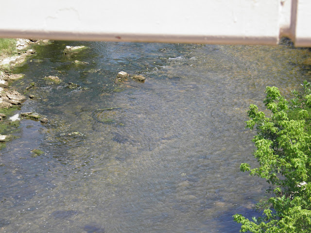
Oh, and yes, you can also see the creek itself.  A creek, to be sure, but a substantial one, and a nice treat to see after crossing so many braided or non-existent streams not too far away in Oklahoma.  


Tuesday, May 22, 2012

The Battle of Wilson's Creek: The Story

In contrast to the much more organized affair that was the start of war in Virginia, the start of the war west of the Appalachians was an entirely different story, full of nervous anticipation, emotionally-charged contests, and almost guerrilla warfare.  Kentucky was occupied fairly early in the course of the war, which prevented it from siding with the Confederacy, despite it being a slave state.  Missouri initially opted for a sort of neutrality, pledging to remain outside of both the fighting and economic support of either side during the war.  Missouri, however, was a land of residents who declared themselves strongly for both sides of the conflict.

Missouri was founded specifically as a slave state back in 1820 in the start of a pattern of admitting both a slave and a free state to the union to maintain a congressional balance between pro and anti-slavery factions.  The state was then heavily settled by slave-owners who took advantage of the readily-available bottomlands along both the Missouri and Mississippi rivers.  Unlike the rest of the slave states, however, Missouri was along the prime western migration corridor, and migrants arriving from the south were soon joined and outnumbered by migrants from both the eastern United States and Europe.  Many of these arrivals had no interest in slavery, and even when they did not finds themselves at odds with the plantation owners, they formed a distinctly different culture from them, with different needs and philosophies of life.  Based on economic differences alone, the new subsistence farmers and the plantation owners were already quite at odds with another.  Then, in 1854, neighboring Kansas was opened up to settlement under the concept of popular sovereignty, and all hell broke loose.  Kansas would be declared a free or slave state based on how many settlers of each made their way into the land.

While the Civil War in general is often considered to be a conflict that pitted brother against brother, the nature of the war in the western states, owing to popular sovereignty and the mess that was "Bleeding Kansas", was one of a very viscous hatred of neighbor against neighbor.  Lawrence, Kansas was almost completely ransacked by raiders from nearby Missouri, who were intent on making sure Kansas would not end up a free state.  Even though it was not under the concept of popular sovereignty, Missouri was no less a hot bed of contention owing to its mixed background of settlement.  The important thing to remember is that this was no mere debate of slavery and freedom, but an ugly conflict involving racism and cultural bigotry.  By the time war began, Kansas was a free state, and Missouri found itself mired in a contest between people who would just as soon shoot one another as they would wait for marching orders.  As was the plan for Kentucky, Missouri was to be seized as soon as possible by Union forces so that Confederate forces would never be given a chance to be mustered.  The locals and the Arkansans had different ideas.

By July of 1861, the Missouri State Guard had received reinforcements from Arkansas, as well as Confederate troops from Louisiana and other places.  Union forces, well aware of the disposition of the enemy, had already seized control of St. Louis and had encamped near Springfield, Missouri by July 13th.  By early August, it became clear that the Union forces under General Nathaniel Lyon were vastly outnumbered by Confederate sympathizers pouring into the region.  Lyon knew he needed to retreat and reinforce his numbers, but he also knew he needed to slow down his pursuers.  In consequence, on August 10th, at 5:00 in the morning, the Battle of Wilson's Creek began.  Tensions were already so high, however, that the Confederate forces, really just made up of ordinary Missouri and Arkansas militia, were more than ready to respond to this assault.  Lyon tried desperately to form lines and advance against the enemy, but they were able to repel most counter-attacks strike for strike.  Eventually, as was the case at Manassas, a relatively green army was not properly prepared to communicate between units, and Union forces became separated from one another, all the more so because they were well out of sight in the complicated landscape of the battlefield.

Despite some success on the part of the Iowa infantry, who were wearing the same colored uniforms as the Louisianans, things did not go well for Union forces.  They were kept in check, never able to make serious advances, and the leadership was getting killed.  Lyon, in fact, became the first Union general to die in the war.  Their spirits sunk, and the objective to take out the pursuing force pretty much moot at this point, the surviving Union forces retreated to Rolla, Missouri.  All the same, just about as many "Confederates" were killed at this point, and their forces were indeed unable to pursue the Union survivors, despite taking the battlefield.  Wilson's Creek thus ended up being a tactical victory for the Union, though in all seriousness, even with later victories in Arkansas, this was at best a Pyrrhic victory.  For nearly the rest of the war, Missouri would be the scene of fierce guerrilla warfare, and the state suffered some of the most severe losses of any land in the United States.

The battle itself, in fact, was far from an orderly affair.  Traditional line warfare simply did not happen here, and the smaller skirmishes going on throughout the battlefield were extremely bloody in comparison to Manassas.  Here, men not only shot to kill, but to maim, and combatants quickly broke down into savage hand to hand combat, complete with an even more savage fight coming from their mouths.  The men, you see, were not exactly regular troops or even conscripts, but locals, locals who needed little provocation or orders to attack their neighbors.  Such venomous hatred, combined with a familiarity of the rough landscape, and an August day that could not be more hot or humid, well, it made things very disgusting.  The film shown at the visitor center of the present day national battlefield documents this well, but is mild in comparison to what things must have really been like.  The battle remains a sacred event in the lives of Missourians, a reminder of just how much the state has suffered through.  As such, the capitol building in Jefferson City features a very large mural of the battle, a piece of art which is very difficult to look at with a passing glare once one knows exactly what it depicts.


Saturday, March 24, 2012

The Santa Fe Trail: The Start of U.S.-Mexico Relations

The Mexican-American war, while perhaps the most important event in the history of the relationship between Mexico and the United States, was not the first meeting of the two nations.  Rather, through commerce and migration, the countries had a relationship dating back to the early part of the nineteenth century.  Mexico was still a Spanish territory when Americans began showing up in Tejas, Nuevo Mexico, and Veracruz.  The men who came to these places were explorers, merchants, and mercenaries, even some fur traders from distant Canada.  Here and there, business of all sorts happened, at least when the authorities were not around.  The peoples of Mexico were more than happy to engage in commerce with the more friendly and generous faces than those which came from across the ocean.  Time and again, however, the Spanish authorities intervened, and the Americans found themselves arrested or deported, just as Canadians, eager to find more fur-trade opportunities, had been many times before them.

Americans still made their way to Mexico, in greater numbers once the Louisiana Purchase was validated by Spain in the Adams-Onis Treaty of 1819.   Spanish bans on Mexican exports still stood, even if relations between Madrid and Washington were becoming more civil.  Like so many of his contemporaries, William Becknell took a gamble that maybe things were getting peaceable enough that trade might sneak by a bit easier.  In September of 1821, Becknell departed from Missouri and set out across the Great Plains toward the capital of Nuevo Mexico, Santa Fe.   About 40 miles out of Santa Fe, at a place known as San Miguel del Vado, Becknell and his five companions were approached by soldiers.  While no record remains of what took place at this meeting, not too much imagination is needed to envision that it was a cordial affair, because Becknell was informed that Mexico was now free, and that Santa Fe's markets were ready and waiting for commerce with the rest of North America.  When Becknell arrived in the city, crowds gathered and a great celebration began.

He quickly found buyers for his small stock of textiles, and he found goods and silver to bring back with him in exchange.  Mexicans wanted textiles, especially the very desirable cotton, which the United States was starting to produce in abundance.  Americans like Becknell gladly accepted silver pesos for it, but they also brought back draft animals, herbs, spices, exotic jewelry, and an amazing rich of mineral wealth of all kinds.  They also found furs; French and English speaking Canadians alike, usually working for the growing Hudson's Bay Company, were part of a vast network already working the interior of the continent, and well-informed about what was going on to the south.  In many ways, Santa Fe commerce was the start of relations between all three North American nations, and the city was very much an international hub of activity.  In any event, Becknell came back to Missouri with a smile on his face and much-needed silver currency to fill the cash-dry economy there with.  The next year, he loaded covered wagons, the first to cross the plains in fact, and did it all over again.  By 1824, traffic between Santa Fe and Missouri had started to impact the American economy enough to prompt President Monroe to order a survey of prominent trail routes between the lands.

The opening of relations was profitable for both parties, and Mexican traders took to the trail just as often as their American counterparts did.  Commerce often did not stop in Santa Fe, and the wagons went clear from Independence to Chihuahua and points southwards.  Santa Fe, however, was the juncture between the worlds of the United States and Mexico, and the city engaged in so much American trade that eventually most of New Mexico's dealings were with a far closer United States than with seemingly distant Mexico.  This is not to say that Santa Fe or the New Mexicans surrendered their culture and identity in the process.  While the New Mexicans embraced becoming a part of the United States during the Mexican-American war, they also retained their language and unique culture that had developed as a marriage between Native and Hispanic worlds.  To this day, many New Mexicans are completely bi-lingual, and cities like Santa Fe celebrate their heritage even as they are undoubtedly American in loyalty and character.  The area still celebrates the link it serves as between the parts of our continent:
Otherwise known as I-25.


The Santa Fe trail, after all, was about introducing cultures to one another, blazed in the forging of ties between two young republics, an opening of borders to commerce and migration.  The opening of the trail was a tender embrace between America and Mexico, and is all too easily forgotten in the wake of a century and half of mistrust, bigotry, power struggles, politics, and drugs, between the two neighbors.  Memory remains, however, and regardless of where one stands on the issue of relations between our two nations (which have really started to improve, despite what goes around), this world of a bonding between two nations can still be seen in what remains of the trail, especially in New Mexico.  Let's start down in Santa Fe,  then:

This part of New Mexico is the junction of the Rockies, the deserts of the southwest, and the Great Plains.  Not too much of a stretch of imagination is needed to see that this was once a world truly in the middle of the path between east, west, and south.  Everything here is distinctively New Mexican, right down to the bus stops.

Here we have a place that is obviously part of the United States, and yet also would not seem too out of place in Mexico, while not being entirely a product of either place.

They most likely did not know it, but the founders of Santa Fe picked a pretty decent location that would become the meeting place of many other "trails" to come in the future:

Moving out from Santa Fe, the trail, Us 66, and now I-25, skirts the southern end of the Sangre de Cristo Mountains (part of the Rockies) before spilling out into the Great Plains.  Pictured here is part of Glorietta Pass.

At the entrance to the pass, the trail passes just to the south of the ruins of the Pecos pueblo, preserved at Pecos National Historical Park.  Glorietta Pass, in fact, has served not only as a passage for the trail, but has been walked by Coronado and his conquistadores, fought over in the Civil War, and long served as the meeting place between Pubeloan peoples and the peoples of the plains, such as the Kiowa and Comanche.  Pecos is probably the most diverse point of cultural meeting in all of North America.  We will come see it in a future post.  For now, here is the view from the ruins, looking back west to the pass.
 The trail eases out at an angle into the high plains of northeastern New Mexico, leaving behind the pinyon-juniper forest and entering one of the most arid parts of the Great Plains, a grassland dotted with cholla cacti, sagebrush, and yuccas.  The golden grass waves in an almost ever-present wind that blows between the great air masses of the arctic and the tropics, and between mountains and seemingly endless plains.
Once in the plains, the trail diverges.  One path, historically considered the safest route, follows the base of the Rockies north into Colorado until it cuts across the land to meet the Arkansas river.  This route is largely followed today by I-25.  Some of the best preserved ruts of the trail can be found at one of its famous sites, Fort Union, where the other path of the trail leaves this one.

This other path cuts northeast-southwest across New Mexico, past dead volcanoes and into the panhandle of Oklahoma, which has some of the most open country in the entire world.  The experience is good for making us feel small when we otherwise feel like kings of the earth, to say the least.  We have the luxury of roads to do this on now.  One can only imagine what travelers heading down the trail must have felt when they saw this, at once both in awe and hoping that the ruts they traveled on would stay visible.

This path continues into surprisingly rugged parts of Kansas before meeting the other path again at the Arkansas river, at which point the trails cut clear across the open land towards Independence, Missouri.  Halfway between the river and Missouri, things would get a bit greener and arboreal again, with some trees even growing in the middle of the prairie, sentinels of the advancing edge of the eastern forests.

At Council Grove, the trail is well-defined, and a memorial sits on it to mark the spot where the United States and the Osage nation signed a treaty to protect safe passage across their homeland.  The town was named for both the treaty and the grove of trees that offered shelter to those getting ready to depart into the treeless expanses to the west.  One of the 12 Madonna(s) of the Trail, placed by the Daughters of the American Revolution, can be found here.

The trail then arrives at its eastern terminus, Independence, a very different place from Santa Fe.  Here we have the text-book definition of a Midwestern American town, a place that even in the 1820's would have been as much a great discovery for Mexican travelers as Santa Fe was for the Americans and Canadians.  The tour we took from west to east was to highlight the impression this must have made on such travelers, heading from the vast, open, dry, adobe west to the relatively more compact, settled, humid, brick and mortar east.  Just as Santa Fe served as the door to Mexico and the inter-mountain west (including the Old Spanish trail to California, by way of Utah), Independence was the place where the California and Oregon trails would start, as well as points to the east, serving as the western terminus of the National Road, which would take people all the way to the Potomac at Cumberland, Maryland.  Here too, in those days of optimism so long ago, could there be found the various peoples of the continent, trading with one another, exchanging cultures, and getting ready to set off across the land to some destination of promise.  No record remains of any parties thrown when the first Mexicans arrived in Independence, but it was quite likely that the meeting was a good one.  

Sunday, February 5, 2012

Sunday Afternoon Post: Back to the East

Today will be the start or a wonderful tradition of not writing too much on a Sunday, mainly because I wrote too much yesterday.  

What is the primary difference between western and eastern North America?  Water.

In this case, as if the forests were not indication enough (not many hickories and white oaks back in Utah or Nevada), there are sometimes huge thunderheads, and not the weak kind that growl once and leave during the Arizona "monsoon".  No, this is Missouri, right near about where northern continental air masses meet Gulf air masses.  Specifically, this is I-44 eastbound about 50 miles from Saint Louis.  

The route is a lovely drive, very hilly, not quite hillbilly, not quite mid-western, not quite much of anything clear cut.  While not quite the true Ozarks, the northern edge of them is a nice, green, rolling invitation back to the humid and temperate east.  

I had always envisioned Saint Louis as being your typical big Mississippi city prone to flooding and stretched out across a gentle landscape, when in fact it is rather compact for a city its size and located in a rather scenic area.  

They do indeed have a river.

And even a giant arch!

Let's head north tomorrow.