Always to the frontier
Showing posts with label National Park. Show all posts

Sunday, April 19, 2015

The Place Of Desert

For the last year or so in American Voyages, I have been largely focused on eastern North America.  My long-time readers and those who dig further into the heap of posts will find that my emphasis started out in a completely different direction, that of the vast, diverse wild-lands that is the West (or in the case of Mexico, the North).  My travels out there were what ultimately inspired me to give a go at this blog, but heaven knows I did not start out loving such a place.  I grew up in the boreal forest, which remains to me the most primal, holy, and majestic landscape on the planet.  I viewed the southern pinelands as the next most incredible landscape, followed by a child's imaginary view of the evergreen forests of the western rainy reaches, and largely disliked that which was in between, the world of the deciduous forests and grasslands.  When it came time for me to take my first ground trip across the continent, I was dreading the flat, boring plains that I would be forced to endure.

Of course my image of them was made uglier by what I figured they would be, a continuation of the flat, artificial cornfield "prairies" of far southern Ontario, Ohio, and southern Michigan.  There was no life between the Appalachians and the Rockies, I had gathered.  But then I drove into central Illinois and saw the sky get bigger.  I crossed the Mississippi and found Iowa to be rolling, and in places where the farms had gone fallow, lush green lands dotted with the occasional Bur Oak (Quercus Macrocarpa) standing as a lone witness to another world.  August rains had come and blessed the land so that it looked as if it were something out of Hobbit country.  Again, I placed my conception of the world on top of the landscape as it truly existed and was perhaps even eager to be seen by my overly-focused eyes. 

Then came Nebraska, and some more corn, especially between Lincoln and where the Platte and I-80 meet for the first time heading west.  That river though, that shallow, silty, seemingly unimpressive river... it stole my heart and my attention.  Perhaps it was the trees that did this; tough-as-nails Cottonwoods (Populus Deltoides) forming gallery forests that made the trip so much more enjoyable for my stubborn sylvan-centric tourist agenda.  The funny thing is, though, my eyes started looking for the prairie.  I had long wondered what the transition between eastern forest and western void was like, and found instead that the corn, or at least my concern for it, had prevented me from finding this remarkable transition area.  Around North Platte, however, I saw it; hills of grass and what I presumed was only grass.  I-80 kept following the rivers, but I was headed for golden California, and the majestic mountains of Colorado.  I turned onto I-76 and into the High Plains, and much like viewing a religious icon, my mind was made quiet and my gaze indirect.  The immensity of all that was not human overtook my concentration; not for nothing have many religious experiences of some of the most intense contemplative types from western Christianity (Jesus, in fact, started to "find himself" in the desert) to the Lakota mystics who once ranged far and wide over that same northeastern Colorado grass included sharing that nature made them forget the self and connect with the infinite.

Doubtless I found such a place in the small, innocent world of childhood.  I remember the towering pines and ancient granite of the Canadian Shield transporting me far away from the worries of the present.  Then I grew up, indulged in material culture, formed a rigid world view like most other college students sharply liberal and conservative alike tend to do, and forgot about my and my world-view's insignificant place in the cosmos.  At some point I started realizing that this was at best silly and at worst insulting to myself, my place in history, and my purpose in the greater world.  Maybe I was looking for something else, or something more whole... but that trip to California plunged me into less of a tourist run and into more of a pilgrimage.  The High Plains cleared my mind and prepared me for the grandeur of the mountains to come, and more surprisingly so, the desert beyond.  I was amazed at the vista given by the Front Range, but the High Plains managed to keep me even more enthralled with my first ever glimpse of an honest-to-goodness western plant, the Sand Sagebrush (Aretmisia Filifolia).

This one was taken at Pipe Spring National Monument, on the other side of its range compared to where we first met on the Colorado High Plains.  I think this is where we fell in love. 

If you've never experience one, I would say that it alone is an excellent reason to go out west.  It feels and smells incredible, with the best olfactory performance coming after a rain.  Like so many White people before me, I always viewed sagebrush as an afterthought, even a weed.  I had encountered its northernmost version, Artemisia Frigida, back in my magical boreal youth.  Perhaps I was bred to hate prairie, however, because I found nothing likeable in that patch of meadow that constituted the "back yard" where I found my first specimen of this plant.  I have since apologized to what I assume is its children.  Back then, however, I was all about the pines, like so many people are.  No one can tolerate the fly-over states, and they seem to view anything even drier as either a wasteland, the backdrop for Vegas and sci-fi movies, or a good place to extract resources and produce more crap for us to throw away.  I certainly headed into my California voyage with a similar attitude.  Then I saw the open skies, and then I saw the sagebrush, and then I saw the yuccas... and then the cacti.  Nearly two years later, on a misty March day, I saw the saguaros, and a view of the desert that had gone from hard on life that had turned into otherworldly had then become something closer to ethereal.  The desert is a place teeming with life that has managed to not only make the best of the situation, but in many cases to positively thrive there. 

I write this because far too often we dismiss the desert as an unwelcome, useless intrusion into our idealized view of the world.  We like it lush and green, happy and managed/cultivated.  Our vision of the world, even the wild portions of it, are often frowned upon if they do not conform to our place in it.  This attitude exists in persons as different as lobbyists for the Koch brothers or ecological restorers concerned with the dwindling wolf populations on Isle Royale.  Those religious types I mentioned would probably tell the rest of us to focus instead on greater things than our immediacy.  I write this because today I read a piece related to this post, written by an "activist" living in the Mojave, an atheist no less.  I wanted to share his piece here, with all of you, and give a brief description of my own of why I think it is important.  Please, take the time to read it, because I'm shutting up now.

https://www.beaconreader.com/chris-clarke/the-desert-is-not-your-blank-canvas

Thursday, January 2, 2014

The View From (Part Of) The Boardwalk At Congaree

As I have said many times, Congaree and the rest of the lowcountry South is a harsh environment for comfort minded humans.  Whether you call it a floodplain or a cypress swamp, the fact of the matter is that the place is spongy and mucky even in drier times.  The grand pines and the gigantic Beech tree (Fagus Grandifolia) are blessed and able to grow to such dizzying proportions due to the abundance of water in this humid subtropical land, but even they don't like what lies just below the first significant set of steps one comes across on the boardwalk.  This is not to say that things resemble a true swamp right away, but water is certainly never far away, and small puddles let the high and dry walker know that they have entered the domain of the river.


And this is where things start to get truly magical, majesty of the pines and beech aside. 


The main players here are the amazing Water Tupelo (Nyssa Aquatica) and Balcypress (Taxodium Distichum) and they are both very annoyingly similar to the forest frolicker.  Because they like getting their feet soaked, they need support in the riparian muck, and this support includes swollen trunk bases.  As a result, it can be frustrating trying to pick out one from the other in a mixed forest of both:


In general, the tupelos seem to have the smoother trunk, and the cypresses look a bit more like fluted columns.  Up close, they are a bit easier to differentiate.  The tupelo are broadleaved, whereas the cypresses (not actually true cypresses) are needled.  If they were fully exposed and allowed to grow open, the tupelo would look something like an ice-cream cone in crown shape, almost as if pruned by a giant gardener.  Remember the backdrops in the Disney version of Pocahontas?  Those slender, vase topped trees growing along the James River look as if the artists involved were actually trying to capture pre-settlement Tidewater Virginia.  For some reason, however, popular imagination of southern river scenes does not otherwise include much focus on the tupelo, probably because of just how unique the cypress looks;  they are far more sprawling and fluid, reminding a northern or backcountry onlooker of a mature Eastern Hemlock (Tsuga Canadensis).  They also have a very cool ground feature which most other trees can't lay claim to: knees.


No one knows what they are really for, but the predominant theories ponder that the knees either help hold the giants up in the soggy ground or help with respiration for the roots.  I tended not to think about it too much when I got to see the knees for the first time in nearly two decades.  Instead, even as I dripped in the humidity and wished the mosquitoes would find a dragonfly to run away from, I just let the place speak to me on it's own terms, removed from science, from history, from names, from preconceptions.  I did not even make it that far into the place before the realities of the hot and humid South and a long drive back to Michigan loomed before me.  I definitely want to go back and see the water's edge, see the palmetto which I never imagined grew so far inland, and just see whatever nature wants to present to me.  I find that is what is best about places like Congaree, little remnants of Eden which act as natural icons to silence the busy mind and heart and allow for a gaze into something bigger than ourselves.  Visit the place, you won't be disappointed.  In the meantime, take a look at these pictures, which I figured could speak for themselves:


More information on Congaree can be found here:

http://www.nps.gov/cong/index.htm

They also have those fancy, new-fangled Facebook and Twitter pages. 

Friday, December 20, 2013

Finding The North In Congaree

Today we take the first few steps onto the boardwalk at Congaree National Park.

One of the first things a northern type such as myself notices about the world between the uplands and the floodplain, as small as it may be, is how familiar the surrounding forest is.  Tall deciduous trees grow rather closely together, many species being the same sort of thing we have up north, if not similar in form to more northerly trees.  A Sweet-gum (Liquidambar Styraciflua) can pass for a maple at first glance, and there are even some Tulip Trees (Liriodendron Tulipifera) around to remind us that even this far south we are still passing through what can still be considered the Eastern mixed-forest.  Still, people expecting something more Southern lowcountry are hoping to see those amazing fluted bases of the cypresses or tupelos.  Instead, before we can even make it a decent portion of the way along the boardwalk, we find... a beech?!


Yes, that would indeed be a rather massive American Beech (Fagus Grandifolia), something one would expect to find at a higher elevation in the Appalachians or most certainly among the namesake Beech-Maple forests of the Great Lakes.  Here the thing is positively thriving, with a girth to it that I have never seen on a deciduous tree short of an oak or a Tulip Tree back northwards.  The upper branches themselves looked like they belonged on a mature tree!


That's what a long growing season and plenty of moisture can do down here, one supposes.  American Beech is not entirely a northern tree, as it can barely make it much into the Boreal forest and ranges slightly south into Florida.  Supposedly down that far it still claims title as a king of the canopy, being a tree that makes it all the way into the final stages of forest succession and is a true feature of the mature old growth deciduous canopy.

With love, USGS, with love.
Still, it is northern enough to have been fondly remembered as a regular feature of the forests of the northern Great Lakes.  Trunk after trunk there is marked by bear claw scratches, and most Black Bears (Ursus Americanus) that I have ever come into contact with were high up in a Beech looking down at me.  While the Beech disappear as the north shore of Lake Superior comes into view, they are certainly a regular feature of the edge of the Boreal world.  To see one of such grandeur in Congaree told me almost instantly that here we have a special place not only for the greater South, but perhaps even for the greater East.  Pretty soon, however, a few more steps along the boardwalk took me into that Southern world I was expecting...

Wednesday, December 18, 2013

Wednesday Filler: The Coolest National Park Entrance Sign

Entrance signs for national parks are wonderful things to see.  Even for people who pass them by and don't otherwise give the place a second look, they have an effect on reminding the onlooker that this is a special place set aside by the nation (it takes an act of Congress to create a full park) for reasons of national significance.  Some signs are cooler than others though.


Many parks don't even put a small spray of local flora or even exotic bedding annuals at the base of their sign, but Congaree sure does.  I was expecting just another sign that I would get really exited over, but instead I found palm trees (Sabal Minor), something I never expected native this deep inland in even South Carolina.  And yes, they and other wonderful truly Subtropical things do happen to grow here, and there are a hundred other reasons why you should be thrilled when you see this sign.

Tuesday, December 17, 2013

The Reality Behind Paradise

Be they Spanish, French, or English, the first colonizers of the incredible coast stretching from Virginia to Louisianne found before them a land of unexpected beauty.  They were greeted by towering trees which stood like the columns on a portico alongside numerous, easily accessible waterways that often flooded the surrounding lowcountry to further enrich some incredible soil the likes of which they could only dream of back in fallow Europe.  The winters were also quite pleasant, those further south being hardly what one would call a winter except in coastal and southern Spain.  Life looked promising, especially in comparison to the deserts which the Spanish found north of Mexico, the extreme vacillation of seasons which the English found in New England, and the Platonic form of winter which the French got schooled by in Quebec.  Then, of course, there was the summer...

Even the baking wastes of Extremadura had nothing on a bad summer in this place.  Heat worse than that of the tropics, humidity to match, and either torrential rainstorms or an oven-like drought would complete the idea that maybe this new paradise was an illusion.  Even the promise of refreshment from the Atlantic seemed far away under the bath-like summer conditions provided for by a generous Gulf Stream.  And then, worse than the weather, oh, much, much worse... mosquitoes.  Let me tell you a story.

Picture a 30 year old, say, from Northern Ontario.  Imagine he is on the botanical thrill ride of his life exploring a region he had not seen since he was a young teenager, about to step into what he considered to be one of the most amazingly underrated national parks anywhere in the world.  A cypress swamp, old growth even, awaits him.  He sees a sign by the start of the boardwalk which will take him into this emerald cathedral, a sign which has a warning:  "Mosquito alert: War-zone".  He laughs!  What are mosquitoes but annoying insects he has grown up with in the Canadian Shield wilderness.  Up there, every June, there are swarms of them, and worse yet, swarms of black flies which seem to block out the sun!  These Southerners surely jest, for just as they make this "sawmill gravy" which they consider to be something special even in the face of superior Poutine gravy, surely they wish to think that their mosquitoes are worse than any in the world.  So there he goes, walking on, admiring the trees.  Then he starts to realize that things are much hotter and stickier than they were back in pleasant Charleston.  He swats a few bugs. 

And then from the maw of hell itself comes the mother swarm of all mosquitoes! 

His friend starts racing back to the safety of the higher ground and the high and dry pines.  He himself admits defeat and stares longingly back into the majestic buttresses of a forest that is sometimes on land, sometimes pretty much in water, and for all the tolerance he has thus far given to this beloved land of his, he has found that this is a climate alien to his own native specifications.  He has been humbled by Congaree National Park, and by extension, the rest of the lowcountry South.  Doubtless to say, many more before him probably were as well.  The South was the slowest to find colonial domination by any foreign born people, probably because the reality behind the lushness and beauty naturally occurring here is that of a rather thick climate.  Yes, every region does have its ups and downs, so this place is no different really, and the trade offs of vegetation, insanely wonderful length of growing season, etc. are totally worth the price of admission, but it does serve as a potent reminder that as in much of North America, preindustrial existence here took determination and a respect for the living world to be possible.  That said, even while June might not be the most comfortable time to visit, it may just be the most fitting, akin to seeing the Mojave during the heat peak in late July. 

But hey, what's so special about Congaree, and why do I keep bringing it up?  Let's find out in our next full-length post. 

Monday, December 16, 2013

The South-Eastern Forgotten History

Most people assume that anything east of the Appalachian divide and south of Quebec was once strictly the domain of the Thirteen Colonies.  Never minding that one cannot help but run into a Dutch name in any given mile of the Hudson River Valley, or that the lower Delaware was once the going concern for a Swedish colonial venture, the fact remains that Atlantic North America was a pretty busy place for Scotland (careful now, the parliaments were not joined until 1707), France, and Spain.  Until the 1750's, anything north of New England (except for half of Newfoundland), meaning even Maine, was pretty much Francophone, and everything from Jacksonville on South until the early nineteenth century was a very interesting frontier world of Spanish and First Born cultures that never really managed to dominate one another.  Long before England became a dominant power even in Virginia or Massachusetts there were colonies and missions set up by the other two major European players on the continent.  Ultimately, mostly due to wars between them and the remoteness of these settlements from their main colonial ventures making logistical support very difficult, the other colonial ventures failed and receded into the fog of history.

36 years before the foundation of Jamestowne, in fact, there were Jesuits who tried to set up camp among the Powhatan of the Chesapeake.  These southern Algonquins did not think much of or against the newcomers in any way, mainly because the Jesuits had by even this early adapted a missionary style that tried to learn about the cultures they were going to evangelize in; such an effort took a lot longer to set up than the approaches favored by other orders such as the Dominicans.  They never had the chance to get to know them; the priests were killed by Paquiquino, a Powhatan man who was claiming to be in league with them.  Far from being a true betrayal, Paquiquino was responding brutally to brutally being kidnapped and culturally assimilated by Spanish conquistadors nearly a decade before.  Needless to say, the Spanish had already been in town before the Jesuits ever tried to set up shop at their mission of St. Mary's.  No trace remains of this mission, nor do we even have any record of where it was specifically located other than somewhere between the York and James rivers.  We do know a bit more about the conquistadors, however.  They set up the earliest European settlement inland in eastern North America, Fort San Juan.

Like St. Mary's, we are not entirely sure of the location of San Juan, but we do know that it was deep into North Carolina, possibly even within a few dozen miles of Asheville.  We tend to think of Spanish ventures in the South as being limited to colonizing parts of Florida and De Soto making a complete ass of himself in his explorations, but Spanish ambition was a pretty huge thing.  An empire had thus far been made extending from Peru to Cuba.  Size was not a problem for a Spain that wanted more and more, and the possibility of success by Protestant rival England and the better chefs known as the French meant that whatever gold lay in store for the taking in mysterious North America could no longer remain behind the veil of a northern mystery.  The French and English, in turn, saw what was happening with Spain in the South and started to get an idea that maybe a future was to be had in settling these lands; in fact as a result I consider the Spanish incursions in this part of the continent to actually be one of the most important events in North American history.  But why this far inland, why in the heart of the Blue Ridge mountains?

Truth be told, this is a story still being written and read, and close to home at that.  Researchers at the University of Michigan, of all places, are trying to figure out just how far the Spanish were trying to go.  One thing is certain: they were pretty serious about the whole affair.  Whenever the French would set up shop, be it at Fort Caroline (the, ahem, secret French origin of Jacksonville, Florida) or Charlesfort on Parris Island, the Spanish would practically come to try and devour whatever had been achieved.  Part of this might have been religiously inspired, as many of the French colonists in these places were Hugenot refugees.  Regardless, the Spanish won and evicted France from ever having more than a commercial and exploratory presence on the Atlantic coast.  The French retreated north to where they had been fishing and trading with the Micmac for half a century, and would later return to ply the rivers of the South from a base in Louisianne.  But the Spanish...

They wanted colonies here.  They founded a few down in Florida, most notably St. Augustine, but they also liked the paradise that the French had found among the Sea Islands south of modern Charleston.  To this end, they founded Santa Elena, built on the ruins of Charlesfort of Parris Island.  They knew, like the French did, that having an outpost so far afield from the main ventures was going to be difficult.  As such, attempts were made to connect the whole thing together overland to Mexico, and Fort San Juan was part of that concept.  This was still the northern land of mystery, however, and not even a mental map of directions had thus far been conceived.  When in doubt, as so many explorers in North America would later find helpful, the Spanish followed the rivers.  The First Born, after all, had for centuries used the waterways to pass goods from coast to coast, and the newcomers were well aware of this.  As the visitor center of Congaree National Park delightfully points out, De Soto did indeed pass through the breadth of the land this way, and those road-dreamers who founded San Juan after him took to the Congaree and associated rivers as part of the first leg of their journey to possibly connect with the Tennessee and then Mississippi and further western waterways. 

But then they left behind that land of mild winter that is the Lowcountry South and hit some heavy snow in the Appalachians, their first true taste of a winter that even northern Europe was unlikely to provide.  This, combined with the sheer distance they had now put between themselves and even the nearest part of their empire in Florida meant that the Spanish would follow suit to the French and go back to more familiar territory.  Were it not for English initiative in the following century, however, they might have been back in force.  They certainly did just that in Tejas, Nuevo Mexico, and Alta California, roughly at the same time that the Carolinas were getting underway in the early 1700's.  Were it not for the threat of war and the serious competition that England was capable of, the South might have looked very different.  As it is, Carolina came and even divided into two Carolinas.  Georgia, designed as a buffer, became a true colony in its own right.  Even without these developments, the aggressive expansion and political culture dominated by almost constant warfare that has come to encapsulate British and American history means that these places would have become part of the United States anyway.

But imagine if the cultural foundations had been... from someone else.  Florida still has a historical memory of being something New Spain, just as Louisiana still has French-speakers.  There might have been more than just a museum or visitor center pointing out that such places once had different flags flying overhead...


The multi-cultural South... not what we expected, eh?

Monday, November 25, 2013

The Natural South: Introductions And Definitions

No major east-west mountain ranges prevent the full fury of an Arctic air mass from reaching its cold, harsh hand well into our continent.  Snow, ice, and cold conditions are thus probable during winter months well into the United States and possible into even low elevations in Mexico and Florida during periods of extreme cold.  The Gulf Stream and the Gulf of Mexico, however, are like thermal blankets which lie next to our shores and keep the southeastern portion of her warm and humid.  The result is that upon heading south from the Great Lakes or New England, a new world emerges where leaves remain on trees and shrubs, lush cathedrals of pines and oaks grow towering over carpets of grasses, forbs, palmettos, and even some rhododendrons and azaleas.  The northern traveler leaves behind any remnant of the harder north as spruce, fir, and some pines disappear into deciduous forests which again give way to pines once more and the first hints of a much warmer world in the fan-shaped leaves of the palm family.  New Englanders first saw sandy and rocky shores covered in dune grass and pines and had to face some intense winters.  The first Virginians glided up broad estuaries lined with the majestic flared columns known as Baldcypress (Taxodium Distichum) and Water Tupelo (Nyssa Aquatica) laden with branches covered in Spanish Moss (Tillandsia Usneoides).  Things were still, hot, rich, and seemingly able to stop time itself.

You see, the west boasts landscapes and vegetation which defy the imagination in sheer scale and determination.  Mexico holds us enthralled with snow-capped volcanoes towering over deserts and jungles.  The north has endless stretches of dark forests seated on a foundation of ancient rock and sand resting in turn among serene and powerful lakes.  In between we have the open horizons of the grasslands which seem to go on forever and direct the eye as much to the beauty of the infinite sky as they do to the small world of grasses and forbs covered in butterflies and roamed by majestic ungulates.  There too we have great forests of oaks, hickories, beeches, and maples, which either stretch between grand rivers or on the slopes of smaller mountains covered in rhododendron carpets.  All these places are exotic, grand, and savagely wild (or at least once were).  Yet in one corner nearly touching on all of these places lies a land of comparative tranquility and an altogether different pace, as if almost a country unto itself.  Here has been set aside a land where heat and humidity have produced a feeling best described as high early afternoon, with plants designed not for blowing in eternal winds, being chilled by the Arctic grip, or surviving drought.  The plants here instead simply exist as if to simply thrive. 

There are two such worlds here, however.  One we could call backcountry, and the other lowcountry.  The backcountry retains something of a frontier feel to it, where the features of the north have not yet fully given way to those of the subtropical lands introduced here.  The horizon is often backed by rises in elevation if not mountains.  The people here were once nation-builders and resistance fighters such as the Cherokee and the Shawnee.  The people then counted among them such persons as Daniel Boone, Davey Crockett, and those like them, men and women who needed room and cared more for solitude than agendas.  This is the land of Willie Nelson, Johnny Cash, James Taylor, and Bluegrass.  This is what some of her iconic backyard looks like:

From Congaree National Park, in the higher ground at the edge of the park.  I was going to put up a pure stand of Loblolly Pines, but there are a good mix of trees in the backcountry, so they had to be content with center stage instead.

The lowcountry still retains something of a gateway feeling in another direction, where the influence of the tropics starts to become more apparent.  The horizon is often backed by broad rivers and ocean. The people here were once also nation-builders but tended to be more on the side of diplomats when dealing with the newcomers, with the notable exception of the Seminoles.  They were the Creek, Chocktaw, Powhatans, and the aforementioned Seminoles.  The people who followed them were largely agrarian; some owned slaves, some just wanted a quiet existence lived on the production of the land, and they definitely cared about agendas and connections with the world beyond the seas. This is the land of Bobbie Gentry, Elvis Presley (to be fair Elvis transcends, but he was definitely a lowcountry boy), Mountain, and Delta Blues.  This is what some of her iconic backyard looks like:

From Congaree National Park again, but this time on the floodplain.  Congaree lies close to the place where the lands of the two Souths meet, or the "fall line" at the edge of the Piedmont.

Now, there are more divisions, of course.  There is a Deep South where palms and moss are a given, and there are the mountains, which don't really have the same feel as the rest of the South (nor did they wish to fight for the same side in the Civil War), and then there are sea islands, deltas, bayous, cove valleys, the Piedmont... a nice assortment of things that we can keep exploring in detail as the blog keeps on going.  In the meantime, for those who want to start to explore on their own, the backcountry can best be called something that starts in the Virginia Piedmont and wraps around the central Appalachians to the central Ohio River valley, wherein one first encounters on either side an increasing number of Southern Magnolias in cultivation.  The lowcountry extends at the edge of this down to the ocean and Gulf, to perhaps Southern Florida (which is its own animal) and well into Texas and across the bottom of the Ozarks, up back into the sloughs of Illinois and Indiana at their most southerly lands.  Here we can find baldcypress, the range of which best helps to define the area. 

Wednesday, January 30, 2013

Wednesday Filler: Life Outside (and Inside) a National Park

Would that the many parks and preserves in North America stand as the crowning parts of their representative habitat rather than islands among development or commercially exploited lands.  Many if not most are islands, and sometimes within themselves as well.  Death Valley National Park, for instance, is often captured in popular memory as a hot, dry, unforgiving bare bones desert, when in fact it features pine forests, waterfalls, and snow capped mountains.  Saguaro National Park brings us images of pristine desert scenes, when in fact it is being encroached upon by Tucson, and a quick step on either side of the park road gate brings one into an entirely different world of cactus or concrete forest.

So it is with Sequoia National Park, where the big trees are hardly the only feature even in the park itself.  Much of the lower elevations of the park are wonderful reaches of the California chaparral world, while other parts are dry open oak forests with yuccas abounding.  While not the big trees that inspire awe and amazement, these environments are worthy of exploration and a reminder that while the purpose of a park is to preserve and allow everyone to enjoy our national treasures, a park also exists to remind us that the world outside its boundaries, while not protected, is every bit as amazing and worthy of more than a second thought.


Sunday, January 13, 2013

Sunday Post: Balancing Act

Our dry continent has a scenic advantage over wetter parts of the world.  We have amazing rocks here.  Since my recent days have become something of a topsy turvy adventure, I figured I might post this wonderful shot from Arches National Park.


Arches is often described as a place that you not only must see before you die, but must see soon before it falls apart.  While the process of erosion is not nearly that dramatic on the dry Colorado Plateau, things do still crumble now and then.  Arches, like much of the plateau, is a great way to introduce kids to the magic of the natural world, and the wonders here are enough to usually make even the skeptical adult take a second look.

As you can see, it is also full of life.  The smells after a fresh rain are beyond compare.  

Tuesday, August 21, 2012

By the Way...

A busy day today finds me putting the posts off until tomorrow, but in the meantime, I can respond to an e-mailed question:

Q: "I thought Algonquin was a provincial park.  How come you kept referring to it as a national park?"

A: The 1893 piece of legislation creating the park was known as the "Algonquin National Park Act" even though control and responsibilities regarding the park fell largely under Ontario's jurisdiction.  While the concept of state and provincial parks was not entirely a novel one (Yosemite had actually been under the control of the state of California since the 1860's), the conservation movement made most of its political strides in both the United States and Canada largely under a helpful federal government.  The states and provinces tended to favor economic development and wanted to protect their interests against conservationists who usually hailed from areas far away from theirs.

The Americans, for example, were largely Ivy-league educated naturalists from the east coast.   You can see how someone in Oregon or Colorado would get upset about an "interloper" from that far away.  Conservationists were usually derided as "do-gooders" and idealists who wanted to interfere with the politics of the locals.  Needless to say, this problem also existed in Canada, the land of strong provincial freedoms.  Ottawa had their role in creating Algonquin, but the province had to be the one to carry the act through.  In 1913 the name of the park was changed to Algonquin Provincial Park, pretty much because it was in all but name.  That said, many people would continue to refer to it, as well as Quetico and Rondeau provincial parks as national parks well into the twentieth century.  When you think about it, the scale and fame of Algonquin are more in line with parks like Yosemite and Yellowstone than your average state park (this is not meant to be a slam on state/provincial parks, some of which are just as world class as the national sites).

As I mentioned a week or so ago, I am heading north to Algonquin on the 31st.  I have a fully loaded and ready camera with me for the trip, intent on making up for years of not liking cameras (I know, I know, silly me).  Be sure to check back on the second week of September to see August posts enhanced with fresh pictures!  I can't let the McElroys do all the work, after all.

Monday, August 20, 2012

"We Have a Vision for this Land"

We continue our journey through the human history of Algonquin, starting from where we left off here:

http://americanvoyages.blogspot.com/2012/08/a-national-forest-and-park.html

In Canada and the United States, the conservationists faced an uphill battle against numerous interest groups that wanted to see them dead.  Early game wardens and rangers did indeed put their lives on the line to protect the lands and life they were assigned to guard, usually by poachers and rogue lumbermen out to let the governments know what they thought of their preserves.  On the legal front, newly created parks and reserves were often lobbied against by timber, mining, millinery, fur, and private land advocates.  Algonquin was unique in that its creation was actually encouraged by the timber industry, as the park was technically created to encourage better forest management.  In the United States, despite a rallying against the concept by American timber interests, the national forests and reserves were created for precisely this reason, and to this day they remain public lands meant for multiple use: resource management and extraction, ecological preservation, and recreation.

The last word is especially significant in understanding what Algonquin would become.  No sooner did the railroad come to Algonquin than tourists started clamoring for holiday options in the wilderness, including luxury hotels set in the middle of the wilderness.  While this might seem a bit at odds with what we envision state/provincial and national parks to be today, there were already grand hotels (to rival the finest accommodation in New York or even Paris) in parks such as Banff by the 1880's.   The truth was, the economic world of the turn of the 20th century still largely catered to the wealthy, and such people were hardly interested in camping in tents and frying up their own dinner, even when in hunting parties.  While this has not remained the case, the fact that early park recreation enthusiasts were wealthy meant that they had considerable influence over the development of parks across the continent.  They did want to see the park exist as a wilderness, for that is why they came to sit on the grand verandas of their fancy hotels.  They wanted to see nature in all her beauty, even if it was from the comforts of civilization.   Most of the larger parks in North America still contain at least one lodge of decent quality, even if Algonquin has largely disbursed itself of this heritage.  Still, my mother's family often raced to the other side of Cedar Lake to enjoy a great dinner and social evening at Kish-Kaduk lodge until the 70's, which now lies in ruin awaiting a possible reclamation as a zone of historic interest.

The economic situation of the continent would slowly change, but the legacy of influence that the rich would pass on to new generations of hikers, canoeists, fishermen, youth groups, and campers never got lost.  Even as the hotel era was slowly winding down, government programs were set in place to encourage cottagers to set up residences on the more accessible lakes.  Hundreds of people still maintain residences in Algonquin as a legacy of such promotional efforts, providing a valuable base of income to the park, as well as assistance to storm-bound canoeists and an extra, tax-free eye to assist the rangers.  While logging interests continue to be important in Algonquin, they are restricted to harvest areas where they cannot be seen or heard by park visitors.  Nearly every year, more and more areas of Algonquin are reverted to a wilderness setting as preserve zones are widened and new studies are set up.  The interest groups still collide at times.  Timber interests and cottagers are often seen as being "in the way" by conservationists who promote visions for Algonquin that seem largely ignorant of how it became preserved in the first place.  Algonquin survived thousands of years of human activity thus far, so hopefully it will be able to survive yet more politics on the part of industry, recreation, and conservation.  One thing is certain, and that is that this land ignites passion in the hearts of everyone who had ever been there.

Keep coming by for a look on what makes Algonquin special from a natural perspective.

Sunday, August 19, 2012

"A National Forest and Park"

We continue our journey through the human history of Algonquin, starting from where we left off here:

http://americanvoyages.blogspot.com/2012/08/an-inexhaustible-lumber-source.html

By the 1880's, immigrants and migrants alike were pushing into the previously undesirable boreal forest of the Canadian Shield.  There were many reasons for this, namely that such land was easily obtainable and cheap to purchase, but more importantly, because it now had links back to developed lands in the form of railroads and lumber company roads.

As was the case of where settlements in the United States tended to pop up, settlers favored cleared land, be it natural or the result of the timber industry passing through.   Like much of North America, northern Ontario has open grasslands, but they tend to appear as pine barrens, often dominated by Jack Pines (Pinus Banksiana) and Red Pines (Pinus Resinosa).  These were once reasonably common throughout the northern Great Lakes and Ottawa valley because the receding Laurentide Ice Sheet unleashed a torrent of melt-water that left behind plains of sand, the effect akin to what happens when you dump a bucket of water on a sloping beach.  Combined with a reasonably frequent fire regime (Jack Pines actually reproduce when their cones are opened by the heat from a forest fire) and the drier conditions provided for on the sandy plains, the forests were often rather open and home to grasses, sedges, and other fun ground cover.

Settlers initially moved into such areas and transformed them into farmland.  The soil was sandy, but it was still arable to a decent degree, and could provide decent pasture if the crops were struggling.

On the other hand, the mountains of Algonquin featured pine forests full of underbrush and maple forests with a rich carpet of seedlings, both of which were either on more of the glacier-gifted sand, or, especially for the maples, a relatively thin layer of "glacial till", this wonderful sandy-feeling gray dirt that grows majestic forests but is horrid at supporting agriculture.  This did not deter some settlers, who slowly moved into the margins of Algonquin as transportation kept getting closer.  As the McElroys point out, these individuals would go to great lengths to clear the forest and set up farms.

A stone fence in the Petawawa Research Forest.  The McElroys have a wonderful article and photos, including this one, at  http://www.mcelroy.ca/bushlog/20030917.shtml.

Settlers might have trickled in to Algonquin at this same snail's pace had nature not been trumped by the timber boom.  All of a sudden, new lands were opening, many completely clear-cut and newly accessible because of the lumber harvest.   Following valleys along the Madawaska, Bonnechere, Opeongo, Petawawa, South, and Oxtongue rivers, settlers started making their way further into Algonquin.  The timber barons became worried that their lands and easements would be encroached upon, conservationists became alarmed that one of the last wild and largely mysterious lands in southern eastern Canada would become just more farmland, and even agricultural experts wondered how much damage would be done if the headwaters of multiple rivers suddenly started becoming choked with run off.

Given that the most determined settlers were already pushing into the area even before the land was being cleared and roads were opening up, these groups started advocating for preservation.  Ironically, the timber barons were often the most vocal in keeping the area wild.  In a completely different turn of passions than were concurrently being unleashed in the United States, the timber industry advocated the creation of timber reserves and national forests!  Men such as Booth had little love for an Algonquin that would be allowed to go to seed and plow instead of regenerating forest, even if they were all in favor of the then-popular clear cuts.  Things were far from set in stone however, and the conservationists had an entirely different agenda in mind for Algonquin.  This was a land worthy of poetry and song, a land to be preserved in the manner of Yellowstone and Yosemite!  Sadly, some of the elements of the Canadian conservation movement were a pale shadow of their American counterparts, led by the environmentalist super hero Theodore Roosevelt.

Alexander Kirkwood, the chairman and commissioner of crown lands at the time of the creation of Algonquin Park.  Kirkwood was enamored by the wilderness he found there, but was also something of a pathetic naturalist.  He often described Algonquin as having open oak forests and grand populations of birds and animals that have never existed there.
Still, in a path toward preservation that was largely sparked by passion rather than sound ecological science, the Algonquin question was quickly given a Royal Commission.  In a rather Canadian move, a decision was reached by compromise and appeasement to all involved parties.  The headwaters were protected, lands were reserved for future timber contracts, and anything not used by the lumber companies was considered a game preserve.  Canada looked to be starting on a path of possible conservation along with the United States, with the same multiple usage intention that American national forests and parks were formed under (albeit with a very different genesis, to say the least).  On May 23, 1893, Algonquin became Canada's second national park (Banff was created in 1885).  What that meant, exactly, would be fought over to the present day.  Come by tomorrow as we conclude our historical journey and find out what players and elements took part in this search for meaning.

Wednesday, July 11, 2012

Wednesday Filler: Empire Dunes from the North

The eastern shore of Lake Michigan is nearly one long beach, which is a bit of an understatement in some areas.

Taken from one of the last scenic viewpoints on Pierce Stocking Scenic Drive in Sleeping Bear Dunes National Lakeshore.  

Ancient glacial melt-waters carrying tons of sand, persistent winds, and a giant lake to keep pushing sediments around?  The result is what you see above.

Tuesday, June 26, 2012

North America's Artificial Tropical Land: Southern Florida

With the exception of historical photos, data maps, and otherwise very impressive photographs and videos, I have wanted to display only pictures that I have taken.  This is not so that I may show off my amateur photographic skills, which a professional photographer friend have said are lacking, but so that I may present things from experience and a personal perspective.  Pictures are wonderful things, but as I have stressed so many times before, they don't complete the story.  That said, I have not been to certain parts of the continent in a while, meaning I don't have a lot of pictures around.  At the same time, even a picture backing up descriptions of sensible experiences is still just a description.  Let's face it, the time has come to move around a bit a more here, and so from here on out, I will be making use of images gathered from around the internet (so long as I have some sort of a sensible connection to them).  When they are not my own photographs, I will include their source in every caption.  This will also be a great way to explore "off the beaten path" from more than just the blog.

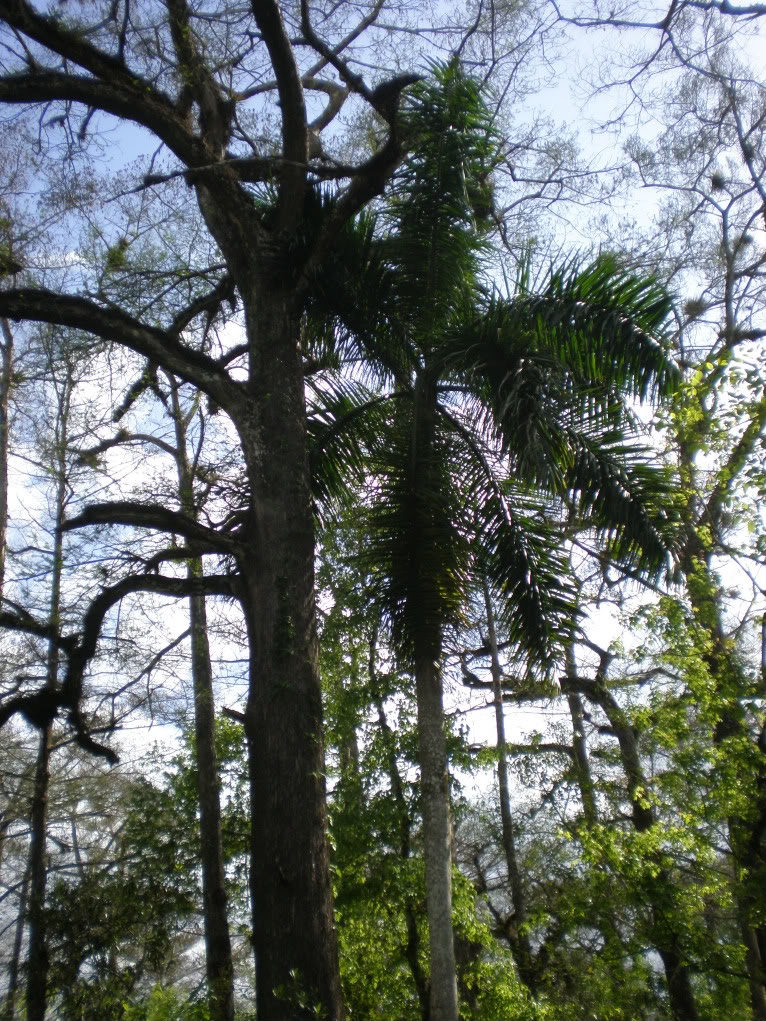
So, that in mind, let's head to the Florida that exists beyond the tourist hot spots and postcard perfect beaches.  Why?  Because when I was browsing some nature books last night, time and again, I came across a refusal to document anything from southern Florida (and Mexico) because it feels too much like a copy of the Caribbean islands.  If you ask me, I think they were just afraid of the production costs of adding in a bunch of more pages to make their guides exhaustive, but here we are.  Southern Florida is a very unique place on this globe, deserving of far more recognition than to be dismissed as "part of something else".  True, it does have some botanical and animal species that are also found in Cuba, the Bahamas, and southwards, and it also has some species that extend their range slightly into the tropical realm from as far north as Quebec, like the Red Maple (Acer Rubrum).  Raccoons (Procyon Lotor) live alongside American Flamingos (Phoenicopterus Ruber).  More unique and becoming increasingly rare is this scene below:

http://forums.gardenweb.com/forums/load/palms/msg0319222516174.html?28
Here we have a wild Florida Royal Palm (Roystonea Regia) growing in a hammock among the Bald Cypress trees, which are noticeably bald during the winter, even though it is commonly in the mid seventies or warmer even in the depth of January.  Deciduous trees do still lose their leaves here, though sometimes the change of brilliant color to bare branches back to spring flowers and leaves only takes a matter of weeks, if even that long.  For the most part, the casual visitor to southern Florida will not even notice this subtle transformation of a pretend winter, as the wild areas that do remain are full of enough broad-leaved evergreens and pines that the northern species do not make much of an impression.  There are native mahogany trees here, as well as the Gumbo-Limbo (Bursera Simaruba), three kinds of mangroves, and 13 native species of palms!

The parts that are not wild, well, they are packed so full of exotics and invasives from the tropics around the world that one would be hard pressed to find something genuinely southern Florida.  This happens to be the case because it is the one place in the United States where tropicals can safely be grown, and in the fine American tradition of planting one's property with perceived beauty over native species, there are manicured lawns everywhere along the suburban streets of Miami and Fort Lauderdale that boast just about every kind of flowering tree and palm you can imagine.   I would know, because when I was growing up, it was the first place and time where I realized that many of the trees around me were not there when things were wild and untamed.  I was six years old and had just taken an interest in both reading in English and noticing that the trees in our Fort Lauderdale backyard were very different from the trees in our Milton, Ontario backyard.  Of course, at that time, even while I wondered what "forest Florida" looked like as opposed to city Florida, I also delighted in the sheer beauty of all the tropical flowers, trees, and even lizards around me, native or not.  I did not care that everything was here artificially and introduced, and especially did not mind that we were even in the actual tropics.


That's right!  Southern Florida does indeed have a tropical climate, but even Key West lies 40 miles north of the Tropic of Cancer.  This is because the land is surrounded by water, and very warm water at that.  This is the birthplace of the Gulf Stream, which also (usually) makes Europe's winters much warmer despite being as far north as much of Canada.  Artificial climates and plants aside though, nothing can really take away from how exotic this land is, both its manicured Miami environs and its primordial but vanishing Everglades wilderness.  The contrast is very noticeable:


Much of the densely, yet comfortably, packed urban areas are built on the only true solid ground in the land, a ridge of limestone which rises only 10 feet or so above the surrounding ocean and everglades, with 24 feet marking the highest point in Coconut Grove, a Miami neighborhood which has retained much of its hammock character of dense mahogany and Gumbo Limbo groves towered over by pines, palms, and the odd high-ground Bald Cypress.  Still, Coconut Grove is but a remnant, and a very incomplete remnant, of what the Miami rocklands once looked like, which was mostly dominated by southern pines.  Development aside, the absence of regular fires in the landscape has altered what remains of the vanished pine rocklands even more. Below is a sample video of some of what remains of this ecosystem and the role of fire in maintaining it, presented by Everglades National Park, which gives you a pretty good idea of what Miami looked like before it was Miami:


This is also a good video for illustrating the role of fires even in a wet and humid place like this.


Outside of the developed areas are vast open prairie-like stretches of sawgrass interspersed with other hammocks; in essence, a very wide, very slow river that drains much of what is green on the map there.  Much more can be said about this unique extra-tropical tropical land, but hopefully this post has served as a nice introduction to one of the extremities of the continent, which we will be revisiting a lot in the future.

Wednesday, May 23, 2012

The Battle of Wilson's Creek: The Modern Park

By 1861, Missouri was well on its way into settlement by both immigrants from the eastern and southern United States and abroad.  Farms were commonplace, well-maintained roads connected vital towns and military outposts, and the southwest corner of the state around Springfield was on several main migration routes to destinations further west.  


Even then, the landscape had not been changed so dramatically as to compare with areas further east that had seen settlement since colonial times, and much of the scenery remained pretty natural.  The battle at Wilson's Creek, thus, was not quite the same open-field affair that Manassas had been.  There were farms in the area, and open land did exist in the form of patches of tallgrass prairie and oak savanna...

 
...but by and large southwestern Missouri was forested.  


Southwest Missouri is a wonderful western extension of forest, so much so that it offers a remarkable contrast to the nearby tallgrass prairies of nearby parts of Kansas and Oklahoma.  The area is on the edge of the Ozarks, and plentiful moisture and warm weather reaches into the place from further south, enough so to classify the region as  humid subtropical climatically.  No, this is not the realm of baldcypress trees and evergreen magnolias, but it is definitely a southern affair.  The forests were reasonably thick, the landscape well watered and the ground sometimes muddy.  This was a difficult place to have a battle, and really was only chosen as a mark of convenience with which to block assaults on a retreat.  Thankfully, most of the men fighting were from the area, or at least neighboring states, and knew the terrain and what to expect of the weather.  This was not a situation of green recruits from states bordering Canada falling over in the heat and humidity as had been the case in Virginia.

So, what can one see here?  Not much in the way of monuments and grave markers.  The battles further out to the west of the then-United States were often side-shows in comparison to the carnage of the eastern sites.  All the same, the park service has done a truly remarkable job of preserving the landscape intact, have marked battle positions rather well, and have a visitor center and museum complete with a full-blown, first rate research library that aids research historians not only looking to find out more about the battle, but about the war in general.  The same cannot be said for the sites at Manassas, Gettysburg, or other major sites.  Heck, the same cannot be said for most national park sites.  To be blunt, this might be, pound for pound, the best Civil War park site out there.  The staff was knowledgeable, friendly, and genuinely interested in telling the story of not just this battle, but of the state of Missouri and the war in general.  The place is definitely worth a stop on a Civil War tour, and is pretty much an essential part of any trip focused on the state.


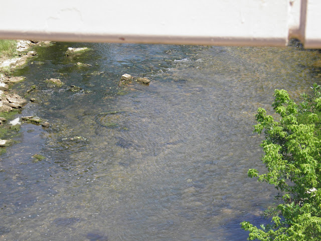
Oh, and yes, you can also see the creek itself.  A creek, to be sure, but a substantial one, and a nice treat to see after crossing so many braided or non-existent streams not too far away in Oklahoma.  


Thursday, March 1, 2012

Q & A Session Two

Q: You seem to be under the impression that the Mexican-American war was a bad thing, and yet if it truly was so horrible, why do you love California and the south west so much?

A: In my post regarding the Battle of Chapultepec, I did not expressly opine that the addition of these territories to the United States is a good or a bad thing.  The fact of the matter is, we may never know how the nations of the United States and Mexico might have developed otherwise had Mexico won the battle, thus having more room for negotiation at the bargaining table, and retained control of its territories.  We can conjecture quite a bit about the way things might have turned out with a stronger Mexico, just as soon as we can conjecture that the United States would have tried to purchase and/or take the lands by force anyway.  What I did say in the post was that the war was unjust, which it was.  What I did say in the post was that the destinies of all three of our nations were forever changed by the war, and they were.  The sheer difficulty involved in taking Chapultepec and holding on to Mexico thereafter kept Mexico an independent nation, even while the treaty made afterwards removed roughly half of its territories from it.  More happened at that battle and its following peace than territorial exchanges; attitudes were forever altered on both sides.

What would have happened to the relations between the two countries if the border remained at the front crest of the Rockies, the Nueces river, and the 42nd parallel?  Again, we may never know.  In all likelihood, Mexico would have found much of the territory too distant and vast to manage, unless they experienced a similar migration northwards that many Americans engaged in going west.  New Mexico would have considered breaking away and joining the United States, to whom they were engaged in a lucrative trade relationship already.  Texas would have pushed for a border at the Rio Grande, which the treaty would have gained for them anyway.  California might have broken off relations with Mexico City as Texas did, though the resistance of Californios to annexation by the United States might have left it as a separate nation.  Now, assuming that New Mexico would have taken the entirety of the upper Rio Grande valley, this would have left Arizona, the undeclared Republic of Deseret (Utah), and the Colorado river drainage of Colorado and a little bit of Wyoming left to Mexico, a wedge in the plans of a bunch of potentially hostile neighbors.  Assuming that the United States would not try to acquire this wedge first, the country might have looked to the 54th parallel as a way to fill out a clear path to the Pacific, which would have taken a large portion of land from what would soon become Canada and... well... things might have become very messy at that point.  Instead, history happened, and the United States picked up what has turned out to be prime real estate.

Granted, the land has become prime real estate because of how it has been developed.  Mexico looked north and saw deserts, missions, and frontier.  The United States looked westward and saw resources, the Pacific Ocean, and a haven for a different way of life for the Mormons, adventurers, rogues, capitalists, etc.  Granted, the land might have developed in a close fashion had the war not destabilized the country so much. Benito Juarez would have still been there, trying to push reforms and a chance at modernization and industrialization, and would have been still backed up by the United States looking for an amiable leader next door from whom they could buy land.  Instead, we had war.  The border was changed, hearts were changed, destiny was forged.  What we have today is simply what we have today, and our role as nations now is to make the experiences of people from both Phoenix and Hermosillo a lot more human and a lot less degrading.  The truth is, as I love the people on both sides of that ever expanding fence, I would love those lands regardless of who is in charge of them!  That said, write to me.  Tell me how you feel about this, tell me what you have studied about it.  The discovery of history never stops, and I am not closed-minded.

Q: What is your favorite National Park?

A: In what region?  Due to my preference for my native land of Northern Ontario, Voyageurs, Isle Royal, and Acadia top the list in the United States.  Parks like them in Canada, such as Pukaskwa and Quetico would cover the Canadian side, though all of these pale in comparison to Algonquin, which is a "mere" provincial park.  As for everywhere else, I really don't know.  I think my most emotional experiences have come from three places out west: The Grand Canyon, Sequoia, and Saguaro national parks.  Here they are as I saw them:


 I was completely unprepared for seeing the Grand Canyon for the first time.  I was expecting an incredible vista, but nothing like the pause bringing, pseudo-mystical feeling I got when I felt so completely unimportant in the face of the power of eternity, standing there on the north rim.  Pictures cannot capture the sensation.  I was preparing myself as best I could to see the Sequoias for the first time.  The redwoods might be taller and a bit more lush, but in essence, a Sequoia resembles the Platonic ideal of a pine (a redwood is a mere spruce, I tell you, a mere spruce!).  Call me a hippy, call me a nature pagan (I most assuredly am neither), but when I walked in the mist and snow to the base of the most massive tree in the world, I felt like I was approaching the favorite personal property of God.  Then I did something I probably should not have, and gently touched the bark, and felt what I can only describe as a sensation of touching something directly consecrated by the hand of the divine.


Finally, we have the cacti.  I had already seen a bunch of chollas, prickly pears, barrels, and such in other parts of the west, but had not yet been to the lower, warmer reaches of the Sonoran desert where the giant stuff could be found.  My first trip there, heading into Tucson from New Mexico on I-10, was on a forty degree day in very foggy skies, in March no less.  I found my first saguaro in a wash east of Benson, and got really excited.  Then I went to Cactus Forest drive in the eastern unit of Saguaro National Park, and saw sights that I will never forget in my entire life.  A forest of saguaros, ocotillos, everything I had imagined... lush, green, alive, and with a smell that I wish I could have bottled and taken home with me wafting through the misty air.  This was actually an experience that made me want to study botany; this "desert" world was just so ethereal that it grabbed my attention and turned me on the path of a new passion.

As usual, leave comments here or e-mail me with questions at BKryda@gmail.com.  By all means, disagree with me and get political!  Discourse can only improve us.

Friday, February 17, 2012

Parks in the News: Pythons in the Everglades

The story can be found here:

http://www.nationalparkstraveler.com/2012/02/sixteen-foot-long-python-captured-everglades-national-park9475#comment-36838

North America is a very diverse continent geographically while also somewhat isolated from the rest of the world, and thus is prone to invasive plant and animal life originating throughout the world.  No matter where something is from, there is most likely a suitable climate and environment somewhere on our continent that is able to proliferate, and in the absence of evolved natural defenses, invasive species can actually come to dominate entire ecosystems rapidly.  Native peoples were painfully aware of this in the form of a myriad of diseases unleashed upon them following European contact, and Kudzu, Tamarisk, and Giant Reeds have demonstrated this within plant communities.

Case in point, the Everglades.  The only truly tropical portion of North America north of Mexico is southern Florida, which accordingly has become heavily populated in recent decades.  Furthermore, the relative affluence of the area means that there are and will be exotic pets, which tend to escape or be released from their homes now and then.  Many exotic pets, especially aquarium fish, reptiles, and birds, are tropical in origin, and most do not survive long outside of the warmest parts of the country.  In southern Florida, these animals flourish.

Read the story to see why this is a problem, in case the truth was not clear.

Petrified Forest National Park

In 1906 the Antiquities act was passed by the United States Congress and signed into law by who we can only  imagine was a rather giddy American president Theodore Roosevelt.  Section 2 of the act permitted the president to set aside parcels of land deemed worthy of preservation, which caused quite a stir at the time (and still receives a bit of bad mouthing today, but thankfully bi-partisan efforts to back up executive decisions regarding the act usually quiet things down).  The forth monument proclamation set aside a stretch of desert on the Colorado Plateau that had piles of petrified wood everywhere.  Petrified wood was no secret treasure; nearly every state and most nations of the world have some variety of wood that has petrified by various means.  Here, however, the wood was plentiful, whole logs remained intact, and looked far more beautiful than many other varieties that had been known at the time.

The problem, of course, was that people could not resist taking souvenirs.  Commercial ventures and organized greed followed innocent rock hunting, and much of it had been hauled away a mere 40 years after Lt. Amiel Whipple surveyed the land and reported about the wood.  Roosevelt was certainly ready to preserve what was left of the wood, and certainly knew about the scenic beauty of the surrounding land.  Congressman John F. Lacey (credit is due to The Wilderness Warrior by Douglas Brinkley) was apparently instrumental in getting Roosevelt to actually sign off on the deal, even while he was also working on preserving Crater Lake and Jewel Cave.  Lacey considered the Petrified Forest to be one of the most amazing treasures of the entire continent.  The Arizona territorial legislature apparently agreed with him, as they had been pushing for protection of the land since 1895.  The monument was created in December of 1906, and later re-designated a full national park in 1958.  Theft of the wood continues to this day, but it was greatly slowed down.  

So what is so special about this place that it deserves national park status?  Well, the wood itself is certainly gorgeous, but it also sits in the Painted desert, which I have to say, certainly lives up to the name, especially at sunset.  One of the reasons that color photography was first developed was to show people how beautiful this land truly is.  The truth is that pictures, as is the case for so many wonders of the natural world, can barely do the place justice.  Seeing this land with one's own eyes is definitely recommended, although the sensory experience does not stop there.  Much of the North American deserts have such unique smells, sounds, and even just a plain feel of the air to them, and this particular portion is no exception.  The air quality, in fact, is considered by the National Park Service to be among the highest of anywhere in U.S. territory.  Anyway, what does the Painted desert look like?


It looks like it was painted.  Much of the area is part of the huge Chinle Formation, which extends throughout much of the southwest and can be found prominently featured in Zion, Capitol Reef, and many other fine places.  

What else is here?


The Puerco pueblo, along with some associated petroglyphs, and even older markings dating back as many as 2,000 years ago.  

While the land seems a bit inhospitable, the climate was apparently pretty decent in the past if such a settlement was founded here.  The Puerco river, while mostly a dry wash, does have some amount of water in it underground, as evidenced by the Cottonwoods.  


Far more recently, people have been using the area as a passing point.  The attraction of the wood, and the convenient location off of Route 66, now Interstate 40, has meant that a lot of tourists have come by this way.  Route 66 enthusiasts consider this park and surrounding area to be one of the main highlights of the classic trip down the length of the mother road, and the old road bed can be seen here, alongside the Painted Desert Inn, which has been lovingly restored.  


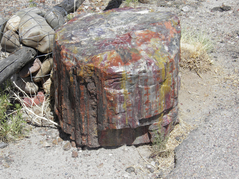
Aside from all this, of course, there is the wood itself.  While not exactly a "forest" in the conventional sense of the term, points of interest such as the Rainbow Forest certainly have nice collections of the stuff, including large logs.   


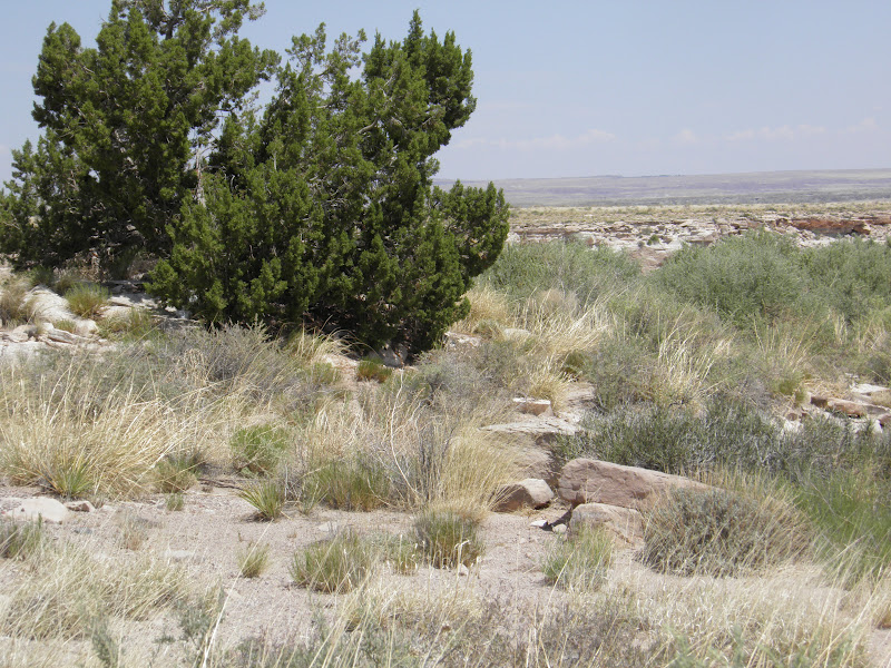
Apparently, before dissolved silica managed to turn wood into, well, almost quartz, some of these trees used to be redwoods.  Such a wet climate must have seemed like a different world compared to the high desert of the Colorado plateau which exists at the present.  Again, however, the desert has its charms, and this particular one, being over 5,000 feet up (the level land and presence of a rain shadow prevents much growth in the way of junipers of pinyon pines), does not have the scorching 100's of the lower deserts to the south and west.  While the main attraction is definitely the wood, ruins, and painted landscape, this is probably one of the better places to explore the "fifth American desert" of the Colorado plateau.  Here one can find lots of sagebrush, various smaller cacti and yuccas, as well as cottonwoods (and the disgusting, invasive, evil Tamarisks) along the Puerco river.  There is even a chance to see the odd White-tailed antelope squirrel and  a lizard or two.  
 This had to be my favorite cactus I have seen in a while.  It had a lot of character for being such a small thing.


Now, as far as the wood goes, while it is illegal to collect any within the park, and huge amounts of it have been scoured from surrounding areas, there are numerous shops that can legally sell you souvenirs of wood harvested from outside the protected area.  I would recommend Jim Gray's Petrified Wood co., which has an incredibly large shop that also sells other Arizona mineral specimens, and has fashioned logs for sale.  Believe it or not, the chair was pretty comfortable.  The eastern stretch of I-40 in Arizona has a bunch of other shops as well, but some might be a bit less reputable in collecting sources.  Even at Jim's, I was not immediately comfortable with the ethics of the situation, though when I spoke to the staff, I changed my mind.  They truly do care about the land, and were surprisingly far more polite and knowledgeable about it than the (non-ranger) staff at the actual park.

All in all, a pleasant place to visit.  Due to the open nature of the terrain, and the distance from any point sources of light pollution, this would be a great place to do some wilderness excursions and back-country camping.  There are supposedly more logs out there, waiting to be discovered.