Always to the frontier
Showing posts with label Not-Midwest. Show all posts

Wednesday, July 10, 2013

Wednesday Filler: Rugged Ohio

When most people think of Ohio they envision yet another dull tract of Midwestern land that is flatter than a pancake and nothing but farm after farm with shelter belts of trees marking the edges of properties.  An occasional city pops up to break the monotony, but it is yet another slightly impressive rust belt city that perhaps has seen better days.  Not so!

US 23 south near Chillicothe, Ohio.

What you see can fairly be called Appalachian.  Much of its flora and fauna are Appalachian species and the land itself is certainly more rugged than a mere pancake plain.  True, northwestern Ohio is among the flattest stretches of land on the planet, having been made so on the bottom of ancient and long passed Lake Maumee, but travel an hour south or east of Columbus and Cleveland and just a short trip east of Cincinnati and one encounters foothills of the great eastern wall.  I mean come on, does that look Midwestern up there to you?  I figured not.

Monday, January 28, 2013

Lake Michigan's Southern Shore: North Meets West Meets East

Dramatic stands of Eastern White Pine (Pinus Strobus) and Jack Pine (Pinus Banksiana) grow among Big Bluestem (Andropogon Gerardii), Eastern Prickly Pear (Opuntia Humifusa), as well as a variety of trees common to the eastern forests, notably oaks, hickories, ashes, willows, and more.  In a low, watery basin sits a spahgnum bog topped with boreal species, mere yards away from an open prairie, in turn yards away from an ash swamp, which sits behind cool depressions in sand dunes which give rise to great pines.  This meeting place is the world of the Indiana dunes, a natural point of junction that has also served as a great crossroads for people traveling between various parts of the continent.

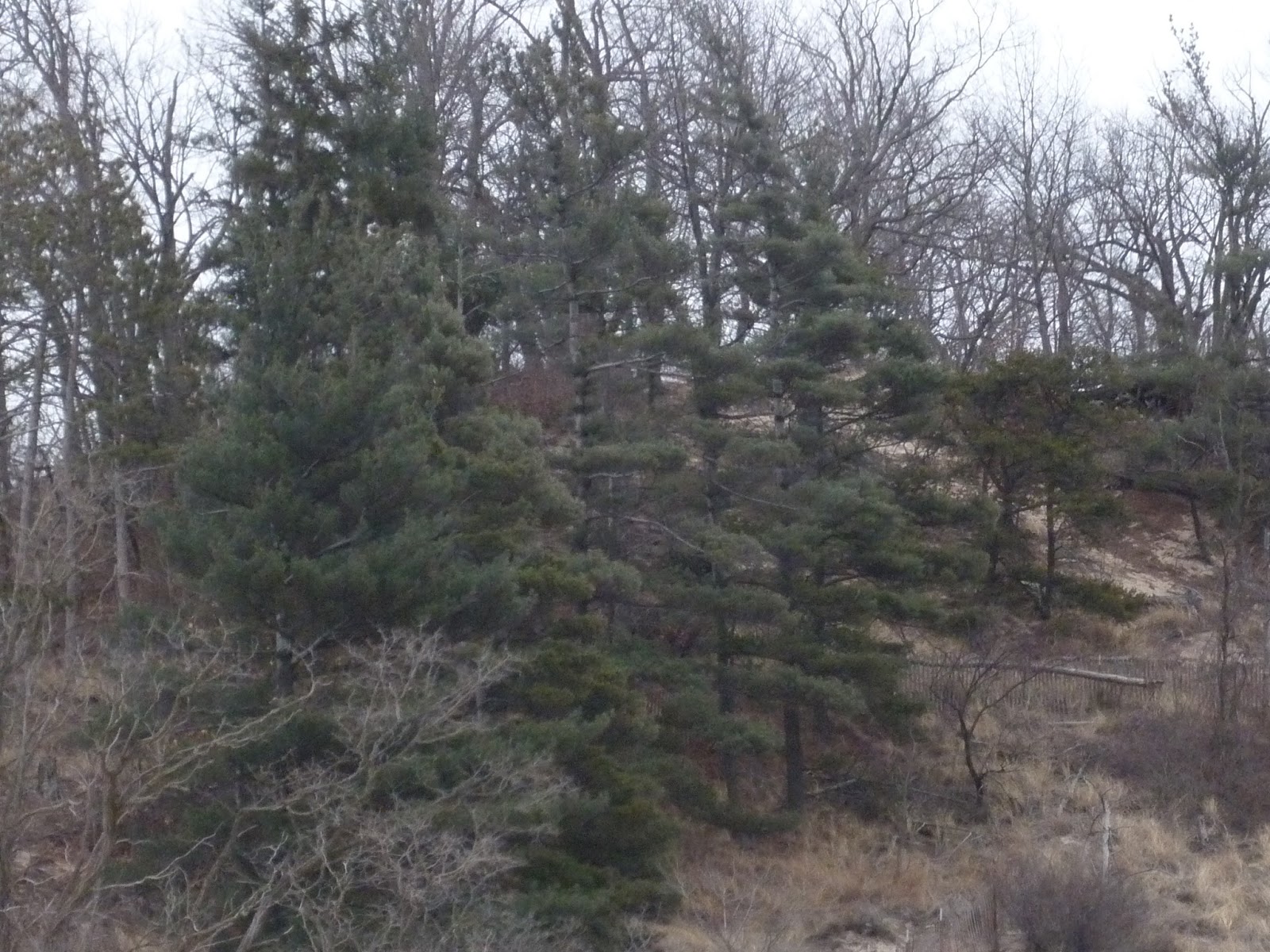
Sand, wind, and glaciers are responsible for bringing together a diverse community of plant life that serves to defy definition for the area.  My first sign that I was in an altogether different place was the presence of so many White Pine that just popped up out of nowhere.

Both shots taken at Indiana Dunes State Park near the end of State Park rd.


Now normally when one comes across such stands so far south it is because park agencies would have planted them to add exotic interest to the environment, an attempt to create something of a "north woods mystique" to state and local campgrounds.  Pines might have existed here naturally at one point, but most that are seen south of the Great Lakes are nostalgic reminders of a timer before the great lumber pillage of the nineteenth century.  Here, however, they remain as relics of the huge stands that once helped to build Chicago.  They rise from the sands in scenes expected hundreds of miles to the north in northern Michigan and Ontario.  Travel only a few miles south, over ancient moraines left at the edge of long vanished ice sheets, and the sand is left behind to be overtaken by rich prairie soils and more temperate forests.  This is, after all, Indiana, a place one would hardly expect the north to thrive in.

Yet thrive it does.


But the north here is not alone.  The dunes are first stabilized by dune grasses...


...and more southerly trees like Eastern Cottonwoods (Populus Deltoides) and Eastern Redcedar (Juniperus Virginiana).


Eventually they are joined by trees found in more mature forests as richer soils are built up in the ever changing world of our eastern plant succession forests.  In some lower places, water stands for a significant portion of the year, and we have moist forests of ash trees, Swamp Cottonwoods (Populus Heterophylla), and other water tolerant trees.


Eventually the lake gets far enough away that its power over the shifting sands declines along with the sand itself.  Departure from the drainage basin of Lake Michigan marks an ecological departure into the Midwest, where a new struggle of plant succession takes place, waged not between sand and plant but fire and plant.  A mosaic of prairie, savanna, and forest stretches in all directions but north from atop the Valparaiso Moraine.  Looking north instead shows us what we have just seen, a meeting of north, east, and west.  These days humans mimic this corridor along our highways 20, 94, and various railroads.  Come by tomorrow for a look at the human presence in Indiana's "southern shores".

Tuesday, April 10, 2012

Defining the Not-Midwest: Politics and Bias

"It seems that everywhere in the USA is the mid-west or west, and how far west of the Atlantic ocean you actually live determines how much of the eastern side of the country you consider to be posers and liars. For example, a poet in Nevada made fun of me for living in Texas, because it isn't the real west. We in Texas make fun of Ohio and Indiana for saying they're in the west." -A friend from Wichita Falls.

Back in 1995 when Oklahoma City endured a domestic terrorist attack, many different media outlets paraded around a lot of different words.  One of these words was "heartland", a term used to describe what politicians and others have long felt to be the core of American society.  The heartland, in this sense, is a place of a strong moral compass, hard-working communities, and simple people that go to church, watch their neighbor's homes while they are away, and never ask for more than they are willing to give, that sort of thing.  While New York and Los Angeles have lost their ways, the right proclaims, the heartland is a place where you can still find all that is good and true of America.  Well, so they say, and yes, career politicians like to talk, don't they?  So where is the heartland?  Pretty much anywhere outside of the east and west coast, oh, and the Mexican part of Texas, oh, and the larger industrial cities, oh, and... you get the picture, and you can probably see where I am going, but first, read on.

Now, is there anything wrong with being a Caucasian, Republican-voting, evangelical Protestant, country-music listening farmer from Davenport, Iowa?  Not at all, no more so than being a Hispanic, Democrat-voting, Catholic, pop-music listening factory worker from Rochester, NY.  The "heartland", in fact, is a pretty nice place.  Attitudes are a bit more relaxed, the pace is hectic only when it needs to be, and yes, you can pretty much see one of the many cores of traditional American culture.  Sadly, most people who bring up the term heartland want to use this sort of atmosphere and concept as a weapon, missing the point that the heartland truly consists of many great elements in the mosaic that is the United States.  Let's take a tour of the United States, leading out to the heartland, wherever that really is.  Let's start in the melting pot of New York City.  It's a great place!  It's full of life, and a rich depository of so many different cultures that actually do manage to not only assimilate, but add into the essence of "America".  At the same time, it can also be extremely insular.  Being from New Jersey, New England, or even the rest of New York state can seem backwards to New Yorkers, even in childish ways (e.g. why are your freeway exits miles apart, why is there no Starbucks in your town, how come you don't drive a hybrid, and why is that car a Ford?!).

Let's move up and down the coast, from say Boston down to northern Virginia, and take in the Hudson river valley as well.  You are the real east, and anything past the first line of hills in the Appalachians is the frontier (and here I figured Daniel Boone opened up the Cumberland Gap back in 1775).  I know people from Albany who think that Buffalo is in the Midwest, and that Rochester is, at most, the front door of the great eastern manor house.  So we see a trend developing thus far, and it is mainly based on skewed notions of cultural superiority.  You see, "east" means life, development, class.  Ah... now look at those terms.  Development, you say?  Surely that means the presence of advanced commercial and civil infrastructure?  That's part of it.  The other part is, well, consideration of the presence of what those on the left consider to be progressive social institutions, meaning everything from support-groups, safety nets for the impoverished, embracing of cultural diversity rather than simple tolerance, etc.

Now this next part might be a bit controversial and dangerous to admit, and don't worry, leftists, I will get to the rightists as well.  Those lands west of, well, the east coast, those are mainly red states, and where they are not, they are apparently economic and social embarrassments in comparison to the shining capitals of prosperity and progress of the land of the sunrise.  Ohio, Indiana, Illinois, and so on?  Rural, lower-income, and tending towards conservatism.  The places that seem to vote blue?  Detroit, Cleveland, Gary, Buffalo, Flint, Toledo?  Who would want to live there, those places are wastelands created by the mistaken concept that "buy and produce American" can get you anywhere, because everyone knows foreign trade is where vitality is best sustained.  Ah, things are looking a bit more ugly now, no?  The bias against the interior looks a bit less political, and a bit more based on class and economic discrimination, the very thing the left claims to loath.  The shining cities of glowing lights and international trendiness looks down on the interior which helps to support foreign trade.  Now remember this statement, I will call upon it soon.

Let's go further inland, to the heartland, and say to Michigan itself.  Now yes, Michigan is a blue state, but its record for voting Democrat mostly stems from the concerns of the working class rather than liberal social agendas about cultural freedom or even, surprisingly, a desire to promote welfare and safety nets.  Here, the raw issues are about employment, affordability of health care and housing, and the living wage movement.  Conservative social agendas are an election year issue here as well, though.  As such, the people here disdain any sort of link to the northeast, and the more conservative types like to be associated with the Midwest.  Quite frankly, the people in the northeast like to stuff them off in that category too, including the Federal Census Bureau.  So here we start to see that the concept of "Midwest" is one of social and political weaponry.   Being a part of the Midwest is either really good if you are rightist, or really bad if you are leftist.    Entire parts of the country get left out of their ideal vision of America just because they don't agree eye to eye on some issues (and yes, by no means do I mean to the trivialize the issues, even while I advocate for some semblance of democracy to fight back against extreme partisan interest groups).  The funny thing is, the people further west feel the same way about the Nearwest that the Easterners do; "you are not a real part of us", unless of course, it is an election year.  So, enough of this anti-political political rant, you are probably requesting.  How does this have anything to do specifically with Michigan, northern Ohio, etc. not being a part of the Midwest?

Well, aside from all the historical details of cultural makeup I have given already in various posts (look for the label Midwest in the right hand column menu if you need to catch up), the Nearwest is just wired differently from other regions in the country.  For one, we are impacted a great deal by Canadian economic movements as much as we are from the rest of the country.  Autos, industrial materials, food, and even energy are traded back and forth across the Niagara, Detroit, and St. Clair rivers, far more so than most people know.  Simply put, it's where our transportation corridors have always linked to strongly.  From there, Detroit connects to Chicago and Buffalo to New York, and thus the traffic between the United States and its largest trading partner (China is still second, look it up in various sources) still goes through the Nearwest.  This, of course, means that the region has a unique role as an economic corridor that both heavily depends on domestic and foreign economic vitality at the same time.  Cities like Los Angeles and New York and their environs are great gateways between the United States and the world.  Cities like Chicago and Denver and their environs are great gateways between different parts of the United States.  Cities like Detroit and Buffalo and their environs are BOTH.  As such, the political concerns of these areas tend to focus on this concept.  They have to.  That said, no state is an island.

The Nearwest is thus considered to be the Midwest by so many people because of political desire, even while the political mindset of the region is "Rustbelt bi-national" rather than interior or coastal.  The region either gets absorbed or cast aside by those interests, and in doing so, it tends to mostly just get ignored, forgotten, or treated as an embarrassment by everywhere except itself and optimistic neighbor southern Ontario.  One day, perhaps, the region will rise again and be noticed not as a place that serves as a chip on the table in the poker game between the shores and the interior, but as a legitimate player in its own right, every bit as impressive as Mr. East Coast, Mr. Midwest, or any of the other Mr. regions out there.  The Nearwest has its own history, its own climate, its own environment, and definitely its own political voice, just like the other great parts of this nation and continent.  Come and discover it, for the Nearwest is a region of its own, not a tool in political jargon.

Monday, April 9, 2012

Defining the Not-Midwest: Geography

Look at the United States.

As you can see, the Midwest is aptly named because it is halfway out there to the western part of the continent.  It sits roughly in the middle of things, even sitting in a time zone (the eastern limit of which is marked by the pale blue line) that is aptly called the central time zone.  The rivers (purple) which flow through it nearly all drain to the Gulf of Mexico, in one spectacular point of land known as the Mississippi delta.  The landscape looks slightly less green than stretches further east do, and in the western edge of the region, things brown out quite a bit as the trees get far and few between.

Now, look at our friends Michigan, northern Ohio, northwest Pennsylvania, western New York, and yes, even southern Ontario.  These areas fall into the eastern timezone, albeit at the middle and western end.  The rivers (pale blue spray on the Lakes and St. Lawrence river) of these areas drain to the Atlantic Ocean through the wonderful inland seas that are the Great Lakes. Things look much greener (though parts of Michigan, Ohio, and Ontario do look a bit more farmed over, to be honest).  And for crying out loud, Detroit is at the same longitude as western South Carolina.  Even the western parts of the state are still due north of the Florida panhandle.  To envision Cleveland being much more western than Erie is simply mind-boggling in the regards of sheer proximity.  Old divisions between north and south at least acknowledged the existence of "border states" both culturally and physically.  Hence, again, the term "Nearwest" is best applied to these areas.

Justification for such a term here is certainly given both in terms of actual location and cultural/commercial links between east and Midwest.  Those rivers do more than just drain water; they have been determining the market for cities such as Detroit, Toledo, Cleveland, and even distant Gary and Milwaukee for over two centuries now (Chicago is a different animal, more of a bridge between, well, everything).  They have sent their goods either to Canada or down the St. Lawrence seaway (and formerly the Erie Canal) to foreign markets.  In contrast, goods from the Midwest have made their way to the port of New Orleans and destinations beyond.  The barges of the Mississippi and Ohio rivers also carry different cargo from their Lake freighter counterparts; grains and produce float down towards the Gulf, while everything from autos to iron ore load up the Lakers destined for the Atlantic.  If the map is not evidence enough of the distinct region that the Nearwest forms, the markets that exist because of the conditions of the map are there to support the theory that we have a separate region on our hands.  Anyway, enough of the bare bones of physical geography, let's take a look at environmental geography.

Much of the Midwest is characterized by its dominance of farmland, grid-patterned cities and orderly plots of land, and in general its heavy development.  Much of Illinois, Indiana, Missouri, Iowa, and parts of Minnesota, Wisconsin, and of course the neighboring plains states used to be quite open.  While a settler standing in the middle of Indiana or Illinois would probably still be able to see trees around, there was a lot more sky and grass than had been encountered down in Kentucky and points eastward.  Things would also seem very flat.  This is not to say hills do not exist in these states, but for the most part, the terrain is a rather level affair.  Much of the original landscape is now gone, replaced by nearly endless agricultural development that took advantage of the rich, deep soils of these areas.  Still, the notable absence of extensive forests is because the farms were simply developing land that was rather open to begin with.
A section of restored tallgrass prairie along I-55, and a scene typical of central Illinois.  There are trees here, but there is also natural open space.


Now, this is not to say that Michigan, northern Ohio, and southern Ontario have no farms.  Indeed, there is a lot of corn grown here.  Here and there, though, instead of patches of woodland, are remnants of some truly amazing forests.  While there are definitely tall trees in Illinois and Indiana, the difference between these regions lies in the elements of the forests.  For one, unless they have been planted, pines and spruce are going to be far and few between in the former tallgrass regions.  There are exceptions to this rule, even as there are patches of prairie in Michigan and Ontario, but by and large a notable contrast will be seen by even the most casual of observers.  Illinois and Indiana have lots of oaks, hickories, elms, and shrubs.  Michigan, Ohio, and points east have maples, beeches, pines, and towering trees of all sorts.
Joy road, near the western limits of Canton, Michigan, a rare instance of a natural landscape in Wayne county.  Here we have a typical maple-beech forest.

As you can see, the dominant landscapes of the two different regions are substantially different.  Again, there are exceptions to the rule in these places, but by and large, the Nearwest has a different flavor from the true Midwest, and this is without bringing the Great Lakes themselves into the debate.  Still need convincing?  Well, come by for the last post in this series of defining the Not-Midwest as we explore the wonderful world of politics, where we find the concept of "Midwest" was probably born.

Wednesday, April 4, 2012

Defining the Not-Midwest: Climate

The interior lowlands of the United States are characterized by a largely humid continental climate.  This means that the vast landmass of North America produces winters in the region that are cold, sometimes downright frigid, and a bit on the drier side.  At the same time, the Gulf of Mexico, perhaps the most powerful humidity factory in the world, aside from the South China Sea, sends north a lot of hot, extremely humid air.  This produces not only the sweltering summers of the region, but also a conflicting air mass, that, when colliding with the continental air masses, spawns some of the most violent non-oceanic storms in the world.  While these two contenders are normally the main event in weather showdowns in everything east of the Rockies, there are alternative influences that sit on the sidelines ready for the tag to get into the action.  The greatest of these, at least in the northeastern United States and parts of Ontario and Quebec, would be the Great Lakes.

The lakes are huge, hundreds of feet deep, and as such rarely freeze over in the winter.  Lake Superior and Lake Michigan have never reported total ice coverage, though Michigan came close in the late seventies.  Open water has a tendency to moderate air masses that pass over them, even if the water is on the colder side.  For Michigan, northern Ohio, northwestern Pennsylvania, southern Ontario, and western New York (see a theme here yet?), this gives such places air conditioning in the summer, and longer growing seasons as well as moderation of arctic air masses in the winter.  Also of note in the winter, the areas within sixty miles or so of open water can see massive amounts of snow thrown upon them, called lake effect snow.  Rainfall totals are higher here than in other parts of the interior, often by as much as 10 inches per annum.  In terms of normal interior weather, these areas largely see quite different effects than much of the rest of the land does.  Tornadoes are possible in Michigan, Ontario, and northern Ohio, but they are often much smaller in raw power than the terrors that can strike places like Joplin and St. Louis.  Storms, waves of extreme temperature, even relative sunshine, they all get muted by the Lakes.  Sometimes it even seems as if air masses tend to stick within state lines.  Just look at Wisconsin and Michigan here!

Or for those curious about how this works in the winter, take a look at this map:

Obviously Ohio is behind an arcing front, and is thus colder than Indiana, but Michigan?  Not so much.  Yes, Lake Michigan is quite the attractive piece of water.  The Lakes influence the temperatures of these lands enough to give places like the Grand Traverse area of Michigan and the Niagara frontier of New York and Ontario a growing season comparable to what can be found in Kentucky or New Jersey.  If this sounds like a stretch, one need merely venture out among the extensive orchards and vines of these otherwise northerly latitudes.  Niagara-on-the-Lake, in fact, actually has a climate that supports several species of cold-hardy palms.  The peak fall foliage times is often late October and early November.  Best of all, spring blossoms last much longer.

So, what does this mean for the Midwest and Not-Midwest besides what will fall from the sky and how warm things will be?  Come by next post to see what defines the differences between these regions in terms of geography.

Tuesday, April 3, 2012

Defining the Not-Midwest: Settlement Patterns

"You know, I like Buffalo.  It's not quite northeast, not quite midwest, but its own sort of thing."
-Anonymous friend from Albany.

In recent years, the citizens of West Virginia have been getting uppity.  No longer content to be labeled anything along the lines of "Appalachian" or "borderline southern", the residents have desired to be counted in the census as, wait for this, midwesterners and southerners.  In the north, particularly in the panhandle, the cultural essence of the state shares much in common with the neighboring parts of Pennsylvania and Maryland, right down to local accents and dialects, and even restaurants and common retail outlets.  For whatever reason, and the next few posts will be about theorizing why this is the case, they have instead opted to be considered midwestern, which they think Ohio pretty much is.  Now, Ohio at least has been called this before.  So?  What's the problem?

Well, West Virginia is, uh, due north of the Carolinas, and south of Pennsylvania and New York.  It lies roughly half way into the eastern timezone.  It was a part of Virginia until the Civil War.  Need I go on?  Apparently I do, because it seems that inclusion in the midwest is one of the most desirable things out at the current time; heartland affiliation is passionately sought after by conservatives claiming to be American traditionalists.  That's right.  I brought politics into this.  Why?  Because they are screwing with geography and don't need to!  For the next few days, I am going to go in depth as to what I think the Midwest consists of, and to be up front and honest, I am excluding Michigan, a good third of Ohio, and most assuredly, I am excluding anything to their east.  Now, why?  Well, I am not trying to do this because I dislike the right, the left, or anything called the heartland.  I am trying to do this because I think there is more regional diversity to this country than often gets recognized.  I am doing this because history and geography deserve to be more than just political wands and magic spells.  I am doing this because I LOVE Michigan, northern Ohio, southern Ontario (and look, I just attacked a boundary), and western New York.  I think these places are unique areas that deserve more than being ignored by greater political camps who only use them to their advantage.  East coasters, midwesterners, you have great lands!  East coasters, midwesterners, don't pass these ones off as more of what you are, and come visit us!  Well, with that out of the way...

Let's start off the series with (and note, I am not using the word "lesson" here) a look into Euro-American settlement of the lands beyond the Appalachian crest.

I realize that this is a mess of map, and that some of the colors look alike.  Let's code it down, then, starting with teal.  Teal, in the valleys west of the Blue Ridge mountains in Virginia, is essentially where the cradle of western expansion lies.  It was from these valleys that the already rustic pioneer population made tracks towards Kentucky, following men such as Daniel Boone through Cumberland Gap, which is the red dot between the two states.  Following, and often with the initial Virginians, would be immigrants from Pennsylvania, including many Germans and other European immigrants who had already been settling there for about 70 years.  The expansion from Cumberland Gap started in 1775, and took off almost overnight.  By 1792, enough people had settled in Kentucky for it to become the first state west of the eastern seaboard.  By 1812, as you can see from the lighter blue on the map, the Kentuckians had spread out along the waterways of the Ohio, Tennessee, Scioto, Miami, Wabash, and finally Mississippi-Missouri rivers.  Today, the southern portions of Ohio, Indiana, and Illinois bear a culture and attitude that was handed down to them by these pioneers.  They are in many ways the first midwesterners, and together with later immigrants who arrived in Chicago and from the National Road, mingled with them, and are the modern midwesterners.

As you can see, however, they did not make it all the way north.  From the upper Potomac and historic core of Pennsylvania, including Philadelphia, a great immigrant port, we have those brown arrows and lines, which consisted of migrants of what have since been referred to as the "midlanders".  With the exception of the Mormons and some religious groups from New England, most of the minority Christian religious groups settled this region, and often started here as well.  Their accents and dialects of American English are markedly different from the Virginians and Kentuckians, without much of a drawl of the south, or the nasal characteristics of the north.  The people of this region that did end up constantly pressing west took the valley road down to Virginia and mixed in with the groups in the south that moved past the Cumberland Gap.  Those that stayed often slowly moved into the interior of the Appalachians and Allegheny Plateau.  They followed the valleys and ridges, often along rivers such as the Delaware and Susquehanna.  Others cut further west on the Potomac and raced ahead of the National Road that began construction in 1811.  They settled in places like Pittsburgh, Wheeling, Cumberland, Altoona, and into Ohio.  From around Columbus and eastward, they mingled with the Kentucky crowd, and founded cities like Indianapolis and Vandalia.  In the parts of Ohio, Pennsylvania, West Virginia, and a tiny bit of the southern tier of New York, they remained a more distinct culture and maintained their dialect and accents.  These regions are also dominated by a staid adherence to colonial architecture, almost as if Philadelphia extended out with the migrants.

Further north still was another great gateway of American expansion, New York City.  From here we see a dark blue stream emerge, with migration that began during the American revolution, and that really got underway after the construction of the Erie Canal.  Unlike the wilderness pioneers of the Cumberland route, or the small town and farm mentality of the National Road expansion, these settlers would be largely urban, extremely diverse, and continue as a stream of immigration well into the 1890s.  Here the American and German majorities would be joined by large groups of Irish, Italian, and Polish settlers.  In the first half of their colonization, and this is key now, they would settle in the areas around Syracuse, Rochester, Buffalo, Erie, Cleveland, Toledo, Detroit, and would pretty much settle most of interior New York, lakeshore Pennsylvania and Ohio, and nearly all of the lower peninsula of Michigan.  Starting with waves of Irish immigrants who started coming to the United States (instead of formerly to just Canada) in the 1840's, the second half of this migration found European immigrants, notably those listed above, also coming to these areas.  More and more, however, the great destination became the interior gateway of Chicago, wherein they settled and spread out across the west to help form part of the modern midwestern culture.  Again, however, such a mixing did not largely happen in Michigan, northern Ohio, and so on.  These areas are to this day largely devoid of Kentuckian influence.

Of particular note are two sub-groups that took part in the early stages of this migration.  The bright yellow stands out a bit, in more ways than one.  As you can see, it starts in Connecticut and joins the Erie Canal route, but then promptly leaves the lakeside migrant routes in northeastern Ohio.  You see, back when the 13 colonies were chartered, they tended to have no western boundary and theoretically shot all the way to the Pacific.  The shore colonies from Delaware northwards were hemmed in by their western neighbors in this regard, but a few of them claimed land beyond the Appalachian frontier anyway.  Connecticut claimed the north shore of Ohio, and until 1800, when it gave up its claim, sent its emigrants to the area.  The "northwestern reserve", to this day, feels like a little bit of New England, with much of the architecture and city plans a spot on match for those back home in the "Constitution state".  The salmon arrows (sorry, I realize salmon looks almost like pink, I have a limited color selection to choose from) that extend from Albany and Buffalo towards Canada are the routes taken by the loyalists of the northeast as part of their exodus from the United States.  Much of southern and eastern Ontario, and a good portion of the land around Montreal, contains the descendants of these people.  Of course, they were not fortunate in having a canal to escape on.  By 1812, they had been joined by Americans taking the water level route through New York, and they with other immigrant groups, mainly from the British Isles and some from Germany, formed the cultural area that has since become southern Ontario.  The region, of course, has many similarities with Michigan and many more with western New York, with the key difference being obvious.

Finally, we have the pink lines representing French colonization.  The French were very compact in their colonization process, probably because they were largely frontiersmen looking to trade and hunt with the native peoples.  Their path of settlement is quite linear compared to the other migrant pathways, and they usually stuck quite densely to the waterways, especially along the St. Lawrence and Detroit rivers.  Much of their presence in the interior of the continent outside of Canada is now largely in names of cities,counties, and rivers, with the exception of places such as northern Maine, the eastern upper peninsula of Michigan, the metro-Detroit area (where many family names are still French), and scattered locales such as Vincennes, Indiana.  Though largely an evaporated influence, the French-Canadian-American presence still adds something unique to parts of the interior, notably southeastern Michigan.

So how do we know how much this has impacted the land, aside from romanticizing the effect immigration has had on this country largely considered to be a melting-pot in which immigrants are absorbed into the American cultural machine?  Well, we could stop to remember that absorb is perhaps a less effective word in describing the evolution of a nation that was essentially added to by all these peoples.  We drink far more coffee than tea, spaghetti is a common place dinner, more perogis are consumed here than anywhere else on earth outside of Poland, and Lutherans and Catholics far out populate Episcopalians.  That said, Lutherans are going to be a lot more common west of Lake Michigan than east of it, perogis are common menu items in Detroit and Buffalo, and you will be hard pressed to find a Tim Horton's in the United States outside of western New York, northern Ohio, or Michigan.  Interesting cultural coincidences, no?  Still skeptical?  Well, come back for the next few days as we delve into this a bit deeper.  You can also check out this interesting linguistic map in the meantime.

Now, I am sure my cultural familiarity with the places and peoples mentioned will be contested, but I can at least be counted on to be an authority on things Michigan, western New York, and Ontario, having lived most of my life in one of these three places.  Come by tomorrow to read more of why I think the Lakes/Nearwest region is unique, and of course, check out this earlier post that explains what I think is unique and special about the actual Midwest.  As always, feel free to leave comments, even and especially if you want to tear me apart on this.  My blog is not a place for totalitarian academic speeches, it is a place where perspectives are shared.