Always to the frontier

Monday, April 30, 2012

Urban Backdrops in Southern California: A Clear View of the San Gabriel Mountains

One of the nice features of city living in much of the west, especially California, is that mountain views are never far away.  When the skies are clear, many of the inland cities surrounding Los Angeles have exquisite views of the nearby transverse ranges.  Closer to the Pacific, the mountains drop off in height compared to slightly further inland, but they are still quite a wonderful background to look out on from a porch.

Now I admit, this view is cheating a little bit.  The foothill freeway (California 210) is a bit elevated and open, but many of the communities near the foothills tend to have excellent views for the most part.  The street below, for instance, is developed and well-planted (including that rather interesting cellular tower), and  yet the San Gabriels still manage to dominate the sky.
Looking north from Monrovia, California

The mountains, in addition to being so aesthetically pleasing, provide a nearby refuge from the heat and artificial landscape of the valley floors.  While they might not look very lush from the valleys below, they are densely vegetated ecosystems of chaparral, and higher up, pine and oak forests.  There are canyon roads which can take valley dwellers up into this different world of lower temperatures (including winter snow), cleaner air, and a more natural looking landscape.  Sadly, the views from the higher ground are no better than those from the valley if smog happens to be thick (hence the title of the post).  In former times, the view below might have included a bit of the Pacific Ocean and the coastal ranges heading towards Mexico.
Mt. Baldy road, near the very top

Still, they are a lovely slice of the natural world sitting among a densely-developed urban area.
Pinus Lambertiana

Most cities in North America are fortunate to still have something wild in the lands surrounding them, even if they are not nearly as dramatic as this.  The San Gabriels have been recognized as such a treasure from the earliest days of conservation in the United States, making this particular urban backdrop something of a model for urban greenbelts and wildland preservation.

Sunday, April 29, 2012

Sunday Afternoon Post: The Incredible Diversity of the Great Lakes

On Belle Isle in the Detroit River is a museum dedicated to the exploration of the local flora and fauna.  While nothing extravagant, the museum does a decent job showcasing how rich in biodiversity the Detroit River and surrounding parts of the Great Lakes are.  One particular exhibit displays specimens of fresh-water mussels.

There are many coastal areas of the oceans that do not have claim to this many species of mussels, let alone other lakes.  

Saturday, April 28, 2012

Chimney Rock

In western Nebraska along the North Platte about 80 miles from Wyoming stands Chimney Rock.  The California, Oregon, and Mormon trails all passed this landmark, which was one of the first natural signs that emigrants were making progress on their journey from the east.  Chimney Rock was a refreshing sight to see, as the monotony of six weeks of travel on the plains started to wear into the travelers.  While the Platte valley is not exactly as dull as most envision it to be (trees grow along the river itself, the plains are quite austerely lovely, and distant bluffs wall in the valley), the rock does tend to stand out among the landscape quite a bit.  
The Lakota had a more colorful descriptive name for it.

Emigrants would stay along the river, about a mile from the rock, perhaps for a day or so.  Some would try to climb to the top, others would just use it as a lovely backdrop for a break and some celebration; the trail was about a third over at this point.  The land would also get a bit more rugged from here on out, as the great uplift of the Rockies actually begins around here.  The result is the rock, as well as the bluffs and mesas that follow it in the miles to the west.  As the Platte carved out a valley for itself through the risen ground, softer layers of rock underneath a hard cap of sandstone eroded away.  Chimney Rock was one of the places where the underlying layers survived, though it continues to erode noticeably even within human lifespans.  For now, it remains one of the outstanding features of a dramatic, windswept, and wild high plains region.

Friday, April 27, 2012

A Slice of Allegheny-land

This is a shot of the Allegheny Mountains off of I-70, looking north, just after one heads east out of the Allegheny tunnel near New Baltimore, Pennsylvania.  It was a nice generic shot of the "middle" Appalachians that is typical of the remaining wild landscape of this part of the range, and I have been passing up using it in a post for several months now.  
The land seen here is just east of the divide between the Ohio and Chesapeake watersheds, and so would technically have been part of the 13 colonies, though it is so deep into the more rugged parts of Pennsylvania that it probably remained a frontier until the 1830's or so, even as much American settlement was steadily pushing out into the central Midwest by then.  The area does have larger towns such as Somerset and Altoona, but by and large, the land retains an undeveloped look to it.  The forests here are largely an extension southward of northern elements like maple-beech forests and spruce-fir forests (on the higher ridges, including the one in the rear in this photograph).  The elevations are not altogether as sharp in relief as they are in New England or in the Blue Ridge to the south, differing from top to bottom at most by 1,500 feet or so.  On the whole, the scenery is soft, somewhat wild, and generally a good place to see some of the quieter and more natural elements of the Keystone State.

Thursday, April 26, 2012

The Eastern Prairies

When a cross section of North America is pictured, starting at one ocean and travelling the breadth of the land to another, common imagination usually orders ecosystems into nice compartments of "what belongs here".  Starting, say, in Virginia along the Atlantic coast, we have southern forests of cypress trees and pines, moving into mixed-forests and maybe spruces and pines up on the higher parts of the Appalachians.  These forests continue, almost uninterrupted and dense until they part beyond the Mississippi river and open into vast grasslands, which in turn give way to mountains, deserts, and finally the verdant Pacific shores.  The truth of the matter is, this is a very inaccurate portrait.  Prairies once existed in parts of interior Virginia and western New York, forests once followed the rivers that drained the plains, and the pre-settlement map probably looked more like a mosaic than a well-ordered set of parallel vegetation zones.

Vast grasslands that once covered many parts of interior North America often existed in isolated patches between "solid forest".  They did so for different reasons, most often because the soil was not otherwise suited to certain types of forest, and because fires, both natural and set by native peoples, would clear out saplings often enough to let the grasses maintain a hold on the landscape.  The frontier between forest and grassland was constantly shifting, as two different worlds were locked in competition for dominance.  Most often, the interface between forest and grassland was convoluted and the two habitats engaged in a dance wherein a little grass and a little bit of tree could be found well within each other.  Dependable rains would usually keep things from being too bone dry to spark regular fires the further east one would go, but in the lands surrounding the eastern Great Lakes, a ton of glacial sand deposits meant that some otherwise moist lands would provide for the drier conditions to support grasslands, or partial grasslands.  Moderately high rainfall would still provide for certain trees that could take well-drained conditions to remain among the tallgrass, notably oaks, junipers, and pines.  "Eastern prairies" would thus be better termed savannas.

Much of these grasslands have gone, however.  The Nearwest has been under steady development and cultivation since the end of the War of 1812, and even where the land has not been completely harnessed, land management and fire suppression has turned most "wild" land into some pretty dense woodland.  Fortunately, western Lake Erie has several notable examples of remaining savannas, especially in the areas around Toledo and Windsor.  I intend to document these here, preserve by preserve.  In the meantime, below are three fine examples of what an oak savanna looks like.  As you can see, the trees are still as tall as one would expect them to be in the well-watered east, and while the tallgrass is impressive, this is hardly what one would call the open range.  Still, it is a lovely and unique ecosystem, and a place of significant ecological diversity.


These particular images were captured at the Kitty Todd Nature Preserve just outside of Toledo.  The preserve is often mistaken for an abandoned field, which is understandable, as most of the surrounding land does have active farms on it, rather than contrasting forests which once would have made this sort of grassland stand out.

Wednesday, April 25, 2012

Wednesday Filler: Oak Savannas of California

While not as densely forested as the more verdant parts of the continent, California does tend to have more trees than most of the rest of the arid parts of the west.  Enough moisture makes it off of the cool Pacific Ocean to bless the land with 15-25 inches of rain a year, and this provides for slopes dotted in oaks and covered in chaparral.  As the land is still relatively dry, the oaks do not really form dense forests, at least not in the foothills and the transitional space between the lower elevations and the coniferous mountain forests.  Instead, they form lovely park like spaces in savannas that do not look altogether different from other savannas on the rest of the continent.

Pictured here is a gathering of California Black Oaks (Quercus Kelloggii), a species found normally at mid-elevations in California and southern Oregon mountains.  Like the chaparral in the elevations below them, they can respond well to destruction by fire, and usually sprout back before the neighboring conifers do.  They are adaptable to the lower elevations of the basins in central and southern California, and have started being extensively cultivated as shade and ornamental trees for gardeners interested in drought-resistant and native plants.  They are a lovely reminder of what is left of natural California.

Want to see some eastern oak savannas?  Come by tomorrow as we explore the oak openings of Ohio, Michigan, and Ontario.  While not as iconically picturesque, the eastern savannas are very different in scale and far more rare.

Tuesday, April 24, 2012

Loons on Craig Lake

While I like to keep American Voyages a blog about things which I have personally experienced, and thus photographed or videoed for myself, it seems like a crime to pass up the opportunity to show this video of a loon on Craig Lake, in Algonquin, that I came across.

Now, truth be told, I have never been to Craig Lake or the higher parts of the Algonquin mountains, but I think being within 10 miles of it and spending a great deal of time in the nearby Petawawa valley qualifies me to post about the local environment and landscape.  The beautiful country you see in the video is the most peaceful and beautiful land in the entire world.  I will let the video do the rest of the talking.

The United States Botanic Garden

One of the nicest smaller side attractions on the National Mall is the United States Botanical Garden, a collection of gardens and a large greenhouse that sits only a short distance from the U.S. Capitol building.  The garden had a rather exciting start back in 1820 when President James Monroe set aside 5 acres of land for a national greenhouse.  The concept was that plants would be cultivated for their seeds for later distribution throughout the Union.  Many of the founding fathers were "farmers", or rather, agricultural developers, and one of the passions of the more rural among them was to put the land to the plow.  While this might seem a bit dull these days, the United States of that era was all about industrial and agricultural progress and innovation.  The new nation wished to define itself not by directly promoting the concept of individual and civil liberties, but by demonstrating what a free nation was capable of.

On top of this love of learning and invention, a new age was coming about in the scientific world, wherein exploration for new resources was starting to give way to exploration out of love for the beauty and diversity of the natural world.  The United States government, in trying to encourage its citizens to make something truly special of the continent, had already dispatched numerous surveyors and explorers into the interior.  By the 1840's, this exploration reached out to distant parts of the world, with a particular interest in anything having to do with the Pacific Ocean.  Species and specimen examples were streaming into Washington, and the concept of a national greenhouse became more of a need as some centralized location was needed to keep and catalogue the incoming treasures.   Many of these would come to be housed in the nearby Smithsonian museums, beacons of inspiration and learning meant to jump-start the American intellect and directives.  Eventually, permanent greenhouses were established in their present location.   A larger arboretum and support facilities for the propagation of new plants exists closer to the Anacostia River on the eastern side of the city.

The garden, like many Mall attractions, is publicly funded and thus free to enter, though donations are always accepted.  This was the intention behind its use from the beginning, and the garden has served the area as a park and place of repose as much as a learning and cultivation tool.  Along the sidewalks of the surrounding streets are specimens that invite passersby in for closer inspection, complete with labels.  Many of these species are natives of the Mid-Atlantic region, showing viewers what the natural side of the area once looked like before extensive development.  This collection contains wonderful things like the Sweetbay Magnolia (Magnolia Virginiana), a plant of the coastal plains.

Also found here are the northern trees and plants which just range southwards into the Potomac estuary, like the Sugar Maple (Acer Saccharum).

Seeing a nice northern tree like that suffer in the soggy heat with me was sad, but it was nice to know that I was not the only Canadian wilting in the heat.

Moving in from the sidewalks, one enters a remarkably quiet and tranquil world for being so deep into the busy heart of Washington.  The Mid-Atlantic plants are here joined by suitable outdoor specimens from the rest of the country, including some of the hardier Floridian species.  I did not take the time to find the Needle Palms (Rhapidophyllum Hystrix) that grow unprotected in the ground here, but they are supposedly really eye catching, especially in mid-winter.  There are numerous benches and wonderful views of the Capitol amongst this diverse collection of plants from across the country.  Closer to the main structure, these are joined by exotic tropicals in the summer months.

For such a beautiful collection, the garden is surprisingly devoid of people in comparison to the rest of the Mall attraction.  I mean, why just take a tourist shot of the Capitol when you can do so in some lush, lovely gardens?  If the above picture seems deceiving, take a look at the next two pictures and see that the views from this vantage are every bit as photogenic as they are in the open sun and crowds of the grassy Mall.
The Place of Chronic Inactivity

General Grant National Monument

The real magic starts inside the greenhouse, which aside from having some lovely air-conditioned rooms in the front parlors, features some of the lovely flora of Hawaii and the Deep South, including Southern Florida.  Seen below is the first room one enters from the front parlors, a Live Oak (Quercus Virginiana) dripping in Spanish Moss!

Along with the Moss are numerous ferns, cycads, and trees that have remained somewhat unevolved since the Jurassic period.


This experience is capped off by a venture into Hawaii, complete with a waterfall and a "lava tube" made of actual lava.  Things dry out a bit in the next room, dedicated to desert flora.


I was a bit plant drunk at this point, and forgot that the collection does indeed house exotic species from around the world, in addition to native plants from North America.  Fortunately, everything is clearly labeled in both name and origin.  While it may seem a bit off-putting that there are so many exotic species in a "national greenhouse", it turns out that many of these are here as rescues from confiscations at USDA checkpoints at international ports of entry.  Yes, people actually do try to rustle and smuggle large plants into the country.  A few rooms are dedicated to providing the visitor with a "native experience".  The southern exposure room, for instance, is actually a model attempt at making a mid-altitude forest that can be found in the Southwest and northern Mexico.  As it was raining buckets at the time (the exposure is indeed exposed), I missed on any good photos there, and instead ran for cover in the 100 foot jungle room, which... well, just take a look.


And yes, that is a log made into a bridge.  Many plants here are native to Puerto Rico and the Virgin Islands.  Finally, in the first and last room of the self-guided tour, one enters the lovely central court, which is full of plants that have economically and culturally impacted humanity from the early days of recorded history, surrounding a charming fountain.

All in all, one of the nicer places to visit in Washington.


Monday, April 23, 2012

The Reed of Doom

One of the purposes of American Voyages is to introduce readers to the natural setting of North America, with native habitats and life within them being the primary focus of exploring that setting.  That said, ever since the era of colonization began, our continent has been introduced to just about everything on the planet that can grow here.  Being that we have everything from tundra to tropical rainforests here, exotic species usually find a home.  In some cases, they add beauty and an interesting diversity to the landscape.  In many cases, however, they completely screw around with what we had before they decided to blight their new home.  We call these things invasive species, and they are just about as fun as the name suggests.  One such awful, awful plant is Phragmites Australis, commonly called the common, or giant, reed.  To make things confusing, we do have a friendly native version of Phragmites here, but the wicked invader is very recognizable.  It is extremely tall, and looks like a pathetic excuse for wheat either in its dark green summer form or, as seen below, its dormant form.

Visually speaking, one can already notice what a problem species this is.  The reeds are tall, up to 14 feet in some cases, and they tend to dominate whatever shallow water they come in contact with, including beaches, which they pretty much turn into reed beds.  They turn water hazards on golf courses into walls!
St. John's golf course, Plymouth, MI.  Hole 27 desecrated!

They grow in dense stands and crowd out all other vegetation.  Aside from the obvious visual and spatial impact, the reeds tend to produce and release acids which prevent most native plants from growing in shared soils.  The practice of salting the earth to prevent anything from growing, it seems, can be found in the vegetable kingdom too.  On top of this, Phragmites is ridiculously difficult to eradicate once established.  They are not killed by surface fires, and actually regrow faster when burned.  They cannot be readily killed by chemicals, as this tends to pollute the water bodies in which they grow.  They reproduce by airborne seeds which tend to be released when the plants are in any way agitated.  

Most state and provincial departments of agriculture and natural resources recommend notifying them if such reeds start making an appearance on private property, and will gladly assist the property owner if they wish to eradicate the pests, once they are determined to be the invasive, and not native, form.  In several states, they are considered a "kill on sight" plant, having earned a reputation nearly as bad as kudzu or the tamarisk.  If for some reason these reeds do not seem to be a pest, this is because you do not own a shoreline property, or care much for fishing (they also destroy spawning beds).  If this was still not enough to convince you of the sheer wickedness of Phragmites Australis, they also taste bad!

Sunday, April 22, 2012

Sunday Afternoon Post: Debating the Pines

In order to give my portfolio and resume a little boost, American Voyages will soon be joined by a second, more technical blog on North American botany.  It is also my hope that the focus of this second monster will guide the purpose of this blog back into more of an exploration of North America and less of a "what do I need to be mad at today" sort of venture.  Anyway, today we look at our good friend, the Eastern White Pine, Pinus Strobus.  Here is a fine specimen from the Oak Openings Preserve just outside of Toledo.

Normally, Eastern White Pine do not naturally seed and disperse in this area, at least according to most data maps.  
Courtesy USGS.  R.I.P., Elbert Little.

I could tell that many of the specimens in the preserve were planted as an aesthetic feature, under the concept that this park was created to be a recreation area as much as it has since become a great preserve.  While pines do often occur in pure stands, the absence of any large stands in the western Lake Erie environs makes it pretty obvious that much of these trees were planned aspects of the landscape.  That said, all the growing conditions for the pine are present in these savannas.  Eastern White Pine require well-drained soils, of which the sands of the savannas certainly qualify.  They are moderately fire resistant, and when mature enough could easily withstand the grass fires that sweep through and eliminate shrubs and most other trees.  Finally, the savannas were in part maintained by lightning-induced fires.  What better lightning rods are there than these pines which often stick out nicely, not only in the open, but also in the canopy?  

They could very well have been more widespread in pre-settlement times, before much of the population was harvested for its excellent wood.  At any rate, they make a lovely scene, graceful pines spread amidst the graceful flowing grasses.  

Saturday, April 21, 2012

National Park Week 2012

Every April, National Park week rolls around in the United States, offering special events and free admission to every one of the 397 units in the National Park system.  Their official video:

Corny, but it goes to show how much these people love their parks.  The United States was the first country in the world to set aside its treasures for the public at large, and they pretty much do this better than anyone else around these days as well.  The various units in the system exhibit a wide variety of natural, cultural, historic, and recreational themes, often showing the nation what it once was, what it has become, and what it hopefully can be.  As such, the parks are not mere beacons of the power of preservation, but marks of national pride and educational opportunities.  Much of what is seen in this blog, in the United States anyway, is features from various parks, because they protect some of the best parts of what the nation has to offer.

This year, the special week runs from today until the 29th.  Go to www.nps.gov to see if a park is around the corner, which is most likely the case.

Friday, April 20, 2012

Returning to a Sense of Wonder

Sometimes politics and culture can get a little distracting and overwhelming.  It would be a shameful thing for this blog to turn into some soapbox when it is meant to expose the continent instead.  Today we can take a break from anything too technical in history, culture, politics, religion, or nature, and instead just become lost in rock, vistas, and primordial creation that existed well before us and shall outlive our mortal span.  Take whatever interpretation from this that you will, for nature can help rejuvenate us in different ways.

A frozen garden.  Bryce Canyon is certainly something not to be passed up in a lifetime.  Don't be satisfied with the pictures, because being there, experiencing any part of the world with as many of the senses as we can, is just an amazing thing.

Thursday, April 19, 2012

My Take on Climate Change

In response to some feedback given about my jumping on the "global warming bandwagon", I offer this post about how I have not done so.  For one, I don't acknowledge global warming, though I do think human-induced climate change is happening on our planet.  For another, I think the issue has unfortunately been politicized to death, in some cases beyond recognition.

I am gifted in having friends who have diverse opinions regarding things political.  I say this because it has allowed me a broad viewpoint from which to see how terribly polarized the political situation in North America really is.  What once might have been issues that could have been tackled by united efforts on the part of a nation's politicians and peoples have instead largely been afflicted by labels which shove them off into some pocket interest of what is leftist or rightist.  Take abortion, for example.  What was once considered almost universally abhorrent from a human rights and social development standpoint (Jesse Jackson and Hillary Clinton were vigorously opposed to it back in the seventies) has since become politicized into an issue of freedom from government interference, ironically something that the right in Canada and the United States would otherwise support freedom of.  I mention this example because it seems to be one of the most potent to use, and to better help explain my opinions regarding the political seizure of concern over climate change.  What would otherwise be a rather straight-forward concern of society has instead been seized by interest groups and politicians (who, let's be honest, have a career to worry about) and turned into a "you don't have the right to tell me what to believe" battle.  In this battle, some otherwise diverse issues get lumped together in odd ways, seemingly precluding the possibility that a liberal person could disdain abortion or a conservative person could support conservation efforts.  This is a sad battle that is harming our society, in my opinion.

Well, we can leave that battle where it stands; if you want to argue about who has what rights (which we should all be concerned about), go find a political blog somewhere.   If you want to read on here, you will find this entry largely devoted to seeing what climate change is, exactly, and, secondarily, what I think some of the issues are regarding why this is such a sticky political topic.  To begin with, a disclaimer:  I am not, officially, a scientist.  I am currently on the path to becoming one, namely in the field of botany, which has interests in climatology in the sphere of biome-related biology.  Essentially, in order to know more about plants, I need to know more about what they require for existence, a part of which is their surroundings (climate, soil, etc.).  Still, I am not, and never will be, a full-fledged climatologist.   Second, and this is the key to understanding the concept of knowledge and argument in general, I admit that the starting point for figuring things out is "I don't know".  As such, I acknowledge that I am but one of many sources of information on the topic of climate change, or anything else for that matter.  This is not to say that I accept a concept of intellectual relativism, because truth does very much exist (that darn philosophical academic background just has to pop its head in now and then), but that I also admit to my intellectual limitations.  Simply put, I don't know everything, and no one really does.  This entry is but one of many entries in our world of knowledge on the topic of climate change, and we do ourselves a disservice by ignoring opinions to the contrary.  Google them if you want to find out more about them!

That said, I think human-induced climate change is real.  I don't think some of the extreme horror stories are true, namely that according to some proponents of global warming that were waxing poetically back in the 70's and 80's, we should have seen global sea levels rise by 50 feet by now.  Mind you, things were ugly, pollution wise, back in those days.  There is indeed a hole in the ozone layer, and back then, it was larger than Antarctica.  These days, it has shrunk by quite a bit, a sign of the progress we have been making in adapting industrial and commercial usage of chemicals to the needs of our atmosphere, as much as ourselves.  Of course, this example of shifting concern is also one of the biggest groaners regarding climate change in general.  Global warming is only part of climate change theories; universal warming will most likely not happen.  Instead, we will see a ton of extremes of heat and cold associated with climate change, as we have in the last decade or so.  Snow in Miami, F-3 and higher tornadoes in January, droughts interspersed by floods?  These have been quite common lately, to the point where they are no longer considered freak occurrences.  Perhaps most disturbingly, our glaciers and ice fields are indeed melting.  Greenland is being melted from the bottom up!  Yes, ice comes and goes, but the cycle of ice ages tends to take place over more time than just mere decades.  Take a look at what is left of the glaciers in Rocky Mountain National Park:

While this alone ought to be alarming, what is perhaps more concerning is the rate at which these extremes have started to happen.  Why is this happening?

Well, the most popular thing to do around the world is to blame the United States for everything.  I mean come on, as a Canadian, I am honor-bound to at least sneer at American imperialism, right?  Well, it turns out that the rapid acceleration of climate extremes and change in the past decade has to do with increased human activity on the global scale, which is indeed accelerating the rate at which things like solar cycles, and natural climate cycles would have already affected the global climate.  Let's start with the human activity side of things.  In the past decade, really more the past twenty years or so, the western world, and especially the United States, has become better at cutting down on things like fuel emissions, energy use, etc.  True, population increases have meant that consumption is balancing this out a bit, but on average, we are getting better at using less to produce more, especially where agriculture is concerned.  Now, about those population increases raising the roof on consumption rates?  Well, the second and third worlds are starting to get more developed.  More and more people in China, India, Mexico, Brazil, and other emerging economies are owning vehicles and homes with modern technology.  As such, to support the burgeoning world economy, even the poorest of nations are consuming natural resources at a faster than normal rate.  While there may be less use of the internal combustion engine in, say, Nigeria, than there is in Argentina, the forests there are rapidly disappearing, grasslands are being grazed into deserts, oil is being released from ancient wells like crazy, and things are accelerating quite a bit.  Sure, its easy to blame the United States for everything, but let's face it, EVERYBODY is responsible for what is going on.

This is probably the source of contention for the conservation movement getting dumped into the furthest reaches of all things leftist.  Take the Kyoto accords, for example.  On paper, and in sound bites, the accords look fantastic.  In reality, they might have been an effort by European and allied governments to economically compete with the United States by introducing different emission standards than have thus far utilized in American industry.  As a result, suspicions have arisen among the American right, wherein climate change or any conservation efforts are linked to E.U. political meddling, and similar efforts at home must have been the result of the left trying to undermine the right either intentionally, or unwittingly, by crippling American industry.  Never mind that much of Europe has long since been transformed away from its natural setting, and the United States, even with its incredible agricultural productivity, still retains much of its "default setting".  Environment controls are, furthermore, supposedly extremely advanced in Europe, financed in part by extreme taxes on fuel.  Oddly enough, North American vehicles often have better emission ratings than their European counterparts, without such brutal taxes.  What I know is that I have lived in London, spent time in Paris and Rome, and my nasal mucous turned blacker than black in all of those cities (actually worse than in Los Angeles).  On the other hand, Europe beats the tar out of North America, particularly the United States, when it comes to widespread use of mass transit.  As we can see, the issues are not as they often get represented by, well, many sides.  What it comes down to is argument over rights, rather than truly over environmental quality, which instead becomes the victim or gets ignored.  The United States, or any country for that matter, fortunately, does not need political things like the Kyoto accords to be environmentally responsible.  Believe it or not, while they have other failings, both the Bush and Obama administrations have remained transparent and active on this front.

The probably truth of the situation is that even while the political landscape gets messed up, we humans have had an impact on our naturally changing climate cycles.  Water, species, and just plain old comfort levels are impacted by this, and I refuse to deny the reality of this situation in American Voyages.  At the same time, I will never turn down an opportunity to further research this phenomenon.  If you want to bring politics here, by all means, do so, left and right, because informed opinion is a blessed thing.  Tomorrow we can again step away from the politics and see more of our wonderful treasures.

Wednesday, April 18, 2012

Wednesday Filler: Maple Saplings!

In the Nearwest, the overnight lows are moving out of the freezing temperatures, which means the forests will soon regenerate and send up new saplings.

Carpets of Sugar Maple (Acer Saccharum) will soon cover the forest floor, waiting for the canopy to open up when a tree above reaches its end.

Tuesday, April 17, 2012

Natural Beauty Roads

In May of 1995, Michigan lawmakers passed legislation that enables the Department of Natural Resources in that state to protect roads that are considered to have outstanding natural beauty, based on the criteria found in these documents.  While the act does stipulate that scenic areas are considered ripe for preservation, most of the roads protected under the act have been preserved because of their natural setting, which is to say that they represent scenery that would have existed along the road in pre-settlement times.  Although existing non-native plants are acceptable along the roadsides, the planting and proliferation of native species are a goal of this legislation.

Natural beauty roads are easily recognized by signage at the termini of their routes.

Speed limits are kept low, which is not normally an issue, as the roads are only designated on local access roads rather than main arteries.  Local access, of course, implies that this is not out in the middle of nowhere.  People do in fact live along these roads, and usually petition to keep them pristine.

As you can see, the houses do tend to be a bit obscured, but the road is obviously still in developed areas, which is the whole point of such roads.  As you can see, the natural watercourse of a draining stream is exposed instead of tunneled under a subdivision.  The drain is not large by any means, and could easily be obscured to make more building-suitable high ground around it, but the property owners decided to keep their land as they found it.  The results are a wonderful green space in, of all places, heavily urbanized Wayne County in south east Michigan.

One could hardly guess that just based on the pictures.  Natural preservation of this sort raises land values, takes little maintenance or public spending, and gives us so much more in return.

Monday, April 16, 2012

The Basilica of San Juan Capistrano

Yesterday I promised to shock everyone by taking them into the "modern" parish church of San Juan Capistrano.  Undoubtedly, some readers envisioned an ugly, hulking, modern disaster that focused more on social interaction than religious worship.  This is not unreasonable of them, as much church architecture of the past forty years or so has ended up being, how shall I put this, lacking spirit.  Some would claim such buildings were cheaper to construct, and that a more pastoral theology of the highlighting of the Eucharist, Word, and community as separate but interconnected elements is all so important.  Maybe so.  Still, nothing is wrong with the concept of tradition, or literally a "handing down" of what we have received in the past.  In the Church, as elsewhere, a nice balance is struck when we can have this intermingled with progression, adaptation, and discovery.  At the risk of sounding political, raw revolution and raw conservatism have never been good for the world.  Organic growth, on the other hand?  Well, step inside and take a look at what this sort of thing does.

The building, from the outside, is a rather plain monumental mass of adobe.  It fits in well with what California and the southwest tries to promote as an image, but it is also obviously a modern structure, which, if not for the dome and cross crowning it, does not seem too out of place.  This is rather deceptive, as the closer one gets to the building, the more the little details tend to jump out at the viewer.  Above the main doors, for example, is the coat of arms of the Diocese of Orange.  From a few more yards away, this thing is a blur that draws people in for a closer examination.  Up close, the building is revealed as a church, and a Catholic Church at that.  Otherwise non-assuming grey doors stand below this, unlocked, and ready to invite people into what appears to be yet more plain, dark space with arches and some chandeliers.

Then of course, you walk into the doors, and find a completely different world waiting.  See all the light?  This was not produced by anything other than the sun itself, which is quite plentiful in Orange county.  The chandeliers are mere accents meant for night illumination, and they are arranged in a flow leading to the altar space, which a few spot lights do illuminate, but because the reredos, or as it is known in Alta California, the retablo, is meant to draw visitors to the focal point of the meaning of the place.

The retablo is built in the baroque style that the Jesuits had brought to New Spain, and that the Franciscans chose to promote when they were forced to withdraw from the land.  All of this took around 20 years to find funding and construction time for, starting in 1986.  The Retablo itself was finished in 2007, a clear indication the the local community wanted to embrace a very different and seemingly distant past in building this sanctuary.  200 years ago, as the era of the mission was drawing to a close, this was a land of native peoples, Mexican colonists, and a frontier.  These days, the city of San Juan Capistrano is largely rich, Caucasian, and decidedly not a frontier.  The city is, however, mindful of a past which ruins and a name keep it conscious of, incorporating both the old and the new to make one of the most distinct communities left in the greater Los Angeles area.  The Catholic Church certainly thought this was a distinct church, as John Paul II made it into a basilica and national shrine.

To take a more detailed look, visit their website.

Sunday, April 15, 2012

Old California: The Missions

California.  The word conjures up images of a vast urban landscape, mountains with towering trees in them, a pleasant climate, dramatic looking beaches, orchards and vineyards that seem to go on forever, and depending on one's political views, either a paradise or a cesspool.  Both in state and abroad, the left focuses on what they deem to be progress, while the right focuses on what a mess progress has made of things.  The past gets ignored quite well here, dismissed either as backwards or a pointless exercise in nostalgia.  Here and there, historical memory can be a bit hard to ignore.  Many of the names of the cities of California bear witness to both a colonial Spanish and Mexican past, and many recall the peoples who once dwelled for thousands of years here.  In some places, the names remain unchanged or slightly altered from older designations that identified them as missions.

First, a little history.  In the push northwards into the deserts and mountains, colonial Mexico stopped sending forth armies to subdue the frontier, and instead encouraged missionaries to introduce Christianity to the various peoples there.  The Franciscans and the Dominicans were usually the first to heed the call, but they were not extremely successful in adapting to very foreign cultures.  Though they would not give up, these orders knew that they were not making steady progress in evangelization.  They were proud of their histories, and proud of the work they were doing in the name of their faith.  Needless to say, when an upstart, young, and fancy religious order came along that seemed to improve on their work everywhere they went, well, rivalries developed into heated debates.  This new group, of course, was called the Society of Jesus, known commonly as the Jesuits.

The Jesuits started off a little differently from the older religious orders.  They did not have a cloistered division, they were not founded for any particular reason to reform or combat the enemies of Roman Catholic Church, and they centered themselves on a theme of "contemplation in action", meaning they existed to bring otherwise secular experiences and disciplines into a religious and theological context and understanding.  Needless to say, they drew in many different kinds of men, but most if not all of them shared a common intellectual fire.  As such, when missionary opportunities presented themselves, the Jesuits leaped at the chance.  Evangelization, you see, was not only a chance to spread the faith, but to explore the world, and even more exciting, to explore cultures outside of the European theater.  This got them into trouble in China, when the Dominicans insisted that religious conversion had to go hand in hand with cultural assault.  The Pope sided with the Dominicans, and, well, China did not see significant missionary activity again until the 19th century.

On the other side of the world, as the doors to China were closing, the gates in New France were thrown open by the Franciscans who were daunted by the wilderness and seemingly savage native cultures before them.  They invited the Jesuits to join them, who proved to have far more vigor in engaging the mysterious forests of Quebec and Ontario than they could have imagined.  In 1629, both orders were thrown out of New France by the English, who briefly held Quebec.  When the dust settled in 1632, the Franciscans did not return.  The Jesuits, on the other hand, threw themselves into their efforts.  In 1639, they founded Sainte Marie on the southern shores of Georgian Bay, the eastern enclosure of Lake Huron.  By 1642, they had founded a mission at Windsor, which would later become Assumption Parish.  This work among the Hurons (Wyandottes), Algonquins, Muskegon, Ottawa, Montagnais, and Iroquois was extremely difficult.  Flexibility aside, the two worlds were very different from one another, with entirely different outlooks on civilization.  The Iroquois openly attacked the Jesuits and French, the Muskegon, Ottawa, and Montagnais tolerated but largely ignored their efforts, and the Algonquins and Hurons suffered greatly for supporting them.  In 1649, the Society of Jesus learned a very painful lesson in adaptation: their first major loss.  Saint Marie was burned to the ground.  Today a church stands over the long lost ruins, which, in the opinion of your author, is one of the holiest places on this planet.

The Jesuits would later return, and push further inland.  Far to the south, they opened up a second front in the Chihuahuan and Sonoran deserts.  Running the length of Baja California, as well as along the western slope of the Sierra Madre Occidental and north into Arizona, there are a series of missions founded by the Jesuits, many of which remain intact and in use as parishes.  One of the most famous remains as Tumacacori, south of Tucson.  The Jesuits had a significant impact on the local culture, offering the "northern" peoples a different look at Spanish and Mexican civilization than they had otherwise become forcibly accustomed to.  Unfortunately, again, this would not last.  On the 21st of July, 1773, after decades of struggle with European monarchs regarding human rights, the Society of Jesus was suppressed.  Overnight, the black robes in the missions were replaced with grey and brown robes of the Franciscans.  Fortunately, much had changed in the relations between the two orders by that point, and the Franciscans, while not abandoning their methods, knew that the walk in this frontier world did indeed require adaptability.  Perhaps more strikingly, they also continued the Jesuit tradition of evangelization through art, and embraced the exquisitely ornate Baroque and Rococo styling of the Jesuit missions.  They built their missions in this style as they moved up the coast of California under the leadership of Junipero Serra.  Here is the most famous of their missions, San Juan Capistrano, built in 1782.

As you can see, Alta California never really disappeared, even under the smog and glitz.  Sorry if the image was a bit blurred, I had issues keeping the camera steady because I was in a state of awe, and this is after having been throughout some pretty amazing churches in Europe.  The smell of cedar wood and countless flowers outside, in gardens planted by the friars (who are better horticulturalists than Jesuits... well... maybe), combined with the wooden beams of the ceiling and hanging chandeliers absolutely shout "Alta California".  I half expected Zorro to jump out at me!  San Juan Capistrano lies mostly in ruins, having been damaged by an earthquake in 1812.  The above "side chapel" is intact, while the main sanctuary forms some of the most impressive ruins in the United States.

This is far from the end of the story, however.  The rest of the mission is largely intact.  In 1833, the mission was secularized, but a parish was formed later, and President Lincoln returned the property to the Church in 1865.  The parish here lives on, having been rebuilt in present form in the 1980's.  Come by tomorrow to see it, and be prepared to be shocked in a good way.


Saturday, April 14, 2012

State Borders

The European mindset that a river makes for a fine border has provided many of the state borders and shapes that mark the political map as of 2012.  Some other borders are marked by mountain ranges and high ridge lines.  In many cases though, straight lines were drawn over nearly every kind of terrain imaginable.  Nature can provide for a demarcation along the boundaries designated by political decisions where land-use policies are significantly different on either sides of the line.  Farms often suddenly give way to forests, for instance.  Out west, along the long, straight borders, one pretty much needs a sign and a few planted trees to know that a boundary has been crossed.

As you can see, there is a whole lot of nothing ahead in Texas, just as in the reverse direction, there is not much that breaks the vista in Oklahoma's panhandle.  This was taken along US-83 at the line between the two states.  The signs along the major interstates are often a bit more dramatic than a simple notification and subsequent "welcome to" sign that is seen here, and roadside attractions will tend to cash in on the change of  jurisdiction.  Along the back-roads like this, though, the differences are often superficial at best.  Border regions, unless they are hotly contested, usually have an ambivalent situation about them, little pockets of transition between cultures and landscapes that are often quite diverse and fascinating.

Thursday, April 12, 2012

The Wonder of Microclimates: The Douglas Fir of Bryce Canyon

Microclimates are amazing things.  They sustain conditions to allow things to grow that would otherwise not be found growing in a particular region.  Here we have a Douglas Fir (Pseudotsuga Menziesii) growing in an otherwise dry and warm southern Utah.  
Even at the relatively high elevations of Bryce Canyon (7500 feet or so), the air is usually too dry and frequently the recipient of warmer days in the 80's.  Douglas Fir are simply not able to easily reach climax growth in such conditions, except in these dark, cooler spaces.  The sun is obviously muted here, which results in lower daytime highs and allows moisture to linger on while the rest of the countryside dries out.  Enough light reaches the trees during certain times of the day (in this picture we see a morning tree in shadow and an afternoon tree in the light behind it) to sustain growth, and when the canyon floor otherwise seemingly sits in shadow, light reflects off of the walls as well.  The larger trees sit well within the canyon amphitheater and are apparently quite the sight to behold; all of a sudden, a canyon walker can round a corner and be staring up at a tree nearly two hundred feet tall, nestled alone in between great walls of rock.

More information can be found here.  Douglas Fir are wonderful trees, and one of the few to naturally exist in Canada, the United States, and Mexico, from nearly up in Alaska all the way down to the higher mountains around Mexico City.

Wednesday, April 11, 2012

Wednesday Filler: The Maumee River

After a few posts of apologetic regionalism, it's time for something more tranquil and focused on nature.  Here we have the Maumee River, just outside of Toledo, Ohio.

The Maumee is quite wide for being such a short river with relatively few tributaries.  Despite its short length, however, the river drains the largest watershed that empties into the Great Lakes.

The Maumee was an important corridor for migration and trade amongst native peoples and early settlers.  The river was one of the routes between Lake Erie and the Ohio River, via a portage around Ft. Wayne, Indiana, to the head of the Wabash River, which was later replaced by the Wabash and Erie Canal.  Until the active frontier focused more on the Chicago portage, the Maumee was greatly desired by everyone seeking to lay a claim to the area, leading to conflicts between the British and Americans in the late 1700's and during the War of 1812.  Later on, Toledo became the great trophy over which Michigan and Ohio came pretty close to spilling blood.  The river today is much quieter, though very developed.  The banks retain some natural scenery in the many parks scattered along them, which include extensive marshlands, ash-cottonwood forests, and even some halfway decent beaches.

Tuesday, April 10, 2012

Defining the Not-Midwest: Politics and Bias

"It seems that everywhere in the USA is the mid-west or west, and how far west of the Atlantic ocean you actually live determines how much of the eastern side of the country you consider to be posers and liars. For example, a poet in Nevada made fun of me for living in Texas, because it isn't the real west. We in Texas make fun of Ohio and Indiana for saying they're in the west." -A friend from Wichita Falls.

Back in 1995 when Oklahoma City endured a domestic terrorist attack, many different media outlets paraded around a lot of different words.  One of these words was "heartland", a term used to describe what politicians and others have long felt to be the core of American society.  The heartland, in this sense, is a place of a strong moral compass, hard-working communities, and simple people that go to church, watch their neighbor's homes while they are away, and never ask for more than they are willing to give, that sort of thing.  While New York and Los Angeles have lost their ways, the right proclaims, the heartland is a place where you can still find all that is good and true of America.  Well, so they say, and yes, career politicians like to talk, don't they?  So where is the heartland?  Pretty much anywhere outside of the east and west coast, oh, and the Mexican part of Texas, oh, and the larger industrial cities, oh, and... you get the picture, and you can probably see where I am going, but first, read on.

Now, is there anything wrong with being a Caucasian, Republican-voting, evangelical Protestant, country-music listening farmer from Davenport, Iowa?  Not at all, no more so than being a Hispanic, Democrat-voting, Catholic, pop-music listening factory worker from Rochester, NY.  The "heartland", in fact, is a pretty nice place.  Attitudes are a bit more relaxed, the pace is hectic only when it needs to be, and yes, you can pretty much see one of the many cores of traditional American culture.  Sadly, most people who bring up the term heartland want to use this sort of atmosphere and concept as a weapon, missing the point that the heartland truly consists of many great elements in the mosaic that is the United States.  Let's take a tour of the United States, leading out to the heartland, wherever that really is.  Let's start in the melting pot of New York City.  It's a great place!  It's full of life, and a rich depository of so many different cultures that actually do manage to not only assimilate, but add into the essence of "America".  At the same time, it can also be extremely insular.  Being from New Jersey, New England, or even the rest of New York state can seem backwards to New Yorkers, even in childish ways (e.g. why are your freeway exits miles apart, why is there no Starbucks in your town, how come you don't drive a hybrid, and why is that car a Ford?!).

Let's move up and down the coast, from say Boston down to northern Virginia, and take in the Hudson river valley as well.  You are the real east, and anything past the first line of hills in the Appalachians is the frontier (and here I figured Daniel Boone opened up the Cumberland Gap back in 1775).  I know people from Albany who think that Buffalo is in the Midwest, and that Rochester is, at most, the front door of the great eastern manor house.  So we see a trend developing thus far, and it is mainly based on skewed notions of cultural superiority.  You see, "east" means life, development, class.  Ah... now look at those terms.  Development, you say?  Surely that means the presence of advanced commercial and civil infrastructure?  That's part of it.  The other part is, well, consideration of the presence of what those on the left consider to be progressive social institutions, meaning everything from support-groups, safety nets for the impoverished, embracing of cultural diversity rather than simple tolerance, etc.

Now this next part might be a bit controversial and dangerous to admit, and don't worry, leftists, I will get to the rightists as well.  Those lands west of, well, the east coast, those are mainly red states, and where they are not, they are apparently economic and social embarrassments in comparison to the shining capitals of prosperity and progress of the land of the sunrise.  Ohio, Indiana, Illinois, and so on?  Rural, lower-income, and tending towards conservatism.  The places that seem to vote blue?  Detroit, Cleveland, Gary, Buffalo, Flint, Toledo?  Who would want to live there, those places are wastelands created by the mistaken concept that "buy and produce American" can get you anywhere, because everyone knows foreign trade is where vitality is best sustained.  Ah, things are looking a bit more ugly now, no?  The bias against the interior looks a bit less political, and a bit more based on class and economic discrimination, the very thing the left claims to loath.  The shining cities of glowing lights and international trendiness looks down on the interior which helps to support foreign trade.  Now remember this statement, I will call upon it soon.

Let's go further inland, to the heartland, and say to Michigan itself.  Now yes, Michigan is a blue state, but its record for voting Democrat mostly stems from the concerns of the working class rather than liberal social agendas about cultural freedom or even, surprisingly, a desire to promote welfare and safety nets.  Here, the raw issues are about employment, affordability of health care and housing, and the living wage movement.  Conservative social agendas are an election year issue here as well, though.  As such, the people here disdain any sort of link to the northeast, and the more conservative types like to be associated with the Midwest.  Quite frankly, the people in the northeast like to stuff them off in that category too, including the Federal Census Bureau.  So here we start to see that the concept of "Midwest" is one of social and political weaponry.   Being a part of the Midwest is either really good if you are rightist, or really bad if you are leftist.    Entire parts of the country get left out of their ideal vision of America just because they don't agree eye to eye on some issues (and yes, by no means do I mean to the trivialize the issues, even while I advocate for some semblance of democracy to fight back against extreme partisan interest groups).  The funny thing is, the people further west feel the same way about the Nearwest that the Easterners do; "you are not a real part of us", unless of course, it is an election year.  So, enough of this anti-political political rant, you are probably requesting.  How does this have anything to do specifically with Michigan, northern Ohio, etc. not being a part of the Midwest?

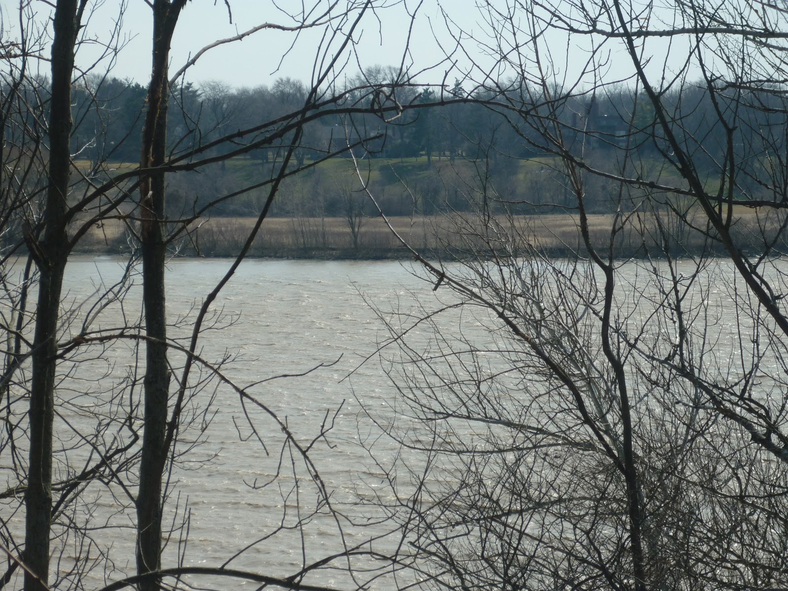
Well, aside from all the historical details of cultural makeup I have given already in various posts (look for the label Midwest in the right hand column menu if you need to catch up), the Nearwest is just wired differently from other regions in the country.  For one, we are impacted a great deal by Canadian economic movements as much as we are from the rest of the country.  Autos, industrial materials, food, and even energy are traded back and forth across the Niagara, Detroit, and St. Clair rivers, far more so than most people know.  Simply put, it's where our transportation corridors have always linked to strongly.  From there, Detroit connects to Chicago and Buffalo to New York, and thus the traffic between the United States and its largest trading partner (China is still second, look it up in various sources) still goes through the Nearwest.  This, of course, means that the region has a unique role as an economic corridor that both heavily depends on domestic and foreign economic vitality at the same time.  Cities like Los Angeles and New York and their environs are great gateways between the United States and the world.  Cities like Chicago and Denver and their environs are great gateways between different parts of the United States.  Cities like Detroit and Buffalo and their environs are BOTH.  As such, the political concerns of these areas tend to focus on this concept.  They have to.  That said, no state is an island.

The Nearwest is thus considered to be the Midwest by so many people because of political desire, even while the political mindset of the region is "Rustbelt bi-national" rather than interior or coastal.  The region either gets absorbed or cast aside by those interests, and in doing so, it tends to mostly just get ignored, forgotten, or treated as an embarrassment by everywhere except itself and optimistic neighbor southern Ontario.  One day, perhaps, the region will rise again and be noticed not as a place that serves as a chip on the table in the poker game between the shores and the interior, but as a legitimate player in its own right, every bit as impressive as Mr. East Coast, Mr. Midwest, or any of the other Mr. regions out there.  The Nearwest has its own history, its own climate, its own environment, and definitely its own political voice, just like the other great parts of this nation and continent.  Come and discover it, for the Nearwest is a region of its own, not a tool in political jargon.

Monday, April 9, 2012

Defining the Not-Midwest: Geography

Look at the United States.

As you can see, the Midwest is aptly named because it is halfway out there to the western part of the continent.  It sits roughly in the middle of things, even sitting in a time zone (the eastern limit of which is marked by the pale blue line) that is aptly called the central time zone.  The rivers (purple) which flow through it nearly all drain to the Gulf of Mexico, in one spectacular point of land known as the Mississippi delta.  The landscape looks slightly less green than stretches further east do, and in the western edge of the region, things brown out quite a bit as the trees get far and few between.

Now, look at our friends Michigan, northern Ohio, northwest Pennsylvania, western New York, and yes, even southern Ontario.  These areas fall into the eastern timezone, albeit at the middle and western end.  The rivers (pale blue spray on the Lakes and St. Lawrence river) of these areas drain to the Atlantic Ocean through the wonderful inland seas that are the Great Lakes. Things look much greener (though parts of Michigan, Ohio, and Ontario do look a bit more farmed over, to be honest).  And for crying out loud, Detroit is at the same longitude as western South Carolina.  Even the western parts of the state are still due north of the Florida panhandle.  To envision Cleveland being much more western than Erie is simply mind-boggling in the regards of sheer proximity.  Old divisions between north and south at least acknowledged the existence of "border states" both culturally and physically.  Hence, again, the term "Nearwest" is best applied to these areas.

Justification for such a term here is certainly given both in terms of actual location and cultural/commercial links between east and Midwest.  Those rivers do more than just drain water; they have been determining the market for cities such as Detroit, Toledo, Cleveland, and even distant Gary and Milwaukee for over two centuries now (Chicago is a different animal, more of a bridge between, well, everything).  They have sent their goods either to Canada or down the St. Lawrence seaway (and formerly the Erie Canal) to foreign markets.  In contrast, goods from the Midwest have made their way to the port of New Orleans and destinations beyond.  The barges of the Mississippi and Ohio rivers also carry different cargo from their Lake freighter counterparts; grains and produce float down towards the Gulf, while everything from autos to iron ore load up the Lakers destined for the Atlantic.  If the map is not evidence enough of the distinct region that the Nearwest forms, the markets that exist because of the conditions of the map are there to support the theory that we have a separate region on our hands.  Anyway, enough of the bare bones of physical geography, let's take a look at environmental geography.

Much of the Midwest is characterized by its dominance of farmland, grid-patterned cities and orderly plots of land, and in general its heavy development.  Much of Illinois, Indiana, Missouri, Iowa, and parts of Minnesota, Wisconsin, and of course the neighboring plains states used to be quite open.  While a settler standing in the middle of Indiana or Illinois would probably still be able to see trees around, there was a lot more sky and grass than had been encountered down in Kentucky and points eastward.  Things would also seem very flat.  This is not to say hills do not exist in these states, but for the most part, the terrain is a rather level affair.  Much of the original landscape is now gone, replaced by nearly endless agricultural development that took advantage of the rich, deep soils of these areas.  Still, the notable absence of extensive forests is because the farms were simply developing land that was rather open to begin with.
A section of restored tallgrass prairie along I-55, and a scene typical of central Illinois.  There are trees here, but there is also natural open space.


Now, this is not to say that Michigan, northern Ohio, and southern Ontario have no farms.  Indeed, there is a lot of corn grown here.  Here and there, though, instead of patches of woodland, are remnants of some truly amazing forests.  While there are definitely tall trees in Illinois and Indiana, the difference between these regions lies in the elements of the forests.  For one, unless they have been planted, pines and spruce are going to be far and few between in the former tallgrass regions.  There are exceptions to this rule, even as there are patches of prairie in Michigan and Ontario, but by and large a notable contrast will be seen by even the most casual of observers.  Illinois and Indiana have lots of oaks, hickories, elms, and shrubs.  Michigan, Ohio, and points east have maples, beeches, pines, and towering trees of all sorts.
Joy road, near the western limits of Canton, Michigan, a rare instance of a natural landscape in Wayne county.  Here we have a typical maple-beech forest.

As you can see, the dominant landscapes of the two different regions are substantially different.  Again, there are exceptions to the rule in these places, but by and large, the Nearwest has a different flavor from the true Midwest, and this is without bringing the Great Lakes themselves into the debate.  Still need convincing?  Well, come by for the last post in this series of defining the Not-Midwest as we explore the wonderful world of politics, where we find the concept of "Midwest" was probably born.