Always to the frontier

Tuesday, December 31, 2013

2013: The Cool Wet One

2012 began with one of the mildest winters in memory.  Here in quintessentially southern Great Lakes South Lyon, Michigan we managed to see our lowest mercury reading a chilly 6 below zero Fahrenheit, but that was a brief adventure into a winter which saw January days well into the sixties and found March acting more like July, even giving us a tornado which we would not have expected until May.  This was followed by a July that acted more like we were in the desert Southwest, complete with 105 degree heat for weeks at a time and absolutely not a cloud in sight.  A sudden frost came in mid-September, rather early for this part of the Lakes, but it was followed by sixties well into December.  This all followed a 2011 which saw extremes of daytime highs in the thirties down as far south as Miami but also record breaking rains just about everywhere.  Not so 2012, which was bone dry and brought drought even to the entire length of the humidity factory known as the Gulf Coast.  Then too, there was Hurricane Sandy, a tropical-strength maelstrom of immense geographical scope; I witnessed the edge of the outer bands passing by here in Michigan. 

Then came 2013, a year in which extremes got altogether left behind, at least this far north.  Not so down south, where tornadoes were reported in January.  Up north we witnessed neither intense cold nor intense heat, but a lack of spring, a lack of summer, and a confused fall.  A killing frost happened in late May, but the growing season managed to last without a killing closer frost in mid-November.  My birthday and the start of the third year of this blog came along with much of my garden was still in bloom, followed by a deep freeze well below normal into the single digits, a freeze that we have risen above for only a few brief days thus far.  Out west single digits blasted the otherwise mild-winter Mojave desert, with St. George, Utah being buried under well over a foot of, get this, wet eastern-style snow.  Unlike in the storm of 2008, the snow stuck around for some time.  Again, however, the rest of the year was punctuated less by extremes than by moderation.  Much of July in southern Michigan was sitting in the upper fifties, ambushed here and there by a few days of summer heat.  Summer almost never came in the first place, with snow happening well into May.  This fall we had sixties from late August until mid-November, and unlike the previous year, we had little to show for it in foliage color.  The trees just seemed to give out almost instantly and without much warning. 

All the while we had the intense drought of 2012 beaten to a pulp in all but parts of California, Nevada, and a tiny corner of south western Oklahoma which has seemed to suffer intensely for the experience.  Rain kept falling, our Lakes seemed to rebound nicely, and the snow seems to have remembered that it belongs here this time of year.  Down South I certainly encountered rain, the likes of which fell in such intensity that I have never seen anywhere else.  This made for treacherous driving, a rather humid jaunt through coastal South Carolina, and a mosquito-empowered trip through Congaree National Park. 

While it is a floodplain, the swamp along the boardwalk in Congaree is not exactly a huge body of standing water.  In this wet year, however, things were very mucky even into June.

Which, by the way, we can continue down the boardwalk on now that the holidays are over.  My dear readers, thanks for continuing to visit us here and to discover more of the continent.  Despite my lack of presence over a good deal of the year, you made this the most visited thus far. 

Friday, December 20, 2013

Finding The North In Congaree

Today we take the first few steps onto the boardwalk at Congaree National Park.

One of the first things a northern type such as myself notices about the world between the uplands and the floodplain, as small as it may be, is how familiar the surrounding forest is.  Tall deciduous trees grow rather closely together, many species being the same sort of thing we have up north, if not similar in form to more northerly trees.  A Sweet-gum (Liquidambar Styraciflua) can pass for a maple at first glance, and there are even some Tulip Trees (Liriodendron Tulipifera) around to remind us that even this far south we are still passing through what can still be considered the Eastern mixed-forest.  Still, people expecting something more Southern lowcountry are hoping to see those amazing fluted bases of the cypresses or tupelos.  Instead, before we can even make it a decent portion of the way along the boardwalk, we find... a beech?!


Yes, that would indeed be a rather massive American Beech (Fagus Grandifolia), something one would expect to find at a higher elevation in the Appalachians or most certainly among the namesake Beech-Maple forests of the Great Lakes.  Here the thing is positively thriving, with a girth to it that I have never seen on a deciduous tree short of an oak or a Tulip Tree back northwards.  The upper branches themselves looked like they belonged on a mature tree!


That's what a long growing season and plenty of moisture can do down here, one supposes.  American Beech is not entirely a northern tree, as it can barely make it much into the Boreal forest and ranges slightly south into Florida.  Supposedly down that far it still claims title as a king of the canopy, being a tree that makes it all the way into the final stages of forest succession and is a true feature of the mature old growth deciduous canopy.

With love, USGS, with love.
Still, it is northern enough to have been fondly remembered as a regular feature of the forests of the northern Great Lakes.  Trunk after trunk there is marked by bear claw scratches, and most Black Bears (Ursus Americanus) that I have ever come into contact with were high up in a Beech looking down at me.  While the Beech disappear as the north shore of Lake Superior comes into view, they are certainly a regular feature of the edge of the Boreal world.  To see one of such grandeur in Congaree told me almost instantly that here we have a special place not only for the greater South, but perhaps even for the greater East.  Pretty soon, however, a few more steps along the boardwalk took me into that Southern world I was expecting...

Thursday, December 19, 2013

Why Is Congaree National Park Special?

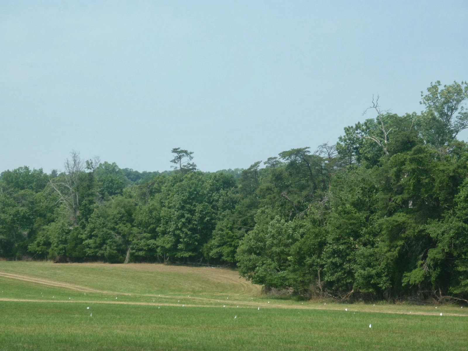
I have mentioned this place quite a bit in talking about the natural South.  Historically speaking it would not have been overly different from many other places in the lush bottomlands of the greater Southern lowcountry.  Yes, its location in the midst of South Carolina meant that it has played host to a number of significant historical events, not the least of which were the exploration of DeSoto and subsequent colonial ventures by the Spanish, as well as being a hiding place from which American nationalists would seek refuge from and use as a striking point against British forces during the Revolutionary War.  By and large, however, this land would just be considered more of what people were taking pains to avoid throughout the South.  People settled on higher ground where the floods could not reach and the land proved workable enough to not necessitate making an existence out of a swamp.  The mosquitoes alone would have sent me packing, as least as soon as summer came around!

Time pressed on, and with it came development.  The end of the antebellum economic system based on slavery meant that the a greater amount of industrialization came to cities like Columbia and Atlanta, along with railroads and a noticeable increase in population.  The swamps were still less than desirable to settle in, but as free and open land became harder to find, they too would fall before the path of civilization.  What's more, there were still incredible trees here the likes of which the first Europeans had seen when they landed on these shores centuries before.  Picture then the typical avarice found in your timber baron and it does not take long to imagine that the giants were seen wrapped in gift paper for the taking.  Baldcypress (Taxodium Distichum) grew this big, and had an even greater advantage to the consumer: extreme resistance to decay and rot.  What else would one expect of a tree that basically thrives when getting its feet wet?  When the forests of northern Michigan and Wisconsin started looking a bit thin of those equally valuable Eastern White Pines (Pinus Strobus) as the end of the nineteenth century arrived, northern millers also started turning an eye to new Southern potential.  With so many eyes on the scenery, it is a wonder that most of the riparian South held out as long as it did.

Congaree was fortunate, however, in having a rather broad floodplain which made extraction more difficult than in many places.  Even Chicago's Francis Beilder, one of the continent's most resourceful and determined timber barons, found that the logistics of extraction were just not economically feasible to make a clear cut of the place.  His company, which by the early twentieth century had purchased the land the park now sits on, left it alone.  Come 1969, prices for timber eventually caught up to the logistical difficulties.  Even as the Tar Sands of Alberta are now tapped for petroleum in an age when the costs of the process of extraction are cheaper than the raw material, so too then did the same reality come to nearly claim Congaree. 

The late sixties were a different sort of time, however.  Even as social upheaval changed the face of the continent and was putting a fight to sexism, racism, and a lot of different conventional ways of thinking, so too had come to pass a new environmental consciousness which had dawned in the wake of Rachel Carson giving everyone a reminder about the danger of our artificial domination of the biosphere.  By the end of the decade, a new appreciation for the science of ecology had awakened local fervor for such otherwise ignored sites like Hoosier Prairie.   What had once been viewed up as a typical Midwestern abandoned field was rediscovered as a true remnant of an otherwise glossed over tallgrass prairie.  In the South, the old bottomland finally got the same recognition, and the Sierra Club and others started to fight for Congaree.   By 1976, just as the locals back in Indiana got a taste and rush of feeling for something they had almost entirely lost, the locals down in deep South Carolina got the same thing for their majestic Congaree.  That's what makes this place so special, really.  Congaree is an amazing link back to the historical, indeed wild and primordial, South.  In an age when political divisions were already working toward the societal breaking point that they find themselves at today, you had all sorts of politicians suddenly drop camp, including even Strom Thurmond, better known for turning back the clock in other less than lovely ways.  All of a sudden people started looking at just how far we had come and just how much we were willing to throw away.

I mention the White Pine logging and Hoosier re-discovery in this post because of just how important Congaree is in relation to the rest of the, well, world conservation movement.  All too often national parks are thought of as areas that protect outstanding natural scenic beauty and little else, and while Congaree does boast incredible spires of trees in a nearly vanished virgin Southern bottomland, we really only see this now after the park has been in existence for a decade and has been officially protected since 1976.  People went nuts over the Sequoias as soon as they were found by us second-born North Americans; a swamp or a floodplain would take much longer to appreciate.  Hell, people still don't appreciate why Cuyahoga Valley got full national park status and probably will not for a long time to come; why be giddy over your typical Ohio low-relief ravine?  There is no towering cliff-face or even old growth forest there, it's just the natural backyard with a few historic trinkets... right?  Guess what, people thought the same thing about your background cypress swamp named Congaree.  People thought the same thing about Joshua Tree National Park until Minerva Hoyt spoke up on behalf of the Mojave.  People thought the same thing about the Everglades (a much better example for this soggy part of the world) until Marjory Douglas told the rest of us to give a damn.

Congaree got a reprieve, and in comparison with some other places like the tallgrass prairie or some bog somewhere on the Canadian Shield, it is easy to see why this place is special.  After all, the trees here are something amazing!  But like all those other places, what is most special about Congaree is how it keeps us connected not only with the wilderness, but with our connection to it.  I may constantly bring up the insane June visit I had among hordes of mosquitoes, but the fact is that this was a wonderful time to visit, to see just how comfortable this Northern Ontarian had otherwise become with the the ease of modern convenience.  It is easy to point out just how easily we can lose historical memory when we demolish a building or change a school curriculum to focus on more "practical" subjects, but it is even easier when do lose that "background" swamp, desert, prairie, etc. that we had to remind us what existence itself was like for those who brought us into our own.  So what does Congaree do for us that other parks do not to the same level of consciousness?

Let's head north for a little bit.

In Canada our national parks got to the same start the way that yours did.  We had our pre-Carson conservationists who had a sense of the overall importance of nature for the soul, you know, like your Roosevelts or Muirs or such.  They saw Banff and made a park out of it (yes, there is more to it than that, but you get the idea) just as down here you had Yellowstone and realized what a unique natural place it was and did the same thing.  After this, though, the Canadian concept of national parks changed.  Perhaps starting as early as 1893 when Algonquin was made into a (then) national park in an otherwise fairly typical section of southern Canadian Shield highlands, park makers got to thinking that in addition to protecting the outstanding areas, perhaps we should start protecting some of the more pristine or exemplary areas of particular biomes across the country.  Today we thus have a place like Point Pelee National Park set aside to show us what is so special about the southern Great Lakes and the Carolinian (eastern-mixed) forest, a place which aside from being a bird-watcher's paradise would not otherwise be seen as significant in the national or continental scheme of things. 

Back South now.

In Congaree we have an amazing park which does this very same thing, celebrating not just the lowland South Carolina landscape but that of the riparian South in general.  In essence, Congaree is amazing not just for its incredible forests but also because it is perhaps the first "regional" park of its kind according to the Canadian concept.  It has been joined recently by a California Chaparral version, Pinnacles National Park, which gives me hope for the future for the central prairies and other "background" scenery.  Yes, there have been many parks created for different purposes in the past which could easily fit into this line of conservation theory (Great Basin National Park really stands out in this regard), but Congaree strikes me as being a huge victory for this idea in general, and it helps that the place is downright beautiful and even a little savage.  Want to see what I saw?  Take a trip down the boardwalk with me next post, but in the meantime check out some of their amazing pictures at their various websites.


Main website

Congaree National Park Facebook Page

Congaree National Park Twitter Page


Wednesday, December 18, 2013

Wednesday Filler: The Coolest National Park Entrance Sign

Entrance signs for national parks are wonderful things to see.  Even for people who pass them by and don't otherwise give the place a second look, they have an effect on reminding the onlooker that this is a special place set aside by the nation (it takes an act of Congress to create a full park) for reasons of national significance.  Some signs are cooler than others though.


Many parks don't even put a small spray of local flora or even exotic bedding annuals at the base of their sign, but Congaree sure does.  I was expecting just another sign that I would get really exited over, but instead I found palm trees (Sabal Minor), something I never expected native this deep inland in even South Carolina.  And yes, they and other wonderful truly Subtropical things do happen to grow here, and there are a hundred other reasons why you should be thrilled when you see this sign.

Tuesday, December 17, 2013

The Reality Behind Paradise

Be they Spanish, French, or English, the first colonizers of the incredible coast stretching from Virginia to Louisianne found before them a land of unexpected beauty.  They were greeted by towering trees which stood like the columns on a portico alongside numerous, easily accessible waterways that often flooded the surrounding lowcountry to further enrich some incredible soil the likes of which they could only dream of back in fallow Europe.  The winters were also quite pleasant, those further south being hardly what one would call a winter except in coastal and southern Spain.  Life looked promising, especially in comparison to the deserts which the Spanish found north of Mexico, the extreme vacillation of seasons which the English found in New England, and the Platonic form of winter which the French got schooled by in Quebec.  Then, of course, there was the summer...

Even the baking wastes of Extremadura had nothing on a bad summer in this place.  Heat worse than that of the tropics, humidity to match, and either torrential rainstorms or an oven-like drought would complete the idea that maybe this new paradise was an illusion.  Even the promise of refreshment from the Atlantic seemed far away under the bath-like summer conditions provided for by a generous Gulf Stream.  And then, worse than the weather, oh, much, much worse... mosquitoes.  Let me tell you a story.

Picture a 30 year old, say, from Northern Ontario.  Imagine he is on the botanical thrill ride of his life exploring a region he had not seen since he was a young teenager, about to step into what he considered to be one of the most amazingly underrated national parks anywhere in the world.  A cypress swamp, old growth even, awaits him.  He sees a sign by the start of the boardwalk which will take him into this emerald cathedral, a sign which has a warning:  "Mosquito alert: War-zone".  He laughs!  What are mosquitoes but annoying insects he has grown up with in the Canadian Shield wilderness.  Up there, every June, there are swarms of them, and worse yet, swarms of black flies which seem to block out the sun!  These Southerners surely jest, for just as they make this "sawmill gravy" which they consider to be something special even in the face of superior Poutine gravy, surely they wish to think that their mosquitoes are worse than any in the world.  So there he goes, walking on, admiring the trees.  Then he starts to realize that things are much hotter and stickier than they were back in pleasant Charleston.  He swats a few bugs. 

And then from the maw of hell itself comes the mother swarm of all mosquitoes! 

His friend starts racing back to the safety of the higher ground and the high and dry pines.  He himself admits defeat and stares longingly back into the majestic buttresses of a forest that is sometimes on land, sometimes pretty much in water, and for all the tolerance he has thus far given to this beloved land of his, he has found that this is a climate alien to his own native specifications.  He has been humbled by Congaree National Park, and by extension, the rest of the lowcountry South.  Doubtless to say, many more before him probably were as well.  The South was the slowest to find colonial domination by any foreign born people, probably because the reality behind the lushness and beauty naturally occurring here is that of a rather thick climate.  Yes, every region does have its ups and downs, so this place is no different really, and the trade offs of vegetation, insanely wonderful length of growing season, etc. are totally worth the price of admission, but it does serve as a potent reminder that as in much of North America, preindustrial existence here took determination and a respect for the living world to be possible.  That said, even while June might not be the most comfortable time to visit, it may just be the most fitting, akin to seeing the Mojave during the heat peak in late July. 

But hey, what's so special about Congaree, and why do I keep bringing it up?  Let's find out in our next full-length post. 

Monday, December 16, 2013

The South-Eastern Forgotten History

Most people assume that anything east of the Appalachian divide and south of Quebec was once strictly the domain of the Thirteen Colonies.  Never minding that one cannot help but run into a Dutch name in any given mile of the Hudson River Valley, or that the lower Delaware was once the going concern for a Swedish colonial venture, the fact remains that Atlantic North America was a pretty busy place for Scotland (careful now, the parliaments were not joined until 1707), France, and Spain.  Until the 1750's, anything north of New England (except for half of Newfoundland), meaning even Maine, was pretty much Francophone, and everything from Jacksonville on South until the early nineteenth century was a very interesting frontier world of Spanish and First Born cultures that never really managed to dominate one another.  Long before England became a dominant power even in Virginia or Massachusetts there were colonies and missions set up by the other two major European players on the continent.  Ultimately, mostly due to wars between them and the remoteness of these settlements from their main colonial ventures making logistical support very difficult, the other colonial ventures failed and receded into the fog of history.

36 years before the foundation of Jamestowne, in fact, there were Jesuits who tried to set up camp among the Powhatan of the Chesapeake.  These southern Algonquins did not think much of or against the newcomers in any way, mainly because the Jesuits had by even this early adapted a missionary style that tried to learn about the cultures they were going to evangelize in; such an effort took a lot longer to set up than the approaches favored by other orders such as the Dominicans.  They never had the chance to get to know them; the priests were killed by Paquiquino, a Powhatan man who was claiming to be in league with them.  Far from being a true betrayal, Paquiquino was responding brutally to brutally being kidnapped and culturally assimilated by Spanish conquistadors nearly a decade before.  Needless to say, the Spanish had already been in town before the Jesuits ever tried to set up shop at their mission of St. Mary's.  No trace remains of this mission, nor do we even have any record of where it was specifically located other than somewhere between the York and James rivers.  We do know a bit more about the conquistadors, however.  They set up the earliest European settlement inland in eastern North America, Fort San Juan.

Like St. Mary's, we are not entirely sure of the location of San Juan, but we do know that it was deep into North Carolina, possibly even within a few dozen miles of Asheville.  We tend to think of Spanish ventures in the South as being limited to colonizing parts of Florida and De Soto making a complete ass of himself in his explorations, but Spanish ambition was a pretty huge thing.  An empire had thus far been made extending from Peru to Cuba.  Size was not a problem for a Spain that wanted more and more, and the possibility of success by Protestant rival England and the better chefs known as the French meant that whatever gold lay in store for the taking in mysterious North America could no longer remain behind the veil of a northern mystery.  The French and English, in turn, saw what was happening with Spain in the South and started to get an idea that maybe a future was to be had in settling these lands; in fact as a result I consider the Spanish incursions in this part of the continent to actually be one of the most important events in North American history.  But why this far inland, why in the heart of the Blue Ridge mountains?

Truth be told, this is a story still being written and read, and close to home at that.  Researchers at the University of Michigan, of all places, are trying to figure out just how far the Spanish were trying to go.  One thing is certain: they were pretty serious about the whole affair.  Whenever the French would set up shop, be it at Fort Caroline (the, ahem, secret French origin of Jacksonville, Florida) or Charlesfort on Parris Island, the Spanish would practically come to try and devour whatever had been achieved.  Part of this might have been religiously inspired, as many of the French colonists in these places were Hugenot refugees.  Regardless, the Spanish won and evicted France from ever having more than a commercial and exploratory presence on the Atlantic coast.  The French retreated north to where they had been fishing and trading with the Micmac for half a century, and would later return to ply the rivers of the South from a base in Louisianne.  But the Spanish...

They wanted colonies here.  They founded a few down in Florida, most notably St. Augustine, but they also liked the paradise that the French had found among the Sea Islands south of modern Charleston.  To this end, they founded Santa Elena, built on the ruins of Charlesfort of Parris Island.  They knew, like the French did, that having an outpost so far afield from the main ventures was going to be difficult.  As such, attempts were made to connect the whole thing together overland to Mexico, and Fort San Juan was part of that concept.  This was still the northern land of mystery, however, and not even a mental map of directions had thus far been conceived.  When in doubt, as so many explorers in North America would later find helpful, the Spanish followed the rivers.  The First Born, after all, had for centuries used the waterways to pass goods from coast to coast, and the newcomers were well aware of this.  As the visitor center of Congaree National Park delightfully points out, De Soto did indeed pass through the breadth of the land this way, and those road-dreamers who founded San Juan after him took to the Congaree and associated rivers as part of the first leg of their journey to possibly connect with the Tennessee and then Mississippi and further western waterways. 

But then they left behind that land of mild winter that is the Lowcountry South and hit some heavy snow in the Appalachians, their first true taste of a winter that even northern Europe was unlikely to provide.  This, combined with the sheer distance they had now put between themselves and even the nearest part of their empire in Florida meant that the Spanish would follow suit to the French and go back to more familiar territory.  Were it not for English initiative in the following century, however, they might have been back in force.  They certainly did just that in Tejas, Nuevo Mexico, and Alta California, roughly at the same time that the Carolinas were getting underway in the early 1700's.  Were it not for the threat of war and the serious competition that England was capable of, the South might have looked very different.  As it is, Carolina came and even divided into two Carolinas.  Georgia, designed as a buffer, became a true colony in its own right.  Even without these developments, the aggressive expansion and political culture dominated by almost constant warfare that has come to encapsulate British and American history means that these places would have become part of the United States anyway.

But imagine if the cultural foundations had been... from someone else.  Florida still has a historical memory of being something New Spain, just as Louisiana still has French-speakers.  There might have been more than just a museum or visitor center pointing out that such places once had different flags flying overhead...


The multi-cultural South... not what we expected, eh?

Sunday, December 15, 2013

Sunday Afternoon Post: Between A Rock And...

This poor Virginia Pine (Pinus Virginiana) seems to be posing for a glamor shot in the latest publication of Rock Gardening monthly. 

Pinnacle Overlook, one of the most accessible and scenic view points in the central-Southern Appalachians!

The forest directly below the pine is Virginia, whereas the small town down there is in Tennessee.  The vantage point this was taken from was straddling Virginia and Kentucky.  Fun!

Saturday, December 14, 2013

Gratitude For Snowy Saturdays

Snow has finally made it to Southeastern Michigan, and it looks as if the ground will have a decent blanket for some time to come (I know that seems shocking to those of you who live in the Ohio Valley or D.C. which has since seen winters to put our historic ones to shame).  This is the first decent snow cover we have seen in Livingston County for well over three years now, a sad situation that has gone hand in hand with extremes of heat and cold, prolonged seasonal lag, and even tornadoes in March, something I thought I would never see.  I write this now because I am thankful that we are seeing something of a real winter this year so far.  I write this because I have seen so many people posting about the snow in Cairo and claiming that such is evidence that global warming is a hoax.  Perhaps it is, but what is not a hoax is that the world's climate is changing dramatically, rapidly, and through our actions.  Snow in Cairo, week long freezes in Florida, an August here in Michigan that felt more like an October, followed by a September that felt more like a July?  These are not normal things, and they are happening more and more.  Hurricanes are turning into half-a-continent wide superstorms.  I, and people like me, don't say these things to scare you into something.  What good does it do me?  What do I get out of it?

On the other hand, there are politicians in the pocketbooks of corporate leaders who want you to feel like this is all some Leftist conspiracy meant to take away even more of your guns, religious freedom, and force you to give money to poor people or else the Planet might explode.  Truth be told, I could care less about your guns as they are your property and not mine, but I do care about how you use them and if you have the right judgment to know when a good time to use them would be.  Truth be told, I don't want religious freedom taken away as I view religion as I view the rest of human everything, an incredibly good thing, again, if used properly and for the sake of looking into our place in eternity.  I myself am a Roman Catholic and believe in my heart and soul that Jesus Christ is my Lord and Savior, which is a very good thing because I have so many, many bad things to be accountable for.   I'm thankful that I can proclaim this without being shot by some control freak despot who thinks I should be something else.  Truth be told, I don't want you to be forced to give money to some poor person, because you might just miss the point of what that deed means.  I want you to understand what life is like for that person and to see them as more than just some required object of charity, as they are much more than that.  Money, like any resource, should be also more than just an object and used a bit more responsibly than we tend to use it, at least in Canada and the United States. 

I could keep going, but this is not a political blog.  Why bring it up at all, you ask?  I bring it up because this is a very political continent.  I tend to view such a reality in a positive light, even while I can sometimes be pessimistic about the path to open war we seem to be set on.  I say this because politics of our sort does have a good side wherein change can come a lot quicker than in more sedate democratic societies.  While I tend to think that extreme partisanship is a dreadful thing that weakens us all, I think that having sides at all means that we care a great deal about some issues.  That partisanship, though, can lead us to believe that we have to follow a certain line and that yucky, ugly things like "climate change" are part of the package of the "other side" and we must therefore think of them as little more than a blinding toxin.  I could probably keep blabbering on here to tell you why climate change should not be just dismissed as a political issue of the opposition, but I think for now I will let this wonderful video do the talking for me:

http://www.upworthy.com/the-future-of-the-earth-s-next-100-years-visualized?c=ufb1

Our continent, and indeed our world, is a precious thing.  It is our home, and we are responsible, as its most dominant species and/or as its caretakers entrusted by God not to keep vomiting on it the way that we have been.  Yes, we do need to rise above political agendas from both sides (looking at you Kyoto accords, you dirty, self-serving German brainchild designed to cripple economies you don't like), but we also need to understand that we are having a really bad effect on our planet. 

In the meantime, there is a solid blanket of snow outside, we are getting a good amount of winter chill needed by the local assortment of ecosystems to thrive, and it does well to remind me that while change is a constant in nature, there is a plan for it and us that are far beyond what our limited visions can even imagine, a plan which our arrogance needs to be reviewed in the face of.  The celestial time table could give a you-know-what about your stocks and futures.  In the meantime, I am happy to have a reminder that I don't actually live in the South that I look at with envy, because down South they don't have these:

I-94 near Port Huron, some of the southernmost Paper Birch (Betula Papyrifera) around. 

And for the moment, I am glad to be reminded that we do, and that I live at the southernmost whispering edge of the amazing hemisphere-spanning Boreal forest.  Those lovely birch there are still holding their own despite thousands of years of gradual climate change after their prime northern weather retreated with the Laurentian Ice Sheet.  They are a testament to a grand plan in which some things do remain constant despite and/or even in the midst of so much change, a reminder that a greater mystery always remains above our little plans and fields of vision.  As the elegance of the birches reminds us, though, not entirely being in control is hardly as bad as it might seem.  This Saturday night, when someone my age should be out getting bombed somewhere, well, I'm instead just happy because I see that pure white blanket outside. 

Friday, December 13, 2013

Fitting Big Trees Into Small Spaces

This can be done!  Now, yes, one should plant in favor of letting nature do its thing and not confine the wild to something as ignoble as pot, but when you don't have the room and want to dwell among more than just concrete, well, there are trees that can do that.  Even better, there are native trees that can adapt oh so well.  Take this lovely creature, since we are talking about the South and all:


You know, in most places they would try to clip the thing into a fine topiary to keep it off the windows.  Not here.  This was taken on Broad Street in Charleston, South Carolina.

 This is a Balcypress (Taxodium Distichum), a tree that around this part of the world gets very wet feet and often stands at the edge of rivers and lakes in actual open water.  Here it was, however, in the heart of Charleston growing practically out of the sidewalk.  It was not alone!

For those wondering, the palm is a Cabbage Palm (Sabal Palmetto), which can be found in almost every viewpoint in the city.  I think this was taken on Church street, but I am not entirely sure.

Here we have a Live Oak (Quercus Virginiana) forming a rather broad crown with such a tiny base.  Granted, the base was filling out its growing space rather impressively.

That adorable little palm growing next to it is a Dwarf Cabbage (Sabal Minor).
Clearly the people of Charleston, even with such limited space, preferred their skyline to be a mixture of artifice and nature.  Except for the some of the major streets, it seemed as if every plausible inch of the city was planted and then on a grand scale.  I have always noticed this a lot about any urban area in the South older than the past few decades; our winter home in Fort Lauderdale had a backyard featuring two seventy foot tall Royal Palms (Roystonea Regia) and a sixty foot Slash Pine (Pinus Elliottii) graced the neighboring yard.  The climate is just going to ensure that a giant scale is the default setting, and the locals don't seem to be too quick to put a stop to growth.  This is not to say that the North is lacking in such a mentality, but just that places like Charleston seem to promote a more organic approach to the city landscape.  I could probably write loads more on the topic, but I figured I would let the pictures do the talking here. 

Thursday, December 12, 2013

Residents Of The Piney South: The Slash Pine

The final leg of our pine tour takes us to where the South leaves frost and snow behind, except during the coldest advances of frigid Canadian fury.  In this place the land becomes half sea, and the air is often tinged with a bit of salt or at least the smell of some rather fishy water, a land where at least an estuary or inlet is never far away.  Things are quite low here, but they are also often sandy or elevated enough to be decently drained.  Hence we have more pines, in this case another fine pine that has very long needles, often the better part of a foot.  Say hello to the Slash Pine (Pinus Elliottii).

All but one of the pictures seen here were taken at what has to be one of the most amazing places on the continent, Hunting Island State Park, just a hop, skip, and jump from Beaufort, South Carolina.  This was taken about a few hundred yards from the mighty Atlantic.
The Slash Pine has a regal form that tends to be rather thick near the top of the crown and somewhat sparser underneath, a silhouette not entirely different from an Italian Stone Pine (Pinus Pinea) and bearing the look of other typical globular pines, would that were on massive amounts of fertilizer.  This pine is nothing if not as robust looking as the rest of the flora in its home turf.  Like the rest of its companion vegetation, especially the Southeastern palms, the Slash Pine can grow in low, mucky land and is no stranger to the world where the swamp and the dry lands blend.  Granted, it can only take so much water, and so does not handle the same sort of situation where a Baldcypress (Taxodium Distichum) reigns supreme, such as in the Everglades.  That said, the Sea Islands are positively FULL of them, and they grow right up to the edge of the Atlantic. 

That's right, what we see here are the first trees one landing on much of the Atlantic shoreline south of Charleston would see.  I have used this picture before, but it illustrated the concept so nicely that it had to be used again.

Like the Longleaf (Pinus Palustris), they form savannas or at least something like them.  Unlike the Longleaf savannas, however, the Slash openings feel just a little sparser and sun-baked, which is odd when one considers how dense an upper crown the pine can produce. 

Looking into the edge of the forest from the Atlantic, or rather the side of Hunting Island near the pier.  Things seem dense, but...

This is what it looks like inside of that vantage point.  Again, these pines have a dense crown seemingly only at the very top.
 
At some points the older trees do form some nice shaded patches, but the ratio of sky and foliage is almost half and half even there.
 Heading southward into the heart of Florida, these savannas get positively full of Saw Palmettos (Serenoa Repens), adding to the feeling that this might be less of a savanna and more of a shrubland sheltered by a super canopy over a nearly missing main canopy, a sort of forest without a forest.  One still feels like they are in a woodland, but in general things remain somewhat open rather than like a jungle.  That sort of ambiguous classification seems to fit in nicely with the bridging role the Slash Pine performs; the other Southern pines lose steam in Central Florida as the climate and conditions transition into true tropical.  A tree that seems at home in something neither called a prairie, nor a forest, nor a swamp, but maybe a little bit of all three seems perfectly suited to a place where the seasons seem to have lost their watch and the land can't decide whether it is a part of Cuba or Georgia (no political pun intended). 

They grow insanely fast, especially compared to the Longleaf, which they are slowly replacing across the land, even farther north than where they are wild.  Many timber interests consider them just as valuable as the Longleaf, and in some cases of mistaken identity or just ease of use, landscape restorers have taken to promoting re-forestation with this species instead of the ancestral Longleaf.  Their fire ecologies are similar, and in fact they look downright terrible in pure tight stands compared to most other pines.

Even when they get thick, though, they still look a bit open!  There is no way that those Cabbage Palms (Sabal Palmetto) could grow in a stand of many other pines.  The thing is, forest diversity permitted or not, they need space to fill out to look less than sickly.
 Both are trees that flourish in a savanna setting, and the most southerly forms of the species even have a similar grass-like seedling stage.  In many ways, this is symbolic of the South trying to focus so much energy on a semi-resort climate and shove the pines and other less than trendy natives away to make room for palm tree after palm tree, exotic flowering trees, and even mild-winter cacti!  A pine, after all, is all sticky, sappy, too big, and "common".  But oh what a lovely backdrop the Slash does make, even in a town setting:

This is the one photo not taken on Hunting Island, but in Beaufort itself.  Many professional gardeners think that tall trees, even ones with a narrow profile, are too big for appreciation in one's garden, to which I have to say that such a philosophy is greedy and self-serving, contrary to the beauty of the neighborhood as a whole.  So what if you can only see the trunk...
And for that matter, one wonders why more cultivars have not been made to show off its already incredibly beautiful wild-type bark:


One would think that the bark is the reason for the name, but apparently a "slash" refers to the sort of jumbled shrubby half-swamp these giants arise from, just like a Loblolly refers to a mire of sorts, or even the scientific name of a Longleaf, Palustris, refers to the swamp (never mind that none of them like their feet entirely soaked).  I digress!  While the Longleaf ecosystem is definitely something that should not be replaced for mere economic convenience, at least the world of the Slash Pine is not too far off, and they really are quite amazing trees.  The thing is, they are a creature of the other edge of the South, the Deep South, more so than a main feature of the broader part of it.  Let's face it, when you find them even at the northern edge of their range in a place like Hunting Island, you can tell that you have arrived in a place that puts the tropical in subtropical. 

Looks a little more Florida than South Carolina in some ways...

Someone tell that Loblolly to get out of the way, people might get confused!  Can you find it?

Wednesday, December 11, 2013

Wednesday Filler: Mossy Pines

As one heads further into the Deep South, one finds a rather amazing lushness develop inch by inch.  One such feature of increasing heat and humidity would be the presence of a plant that loves both, namely Spanish Moss (Tillandsia Usenoides).  It is an epiphyte (air-plant) which hangs off of trees and lives off of nutrients that would otherwise wash off the branches.  Contrary to what one imagines, it does not in any way damage the tree it grows on.

Both shots taken in Beaufort, South Carolina.

Normally the moss favors the broad, open branches of the Live Oak (Quercus Virginiana) or Baldcypress (Taxodium Distichum), but as seen above it will occasionally grow on a pine like that Slash Pine (Pinus Elliottii).  A host is host, even with thick clusters of needles.  Botanists theorize that Spanish Moss is carried from place to place and thus reproduced by birds using it as nesting material.  Fewer birds colonize the pines than the other trees, but perhaps the wind also works where the birds (or the less picky birds) fail to nest.

Tuesday, December 10, 2013

Residents Of The Piney South: The Longleaf Pine

The South did not always look as it does today.  The Loblolly Pine (Pinus Taeda), while common in pre-settlement times, was not nearly the apparent monoculture of endless coniferous wallpaper that it is today.  Once there were pines that were as tall and as graceful as the Eastern White Pines (Pinus Strobus), the best example one might give for their northern counterpart.  Both grand trees managed to make their way to the crown of forest existence only through a baptism of fire, and the northern majesty and southern elegance alike needed the flames to wipe out the competition and let the sun do its work.  The two could not otherwise be more different, however.

The White Pine, you see, needed competition gone to reach into heights above what would later fill back in as a main canopy beneath their super canopy.  This southern pine I speak of, however, was a creature of the savanna more so than the forest.  This pine is the Longleaf (Pinus Palustris).  Like the Loblolly, there are very few pictures of it that I can say to have taken, but not for the same reasons at all.  The Longleaf, you see, is a tree that has fallen on hard times for the last 150 years.  Aside from isolated trees (which can be found rather frequently), only a quarter or less of the ecosystem they supported in great numbers still exists.  In truth, I have never experienced a Longleaf savanna with my own senses.  Only recently in Congaree National Park did I even see a stand of more than several of them together:

Congaree is probably one of the most amazing national parks in the world, just in terms of sheer treeness.
And what a sight they were.  I was already pining away (did I just do that?) to see a gathering of them after having an inspiring read of Janisse Ray, but what I saw when I found them in an approximation of their past glory, I was surprised by just how impressive they truly are.  Up close they look somewhat similar to any globe-clustered pine, in some ways even more like an old growth Red Pine (Pinus Resinosa) than a Loblolly is, but from even a slight distance, the scale and elegant sweep of their branches puts them in a beauty class more approximate to that of the White Pine.  The forest you see above is not the best approximation one could give of what a healthy forest of these things looks like, namely because they were very much a creature of the forested grassland, soaring over happy little seedlings, blueberries, palmettos, Wiregrass (Aristida Stricta), and enough forbs to make even the Midwestern tallgrass prairie swoon in lust.  Apparently one could stand in a Longleaf "forest" and look in all directions and see miles and miles of trunks soaring over the park-like expanses as if they were columns in a natural cathedral of Cordoba.  Imagine it, a place where the game was plentiful, the breeze blew freely under a semi-open sky, and yet the grand trees still provided a lovely shade as if one were in thicker woods.  I suppose I have a weakness for our native grasslands of any stripe, yet you have to admit that this sounds pretty damn wonderful. 

The First Born certainly did.  In addition to the fires that the many storms of the region would provide and the grazing that the many ungulates, including Buffalo, would do, the First Born would keep the place as it was supposed to be by now and then starting a fire of their own, just as they would in the rest of the eastern grassland ecosystems.  This was simply their style of land management, to continue the work that nature was already doing and use it within their agricultural and hunting practices.  Then along came us, the Second Born, who were used to fencing off plots of land and requiring the soil to be productive not only for sustenance, but the generation of capital.  The first two and a half centuries of Southerners loved this ecosystem too for its fertility, but also because the trees were just incredible to use for lumber.  At the same time, there was a different pace of life in the South that let the land become conquered much more slowly.  Similar to how a semi-solitary existence and frontier mentality was the norm in the backcountry stretching from Vermont to the Smokies, the lowland people of the South did not try to farm over every square inch of what they saw and actually sort of blended into the back woods.  Yes, I did classify the land that the Longleaf once grew in as the low country, but Southern culture is a unique thing that blurs divisions like that.  More on this as the blog endures.

But then great changes came about as industrialization and productivity started taking over the nation after the Civil War.  The frontier moved west, and along with it went the go-to-hell rugged individualism of the Eastern backcountry.  That said, as the beautiful but inhuman plantation existence came to an end, many Southerners went back to fending for themselves and went into small-scale cotton farming in that wonderful ground that the Longleaf savannas once blessed.  In tandem, however, the market became more spread out and roads of rail and dirt alike starting developing the land faster and faster, and with it went what was left of those marvelous parklands of pine.  The pace has only increased ever since, along with the rate at which the last remnants of the old, colonial even, Southern culture have disappeared.  Again, this is not necessarily the classic movie-type slave-holding plantation culture, but something as older than cotton or Loblolly stands.  Like the Longleaf itself, such a culture is a lost memory consigned to the same dusty bin of history where the First Born sit, buried even behind the plantations and the sharecroppers and the other stuff that is now buried behind whatever it is we have developing today.  Almost makes me sound like an old man telling the kids to get off my lawn...

Anyway, as I neglected to provide a map last time for the Loblolly, and since the comparison of how deep into the South we are getting with our pines seems appropriate to now give, here's the Lobolly range:

Thanks USGS!

And the Longleaf range:


As you can see, the ranges are comparable, but the Longleaf likes just a little bit more of a lower and hotter climate and does not venture too far onto the Piedmont.  Ready to get even toastier and really sub-tropical?  Feast yer eyes on the range of the Slash Pine (Pinus Eliottii), which will be our next and final guest of pines before we get into some really fun Southern stuff:


Yep, this is where we really start getting into the DEEP South.  Heck, you can't even see Canada on that map.

Monday, December 9, 2013

Residents Of The Piney South: The Loblolly Pine

Sometimes a tree is just considered a weed with a trunk.  In much of the South, pines are considered to be simply background material, stuff that grows in the way of development and agriculture.  A friend I met back in college, a Carolinian in fact, told me that pines were sometimes even considered to be more than just a weed but a real nuisance.  "They don't take too well to storms and hurricanes, and leave a tangled, sap-filled mess to clean up".  Pines are nothing if not sap-filled, but I hardly considered that to be problematic.  After all, they are just as ubiquitous in Ontario as they are in the Carolinas and we go out of our way, occasional tornado or violent microburst aside, to pay vast sums of money to get mature ones in our landscape if they are not already present.  In mostly deciduous SE Michigan and NW Ohio, nearly every public works landscaping project includes at least shelter-belts of pine, usually Scotch (Pinus Sylvestris) or Austrian/Black (Pinus Nigra) but often the native reds and whites.  Mile after mile of I-75 is lined in such a way up in these parts.

I-75 in Georgia or I-95 anywhere south of central Virginia look like such a landscaping project put into years of growth, and a nearly solid wall of Loblolly Pines (Pinus Taeda) screen off the northern tourists and other thru-travelers from the local world.  Janisse Ray even insisted that this was their purpose in her masterpiece Ecology of a Cracker Childhood.  Janisse, you see, loves all the spires of her native forests down in Georgia, but just as I have a particular weakness and reverence for the Eastern White Pine (Pinus Strobus), so does Janisse look upon the noble Longleaf Pine (Pinus Palustris) with grand esteem.  To her, is the Loblolly a seemingly unworthy also-ran that has filled a niche that the Longleaf once dominated?  Without a doubt, she considers it an important and lovely tree, but it is just in so many ways ordinary and second-fiddle to the monarch that was once the Longleaf.  This is not to say that Loblolly Pines are bad trees, just that they are an unfortunate sign of the times wherein entire ecosystems have been disrupted and trees such as this one find a place in an ever-changing world made by humans that lets such highly adaptable species thrive.  The Loblolly is one such tree.

The Lobolly, you see, does not mind getting its feet wet, unlike most other pines.  It can tolerate being at the margin of a swamp better than most of its genus, even while it can handle the harsh, alkaline conditions of an abandoned clay-soil farm field baking in the sun.  Surprisingly, it does not take well to the pure prairie environments found scattered in the South, notably the eastern extensions of the central prairies into the Louisiana coastal plains and the Black Belt, an arching area of prairie (that can now be seen on physical maps as a dense concentration of farmland) stretching across central Mississippi and Alabama.  Like most established prairies, the incredible roots of the grasses and forbs have contributed to the formation of a rich, dark mineral soil.  Likewise, rich soils can be found in the Mississippi valley, an area which forms a significant gap between the eastern and western portions of the Southern forests.  While the Loblolly does tolerate getting its feet wet, it does not like them soaked.  Such land is instead reserved for incredible stands of tupelo, cypress, cottonwoods, and willows (along with the lovely Red Maple <Acer Rubrum>).  In short, we can see that it dislikes certain ecological extremities and even in its very broad choice of tolerable situation is still... average.  Simply put, the Loblolly is a common tree that you will find across much of the South, from Texas clear to southern New Jersey. 

That's the direction I became inspired by when writing this post.  You see, I have so very few specimen pictures of the Loblolly because of how "common" they really are.  Most of my shots incorporate the sentiments of how they get viewed by Southerners, as background scenery behind modern development.
There they are, filling up the backdrop in Santee, SC, just off of Loblolly-framed I-95.  I witnessed very few trees, except maybe old survivors that were big enough to not be considered "weeds", used in a landscape around homes or businesses.  That honor instead went to cold hardy palms (like that lovely Pindo Palm, Butia Capitata) and magnolias fighting with crepe myrtles for places of honor on the front yard.
 In fact, aside from the photo of your typical "it was too big to just yank out" Loblolly back a few posts ago, this is the only canopy or crown shot I have of them!  I regret this, as a stand of Loblollies (and do they ever make fine stands, just like the Red Pines do up north) is a wonderful wall of green, a wall which I remember fondly as a child welcoming me to a South that otherwise felt so very distant from my far north.  I always tried to squint deeper into those dense growths along I-95 and wonder what the forest was like inside them.  Even at that age I figured that this was not a natural situation, that there had to be more in the forest besides a single giant plantation of one tree.  For the life of me though, even as common as they were, they were a tree that seemed to outweigh all the other elements of the landscape.  Only after a half day of Loblolly wonder would I notice the subtle changes that happened in Georgia as Saw Palmettos (Serenoa Repens) started carpeting the understory and Slash Pines (Pinus Elliottii) started to take over, especially into Florida.  The bigger needle globes of the Slash Pines were part of the very different world of the Deep South and Florida, not a Red Pine look alike that the Loblollies were.  The Loblolly fit perfectly into a Canadian child's image of what the South looks like: the same as the north, but with even more pines, palm trees, and a night time that was as hot as a Northern day time, complete with some buzzing outdoor light illuminating this mysterious pine that grew even in such a hot land. 

I was too young to imagine that things had not always been this way.  This is not to say that I had no imagination or that I knew not what a wilderness was (I grew up in one), but that I was simply ignorant of the fact that the Loblolly would have been truly an "also ran" back in the days when the Longleaf was king of the forest and savanna.  The settlers who followed the First Born would have seen that very different world of an incredible arboreal diversity, with towering pines stretching forth above grasses and flowers stretching as far as the eye could see, kept open by the same agent of nature that made lower Michigan, Ohio, and Southern Ontario into a natural park of oak openings, fire.  I imagine, as Janisse Ray does of a South long past, settlers living among these giants, every bit as transfixed upon them as... a child doing the same thing when confronted by the inheritor pine, the Loblolly.  Maybe it is not, after all, such a common tree as it is a survivor and a triumph of nature trying to cope with human development.  I consider the Loblolly to be an arboreal emblem of the modern natural South, in which nature still manages to rebound like, well, a weed!  Even in farm country down there you can't help but run across a tree every few hundred feet, and often enough it will be a Loblolly.  In truth, I have never seen the ancestral forest with my own eyes, and I can only imagine the grandeur of the Longleaf Savanna.  The Loblolly, though, has managed to welcome me home every time I have come back to this land of the South, which holds such an irresistible lure to a botanist who is still a child at heart. 

A part of me wonders what life was like where this tree held its own once against the broad rule of the Longleaf.  Perhaps places like Jamestown, places where the continent started to forever change into the modern land it has become, are places where one can still find a forest of curiosities otherwise stepped quickly past by human advancement.  Here maybe can be seen not some oak or pine parkland that provided an irresistible lure to colonial settlement, but a needle carpeted half-forest, half-opening maze of strange trees that grew beyond the landings of mushy cypress forest infested with mosquitoes.  Would the first Virginians have tried to press on toward higher ground capable of more agricultural wonders and either ignored or found inconvenient the odd forest that was too open to give good shade, yet to thick to plop a house on?  What would they have made of this place come winter when even the leafy shrubs beneath the pines would refuse to surrender their greenery, like the Red Bay (Persea Borbonia) or the Loblolly Bay (Gordonia Lasianthus)? 

Both of these delightful messes were captured at Historic Jamestowne, in the drier center of the swampy hook of land that John Smith and company tried to give Virginia a decent go at.

Were such forests taken in by the colonists like the Red Pine forests of wonderful blueberry (Vaccinium Augustifolium) and Wintergreen (Gaultheria Procumbens) understory of an otherwise grand White Pine dominated North, which together with the more open Jack Pine (Pinus Banksiana) openings on sand and granite (depending on what side of Lake Huron you would find them on), and considered second fiddle and scrubish by their northern settling counterparts (compared to the valuable timberlands of the White Pine supercanopy forest)?  We may never know.  After all, we don't even notice the trees around us these days...

But what about that Longleaf?

Sunday, December 8, 2013

Sunday Afternoon Post: Looking Like A Southern Pine

Just a little picture today to keep the blog going.  When I will reference comparisons between pines in the coming posts, I probably will be bringing up the noble Red quite a lot.  Here she is:

Such a lovely, open crown.  This was taken in Ontario, home of the best Red Pines.  Sorry, Minnesota. 
Red Pines (Pinus Resinosa) are definitely a creature of the north, not making it farther south than Milwaukee in the west and sticking to the mountains only as far south as Scranton in the east (with an isolated anomaly in West Virginia), but they bear a striking resemblance to the Loblolly Pine (Pinus Taeda), which never even come 100 miles near each other at the closest extremities of their range.  While it might be interesting to think of the two trees as subspecies of one another, the Red Pine has needles in clusters of two, while the Loblolly keeps them in threes.  Their cones are also a bit different, with the Red Pine's being brittle and open, and the Loblolly's being spiny, tough, and closed. 

Other than that, they present a similar crown profile in advanced stages of growth, with nice globular masses of needles arranged as if they were ornaments on the trees.  They both like things well-drained and even exposed and windy, the Red Pine being immune to the worst of winter cold and the Lobolly able to handle the worst of southern summer heat.  They also get treated as second fiddle to the two botanically worshiped pines of their same ecosystems, The Eastern White (Pinus Strobus) for the Red and the Longleaf (Pinus Palustris) for the Loblolly. 

Saturday, December 7, 2013

Residents Of The Piney South: The Virginia Pine

Head anywhere south of the Ohio River or the Mason-Dixon line and all of a sudden you will find more pines than you can shake a stick at.  The first such wonderful resident is the Virginia Pine (Pinus Virginiana), which looks something like a Jack Pine that moved south and got a bit of a fuller crown and straighter branching as a package deal.

Taken at Cumberland Gap National Historical Park, one of the most cultural significant, scenic, and underrated places to visit in the eastern United States.  Here we see an absolutely stunning specimen of our friend that I would have to rate as the finest Virginia Pine I have ever encountered to date.  Here we see the pine in her full glory, worthy of being counted among the most stately Jack Pines (as featured in the painting of the same name).  The tree also bears a silhouette not far from that of a mature Eastern White Pine (Pinus Strobus).

Needles borne in clusters of two, like the Jack Pine.

Irregular spreading crown, especially while young, also like the Jack Pine.
In the east, they like to wander only slightly far from their mountain homes and thus are found mostly in the backcountry, or Piedmont.  In fact, the Virginia Pine never seems to stray very far from the Appalchians in general, as seen in the following map of their current natural distribution:

Public Domain.  Thank you again USGS, and rest in peace, Dr. Ebert Little.


In Virginia, even right up north near Washington, they seemed to be filling a role comparable to what Eastern White Pines used to, individual trees scattered among deciduous forests, sticking up above the canopy (but in much less of a grand profile). 


Not the best illustration of the concept, but it was the best I could do in 100 degree weather.  This was taken at Manassas National Battlefield Park, just outside of the Virginia side of the DC metro area.

Mind you, they do perform this role further on in their range, even if still only a junior partner to what the Eastern White Pines used to do in forming the supercanopy. 

Also from Cumberland Gap.  All such pictures were taken near the Pinnacle Overlook, which in addition to being a stunning vantage point to take in the Gap itself and the three surrounding states, is an excellent place for the casual explorer to have a taste of central and southern Appalachian flora.

Admittedly, I did not think too much of them for quite some time, a sentiment apparently shared by tree lovers of the past.  I do not recall seeing one at any botanic garden or historic home grounds anywhere one would expect to see them.  This is not overly shocking, as, again, they not present a robust profile as do the other native pines of the east.  Given a chance, however, they can form an elegant profile that makes for a lovely accent to the natural landscape and one that decidedly marks the passage between the Appalachians and the surrounding lands.

Same as above.
US 25 leaving Kentucky and approaching the modern tunnel under the Gap towards the junction of Virginia and Tennessee.
In the true Appalachians and plateau country to their west they are an entirely different animal, albeit again acting like the White Pines in certain situations.  Here they seem to favor rocky, well-drained soil and often grow as if emerging right out from the exposed rocks of the grand eastern mountains.  Much like the Pitch Pine (Pinus Rigida) barrens of further north along the Appalachians, or the Jack Pines growing under similar conditions on Georgian Bay, this is where we can find the Virginias often serving as the dominant tree, laughing at even the hardiest oaks and junipers. 

While not as open as the rocky haunts of the Jack or Pitch Pines, probably due to the greater precipitation available to them in their southward approach, the same effect is appreciable.  Both photos were taken at Pinnacle Overlook.


Such a phenomenon of the hardy pines can be found with relative ease by modern travelers: simply drive along any rock cut or past rock outcrops and even a thick stand of Virginia Pine might not be too far away. 

This blurry windshield shot was taken in a rather unwelcoming stretch of US 23 in Kentucky across the Ohio River from Portsmouth, Ohio.  While the valley had some lovely views, the area is lacking in safe pull out vantages.  Here they at least have a reason, as small bluffs press in close to the road.  

Further south along US 23 in Kentucky, somewhere between Louisa and Hagerhill.  Where there are rock cuts, there are Virginia Pines thriving in the rocky, thin soils that wash down onto them and collect in the crevasses.  And yes, another windshield photo, but broad shoulders are far and few between in this part of Kentucky.
But while they thrive in rocky, dry areas, they are perfectly at home in richer soils more befitting of a forest area. 

Taken near Martin, KY, on Kentucky 80.

Virginia Pines are often the first trees to make their way into abandoned fields.  While the Appalachians do have grassy areas, be they summit balds, small pockets of the easternmost extensions of the prairie, or (formerly) buffalo corridors, grasslands here tend to be but the first stage in landscape transformation rather than a permanent feature.  Most seedlings of the region are somewhat vulnerable to intense sunlight and exposure, leaving the hardier oaks and Virginia Pines the job of handling the scorching summer sun that reminds the human traveler and dweller that this is, even in the mountains, a land of heat and the edge of the South. 

But again, this is not the land of pine barrens, and the Virginia Pine does not get to be the star of the show as do the Jack or Pitch Pines.  Eventually, the pines get surpassed by the forest once trees start shading the ground and making conditions a bit more palatable to other species.  Unless they happened to form a dense enough stand in the harsher conditions or can be found where such conditions never go away (as in an outcrop), much like the mighty White Pines, the Virginia Pines find themselves thinned out and striving for the canopy:

It almost looks like a Pinus Strobus, really.
One of the many overlooks along the road to the Pinnacle Overlook.  The town seen beyond the pines is Middlesboro, Kentucky.

"Accent piece" or not, however, Virginia Pines are certainly a lovely and integral feature of the central and southern highland landscape.  They are very much a traveler's tree, being a pioneer that welcomes back the forest from even centuries of cultivation and welcomes the human wanderer into frontier lands beyond the greater regions of both North and South.  Want to see more?  Time to get really into the South!