
Now, before we continue, a few things about your author... One, he is obviously well-versed in geography, the natural sciences, and modern North American cultural anthropology. He developed a passion for these things when he was growing up, mainly because he was one of the few kids that did not spend long car trips bickering with and teasing his sibling (reverse actually), looking at books and electronic games, or sleeping. Instead, hours were spent staring out the windows and watching worlds change. Trips to Northern Ontario or all the way down to Florida were never boring, because they were a chance to be surrounded by that wonderful granite or those palm trees, respectively. Second, your author, despite being very knowledgeable, is also very imaginative and can sometimes put things on maps that are just not really there. Sure, when he gets there, things make sense, and if you were to dump him into the middle of a swamp, he would most likely be just fine, know where he was, and be able to find his way around without a map or compass.
Case in point, even though he had been there before, and knew what was in the area anyway, well... there was a very different conception of what "Virginia" would be like. This, after all, was the south, no? Virginia was where the Civil War started and ended, where every soft drink is called a coke, and people speak with that charming southern drawl in their voices. Yes and no. As usual, take a look at this map, then we can figure out where to go from there.

Starting at the far southeast, down by Norfolk and inside the yellow line, you have the Tidewater region, one of the first areas in the United States settled by English speakers. Moving further inland, you leave the salt water estuaries and swamps behind and find drier ground of the coastal plains, and then also an area called the Piedmont, which is west of I-95, the highway you see running between Richmond and Washington. The areas seemed similar enough to me that I lumped them together. Past the teal line, things get a bit more vertical and you run into the beginnings of the Appalachians, including the Blue Ridge and Shenandoah mountains.
Now, falling back up to where we noted that your author gets silly regarding expectations, imagine there is no yellow line there, and you have him staring at the map before getting excited about heading to "the South". Instead, you find what is more appropriately called "Mid-Atlantic", even "East Coast". You see, especially up towards Washington, while you might have Pepsi referred to as Coke, Magnolias and the odd palm tree lining city streets, and a bit of an accent to the locals, you also have a hectic pace to life, Wegmans, a developed urban landscape, and no guarantee for the area landsliding either a red or a blue candidate. Likewise, when you do manage to find a more natural setting, things will not look shockingly different from much of the rest of the lower elevations of the north eastern part of the country.

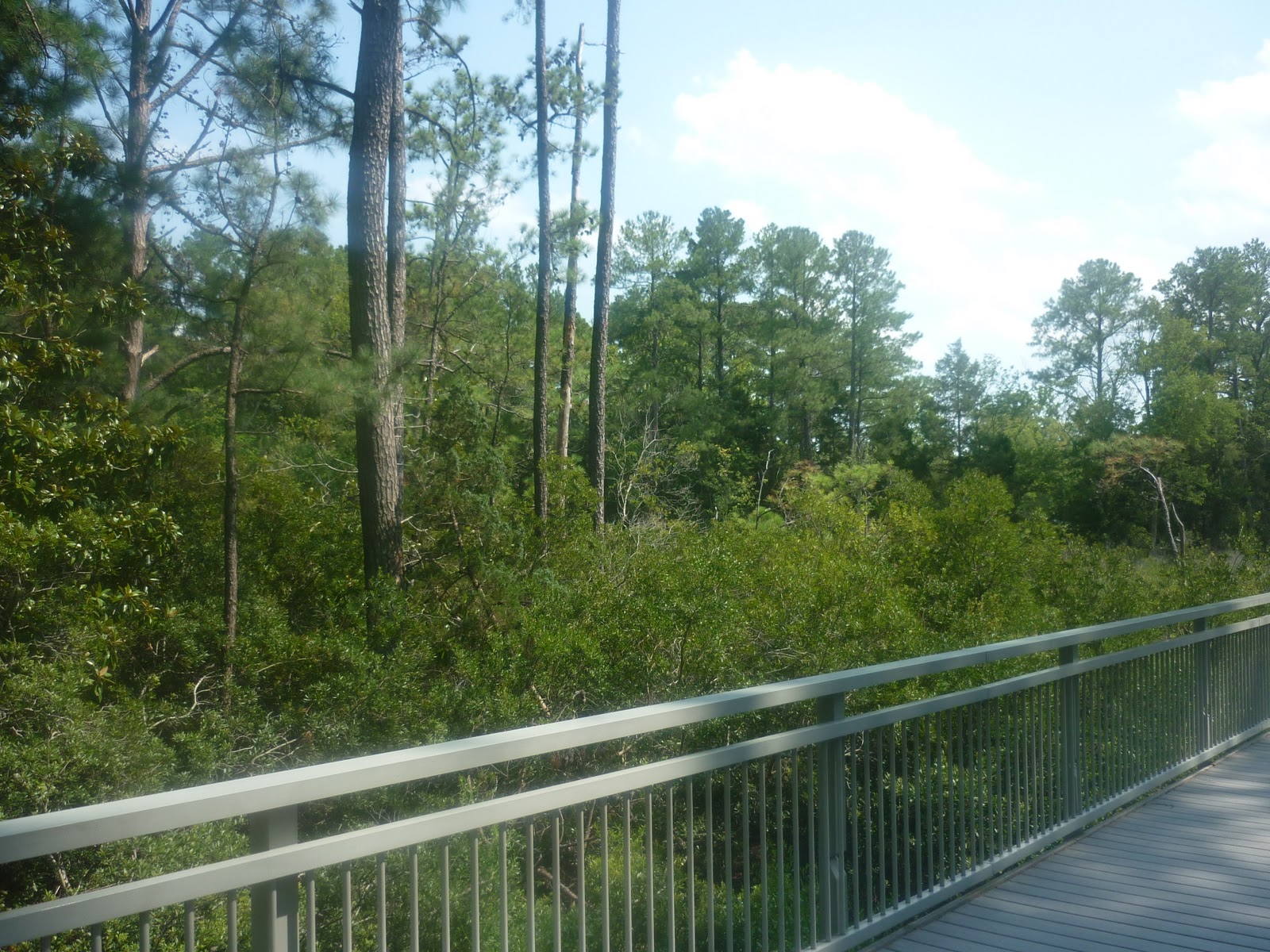
This was taken near the Potomac river near the Great Falls of the Potomac. Here we maybe have a lusher forest than one might find in Michigan, Upstate New York, or even New Jersey, but with the exception of a few tupelos or the insane amount of Kudzu everywhere, this is hardly what a person from those places would consider exotic or different. Heading twenty miles south, we run into Manassas National Battlefield Park:

There definitely are a few unique things here. In the midst of the familiar hardwoods you see Virginia pines sticking out above the canopy. Down here, they have a slightly longer growing season and better soils to grow in. Northwards, they are scrubby and small, and tend to stick to sandy, well-drained areas in which they are the predominant species of tree (pine barrens are thus named). They get taller the further south you go, and things like maples start to disappear, while other pines become more predominant and new kinds of farms start appearing.

In this case, cotton fields start to show up, and by this time, the "South" starts to creep in. Perhaps cotton fields could serve as one main indicator of where the southern states truly begin, as they are good signs that you are either near some historic feature of the ante-bellum south, or that you have crossed one of the old survey borders wherein slavery was contained/permitted, depending on your point of view. In fact, even way out on the Texas Panhandle, as soon as you cross from Oklahoma south of the famous 36,30 latitude, there are cotton fields to be seen. This particular field was the first one I encountered that trip, on the grounds of the Shirley Plantation:

Now let's face it. Plantations are very much a part of the general image one thinks of when "South" is mentioned. This particular one might not be as grand as the ridiculously huge mansions common elsewhere, but that is because it has a much older history, with even the building itself dating to 1738. This was the house where Henry Lee was married, and where Robert E. Lee spent some of his childhood. The estate sits on the James river, not far away from Richmond, where the yellow line moves in along the river near the city. In many ways, the plantation is at the edge of another world.
I mention that because the Lees, like so many Virginians, were reluctant to fight against the Union during the Civil War. Yes, Virginia did secede, but then, as now, much of the state had more ties to an older colonial past, and markets that shared commerce and interests with regions northward, more than southward. At the same time, slavery was going strong in this area until the last moment, and it was indeed the army of the Shenandoah that secured a victory for the confederacy when the war truly got underway at the First Battle of Manassas. Some of the most effective and famous leadership in the Confederate army came from Virginia. Some of those men, such as Stonewall Jackson, even had qualms about slavery, though like the Virginians of the Revolutionary era, owned slaves of their own. Borderlands everywhere, it seems, tend to have some degree of ambivalence about them.
So what happens when you travel past that yellow line into true tidewater Virginia? Well, that is where the "South" starts to appear a bit more.

These were both taken on a very hot muggy afternoon off a walkway in Jamestown. The park is a special place where one can see roughly the same view that the very first Virginians saw when they landed here in 1607. Here can be seen Pond pines, and in the second photo on the left you can also make out the shiny leaves of the Lobolly bay, one of the first larger evergreen broad-leafs that can be found heading south. What really made the swampy little colonial landscape stand out though was the Baldcypress.

At first, I did not recognize it. Further south, in the coastal Carolinas and onward, they grow in large stands of extensive swampland, often dripping in Spanish Moss. Here, and when I was last in Arkansas, I did not notice any of that wonderful stuff hanging from it, but the profile of a large cypress is unmistakable nonetheless. Once I adjusted the scale after seeing this larger tree, things became obvious.

Just as Black Spruce grow where the true North really starts, these trees are good signs that you have crossed into the edge of the true South. On the Atlantic coast, this is about where they stop growing, while further west, they can be found up the Mississippi river as far north as extreme southern Illinois.
Trees and plantations, of course, do not a region entirely make. At the risk of sounding stereotypical, when I spent the night in nearby Hampton, Va, I drove past more fried chicken restaurants advertising grits than I ever wanted to see. Don't get me wrong, us northern types are unhealthy too with our coney islands and poutine!
There were other signs as well, some along demographic lines, others involving product advertisement and even the kinds of music being blared out of cars at unreasonable volumes. I have to say, it was pretty exciting. At the same time, it was a real tease. This was, after all, only the edge of a rather large portion of our continent, sort of only a scratch on the surface. As a young kid, I did not have much interest in taking pictures or writing a blog, so needless to say I have next to nothing of areas further south. Nevertheless, those trips down the length of I-95 did make enough of an impression on me to pay more attention to places and people in general. OK, fine, mostly trees, but you get the idea.
No comments:
Post a Comment