Manassas National Battlefield Park encompasses much of where the fighting action took place during the First Battle of Manassas. As is the case in most eastern parks, it is surrounded by private land, but has managed to keep most of the atmosphere of the field intact. The park is fairly easy to move about in, and most prominent sites of the battle are recognizable. As in the last post, the comments for each photo are below the individual pictures.
Like many Civil War NPS sites, Manassas contains a variety of markers and monuments to denote what took place at various points of interest. This particular monument marks the passing of General Bee, who gave the famous remark about Stonewall Jackson that inspired the Confederates to get a second wind and turn the tide of the battle. Pictured in the introductory post, a statue of Jackson doing just what this monument says stands nearby.

The park visitor center lies on Henry Hill, where the most critical fighting took place, and where Judith Henry was killed inside her house, the first civilian casualty of the war. The wooden house pictured here was built on the same location as her destroyed home, and is representative of a fairly ordinary house of the time. The hill does provide a rather nice view, and in the distance one can make out the Bull Run Mountains, as well as faint views of the more distant Blue Ridge Mountains, which from one of the sides of the Shenandoah Valley, where Johnston's reinforcements were coming from.
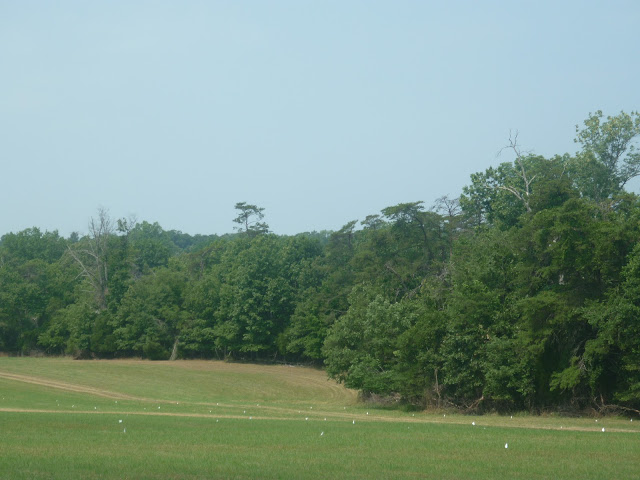
In many Civil War parks, cannons are often everywhere, usually denoting artillery emplacements. Behind the lines of guns can be seen a fairly typical example of Piedmont forest, this particular one thick with Virginia Pine (
Pinus Virginiana) and a mixture of different hardwood trees ranging from oaks and hickories to maples and American Sweetgums (
Liquidambar Styrciflua). In pre-settlement times, the area would have been heavily forested. Like much of the rural areas east of the Appalachians, the nature of the soils and depletion of soil quality by poor crop management of cotton and tobacco plantings meant that the landscape was not largely open farm. In some cases, depleted land was abandoned as settlers moved on, leaving fields interspersed by forests such as this one.

The dense canopies tend to block out much of the sun, as is the case for many mature eastern forests, and many places show signs of deer browsing, wherein the foliage is nicely trimmed on a single level. In places where local roads did not prove up to the task of transporting the Union marchers, the men would have made their way through these woods. While they do seem shady and inviting, I can tell you from personal experience that the heat and humidity did not make the experience much more pleasant than it would have been in full sun. While they do share many species in common, the forests of Piedmont Virginia and Minnesota and New York do not share environmental blessings. Here, hot means hot and sticky, even in the shade.
In fact, you can pretty much see the humidity rather well. I know I have used this picture before, but it does a good job of illustrating the nature of the landscape around the battlefield. Here we see a wonderful assortment of trees that show just how much variety a transitional landscape like the Piedmont can bring to the local biomass. In addition to the Virginia Pines, we also see some Shortleaf Pines (
Pinus Enchinata) making a nice burst from the canopy. Friendly forests to the Virginians, dangerous hiding places to the Union forces.
One of the surviving buildings in the park is the
Stone House, which was used as a stop on the Warrenton Turnpike (now U.S. 29) which ran alongside it. At the time of the battle, the house belonged to Henry P. Matthew, a Virginian farmer. As it was located near the site of some heavy fighting, easily defensible due to its stone walls, and on the roads back to Union territory, the house saw use as a hospital. Well over 1,000 men were wounded nearby and treated in the house and on the grounds. It contains period furnishings and is actually pretty well insulated against the summer weather.

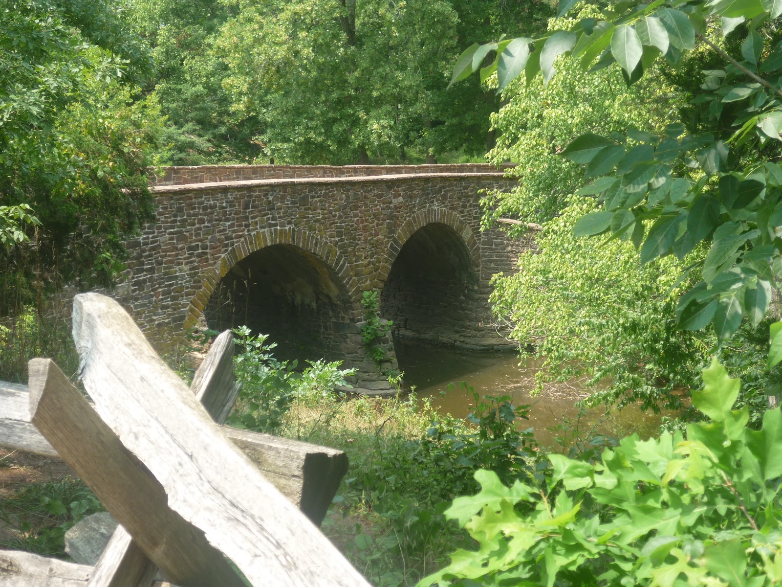
Not far down the road alongside the house is the actual namesake feature of Bull Run, a small stream which eventually ends up in the Potomac. Bull Run is crossed by the Stone Bridge, which saw some of the earliest fighting in the battle, where Tyler's flanking met with serious resistance. The bridge was destroyed during the battle, and the current bridge is a recreation made during the late 19th century. As you can see, Bull Run is not very broad or deep, and is crossed by other bridges in the area, as well as many fords. Still, it provided enough of an obstacle to assist the Confederates in maintaining their early lines, until they were forced to retreat by Sherman's surprise attack. The run is rather healthy, and has many fish in it.
So, what we have mostly seen are shots from the heart of the battlefield, mostly around Henry Hill.
Identified features are Henry Hill, Bull Run, the Stone House, and the surrounding lands, which remain roughly in the same condition that they were in for the actual battle, perhaps slightly less forested then. The park is definitely worth a visit if one is going to be in nearby Washington for a few days, a destination for those interested in history, nature, or both.


No comments:
Post a Comment