 |
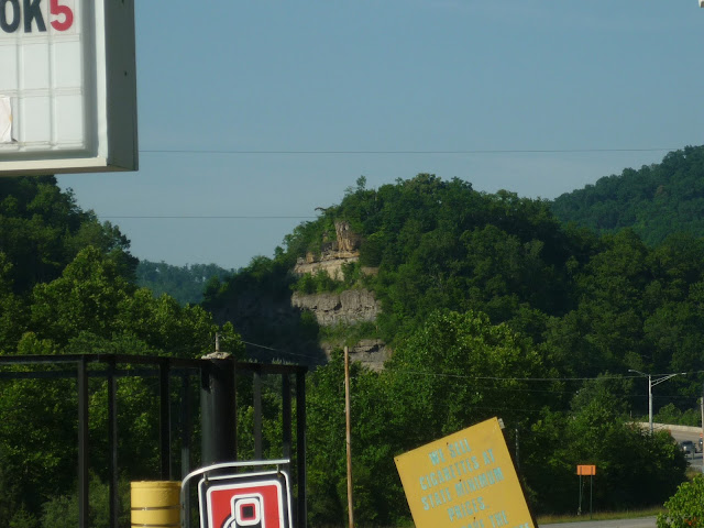
| Somewhere along Kentucky 80 near Martin, Kentucky. |
I did not take many pictures of the terrible scenes down in Kentucky, but the Earth down there is literally being blown up one piece at a time. Here, have a second picture, just to see the object of the disfigurement:
 |
| Southbound along US 23 somewhere between Prestonburg and Staffordsville, Kentucky. |
See that thin black line below that gray/black looking layer? That would be coal. That's right, this is going on just for a little line of the fossil fuel that we can't seem to get enough of in this country. If you want to see more wasteland, take a look at Google Maps and center the view over the point where Kentucky, West Virginia, and Virginia meet. Turn it onto satellite view and take a look at the area stretching from Hazard, Kentucky to about Summersville, West Virginia. Those big gray blotches are basically mountains that have been shaved out of existence and often replaced by little more than a thin layer of dirt covered in Kentucky Blue Grass seed. You can see "restoration" first hand by checking out the blotch when you search for Bolen Cemetery in Kentucky and open the streetview to the barren area. I stopped the car there but did not manage a picture, being so much in disgust of what I saw.
Even if you don't care about the visual appeal of mountains, you probably figured correctly that this sort of thing has to be terrible for the local water supply. Not only do the locals get poisoned by water that basically turns into sludge, but think about the fact that water from here can impact people all the way down the Cumberland River watershed (and beyond). The scars are not only gross looking, they also ooze out some awful goo.

No comments:
Post a Comment